CNY_WX
-
Posts
2,717 -
Joined
-
Last visited
Content Type
Profiles
Blogs
Forums
American Weather
Media Demo
Store
Gallery
Everything posted by CNY_WX
-
In the meantime we have our warmup act on Friday.
-
-
Sounds like this guy was showing off his knowledge of sub oceanic features.
-
http://www.severe-weather.eu/mcd/no-snow-for-the-southern-side-of-the-alps-in-the-foreseeable-future/?fbclid=IwAR21ZO2Q8RBN9QIw9PKUEupiVvFnc_xZUbrAHciZbdCl4XuXqBnKntnUBeI i know this article is a week old but it explains what’s been going on over there. Feet of snow on the north side of the Alps and no snow and mild temperatures on the south side.
-
A lot of the snowfall in the Alps is orographic in nature.
-
I would say the core of the airmass over Canada is at least -40 C which is -40 F!
-
The negativity over one run is unbelievable.
-
That could be the blizzard of 1966 all over again! Almost exactly the same time frame!
-
Therefore always one killjoy in every crowd, lol! I agree it’s way too early to get excited but we can’t help ourselves, can we?
-
How about the Canadian?
-
Only 37 model runs to go........
-
The back edge of the snow is rapidly approaching from the northwest as the arctic front passes through.
-
Another burst of heavy snow coming through right now. Nice flake size.
-
Still snowing but the sun is trying to break through the overcast.
-
I measured 4.6 inches with 0.35 LE giving me a ratio of 13.14:1 at 7 AM. Probably got at least another inch since then and it’s still snowing at least moderately.
-
Started snowing moderately about 15 minutes ago, my deck is already white. The temperature has finally dropped to 32.
-
Looks like a band is trying to form but still cellular in nature.
-
Light snow here right now but the temperature is still at 34 so it’s not sticking yet.
-
Snow is starting to mix in, 35 degrees.
-
Still 36 and raining here. It reached 40 overnight.
-
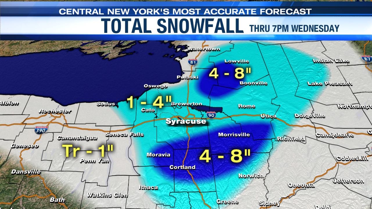
This is Channel 9’s snowfall forecast through 7 tomorrow night I also included Meteorologist Jim Teske’s write up He’s calling for 10-16 on the Tug for the entire event: Here is our first look at new snow later Tuesday night into 7 pm Wednesday evening. Along with the snow there are strong westerly winds causing blowing snow and reduced visibilities. **This is the first part of a long duration snowfall** Additional snow falls Wednesday night into Thursday. For planning purposes, our first estimate of total snow in the Syracuse area by late Thursday night is 5-10" Over some of the higher elevations south of Syracuse and the Tug Hill stormn totals end up at 10-16"

-
From 1995 until I retired in 2016 I commuted 60 miles one way daily to Utica. As a result my cars were always something reliable that got good gas mileage. I owned a 2002 and a 2007 Civic that had 117,000 and 183,000 miles respectively when I got rid of them. My current car is a 2012 Cruze with 137,000 miles. I am going to replace it in a couple of months and have pretty much decided on a Mazda CX-5. Since I have always gone bare bones with my cars (at least since 95) I am leaning toward getting the Grand Touring Reserve trim level to splurge a little. That’s the lowest level that offers the 2.4 liter turbo four. My wife drives a 2014 Subaru Crosstrek, orange of course! BTW, my Cruze has been great in snow even with all season tires. I never plowed through 6 inches of unplowed snow but it is a tank traveling the thruway.
-
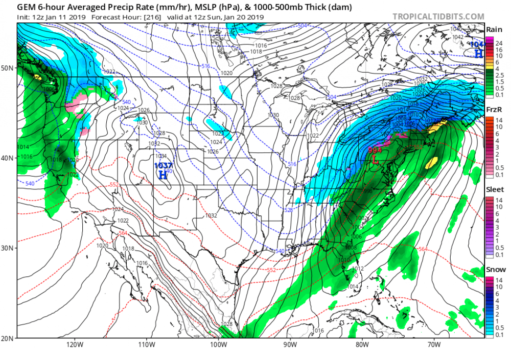
GFS is much weaker with the northern short wave as a result the surface low is much weaker.
-
12Z GEM phases but too far east for us.
-
This snow is being caused by sea effect off of the Adriatic Sea. Also, these towns are in the Appenine mountains at a couple thousand feet so I doubt it’s extremely high density snow.