CNY_WX
-
Posts
2,717 -
Joined
-
Last visited
Content Type
Profiles
Blogs
Forums
American Weather
Media Demo
Store
Gallery
Everything posted by CNY_WX
-
Isn’t that a baroclinic leaf?
-
URGENT - WINTER WEATHER MESSAGE National Weather Service Binghamton NY 101 PM EST Wed Nov 14 2018 NYZ017-018-151815- /O.CAN.KBGM.WW.Y.0027.000000T0000Z-181114T2100Z/ /O.CON.KBGM.WS.A.0006.181115T1500Z-181116T1800Z/ Southern Cayuga-Onondaga- Including the cities of Auburn and Syracuse 101 PM EST Wed Nov 14 2018 ...WINTER STORM WATCH REMAINS IN EFFECT FROM THURSDAY MORNING THROUGH FRIDAY AFTERNOON... ...WINTER WEATHER ADVISORY IS CANCELLED... * WHAT...Heavy snow possible. Total snow accumulations from Thursday morning through early Friday afternoon of as much as 7 or 8 inches possible. Any additional lake effect snow showers will only amount to an inch or two at most this afternoon. * WHERE...Onondaga and Southern Cayuga Counties. * WHEN...From Thursday morning through Friday afternoon. * ADDITIONAL DETAILS...Travel could be very difficult. The hazardous conditions could impact the morning or evening commute Thursday and Friday.
-
My wife and I went to a Yankee/Blue Jay game in Toronto last July. We ended up being an inning late to the game (missed an Aaron Judge homer)because the last 5 miles took us an hour. What kind of job do the road crews do keeping the roads cleared of snow? Maybe we’re spoiled because the crews here generally do a good job considering how much snow we get.
-
4.3 inches here, 0.26” LE. I guess that’s on the low end of most forecasts but we were all hoping for more.
-
I thought the worst part of this was supposed to be between 4 and 10 AM? Not even one school delay this morning.
-
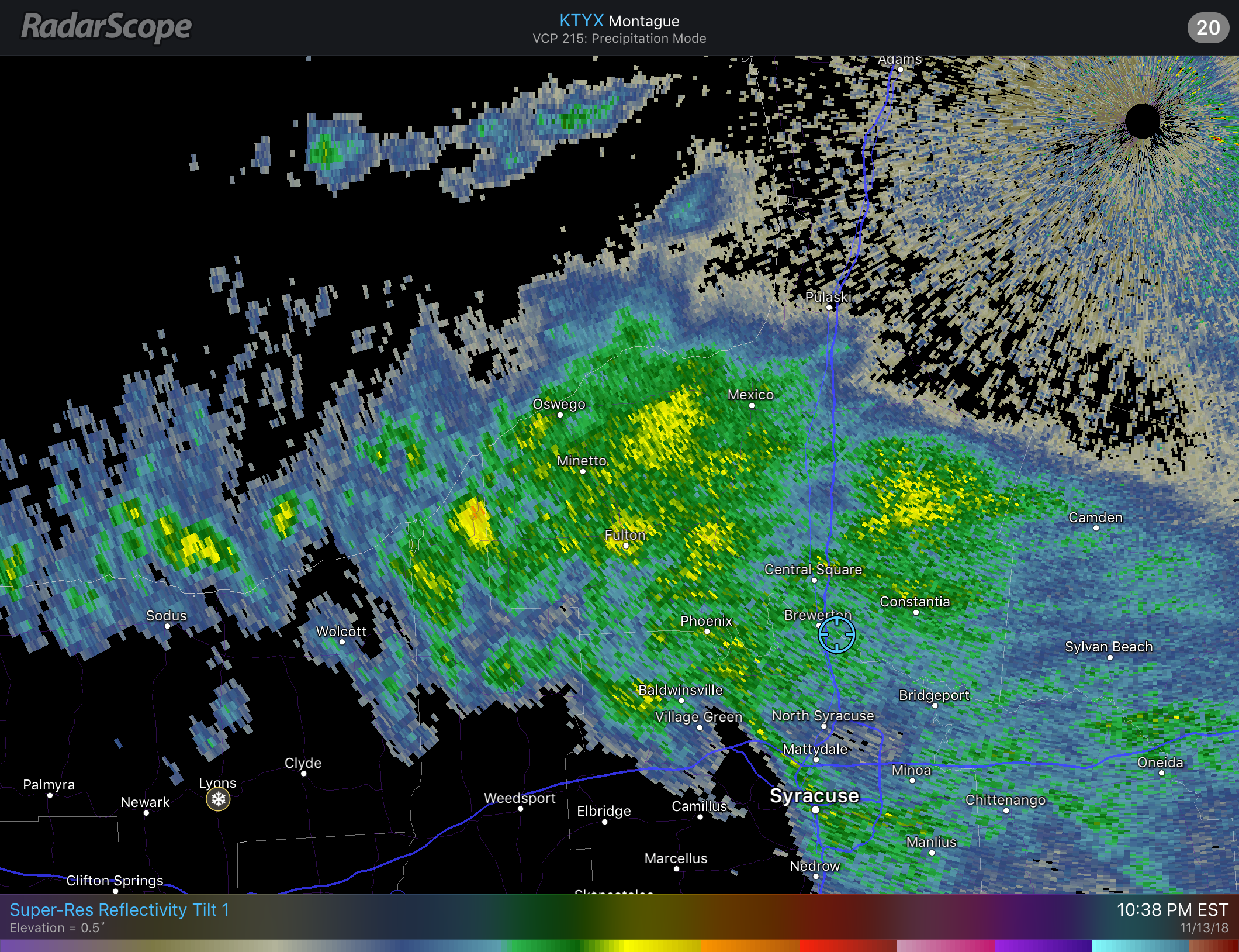
Steady light snow with decent flake size falling right now. My deck is covered. Temperature has fallen to 29 so this is a real snow unlike last night’s. Radar is showing more yellow returns but the band still hasn’t organized.

-
The CoCoRaHS reports coming in show higher elevations south of Syracuse got 2.5 to 4 inches.
-
About 3/4 inch of wet springlike snow at 7 AM. Still snowing steadily but the back edge of the snow is rapidly approaching from the west.
-
First measurable snow of the season here overnight. Not much, about a half an inch on cars, roofs and grassy surfaces but it’s a reminder of what’s to come.
-
Looks like rain on the lake plain. Maybe a period of lake effect after the storm passes.
-
12Z GFS brings this weekend’s storm further west, right over CNY. That pretty much guarantees all rain for this area if it verifies.
-
That system starts out tropical then transitions to extra tropical? It’s down to 974 mb over Norfolk, VA before weakening. Just what eastern South and North Carolina doesn’t need!
-
It’s pouring here right now. The temperature has fallen about 5 degrees since we got in that band but it’s still in the mid 40s so not close to flipping. Here on the lake plain we’ll be the last to change.
-
I have seen early season games postponed due to snow in April at Yankee Stadium. April 9, 1996 Andy Pettitte threw 6 strong innings in the snow with temperatures in the mid 30s.
-
Once we get to April 1 it’s definitely time to flip the switch to warm weather. I saw a story on the news yesterday about how the Syracuse Chiefs are getting concerned about the condition of the field with opening day only about two weeks away. They are spreading black grit on the snow on the field to absorb the heat from the sun in order to melt it faster. Major league opening day is next weekend and golfers are getting anxious to start hitting the little white ball.
-
I should have thrown it out as soon as I saw that!
-
Wouldn’t this be some April Fools joke! In reality I think the joke’s on us!
-
The 18Z NAM made a huge jump NW now bringing snow up to the I88 corridor. I know it’s an off hour run of the NAM but it makes it a little more interesting. Let’s see what tonight’s global models bring.
-
This winter does score high marks for longevity, extreme cold early and several significant if not crippling snow events. The main factor bringing my overall grade down is the insanely warm spell in February and lack of an extremely deep snow cover at any time. When you set the all time record high temperature for February at KSYR it can’t be ignored. A couple of weeks ago I would have graded this winter a C+/B- but recent snows have brought the grade up to a B.
-
My thermometer registered a numbing 1 degree for a low last night, brutally cold for the middle of March. With the mid week systems almost definitely missing us it looks like maybe next weekend might be our last chance for a significant snowfall. The pattern is changing and after next weekend we’ll be staring at April. At least I won’t have to worry about an early first mow this year!
-
This is currently the third snowiest March on record at KSYR. Only 1993 with the Storm of the Century (42 inches) and 2001 were snowier. I think second place is reachable but I don’t know if we can break the record. Maybe if we can get that storm next week to come north 100 - 150 miles. Syracuse's snowiest months of March Rank Year Inches 1 1993 54.4 2 2001 45 3 2018 42.2 4 1992 41.3 5 1984 40.3 6 1947 38.6 7 1971 37.2 8 1956 36 9 1950 33.9 Source: National Weather Service
-
Only a dusting here this morning which will be vaporized shortly.
-
My final measurement for yesterday was 13.8 inches on 0.60 LE which gives a 23:1 ratio. I was definitely surprised at how much snow was in my driveway before I snowblowed.
-
I was thinking the same thing, lol!
-
Still dumping snow here. Got to be up to 6 inches this evening, 9 for the day.