SchaumburgStormer
-
Posts
5,847 -
Joined
-
Last visited
Content Type
Profiles
Blogs
Forums
American Weather
Media Demo
Store
Gallery
Everything posted by SchaumburgStormer
-
Chicago metro to get a tornado watch shortly per MD
-
Rotation tightening on the cell S of Des Moines
-
Looks like some large hail on that cell as well. Getting some radar scatter
-
PDS tornado watches from Louisiana to Minnesota. Insane
-
65/57 in DeKalb Co w/sun. The fuse is lit
-
Can easily justify high risks where the moderates were placed yesterday stretching into N central IL
-
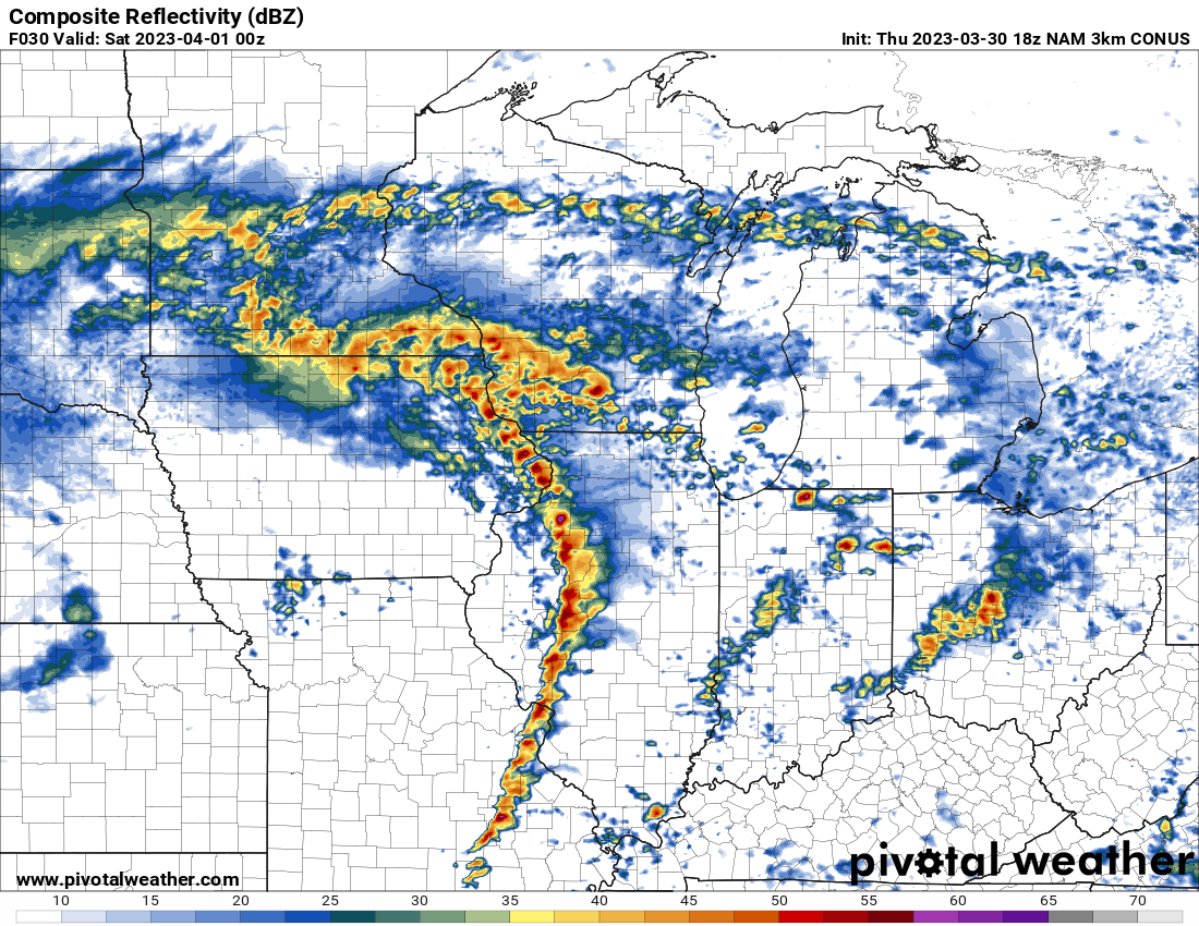
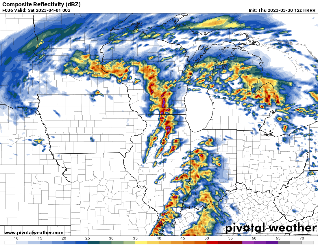
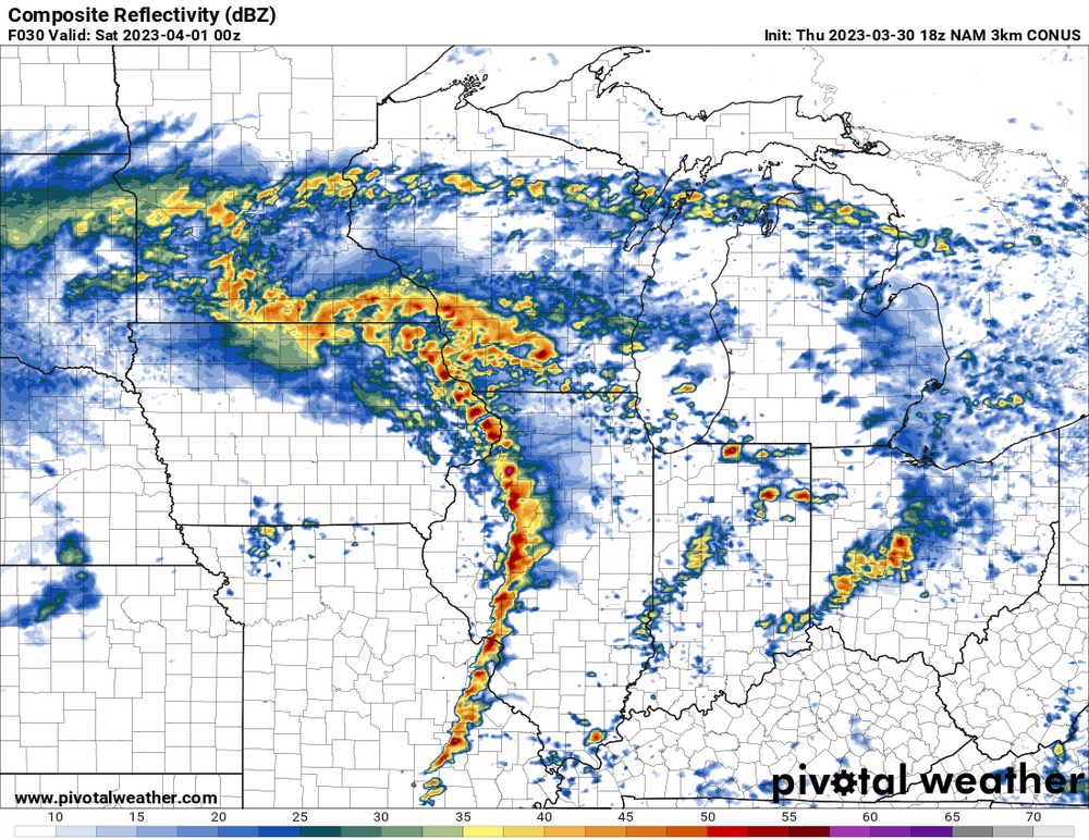
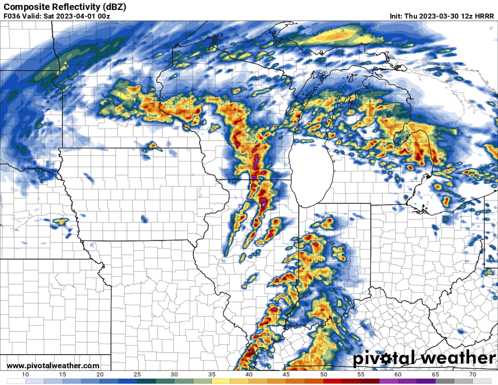
Seems like it’s going to be one of those days where everything is going to be spinning. HRRR continuing to show multiple significant updraft helicity tracks through IL.
-
Absolutely terrifying map. Major nados through multiple major IL metros. Definitely starting to look like all systems go for a major outbreak.
-
LOT pounding it too. Concern for several tornadoes into the area, including a noted risk for significant/long- track tornadoes, continues to increase with the latest forecast guidance. This guidance puts the low-level wind/thermo tornado parameter space into the upper-echelon climatology of values for our area, highlighted by significant 0-1km EHI and 0-3km CAPE that will be realized by discrete supercells. At this point, the highest threat area for tornadoes appears to be near/west of I-39. However, the eastward extent of the highest supercell/tornado risk will be determined by how quickly convection evolves toward a linear mode.
-
Just your everyday string of supercells plowing through IA/IL
-

Severe Weather 4-4-23 and 4-5-23
SchaumburgStormer replied to cheese007's topic in Lakes/Ohio Valley
Ground speed will be a big issue if this or Friday’s setup drops something sig. A major wedge moving at 50+ mph would be wild and terrifying. -
Has discrete sups heading towards the metro.
-
I had previously taken the week off (kids on spring break), but I will probably stay hyperlocal and let the storms come to me. Not much margin for error if you target the wrong spot with 50+ mph storm motions.
-
Shocked. Just shocked… that the warm front got hung up on I-80. It’s that time of the year where it’s 65 in LaSalle and 45 in DeKalb.
-
March 24-25 Palm Killer (Snow Event)
SchaumburgStormer replied to hardypalmguy's topic in Lakes/Ohio Valley
That would have bounced my winter grade to an F+. Fucking abysmal for a snow weenie -
March 24-25 Palm Killer (Snow Event)
SchaumburgStormer replied to hardypalmguy's topic in Lakes/Ohio Valley
Another shithole “storm”, another slushy inch. -
March 24-25 Palm Killer (Snow Event)
SchaumburgStormer replied to hardypalmguy's topic in Lakes/Ohio Valley
Depth change map on the 18z NAM would be my biggest snow of the year... In basically April as is the tradition. -
Down in Will Co today, some legit snow squalls. Top 5 event
-
Hoping this weekend is our last real "cold" push of the season.
-
Tulips are popping. Lets move on to spring.
-
Quality mood flakes. Shame it’s march, not December…
-
Got more snow in the past 3 days than I had from November to late January. A touch over 6” the past few days
-
Got about 3” on grass surfaces
-
Another “storm”, another brutal gradient. <3” here while RFD makes a run at 7
-
2.4” on the board, but compaction and melting has a good bet less on the grass