-
Posts
6,220 -
Joined
-
Last visited
Content Type
Profiles
Blogs
Forums
American Weather
Media Demo
Store
Gallery
Everything posted by Quincy
-
I stayed far away from that hail core, but had a neat vantage point of structure to the south:
-
Heavy Rains and Flooding May/June 2021
Quincy replied to janetjanet998's topic in Central/Western States
I’m in Stratford, OK which is about an hour SE of Norman. It’s been raining here almost every day for the past 3+ weeks. Yards are flooded. Grass is growing out of control. Reminds me of 2015, except even later in the spring. It’s crazy that it’s been so much hotter in the northern states lately than we’ve been at all this entire spring! I only had two chase days in Oklahoma all year too. Definitely a weird year and an odd pattern. -
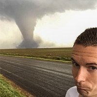
Caught a glimpse of the tornado near Fort Stockton, TX today. Only managed a couple pictures due to terrain and power lines.
-
I think in Colorado it was a noteworthy tornado. Once it got into the western Oklahoma panhandle, it was a lot less conclusive. It may have touched down a few brief times over the border, but I think the main deal was earlier. Terrain was a pain, for visibility and navigation.
-

Severe Weather May 26th- 28th 2021
Quincy replied to weatherextreme's topic in Central/Western States
I went for a Hail Mary with targeting the Fort Stockton area of SW Texas today. I figured Oklahoma would be slop with mega chaser convergence anyway. A supercell near Sanderson produced hail up to 2.0” and there were a few photo opportunities before and after that. -

Severe Weather May 26th- 28th 2021
Quincy replied to weatherextreme's topic in Central/Western States
Hanging back near Scott City. Watching dozens of chasers flood north, but I’m hanging back in case we get CI in southwestern Kansas soon. Looks like a tornado is also ongoing at the moment in far southwestern Nebraska. -

Severe Weather May 26th- 28th 2021
Quincy replied to weatherextreme's topic in Central/Western States
That’ll spell problems. Any storms that go up in western Kansas over the next few hours should rapidly become severe. -

Severe Weather May 26th- 28th 2021
Quincy replied to weatherextreme's topic in Central/Western States
Even several HRRR ensemble members show earlier CI -

Severe Weather May 26th- 28th 2021
Quincy replied to weatherextreme's topic in Central/Western States
HRRR shows convection holding off until just about 23-00z, but then erupting into a mixture of discrete and semi-discrete supercells. SPC cautioned that some CAMs show convection initiating several hours sooner. The 12z DDC sounding is cautionary as there isn’t much of a cap and the convective temperature is 80F. HRRR showed temps reaching the 80s by early afternoon. I’d think a compromise is probably the most realistic scenario, especially with HRRR having a “late” bias with CI. -
Planned on storm chasing near Lubbock on Tuesday, but wound up on a marginal supercell closer to Amarillo. I was mildly surprised how long it persisted. It had some neat structure for a while, too
-
Chased a high based supercell in far northwestern Kansas this afternoon/evening. Quite a bit of wind and hail with this storm. Pronounced inverted-V thermodynamic profiles (71/46 at GLD 01z).
-
Questionable low-level thermodynamics up there and it’s hard when the velocity scans are relatively high due to distance from radar sites.
-
Almost! But not quite.
-
I’m not chasing Kansas due to other obligations, but I’d be lying if I said I wouldn’t chase it, if I were available. It just doesn’t strike me as a big tornado chase. I am mildly intrigued by the dryline in SW Oklahoma. As usual, the HRRR has been playing catch-up with moisture return. With that said, it still looks like dews are a tick too low for a more certain storm threat. At this point, I think there will be attempts at convective initiation around 22-23z, but given limited moisture, relatively large T/Td spreads and residual CINH, I doubt that there is any robust, sustained convection. It doesn’t strike me as a “drive three hours west and get PUMPED” setup, but if trends improve, there is a non-zero threat of a supercell.
-
Is it bad that I barely look at long range or even medium range guidance with respect to severe threats? It’s probably easy for me to say, living in Oklahoma. I feel more for those who have to travel long distances, and/or delicately plan PTO for chase trips. Models change and patterns evolve. As mentioned, as we get later into May, moisture will be better and severe setups will become more common. We’re still in that transition period. I don’t have data offhand, but I know that historically, early May has known to be quiet more often than not. It gets sandwiched between late April events (usually in the mid-South/Southeast) and peak trends in the second half of May. Think of it, most severe setups will change even the DAY OF. There isn’t too much use getting fixated on details. Threats seem to fall apart, far more often than the needle is threaded. Tomorrow looks blah and the pattern looks relatively timid for the following few days. Wake me up in late May.
-
Very hazy as I follow supercells east of Del Rio, TX. I can either go east and play it close (hoping low level rotation tightens up after 00z) or take a more southeasterly route to attempt to see more structure. The road network is very limited.
-
The LLJ axis is definitely shifting east. Even the Del Rio area is on the fringe, but short term guidance shows low-level flow rapidly strengthening around and shortly after 00z.
-
Several things… Opted to chase Colorado yesterday and ended up missing the landspouts. Not a big deal, I’m kind of a tornado snob, but it was fitting that I missed tornadoes closer to home, in NW Texas, yet again. The supercell, in general, was very dusty/grungy, so there weren’t too many photo opportunities. It looks like a tornado hit the town west of where I live last night… Torn between Rel Rio and NW Texas again. If the terrain and road networks were better, I’d definitely go with the southern target. Still reviewing data, but it’s also been interesting to see tornado warnings and even a couple tornadoes this morning via radar. We should be in for another busy day…
-
Having had some more time to look over Tuesday’s setup, I have to say that most of it is a big mess. In my view, TX/OK looks a SLGT-risk caliber setup, but I wouldn’t even have enough confidence to include a sig hail area, due to limited/fragmented instability fields. Having said that, I’m more intrigued by prospects near the surface low/triple point in western Kansas. The NAM seems most aggressive, with 0-3km lapse rates around 9 C/km with favorable low-level moisture and substantial hodograph curvature. The EC/GFS show somewhat less favorable moisture return, leading to more marginal instability profiles. Since this is still 42-48 hours and the setup will continue to evolve, I don’t have high confidence in zeroing in on an area for severe thunderstorms. I’d lean toward surface low proximity, but that could fall into failure mode as well.
-
The models (NAM/GFS/EC) show what I’d call “blotchy” instability maps. The wind profiles don’t look all that bad with guidance suggesting some backing/strengthening of low level winds. I think one of the issues is going to be ongoing/stratiform precipitation during the day, limiting instability. It could be a setup with a few widely spaced supercells, within an otherwise messy setup. Not sure where the best threat could evolve, but it could be anywhere from SW Texas (Fort Stockton area?) to western OK. Not sure I’m sold on much of a threat with northward extent into Kansas, but we’ll see.
-
Messy storm mode and less favorable lapse rates, compared to areas farther NW.
-
Was in like the 10% of chasers today who were in NW Texas, but were not on the tornadic supercell. Captured a few pictures, so not a complete failure, but pretty close to it
-
Big ice makers today
-
One observation I’ve noted about the NW Texas tornado watch is that low-level hodographs are still relatively small. 0-1km SRH via 21z mesoanalysis is below 100 m2/s2 near and immediately ahead of the arc of cells.
-
It looks like a lead, subtle perturbation in the warm air advection regime sets off a mess of convection by midday across central/eastern Texas into eastern Oklahoma. While the HRRR lacks CI away from the triple point area in NW OK (which gets undercut by a cold front), the 3km NAM and WRF/ARW members are much more active in SW OK. Looking at the HRRR forecast soundings, I’m not quite sure why it doesn’t initiate convection there. It shows virtually no CIN, temperatures reaching convT and large CAPE profiles. I’m guessing it has to do with overzealous mixing and/or the tendency for HRRR to be too late with CI. The setup does seem a bit off. Maybe a touch too slow as some have mentioned, at least in comparison to 4/22/20. The HRRR is furthest north, while the 3km NAM places the triple point the farthest southwest. At this juncture, I’d say Texas is mostly out of any dryline action, with the only possible exception being if the low tracks farther south. If the 3km were onto a trend, maybe you see storms initiate in far NW Texas. The surging cold front looks like it will undercut storms closer to the surface low in western OK. We may have to wait until morning to really get a better idea of specifics, but I wouldn’t write this setup off yet.


