Quincy
-
Posts
6,220 -
Joined
-
Last visited
Content Type
Profiles
Blogs
Forums
American Weather
Media Demo
Store
Gallery
Everything posted by Quincy
-
Insane wind gusts via 18z HRRR. Let it rip.
-
Shows up nicely at 700mb, especially later today. Definitely looks like an inverted trough.
-
SCP as a parameter can be overrated, but if nothing else, I like to see the crossovers and where CAPE/shear juxtapose with vertically veering wind profiles.
-
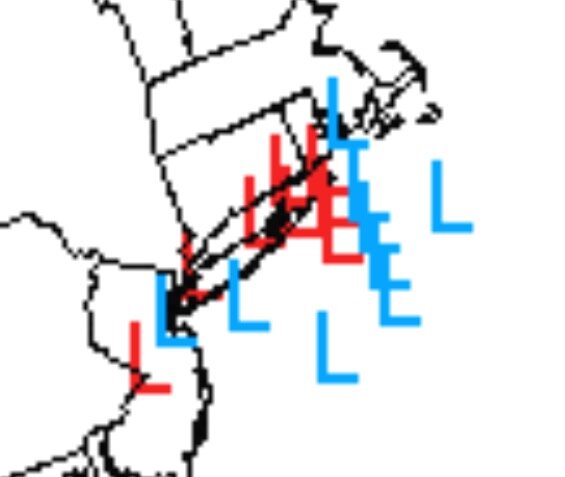
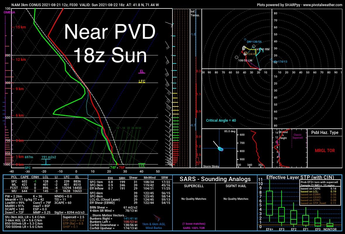
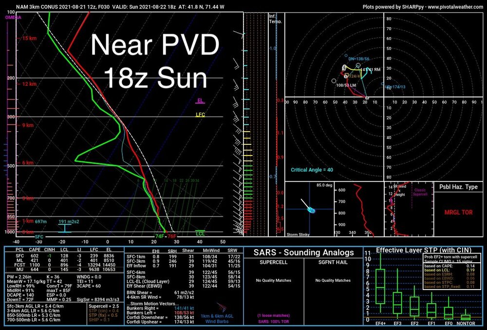
There will be a modest risk zone in the right front quadrant. Wind profiles are favorable and you don’t need much instability with tropical systems, given rich moisture profiles, but you’ll see a nose of skinny CAPE advect into southeastern SNE. Timing is favorable during peak heating Sunday afternoon to locally boost instability, particularly between rain bands. Since the system is slowing down and weakening, don’t expect the threat to make it too far inland. Picked a sounding near PVD at 18z Sunday and you’ll see a marginally favorable environment. Low level shear supports a brief spin up or two, but without a larger, more intense wind field, the threat should be fairly localized.
-
The fixation and on surface winds away from the immediate coast always seemed silly. I’ve been trying to stress the somewhat overlooked coastal flooding/surge topic for a while, but it seems like some are more interested with peak wind gust potential atop Mount Tolland.
-
Pretty meh wind field outside of the immediate coast and area near landfall.

-
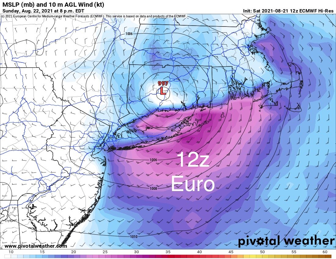
12z Euro similar to 00z, only slightly weaker and a tick east. Takes the center from eastern LI into the MMK area. Inland wind field looks weaker.
-
Not really sure if characterize that as “extreme lack of shear.” If anything, shear is increasing along the mid-Atlantic coast and decreasing over New England. Modest shear downstream, but yes, somewhat less than you’d expect to see for a tropical system heading toward SNE.
-
If intensity is AOA NHC progs, then there will be major problems. I just think the realistic scenario is still bad, but a land falling TS with gusts of 50-60 MPH, mainly SE of I-95/395. If there was a solid cat 1 coming onshore at GON, that would be very bad.
-
Pretty sure there was ET going on there. I’m talking about a more “pure” tropical system with a relatively small core wind field.
-
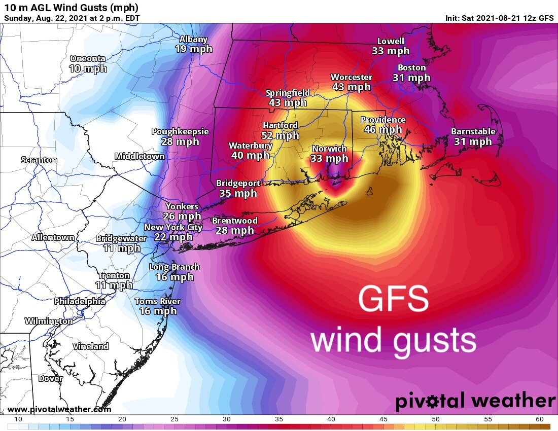
Highest inland wind gusts from GFS look like maybe 60 MPH. Still robust and damaging, but model simulated wind gusts near the surface are almost always overdone in similar situations.

-
Yeah, that wording is suspect. How often does I-95/395 see power outages from nor’easters? Sure, there will be a lot of power outages, but that scale seems to imply it will be the worst on record or something.
-
12z RGEM goes right over BID:
-
Not good for surge in Narragansett and Buzzard bays
-
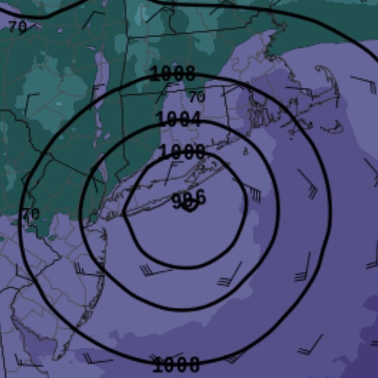
FWIW, 12z HREF mean takes the center toward central LI, much like the official NHC track:
-
Is that for LI or CT landfall?
-
Some of the mesoscale models have an overly amplified bias that tended to result in a more W/NW track. I imagine that has some parallels to winter nor’easter biases.
-
Good call IMO. You can’t waffle back and forth with every model suite. Sure there are trends, but there’s also model noise too. We may see another adjustment through today. Best to maintain continuity and not make drastic shift changes every few hours.
-
12z NSSL WRF still likes the west camp:
-
Maybe because the EPS has better verification skills than GEFS?
-
HRRR has been ticking slightly east over time, probably just correcting for the far left track. 12z run shows a slightly more robust wind field, but still takes the center from central LI to near Danbury.
-
I don’t see any reason to deviate much from the official NHC track.
-
NHC forecast is directly fed into their graphics. Isn’t it good to have some uniformity? You don’t want stations going rogue like some do in Oklahoma and start using their own made up warnings, for example. Let’s give ‘em a break. Don’t think that’s a fair criticism.
-
SREF spread is tightening up. Solid consensus on landfall near eastern LI/BID.