Quincy
-
Posts
6,220 -
Joined
-
Last visited
Content Type
Profiles
Blogs
Forums
American Weather
Media Demo
Store
Gallery
Everything posted by Quincy
-
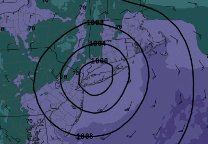
3km NAM pegs eastern LI for landfall
-
No wind damage for Kev and no more damaging tor threat. What’s he got left to hope for, maybe damaging rain?
-
Medium range forecasting ensemble suites for short term forecasts FTW
-
It’s not making a landfall in western CT as a cat 1, lol.
-
I can’t decipher much of a synoptic level trend, but I do wonder how intensity affects this thing. Keep an eye on that today for any last minute effects on the track. Maybe a subtle trend for the ridge to be slightly stronger at the end? Could just be noise too:
-
If the RGEM is right, no spinners for Kev
-
You want the track a tick west so KTOL stays in the spinup threat zone on the RFQ.
-
There will be some inland outages too, but I can’t imagine anything widespread or long term away from the areas near the landfall/immediate right front quadrant.
-
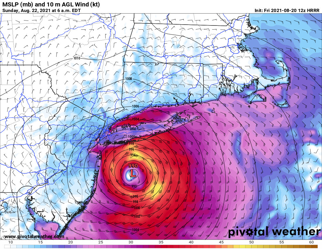
Inland winds (we’re talking over 40-50 MPH sustained) were never really expected, unless you were looking at weenie models that are notorious for exaggerating tropical cyclone strength, or maybe a few outliers model runs. Personally, I think the coastal flooding/storm surge angles are not being hit home enough. Then again, I’m not watching local media, so hopefully they are covering it more extensively. It also looks like you could see a brief spin up or two east of I-91. Sure, there will probably be quite a bit of power outages, especially across Long Island and the I-95 corridor, but at this point, the difference between TS and borderline Cat 1 is negligible. For public awareness, I think going with the hurricane warnings was warranted. It’s a bit like the Irene situation with that respect. (Plus that could have maintained hurricane status if the track was slightly further east) Barring some drastic intensification, we’re looking at a solid tropical storm (at worst) hitting LI/CT from the SSE. Certainly an uncommon event, but not up to the task to match storms like Sandy or Gloria. Even if it does become a hurricane, the conditions (SST and forward speed) do not suggest we’re seeing a hurricane landfall. Even rainfall looks rather meh. 06z HRRR/NAM show most of SNE getting less than an inch of rain, outside of western CT. Could see 1-3” here, particularly where orographic lift helps. It’s good to be ready and prepare for the worst, but eventually you have to look at the data and accept that this may underperform many expectations in terms of inland impacts.
-
Lots of noise, but some more ensemble data… 21z SREF (latest) mean track is into central/eastern Long Island, but a few ARW members are clustered near RI/SE MA. The NMM members (blue) are more amped, as usual, resulting in more of a westward deviation. Meanwhile, 00z HREF mean track is more in line with the westward track: Not sure how useful the NSSL WRF is for a tropical system, but it is closer to the overall model consensus. It shows a landfall near Southampton.
-
Low 70s dews with NE winds FTW
-
Looks like it’s hooking NW now
-
May have to settle with Henrietta
-
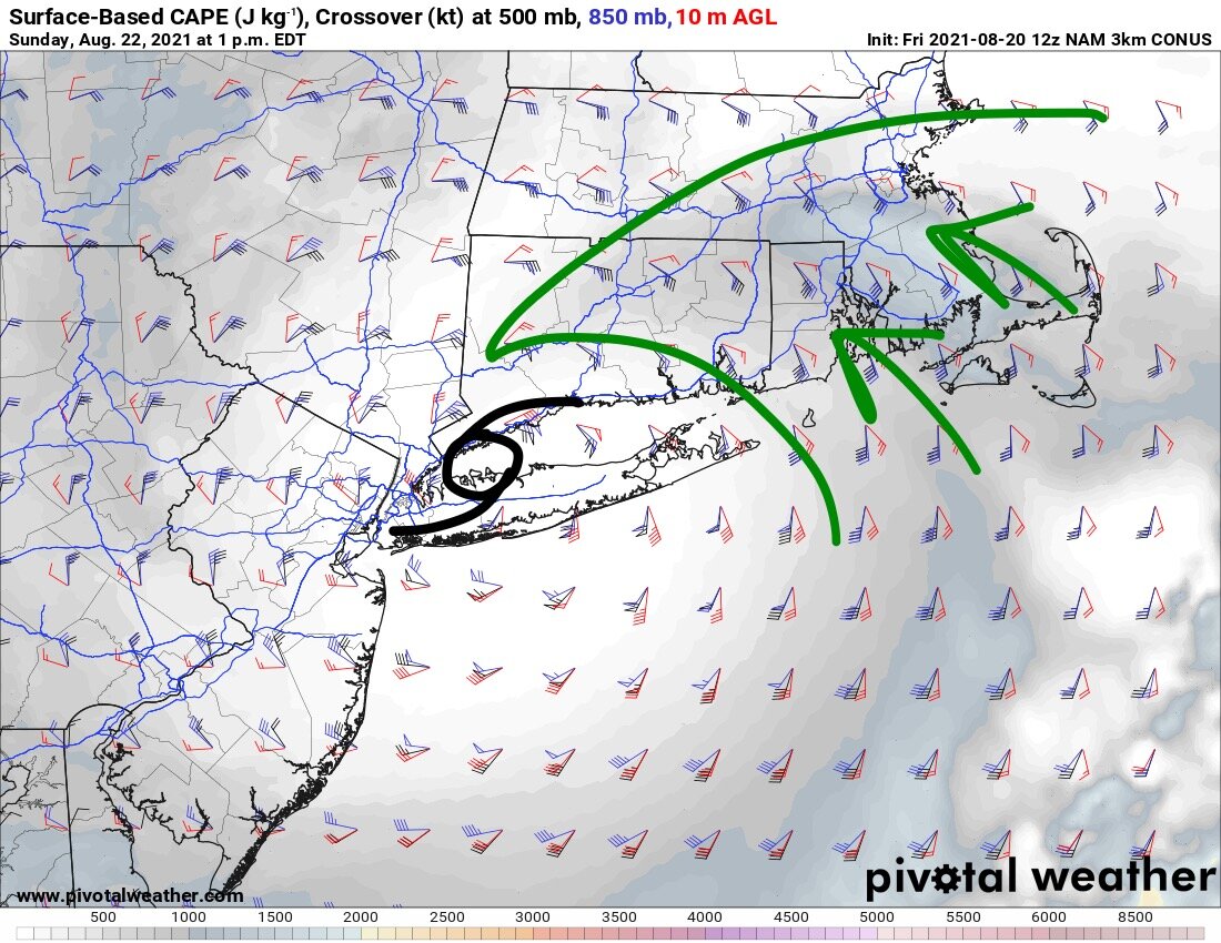
Regarding the tornado threat: As some have mentioned in the thread, these systems tend to produce “weak” tornadoes, often EF-0 or EF-1. They’re favored on the right side of a land falling tropical system and it’s rare to have a relatively intact system making landfall on Long Island (or vicinity) in such a way that weakening won’t be rapid. Low to mid-70s dews should advect into southeastern SNE, juxtaposed with enlarged hodographs. The strongest low-level flow should be confined to close to the storm center, but in this scenario below, you could see a tornado threat up to BDL-ORH and possibly BOS. Lapse rates are weak, but deep moisture through the profile and favorite wind fields drive the tornado threat, with only modest instability required. Should add that this may be favorably timed with afternoon heating on Sunday as well.

-
Looks like an 80-100 mile shift west from 00z.
-
It looks like Kev’s trees may not be uprooted after all. Thank goodness.
-
Elevation helps, but the trend isn’t his friend
-
AMOUT
-
Shoreline and coastal plain, yes. Tolland-Union mountain chain, not so much. Inland winds with these systems are usually overdone.
-
Most of the significant impacts seem to be limited to I-95 and points southeast, as I see it. Unless it continues farther/faster northwest before weakening and looping. Then you’d see more rain and maybe a spin-up threat farther inland into CT. Otherwise it’s probably going to underperform the expectations atop Mt. TOL. It’s bad news any way you slice it for south facing shores, bays/inlets and Long Island Sound. Probably the same for the South Shore of LI, especially if there continues to be any west/southwest trend.
-
Not sure if this will embed correctly, but see the trend of the steering currents. The orientation of the eastern US trough is more supportive of a northward pull, rather than the more “typical” sling to the NNE/NE:
-
Can’t underestimate the potential for coastal flooding and storm surge, especially in Long Island Sound. Those trajectories just funnel right in. This would be ugly for the Connecticut coast. At least the wind field with this thing isn’t as big as Sandy, but still…

-
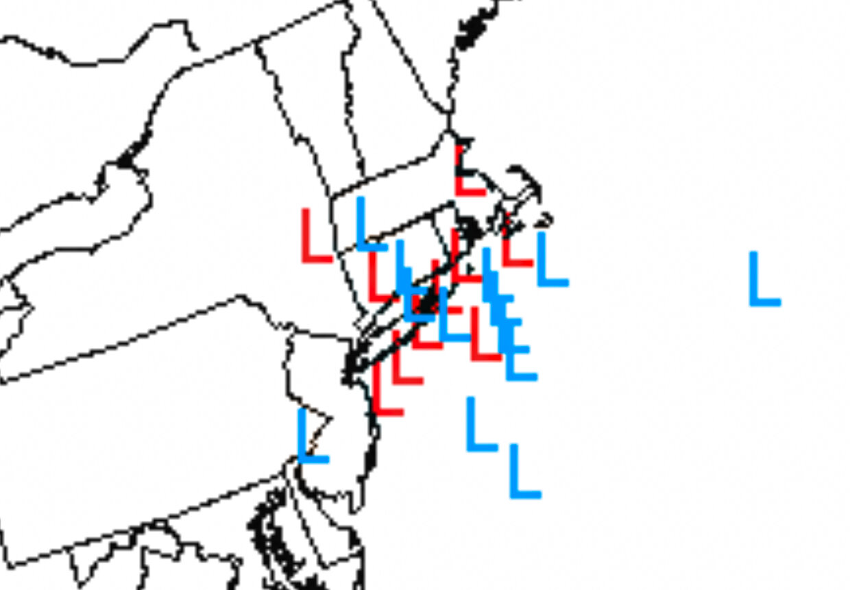
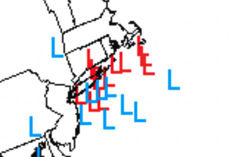
Latest SREF low centers at 12z Sunday: https://www.spc.noaa.gov/exper/sref/sref.php?run=latest&id=SREF_Spaghetti_Low_Centers__

-
FWIW, RGEM takes the center up into central LI. Rapidly weakening, so Tolland gets spared from the apocalypse. Not much rain with that scenario.