Rjay
-
Posts
28,401 -
Joined
-
Last visited
Content Type
Profiles
Blogs
Forums
American Weather
Media Demo
Store
Gallery
Everything posted by Rjay
-
December 16-17, 2020 Storm Observations and Nowcast
Rjay replied to wdrag's topic in New York City Metro
-
December 16-17, 2020 Storm Observations and Nowcast
Rjay replied to wdrag's topic in New York City Metro
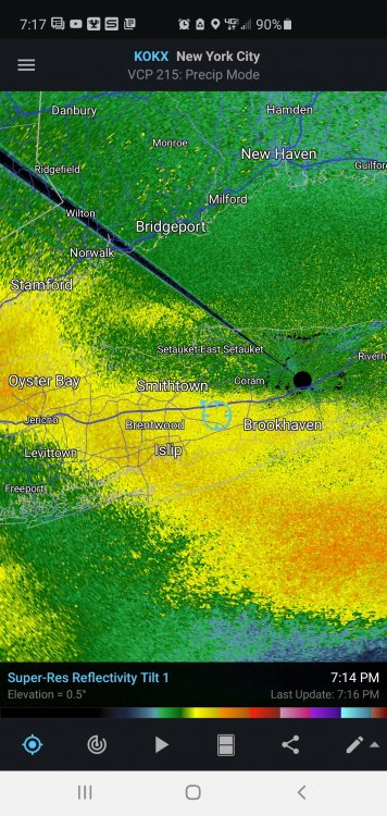
Islip still reporting light snow lol -
Well from Belmar on north to nyc and LI their futurecast is god awful.
- 3,762 replies
-
- 1
-

-
- heavy snow
- heavy rain
- (and 3 more)
-
December 16-17, 2020 Storm Observations and Nowcast
Rjay replied to wdrag's topic in New York City Metro
Ripping- 1,011 replies
-
- 2
-
-
- heavy snow
- sleet
- (and 4 more)
-
Lol hate you
-
December 16-17, 2020 Storm Observations and Nowcast
Rjay replied to wdrag's topic in New York City Metro
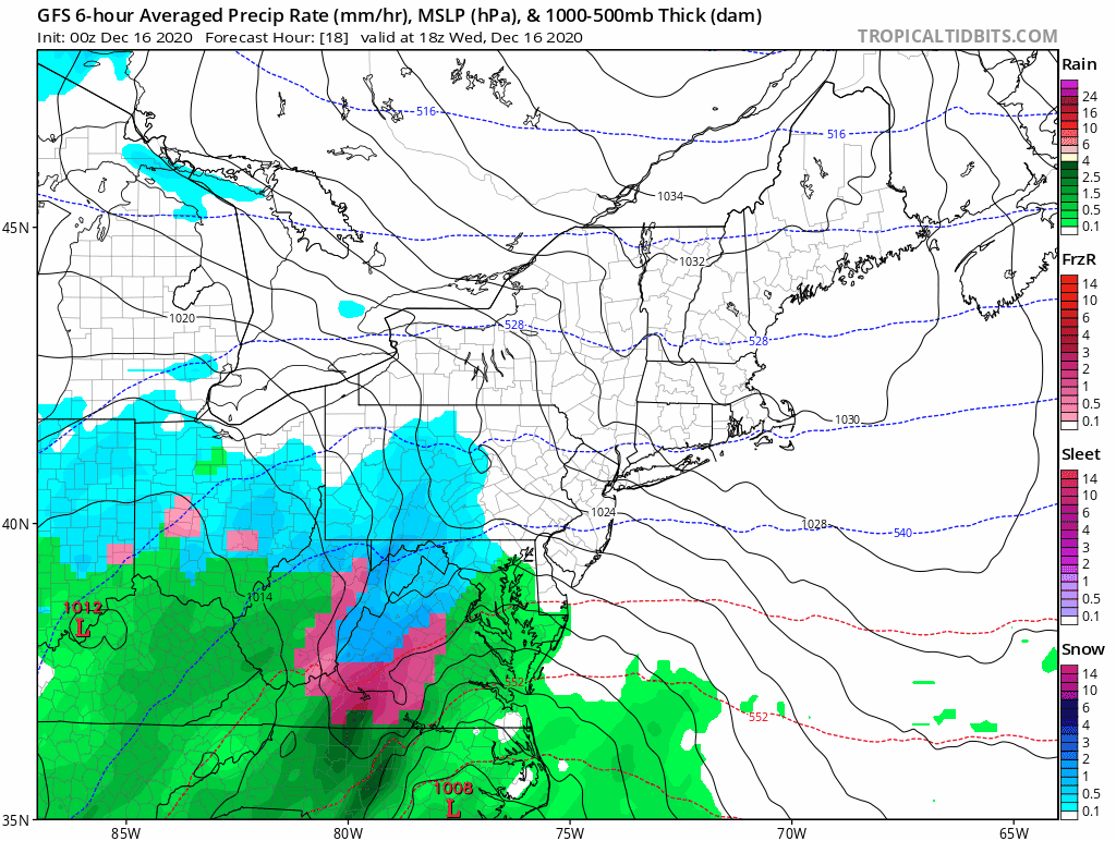
@bluewave. Are you having trouble with the Stevens Flood Advisory System plots? -
I don't think I've had thundersleet since January 26th, 2011.
-
This is def a concern but anywhere north of I78 it should be easy to hit at least 6" before any flip or dry slot.
- 3,762 replies
-
- 3
-
-
- heavy snow
- heavy rain
- (and 3 more)
-
The 50/50 sliding east quicker than originally forecasted put them back into the game imo.
- 3,762 replies
-
- 1
-
-
- heavy snow
- heavy rain
- (and 3 more)
-
@MJO812/@LibertyBell/Me 5-10" @psv88/@jm1220 /@uofmiami 8-14" @Allsnow/@Stormlover74 /@forkyfork 8-14" @BxEngine/@snowman19 10-16" @Animal 14-20" @snywx and crew 14-20" @Tatamy 18-24" @Juliancolton 18-24" Bust zone is NENJ, NYC and LI
- 3,762 replies
-
- 15
-

-
-

-
- heavy snow
- heavy rain
- (and 3 more)
-
Maybe this is the weenie version but fwiw (not much) it only rains on the barrier islands.
-
I think it was 10" the morning of the 13th and 2" late night or the next morning. Anyway, back to this storm.
-
You don't remember the Feb 2014 event? Almost brought JM to tears lol
-
South of Merrick Rd in Merrick had 6/7" in that Feb 2014 storm. A few miles north had around 1'.
-
Feb 2014. 5 for you. 11/12 for me. Barrier island to Southern State.
-
So this wouldn't have happened if people didnt use social media and we made the thread 3 days ago instead?
- 3,762 replies
-
- 1
-
-
- heavy snow
- heavy rain
- (and 3 more)
-
That's what I missed. I did not see the 50/50 scooting out that quickly.
-
Thank god you guys have your own thread lol