Rjay
-
Posts
28,401 -
Joined
-
Last visited
Content Type
Profiles
Blogs
Forums
American Weather
Media Demo
Store
Gallery
Everything posted by Rjay
-
December 16-17, 2020 Storm Observations and Nowcast
Rjay replied to wdrag's topic in New York City Metro
Cement- 1,011 replies
-
- 2
-

-
- heavy snow
- sleet
- (and 4 more)
-
December 16-17, 2020 Storm Observations and Nowcast
Rjay replied to wdrag's topic in New York City Metro
It rained for 5 hours while I slept. -
December 16-17, 2020 Storm Observations and Nowcast
Rjay replied to wdrag's topic in New York City Metro
Lots of blowing snow outside right now. That last band was legit.- 1,011 replies
-
- 2
-
-
- heavy snow
- sleet
- (and 4 more)
-
December 16-17, 2020 Storm Observations and Nowcast
Rjay replied to wdrag's topic in New York City Metro
Up to 32 from 30 last hour. Winds gusting to 40mph at ISP. -
December 16-17, 2020 Storm Observations and Nowcast
Rjay replied to wdrag's topic in New York City Metro
North of State College through Binghamton and Albany getting crushed- 1,011 replies
-
- 1
-
-
- heavy snow
- sleet
- (and 4 more)
-
December 16-17, 2020 Storm Observations and Nowcast
Rjay replied to wdrag's topic in New York City Metro
- 1,011 replies
-
- 1
-

-
- heavy snow
- sleet
- (and 4 more)
-
December 16-17, 2020 Storm Observations and Nowcast
Rjay replied to wdrag's topic in New York City Metro
Sleet/snow here. -
December 16-17, 2020 Storm Observations and Nowcast
Rjay replied to wdrag's topic in New York City Metro
Still snowing here -
Who knows. I don't get all crazy about measurements unless a spotter or a weenie is off by like 6"
-
They plow way more often out here than they do in my old neighborhood.
-
Lol yep
-
We live pretty much in the same neighborhood. I like it here so far.
-
I'm about .25 miles from the airport. I have to find a good place to measure. No snow board or anything here yet. My front lawn says I have 5" but *shrug*. *watching snow blow off the trees and house right now so...yea
-
How far are you from the airport?
-
December 16-17, 2020 Storm Observations and Nowcast
Rjay replied to wdrag's topic in New York City Metro
Still snow here. But flurries lol. -
December 16-17, 2020 Storm Observations and Nowcast
Rjay replied to wdrag's topic in New York City Metro
Yup. Wild. -
December 16-17, 2020 Storm Observations and Nowcast
Rjay replied to wdrag's topic in New York City Metro
Flake size went from enormous to tiny. -
December 16-17, 2020 Storm Observations and Nowcast
Rjay replied to wdrag's topic in New York City Metro
Plus i couldn't even tell you what county Piscataway is in -
December 16-17, 2020 Storm Observations and Nowcast
Rjay replied to wdrag's topic in New York City Metro
Same. It's like they're on delay. -
December 16-17, 2020 Storm Observations and Nowcast
Rjay replied to wdrag's topic in New York City Metro
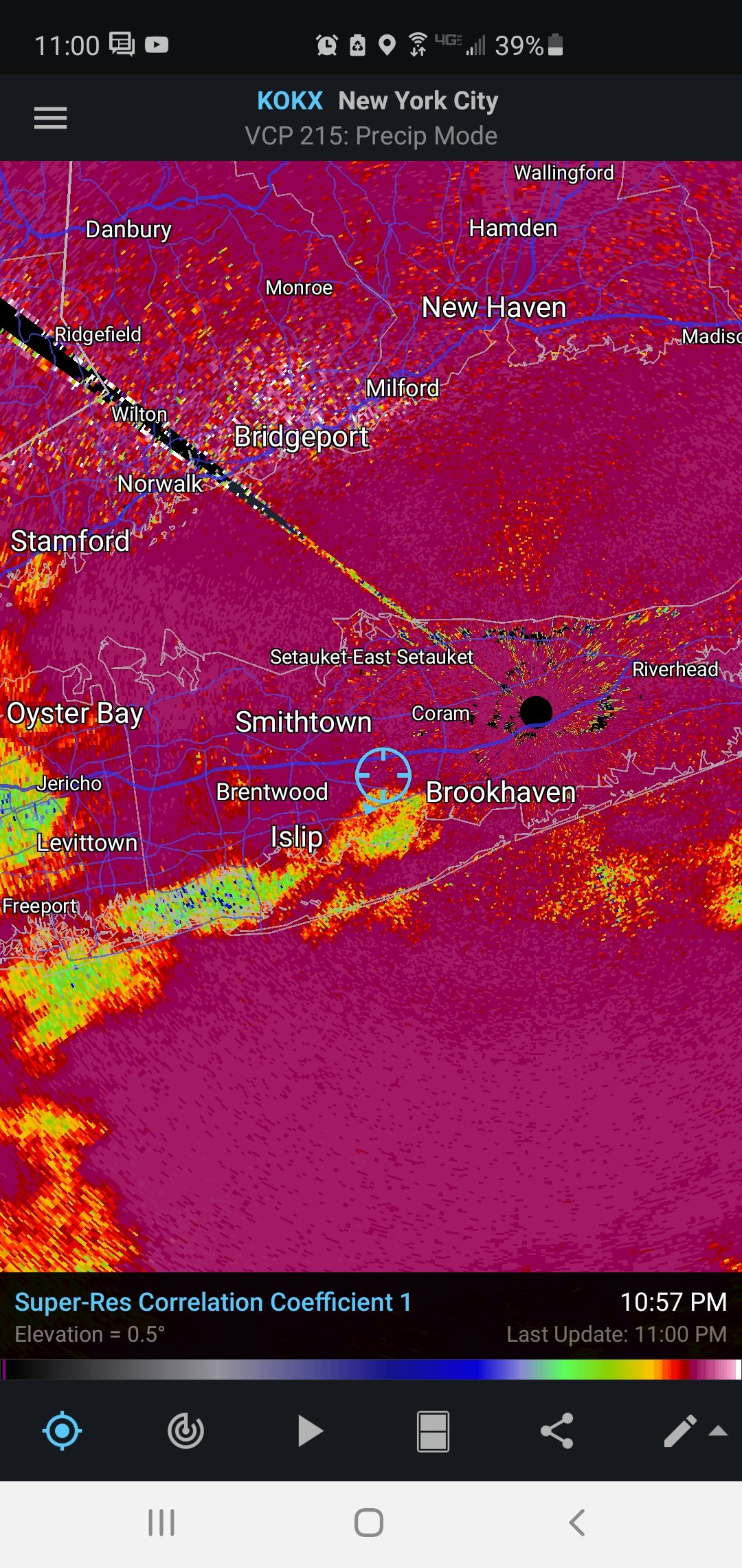
That's why I said "roughly". I drew that with a finger lol- 1,011 replies
-
- 1
-

-
- heavy snow
- sleet
- (and 4 more)
-
December 16-17, 2020 Storm Observations and Nowcast
Rjay replied to wdrag's topic in New York City Metro
^roughly- 1,011 replies
-
- 1
-
-
- heavy snow
- sleet
- (and 4 more)
-
December 16-17, 2020 Storm Observations and Nowcast
Rjay replied to wdrag's topic in New York City Metro
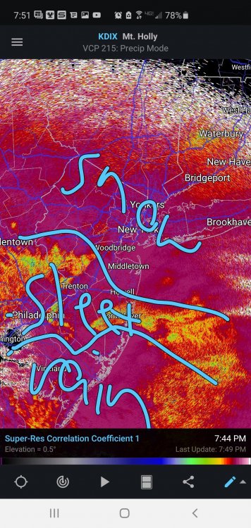
- 1,011 replies
-
- 1
-
-
- heavy snow
- sleet
- (and 4 more)
-
December 16-17, 2020 Storm Observations and Nowcast
Rjay replied to wdrag's topic in New York City Metro
That's fine. It's beautiful out there
- 1,011 replies
-
- 1
-
-
- heavy snow
- sleet
- (and 4 more)
-
December 16-17, 2020 Storm Observations and Nowcast
Rjay replied to wdrag's topic in New York City Metro
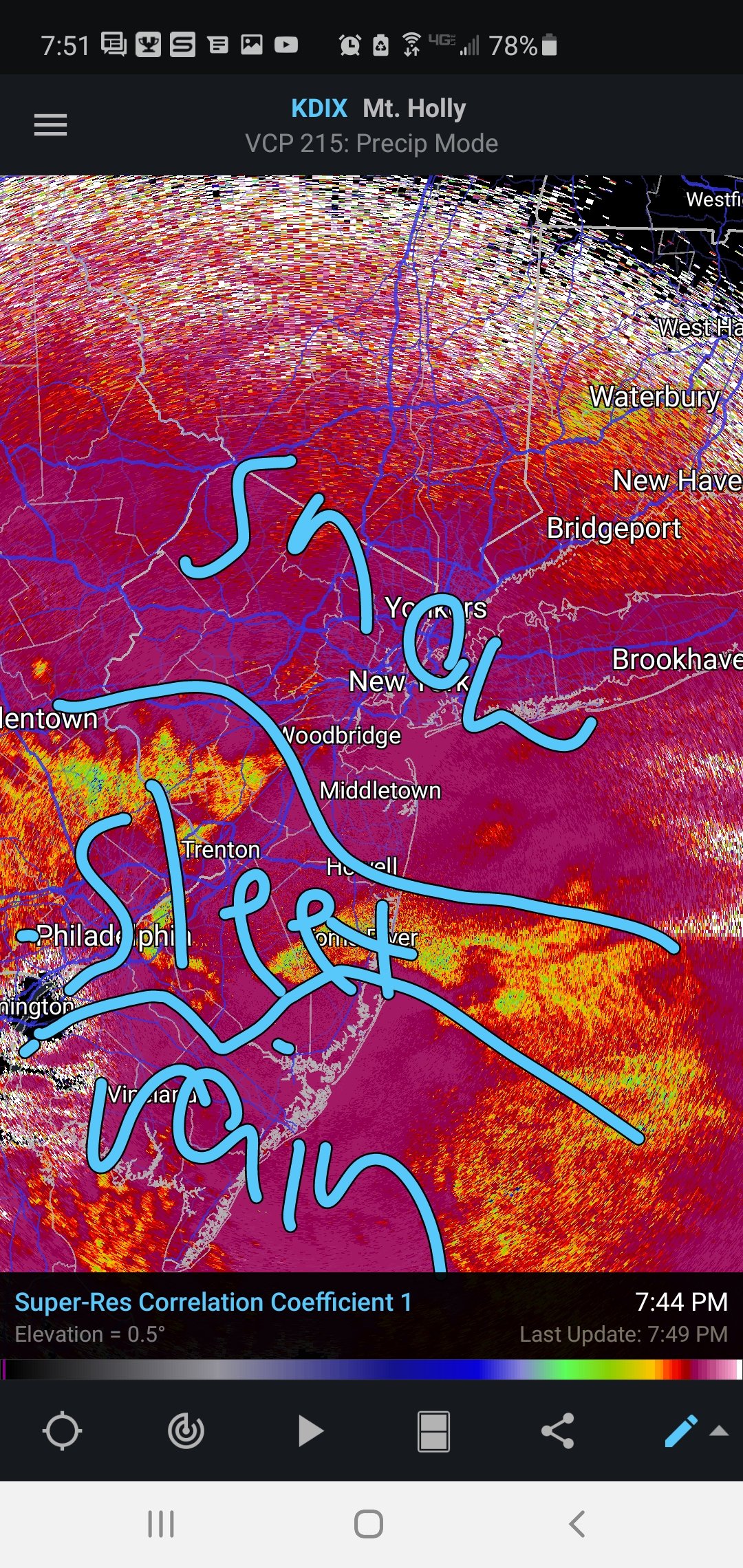
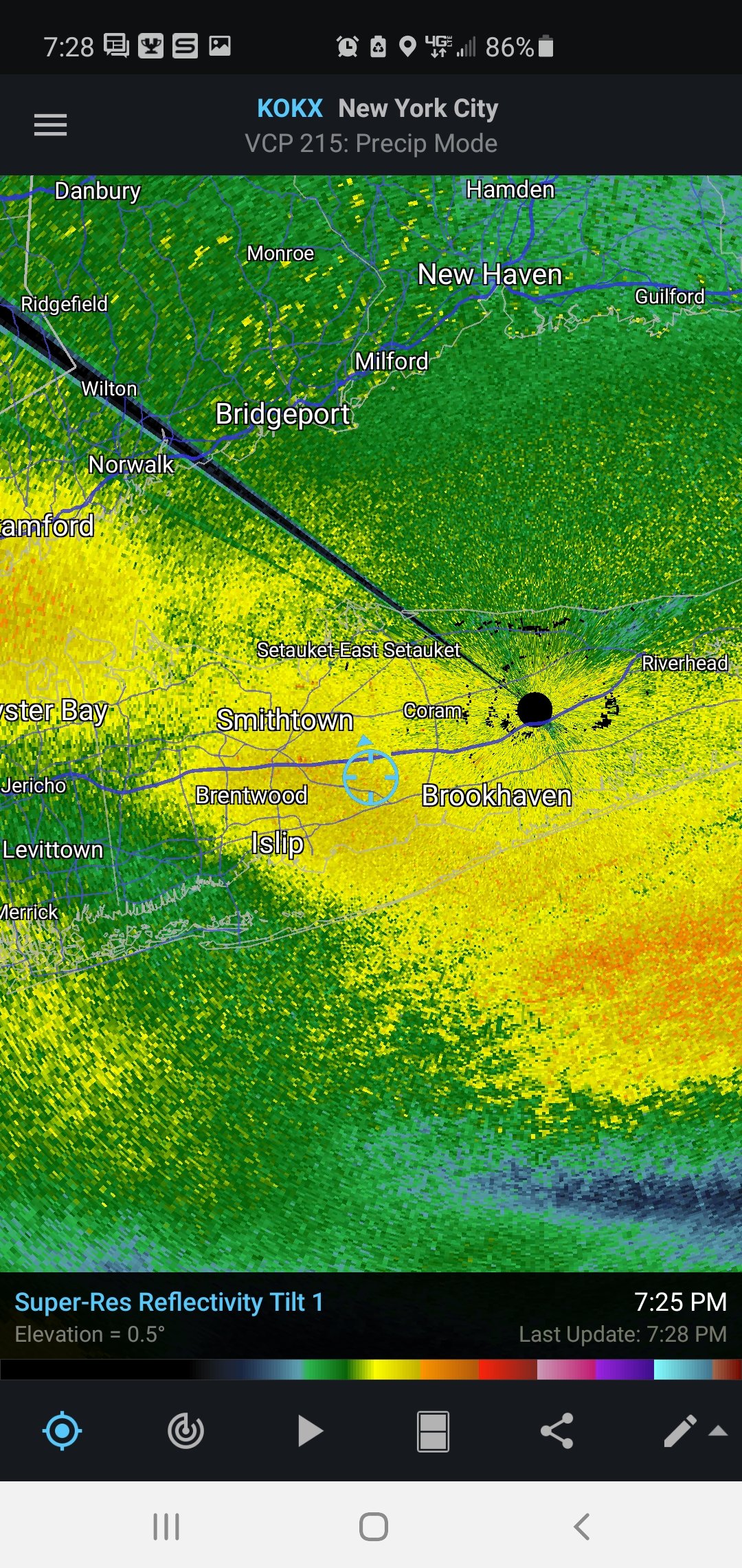
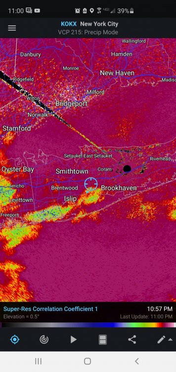
I'm outside. My fingers are frozen. And it's not light snow. Just peek at a radar. -
December 16-17, 2020 Storm Observations and Nowcast
Rjay replied to wdrag's topic in New York City Metro
Next person that mentions Donald Trump, Joe Biden or anything political goes byebye. Enjoy the damn snowstorm you nutjobs!- 1,011 replies
-
- 7
-
-
-

-
- heavy snow
- sleet
- (and 4 more)