nycsnow
-
Posts
4,909 -
Joined
-
Last visited
Content Type
Profiles
Blogs
Forums
American Weather
Media Demo
Store
Gallery
Everything posted by nycsnow
-
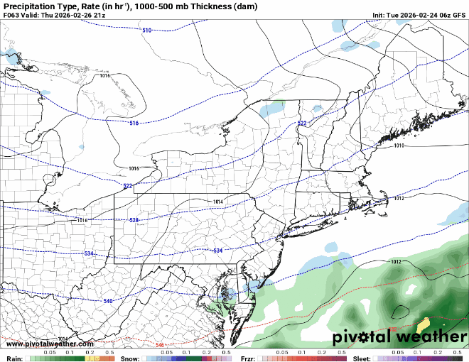
Gfs seems to be on its own with the amount of rain for the 4th and the coverage of showers
-
Gfs op and AI want nothing to do with Monday, really euro AI on its own
-
Insane melting going on
-
Might not be much snow cover next week, it’s fading fast in city. Just the piles won’t melt
-
And moved up to a Monday daytime event, we have gotten our bumps north let’s see
-
Euro ai came a bit north for Monday the op gets shredded by the high

-
Let’s see how many thread the needle situations we can get lucky with in a week lol
-
Next 9 days on gfs
-
Trending north Friday
-
Gfs is more of a Monday afternoon into early Tuesday. Still a week out I’m sure in a couple days if it’s real we’ll see the timeframe… the way this years been wouldn’t be surprised to see it end up back on a Sunday Monday. Seems like most of our snow has been lol
-
Looks like all the bands nyc east are about to merge…
-
Puking snow in Massapequa
-
That band over Nassau is ripping
-
Long Island band seems to be weakening
-
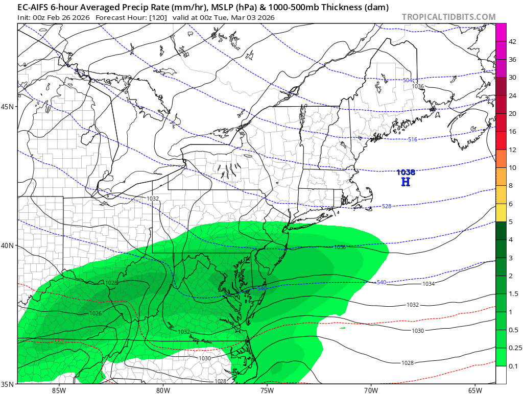
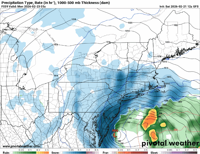
gfs had this Saturday, overall gfs nailed this storm
-
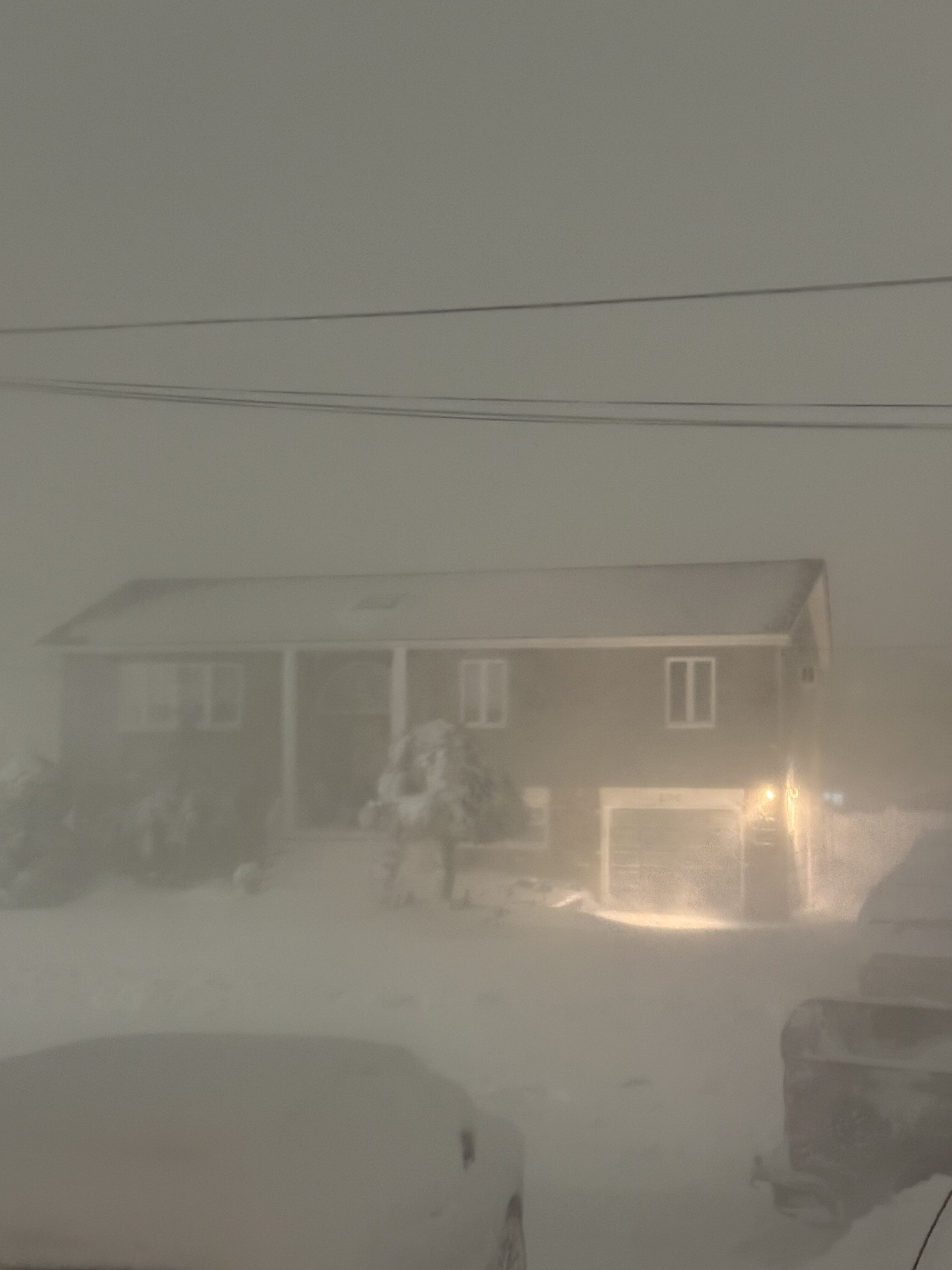
Legit can’t see across the street Under the li band
-
These bands are gonna merge I think… the metro and Long Island gonna get destroyed
-
-
Are these Long Island bars bands not gonna make it anymore west?
-
To come
-
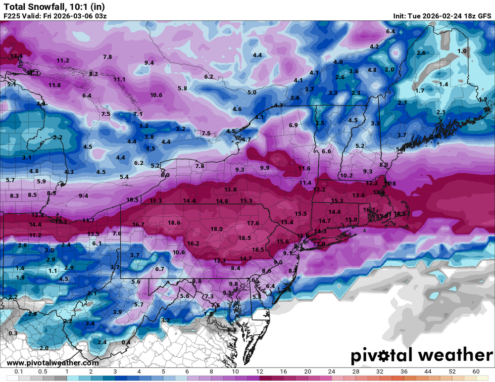
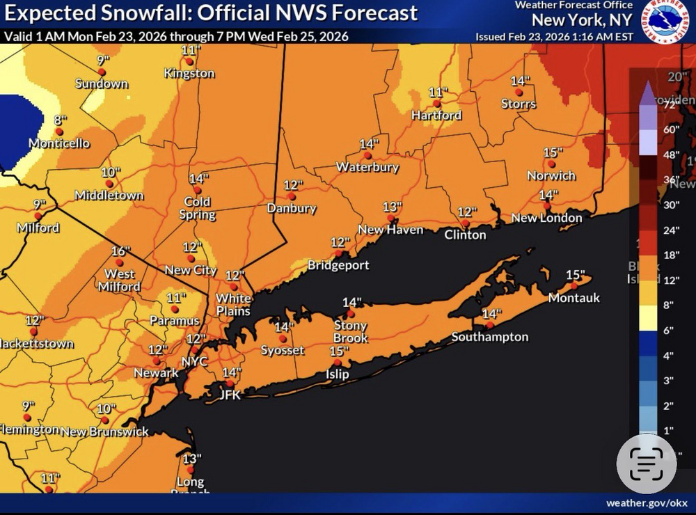
Hrrrr says most of us are getting another 12-15….
-
Crawling
-
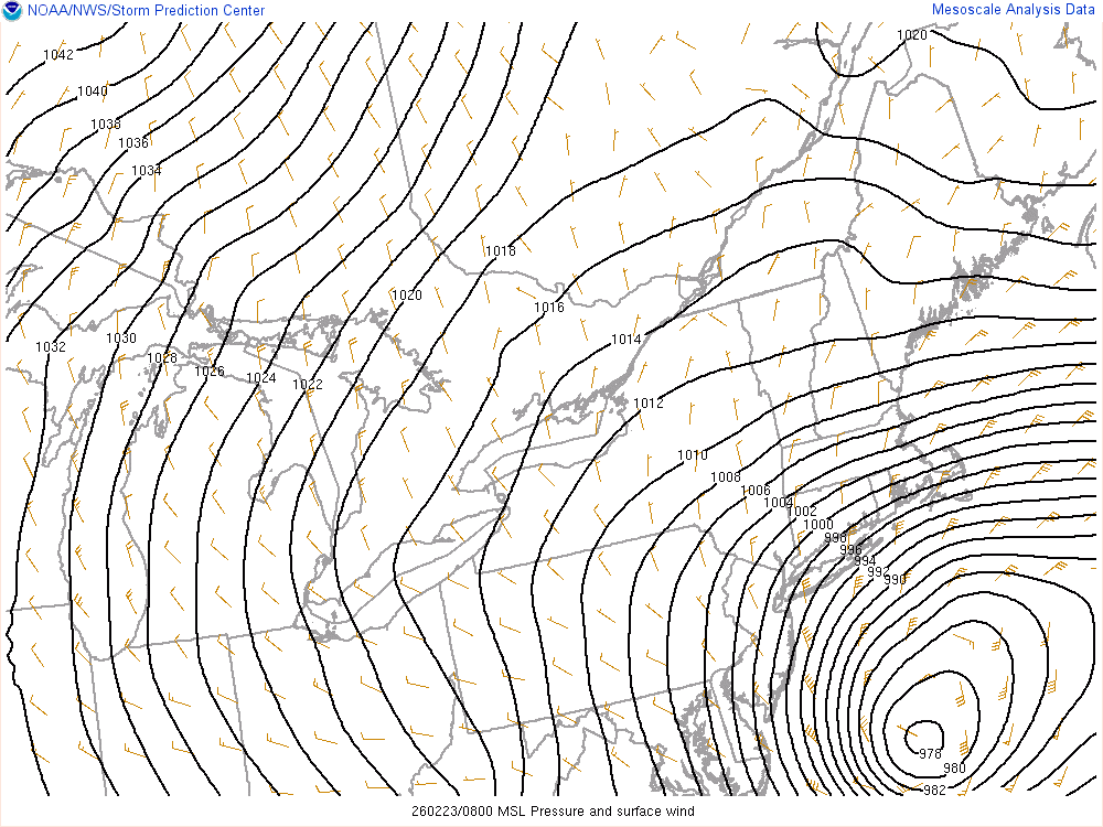
Storm is barley moving