nycsnow
-
Posts
4,909 -
Joined
-
Last visited
Content Type
Profiles
Blogs
Forums
American Weather
Media Demo
Store
Gallery
Everything posted by nycsnow
-
-
Good thing I went to my parents no power at my place in Staten Island
-
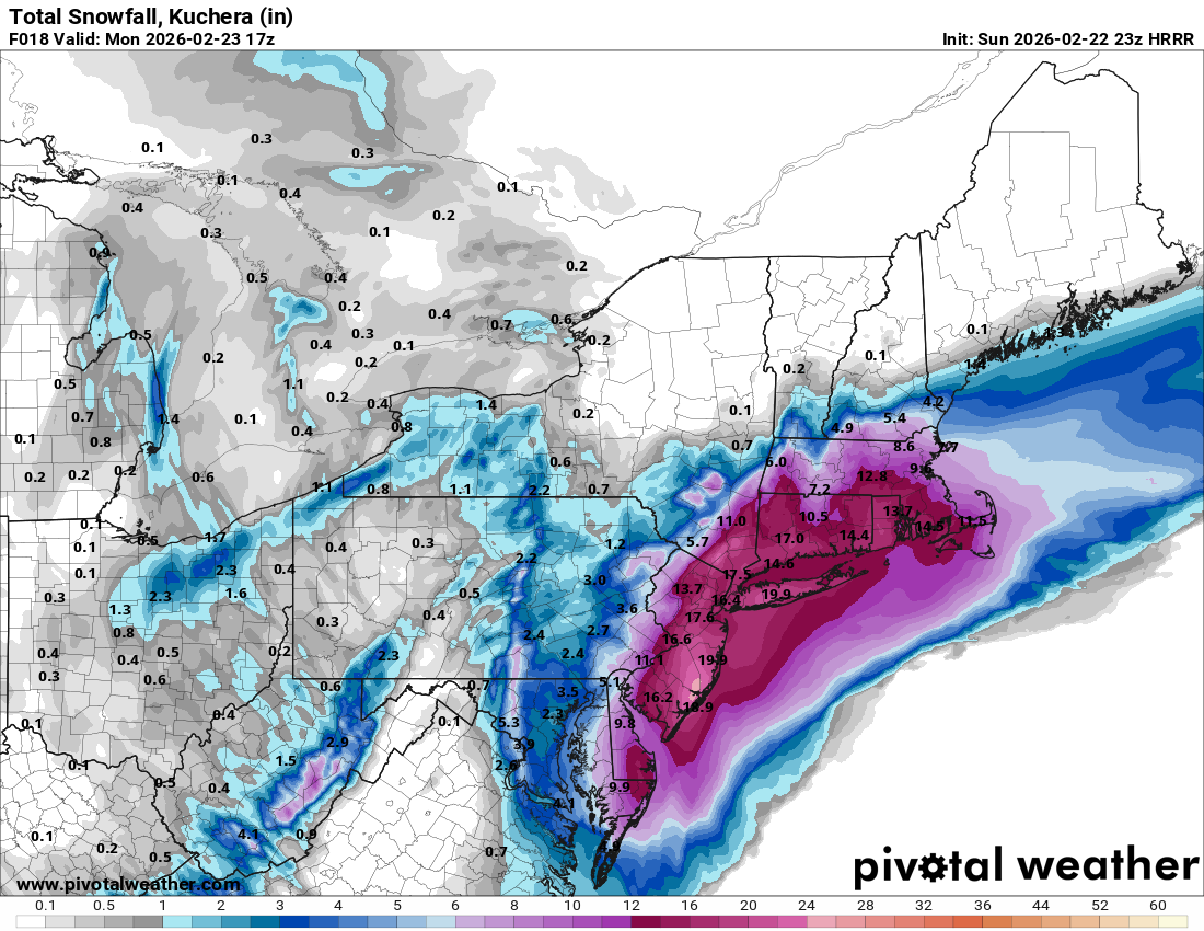
South shore of Long Island , Massapequa might be close it’s been non stop
-
Those big totals might be in trouble on Long Island unless some bands make it onshore, that deform band to the west is the show atm
-
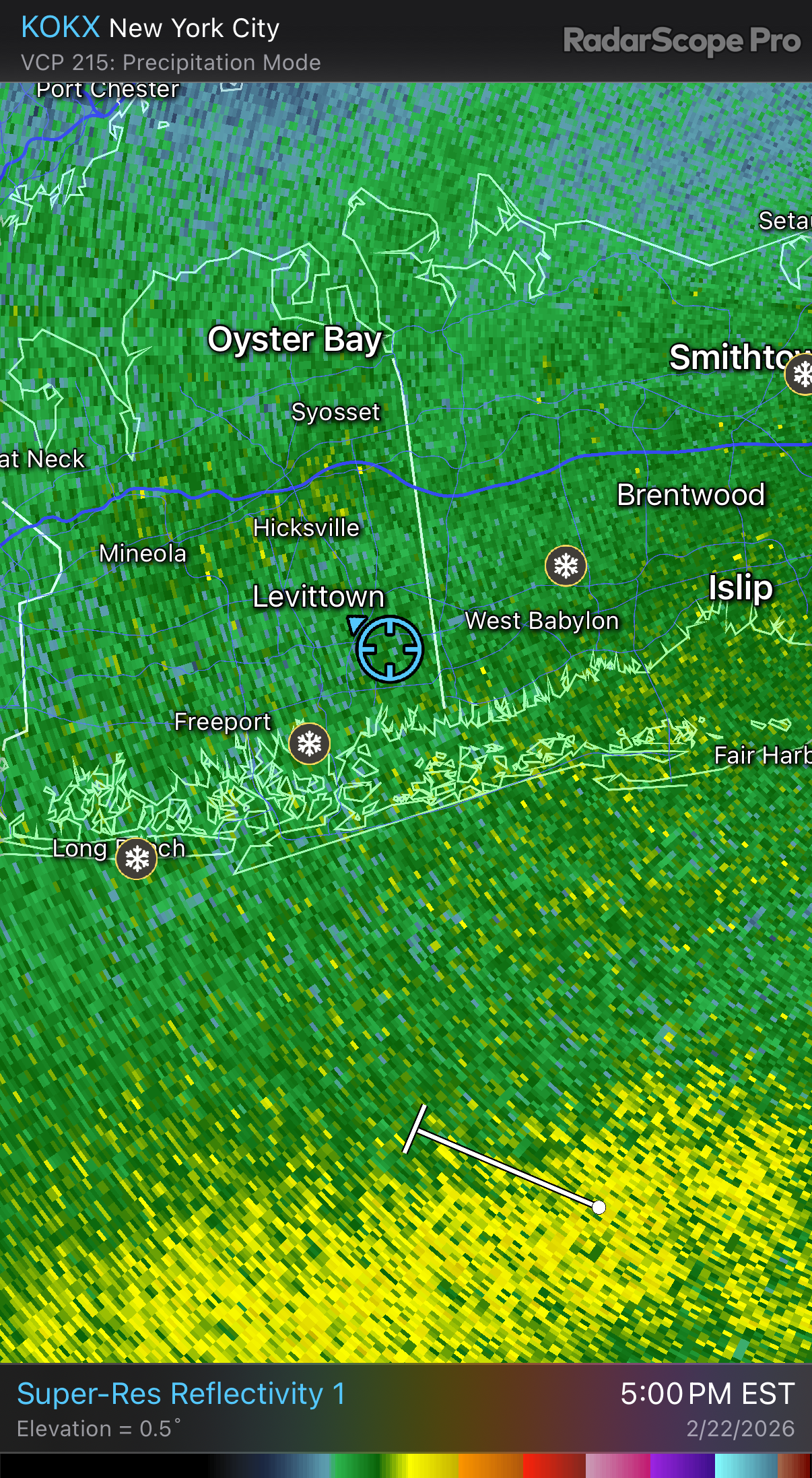
Radar looks good south of Long Island… hopefully bands keep building
-
So anyone taking a power nap or pulling all nighter?
-
Dongan hills Staten Island 1 foot
-
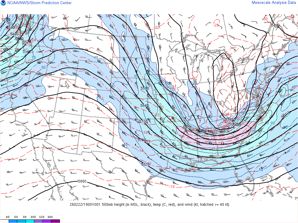
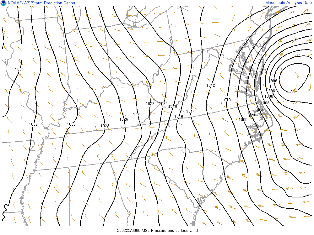
Special Weather Statement National Weather Service New York NY 1108 PM EST Sun Feb 22 2026 Northern Fairfield-Northern New Haven-Northern Middlesex- Northern New London-Southern Fairfield-Southern New Haven- Southern Middlesex-Southern New London-Western Passaic- Eastern Passaic-Hudson-Western Bergen-Eastern Bergen- Western Essex-Eastern Essex-Western Union-Eastern Union-Orange- Putnam-Rockland-Northern Westchester-Southern Westchester- New York (Manhattan)-Bronx-Richmond (Staten Island)- Kings (Brooklyn)-Northwest Suffolk-Northeast Suffolk- Southwest Suffolk-Southeast Suffolk-Northern Queens- Northern Nassau-Southern Queens-Southern Nassau- 1108 PM EST Sun Feb 22 2026 ***Multiple Bands of Heavy Snow to Impact the Area Overnight*** Bands of heavy snow will move across the area through the overnight as low pressure rapidly intensifies to the south. Some of these bands will produce 2 to 3 inches per hour rates. However, in between bands, snowfall rates may drop off to about an inch per hour. Farther to the west, across western portions of the Lower Hudson Valley and interior portions of northeast New Jersey there will be a sharp back edge to the heavy snow and some uncertainty as to how far these bands get. This could impact snowfall totals across this area. Additionally, winds will become a factor as the night progresses. Blizzard conditions are expected and will make travel treacherous and potentially life-threatening
-
Basically moving due north
-
Legit full blown whiteout
-
Hrrr slowing down and showing more snow now, maybe picking up on the fact this things just not moving really down south

-
Radar absolutely exploding south of LI
-
Looks more east
-
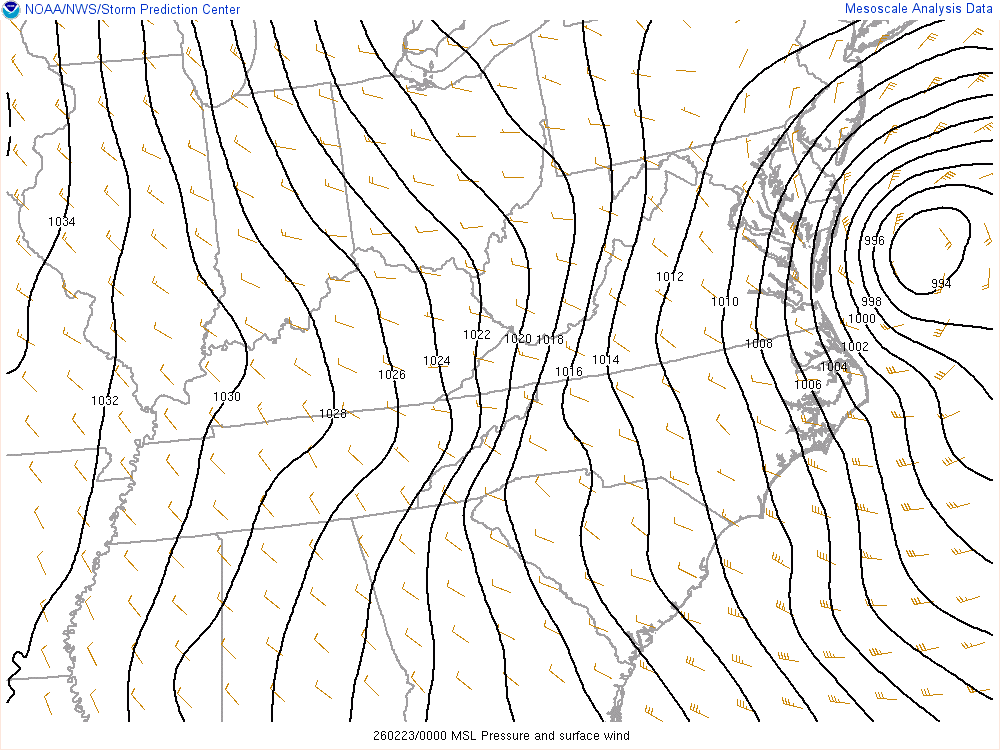
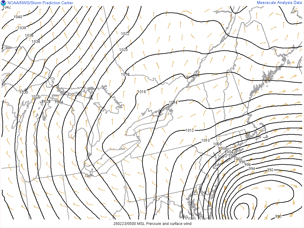
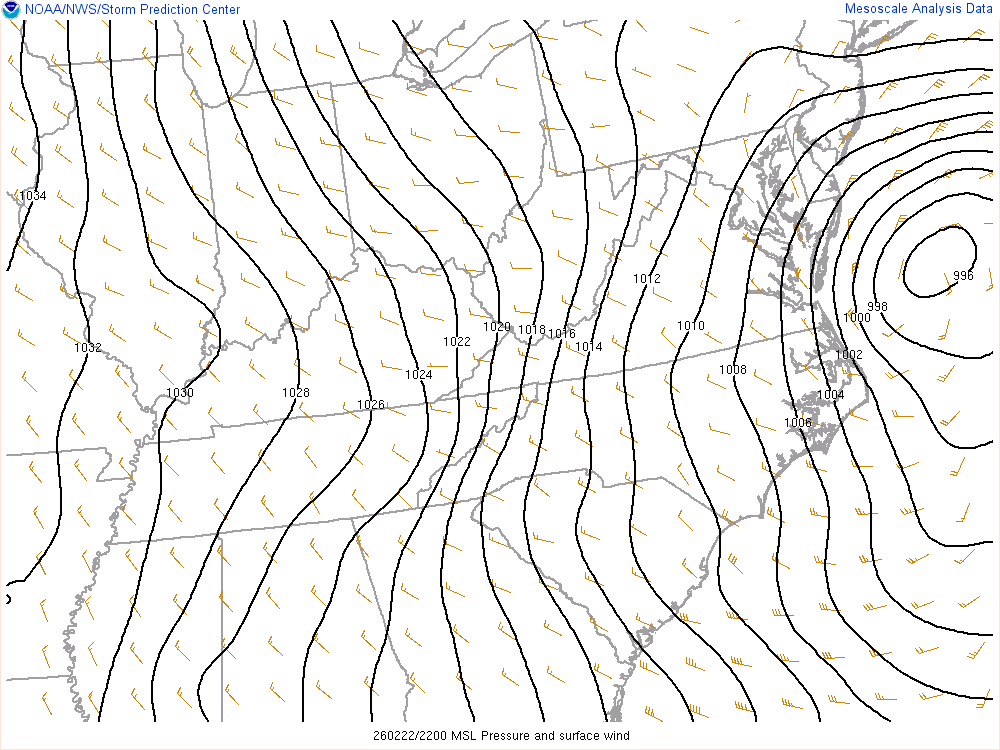
994 and tucked in more from last hour
-
Ripping In south east Nassau right now
-
Still snowing
-
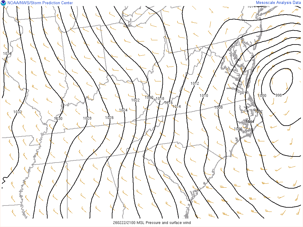
996 and crawling
-
Are we negative tilted yet?
-
Radar looks gorgeous

-
998 tucked in
-
FWIW I compared the hrr and rap initializing and they’re almost identical to current meso data low is in same spot and they are 1001 mb hour 1 it’s currently 1002
-
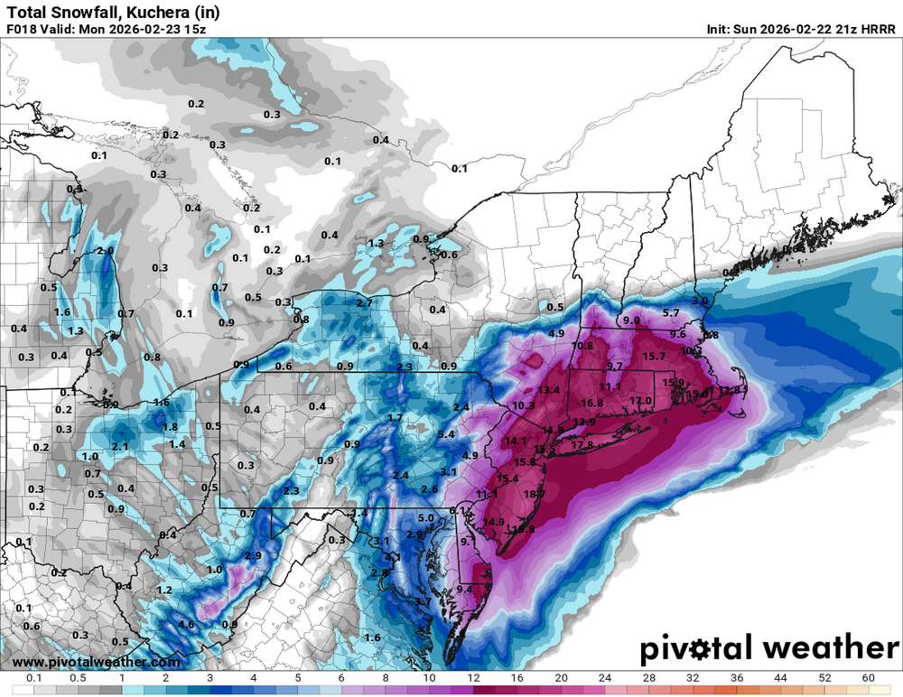
I really think the further east you go closer to 2 feet, if the banding is legit 24-30 might happen for someone
-
Radar looks great, low looks great. Meso models look great… it’s coming