nycsnow
-
Posts
4,909 -
Joined
-
Last visited
Content Type
Profiles
Blogs
Forums
American Weather
Media Demo
Store
Gallery
Everything posted by nycsnow
-
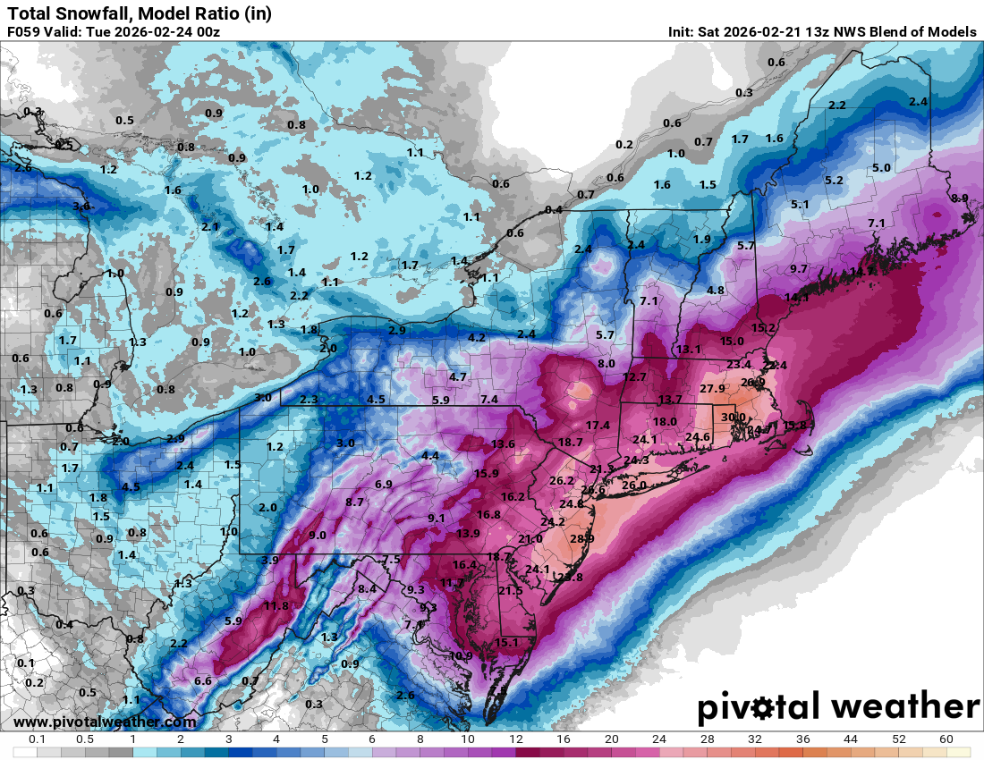
10-20 localized 2 feet
-
Nam is gonna be ridiculous
-
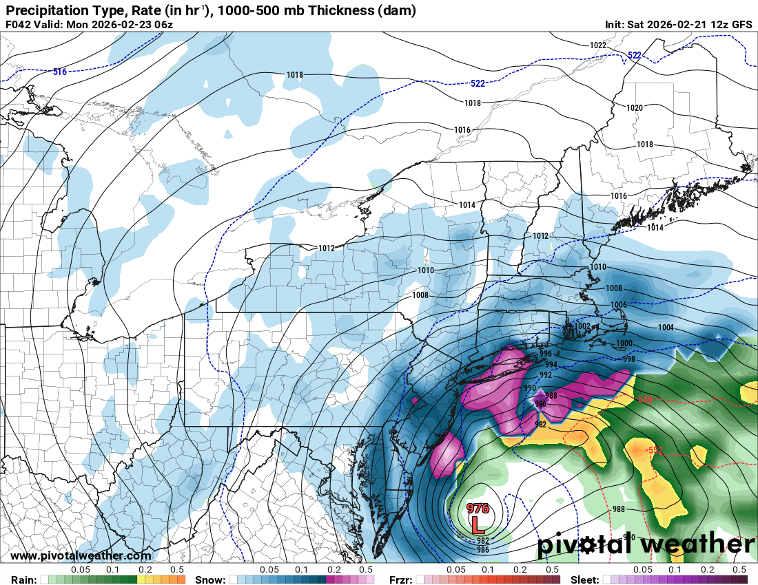
It’s still snowing after this
-
I bet we’re gonna have a large coverage blizzard warning by afternoon update. Don’t see why they wouldn’t upgrade today or tonight
-
-
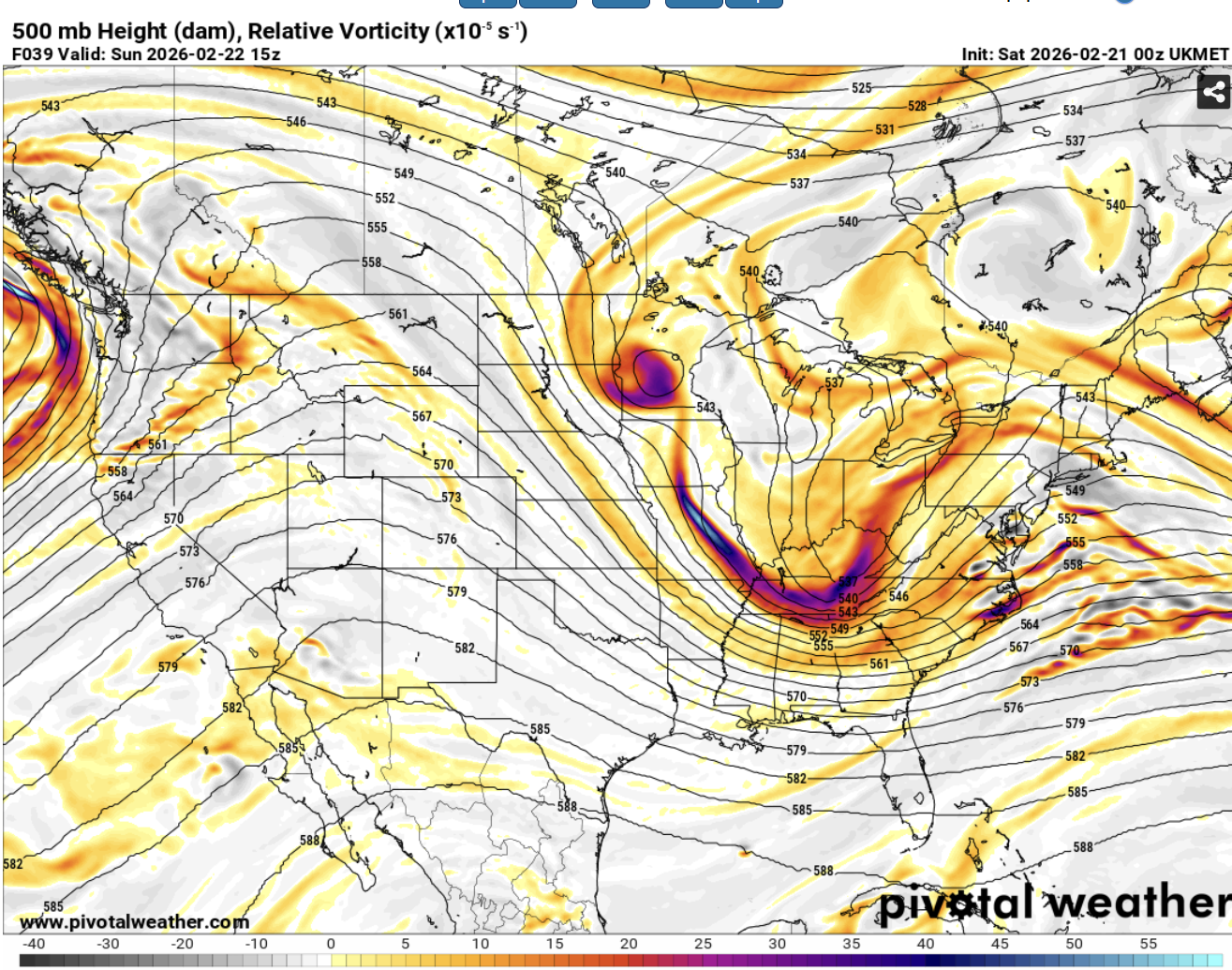
Ukie tucking in
-
Canadian running, hopefully it trends tucked
-
Icon eps west
-
-
Rgem tucking in more to
-
-
Icon gonna be 1-2 feet, tremendous increase
-
Icon gonna be a lot better
-
Still snowing at end of this run
-
Fv3 joining in
-
2-3 feet on this run lol
-
-
The Nam just runs so slow lmao