GrandmasterB
-
Posts
805 -
Joined
-
Last visited
Content Type
Profiles
Blogs
Forums
American Weather
Media Demo
Store
Gallery
Everything posted by GrandmasterB
-
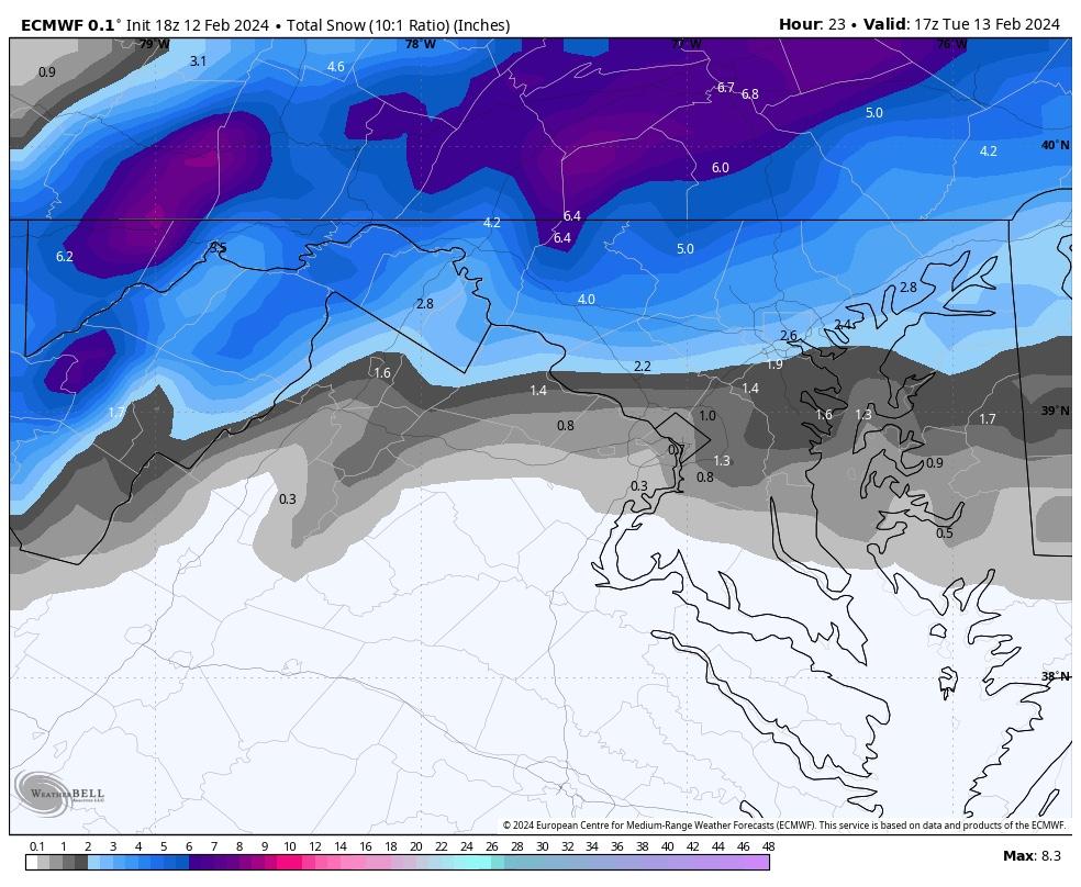
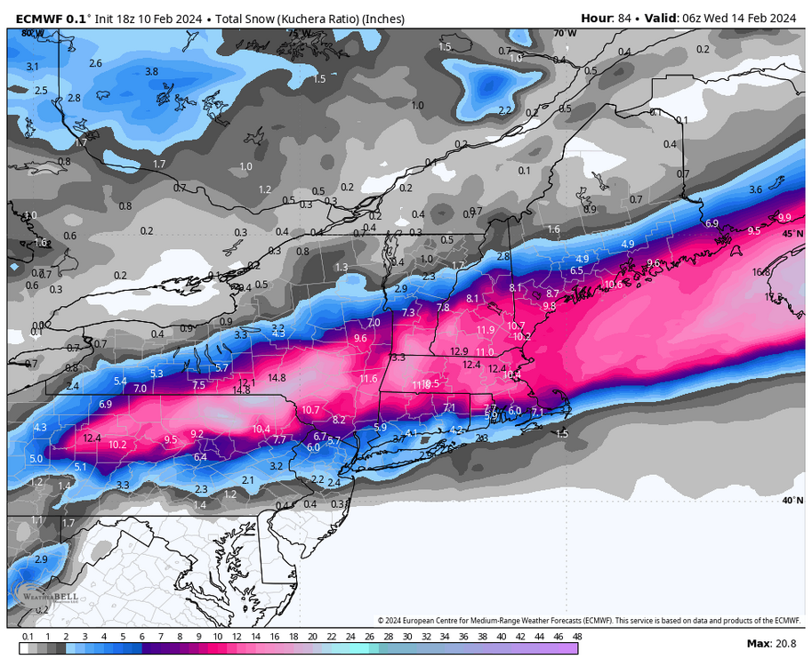
Full cave from the Euro

-
I think this is reasonable and probably what I would forecast. Now the warning in DuBois on the other hand…
-
How fast can I sign for this??
-
LOL, just not even close to much other guidance.

-
The Euro has a little bit of support from the Ukie, but no support at all from the mesos. As AccuChris mentioned gotta lean mesos at this stage.
-
ninja’d

-
I actually think that’s a bit too aggressive. Gotta hope the rates are there.
-
I think if the Ukie is the absolute floor for this event, that’s a great sign.
-
Coastal delayed in getting going is a big time watch out on Miller B’s as we’ve all experienced. Caution is warranted.
-
It’s clear that it will be pound town somewhere in that band.
-
Based on both NAM maps, if a forecaster said 2-5” for Lancaster/MDT/York that would probably be fine.
-
Very broad swath of accumulation on those NAM maps. That’s good to see.
-
For the record, no headline currently for Lancaster with impacts modeled within 18 hours.
-
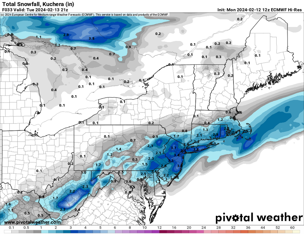
Yesterday’s 18Z NAM was the first model to show the southern solution. So you’re correct.
-
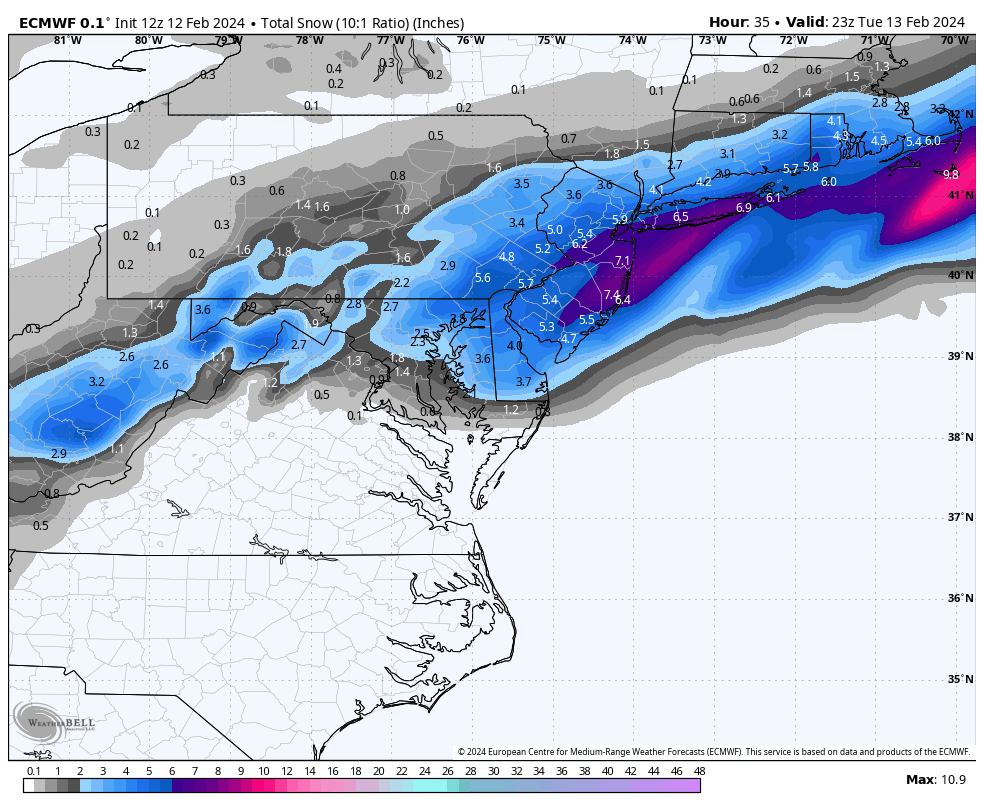
If it occurs as depicted there…oh man. Thats a ridiculous look. Blizz is a legend for this one!
-
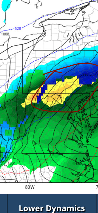
Not sure what the orange mix is on the Canadian but I’m going to assume it’s heavy snow.
-
If I knew ahead of time that all I needed to do was tell Blizz he was a weenie and we’d get a snowstorm I would have done it a long time ago.
-
Apparently Blizz is a miracle worker
-
Yoooo WHAT???
-
The Blizz Storm lives! Every 10 miles makes a huge difference.
-
The NAM isn’t cooking up a different evolution, it’s just south east of all other guidance…which could be a trend. Wait and see now.
-
All aboard the Blizz train as the NAM goes wild for all of us!
-
If we haven’t had a storm named after Blizz yet this year I’m nominating this one! Keep up the good fight Blizz, most of us love it.
-
yikes!
-
Love the optimism Blizz! Still a ways to go I guess.