weatherwiz
-
Posts
79,817 -
Joined
-
Last visited
Content Type
Profiles
Blogs
Forums
American Weather
Media Demo
Store
Gallery
Everything posted by weatherwiz
-
Have to watch that, some decent rotation
-
Yup that will probably be the best/only cell really this far east.
-
Nasty cell east of pittsfield
-
Nice looking hook near Schenectady
-
From the temperature profile (which this is also apparent by how poor the 700-500 lapse rates are) convection would really struggle in that environment. The llvl turning is nice but not a ton of speed shear there in the lowest 3km or really through the column...winds aren't really increasing with height. Could see some gusty winds in that environment with the dewpoint depression/inverted-v look
-
Yeah this is more central/northern New England today. Best forcing too late for southern areas. Those mlvl lapse rates hang on a few more hours today and there could be some nasty storms up north.
-
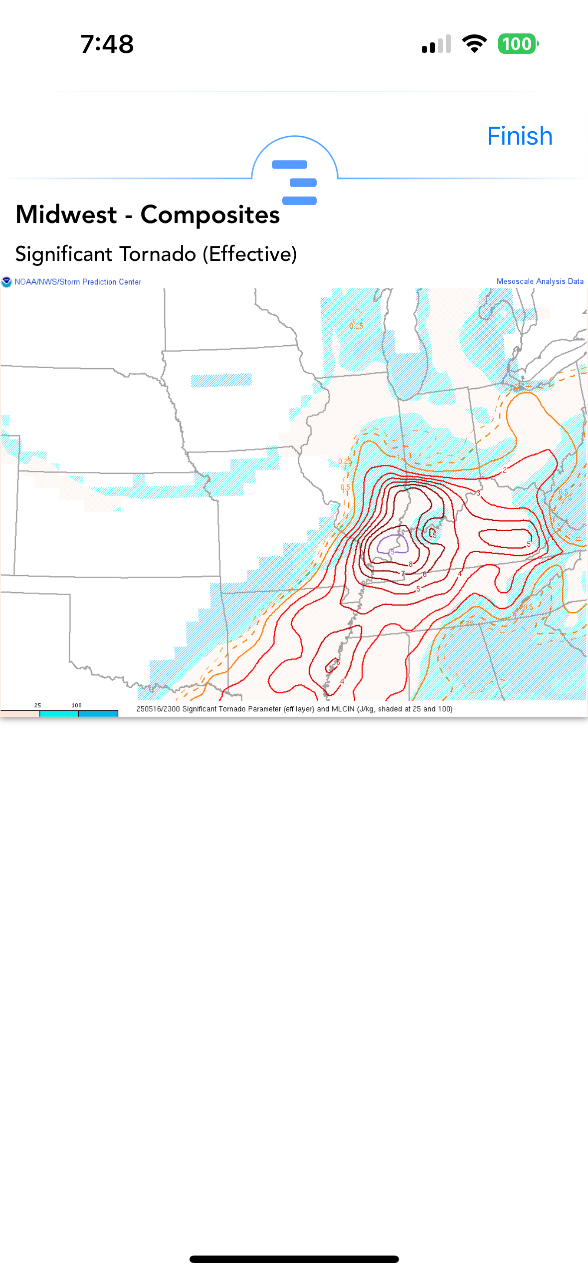
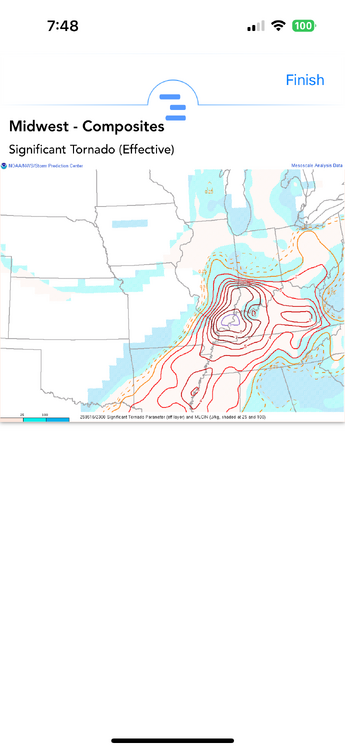
Correct, discrete cells is where you can get violent, long tracked tornadoes in these setups. Those cells are in a prime environment. Going to be an ugly few hours
-
This is insane
-
IND 65 knots!!!!
-
I couldn't imagine being in any of those buildings on the higher floors and seeing that. I think I would literally start jumping floors and not even running down the stairs
-
ummm I certainly hope that's a rain shaft unfortunately it isn't
-
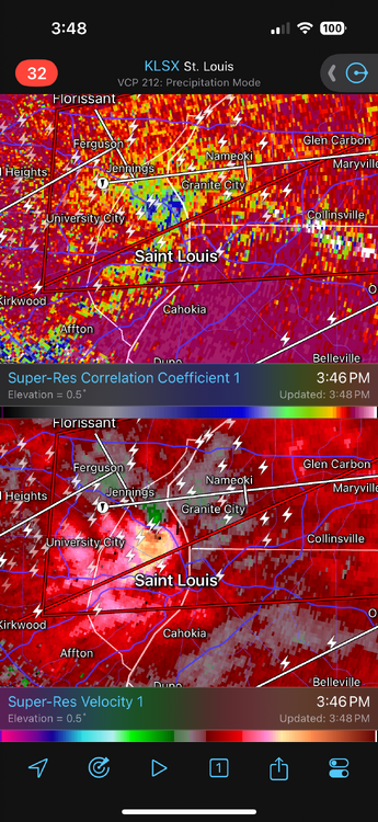
Gotta be close to tornado emergency call there...if that gets any stronger that may happen
-
Nice KSTL 161938Z COR 22032G47KT 1/4SM R30R/2200VP6000FT +TSGRRA SQ FEW045 BKN070CB OVC090 23/18 A2964 RMK AO2 PK WND 24047/1936 RAB12GRB36 TSB16 PRESRR CONS LTGICCCCG ALQDS TS ALQDS MOV NE GR 1/2 P0006 T02330183
-
Oh shit
-
My niece is graduating from college and the ceremony is Thursday at Dunkin Park in Hartford...looks like crap
-
Mildly intriguing but been oozing alot over tomorrow
-
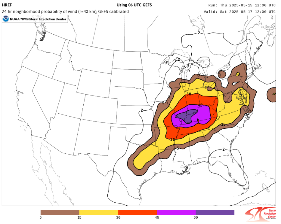
Probably fall short of the distance criteria for a derecho but could be close
-
We may eventually see a moderate risk (maybe high for tomorrow) in the Ohio Valley
-
Perfect, that was an option I was debating too. Ultimately, I'm not looking to get crazy or too much into the weeds with precipitation, just want to focus on "where it's wet" and "where its dry"
-
Is this the best source out there for precipitation anomalies? https://psl.noaa.gov/data/usclimdivs/ I wish something was available here https://psl.noaa.gov/data/atmoswrit/map/ to create custom climatology periods. https://psl.noaa.gov/data/usclimdivs/ offers several climatological periods but I wish they had a long-term one that went through at least 2010. 1895-2000 is great for a very long-term but wish it went through 2010. 1951-2010 is also solid but wish it started back farther lol.
-
I can’t wait for it to be about 20F warmer with dews about 35F higher. It’s nice outside but even better with 90-70
-
Meant more into Montana and maybe Wyoming...should have specified that
-
The pattern is going to be active with fronts moving through and some multiple anomalously strong lows developing within the northern Plains (probably bringing some accumulating snow to higher mountain peaks). We're going to have plenty of precipitation chances through the end of the month. But with the pattern the nice days are going to be quite nice and the bad days are going to be pretty awful.
-
Did anyone know you can view 4 panel charts on COD and choose which 4 products to display??? https://climate.cod.edu/products/forecast/mod4p.php?model=HRRR&runtime=12# HRRR outdated in that link but NAM/GFS fine. Would be sick if it had euro
-
Man so much beer in there the last 10-12 hours I almost got drunk reading it