weatherwiz
-
Posts
79,817 -
Joined
-
Last visited
Content Type
Profiles
Blogs
Forums
American Weather
Media Demo
Store
Gallery
Everything posted by weatherwiz
-
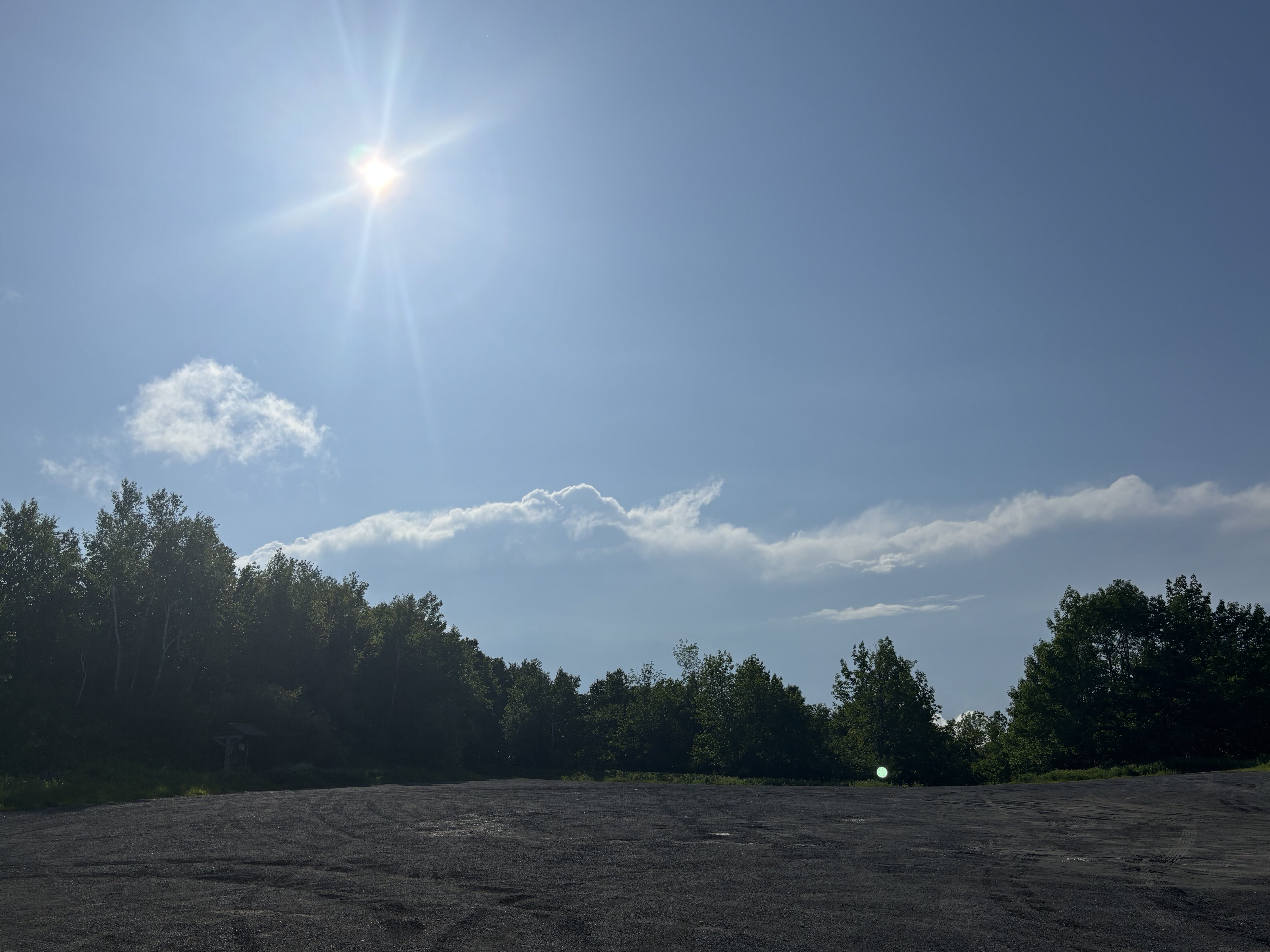
Seeing 45-48 mph pixels headed our way!!!
-
Hearing some thunder!! Must be CC lightning
-
Hoping for at least a few lightning strikes and 40 mph gusts
-
That’s our cute little storm off in the distance
-
Let’s go

-
Not going for severe, going for lightning
-
Headed out shortly. Going to Petersburgh, NY
-
Dons don’t wear shorts
-
That’s if I can ever get out of the stupid DMV
-
Probably headed towards Albany later…maybe just south or maybe a bit closer to NY/VT border.
-
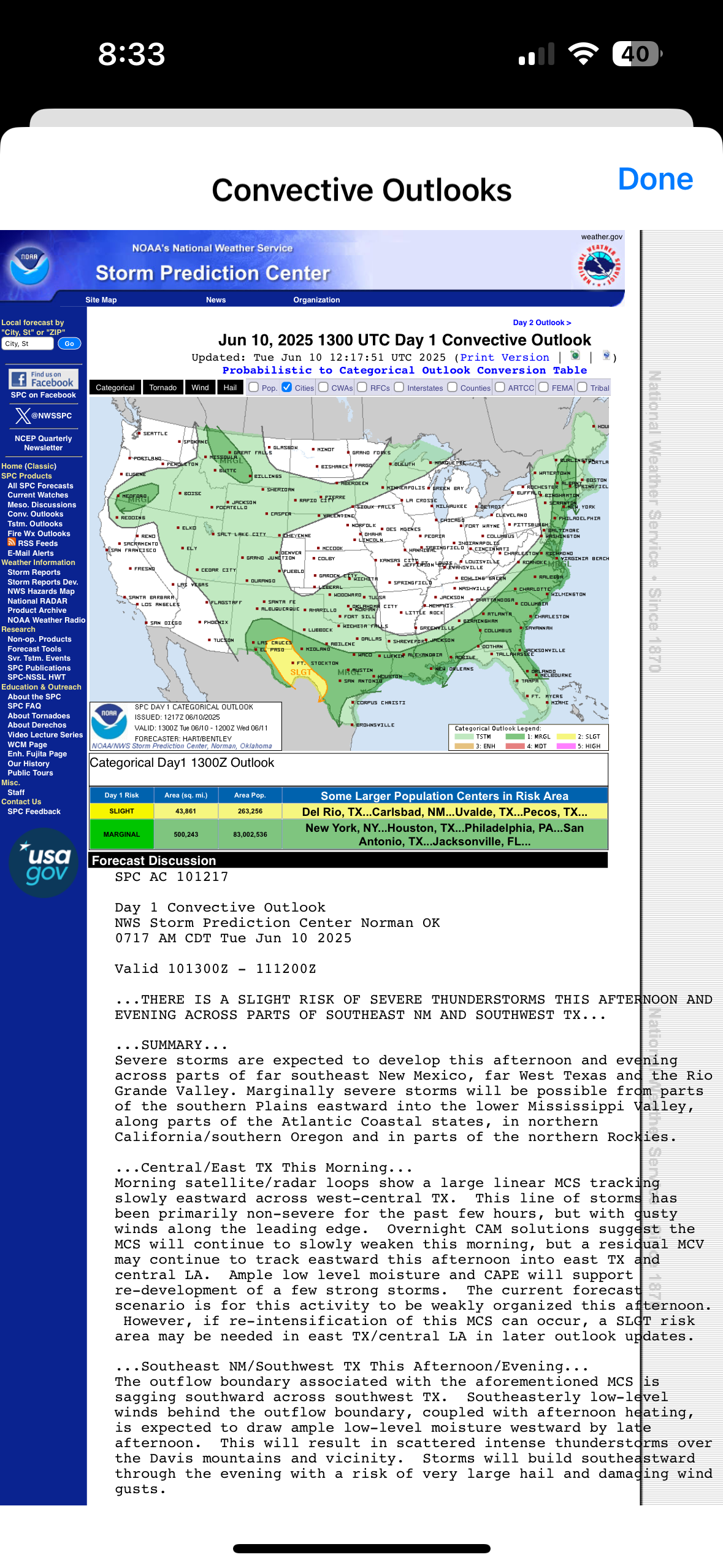
Happened one outlook earlier but AIT
-
Accuweather should just rebrand to Climoweather
-
Unfortunately, all I can do is live in fantasy land but the Euro and GFS hint at some big severe potential the weekend of June 20th.
-
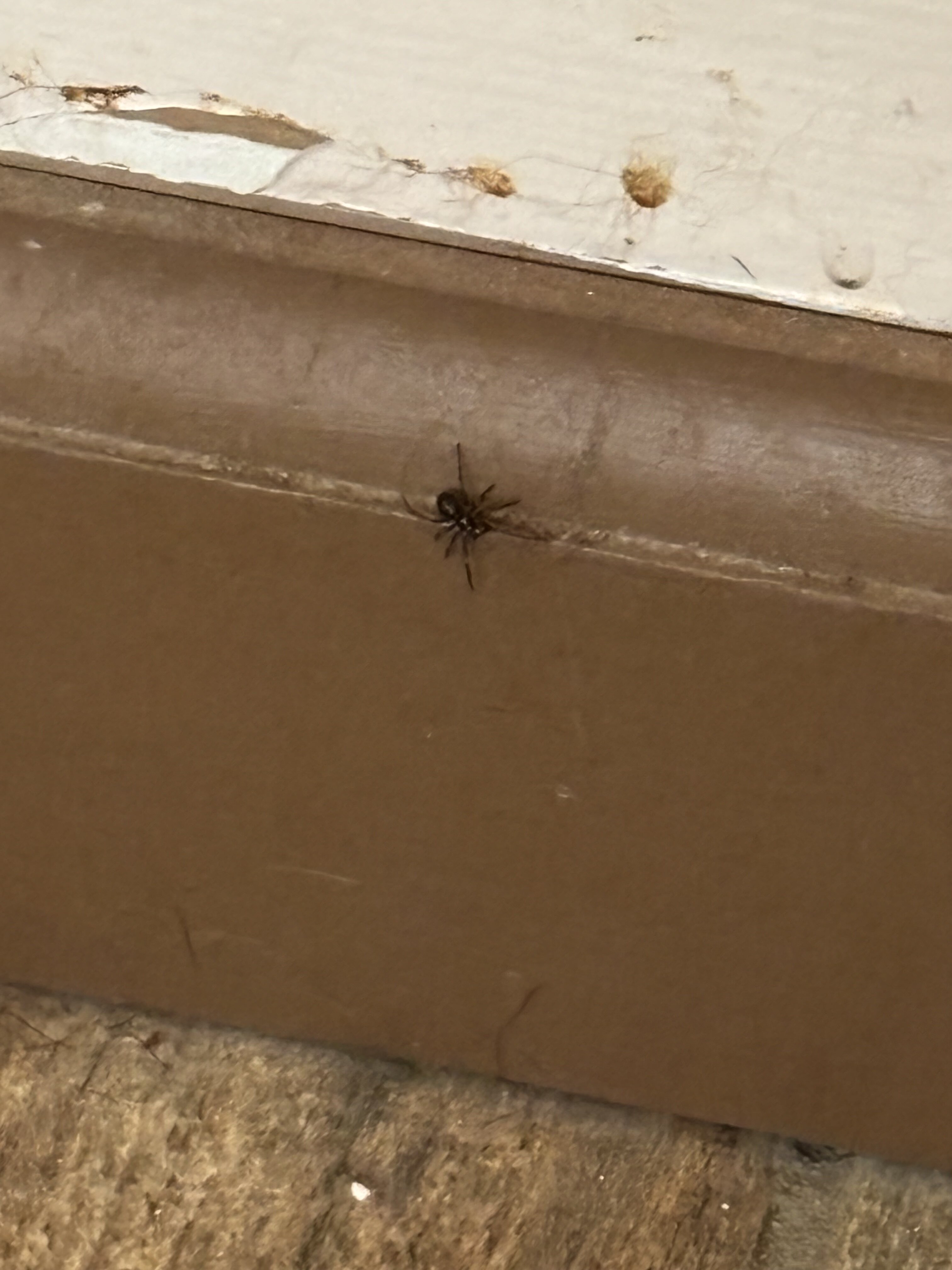
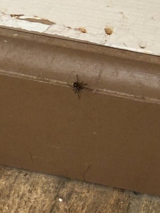
Was mopping and saw this at the base of the wall. Looks like a black widow
-
I'm bored....last few days of vacation for chasing so may as well utilize it. Was watching Twisters the other night along with what was going on in the southern Plains the last few days and I think next year is definitely going to be going out west. If I am ever going to make that happen it has to be in the next year or two.
-
hoping to go into NW Berkshire county tomorrow...maybe up around Albany if it looks good for some lightning at least
-
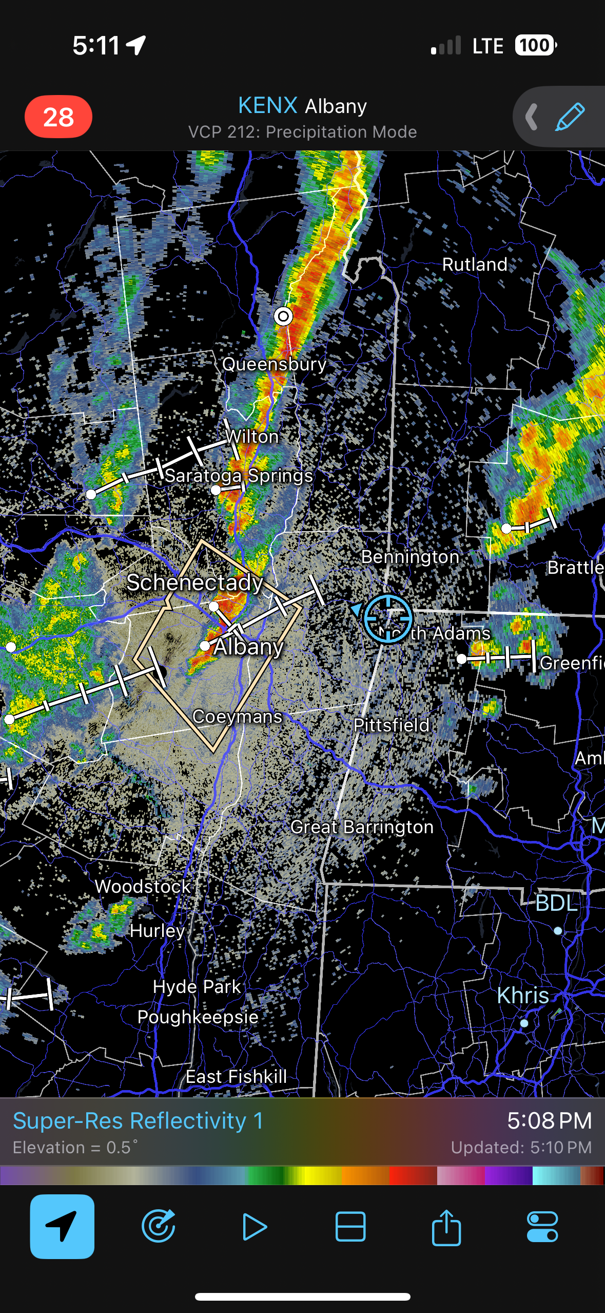
eastern NY into Berkshire County definitely game on for a few strong thunderstorms late tomorrow afternoon and early evening. May see a marginal risk with 13z update tomorrow.
-
Yeah this blows...we'll have warmer days once winter rolls around
-
Wonder if there could be some strong storms tomorrow late afternoon out in E NY
-
It's been quite an active start to the season this year...I'm not sure if it's like top 5 but its been on the active side.
-
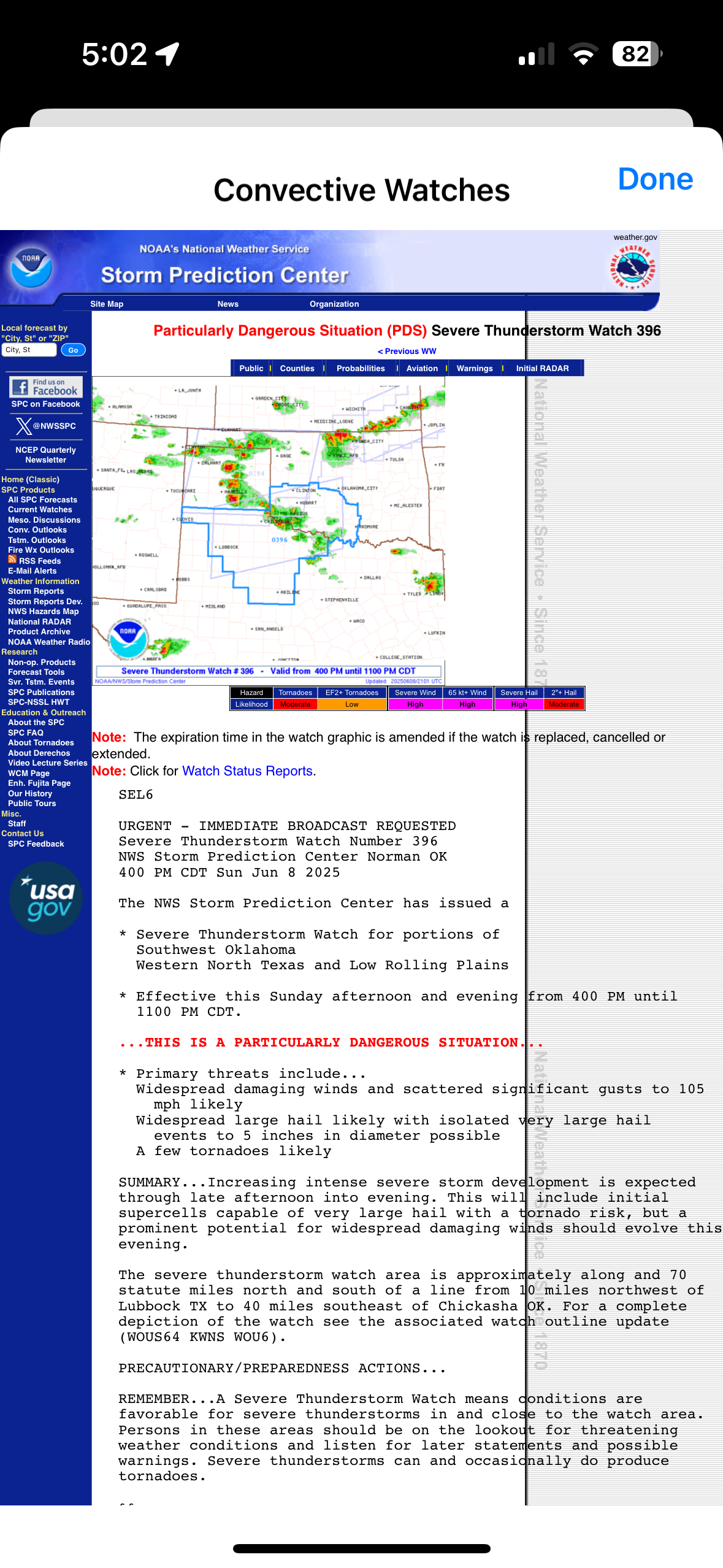
Now this is a watch

-
Only signs I noticed were “no alcohol allowed”
-
Yeah I’m not sure what to think and whether I should be concerned. I wasn’t walking in any grassy/forested areas…it was generally concrete. When we were leaving there were a few bugs flying around my leg there so maybe I had got something and the little black dot was a part of it. But for all I know these could have happened from home lol.
-
Yes and I pay extra for this MDVIP program so I can text my doctor which I may. I don’t want to like go anywhere for just a bit bit this looks…not good lol
-
Have some really weird bug bite or something on the bottom of my leg. When I came back from Wachusett the other day and got in the shower, I noticed a few small red bumps on my leg and two of them had a tiny black dot on them. They were way too small to be ticks though, but the one on the bottom of my leg has increased in sized a bit and is really dark red…even looks like it has a bit of black. Weird