

weatherwiz
-
Posts
71,254 -
Joined
-
Last visited
Content Type
Profiles
Blogs
Forums
American Weather
Media Demo
Store
Gallery
Posts posted by weatherwiz
-
-
2 minutes ago, Hoth said:
It was snowing in northern NY last weekend. Wonder if left over cover in the high peaks can dampen the threat a bit?
maybe add more moisture

-
 1
1
-
-
1 minute ago, Typhoon Tip said:
this is gonna be schweeeet ass schadenfreude bust
I was just reading the outlook and they mentioned numerous severe gusts across MI...I don't think the thermodynamic environment there was impressive either. Perhaps the high Dcape will help? Maybe it is a bit noteworthy too that we were able to get some pretty decent gusts yesterday and you would think today conveciton would be much deeper. but idk...MLcapes less than 1000...tough to get truly excited
-
WOW...mod risk. Kind of odd to see that with such meager MLcape
-
1 minute ago, RUNNAWAYICEBERG said:
Not the way you drive. You’ll get there on Sunday.
??? are you implying i drive slow. I'm the total opposite

-
2 minutes ago, yoda said:
Guaranteed EF2 for in the 10 percent tor zone now since Wiz will miss it

-
1
-
-
I wonder if I could still make chasing. I get out of work in Branford at 5. (
 wishful thinking)
-
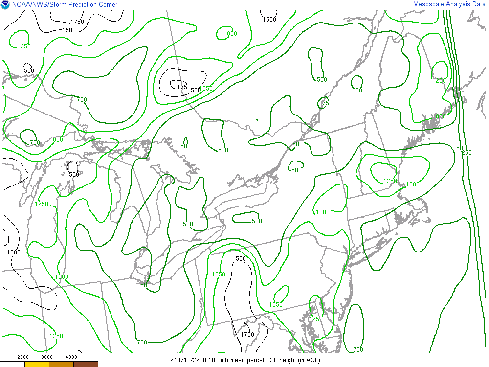
those LCL's lol
-
Tornado Watch coming soon up north
-
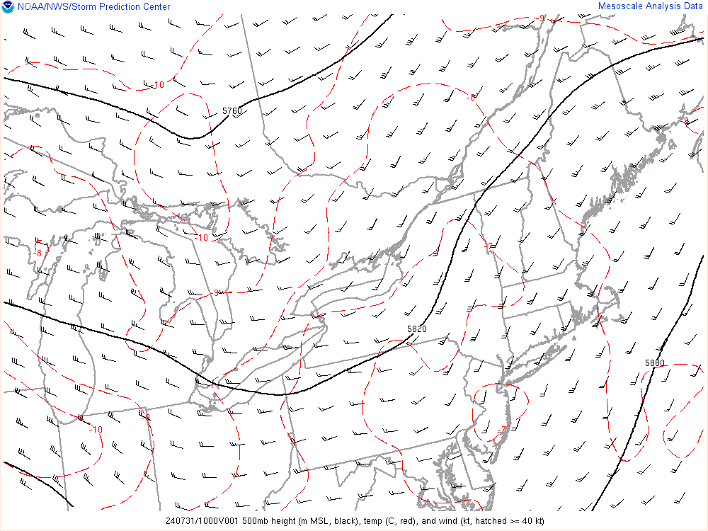
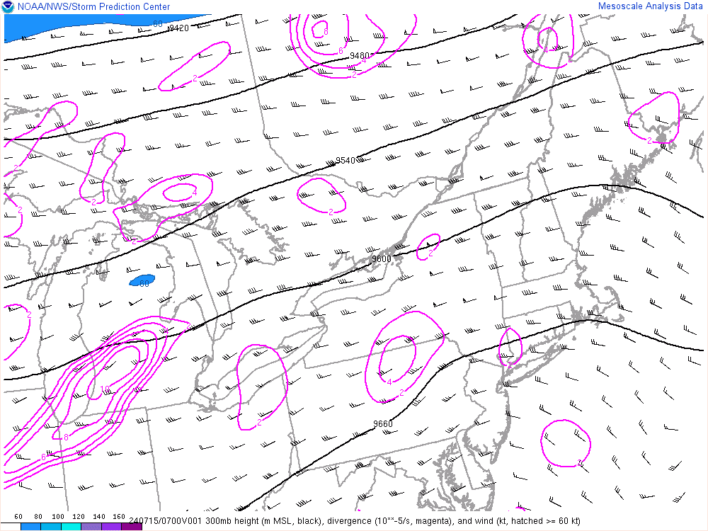
Very potent ML and UL jet streak will really enhance upper divergence
-
I'm a bit surprised at the late timing shown by the 3km NAM. Doesn't push anything through here until around 4z or so
-
1 hour ago, CoastalWx said:
Usually westerly flow FTW. Pretty good winds aloft (50kts near 700). ML CAPES are not that impressive, but I still note guidance is bring some good storms right to the coast and even srn areas. So I was intrigued and looked to see why. Initially best instability is pike north where better srfc to 850 theta-e lies. However by late day it looks like a surge of higher theta-e down to 925 moves in. Also coincides with better MU CAPE draped near the Pike at 00z. So, this almost looks like storms forming at nose of good low level theta-e..almost like an elevated type deal, but not quite. Also seems like H5 temps are slightly cooler E and N you go. So that will help. Warmer temps in srn NY state at that level. Note the HRRR has decent UH swaths near pike and north. UH Udraft Helicity, could mean a couple of these could be rather strong or even severe.
Yeah I found it intriguing the past few days how the models increased instability towards the evening...something you don't usually see happen around here and especially this time of year. Initially I was thinking maybe a plume of steep lapse rates was moving in but yeah...that's a pretty decent plume of theta-e air which moves in later on.
-
Is the NAM Nest not working?
-
There is a reason we do May 1st as the countdown until severe weather season and that's b/c the season begins in May and looks like we're right on time this year as we are looking at the likelihood for showers and thunderstorms both tomorrow and Friday and the potential exists for some of the thunderstorms to become strong to severe.
While the main cold front is still well west tomorrow, several pieces of shortwave energy will be moving through the fast westerly flow aloft during the afternoon tomorrow and a pre-frontal trough may be set up just to our west but the main driver for forcing tomorrow will be pieces of energy moving through the flow aloft.
With temperatures well into the 80's to near 90 away from the coast and dewpoints climbing into the mid-60's combined with fairly steep mid-level lapse rates will yield the development of moderate instability tomorrow afternoon. While winds in the lowest couple km aren't particularly strong there is plenty of speed shear tomorrow afternoon with a LLJ exceeding 30-35 knots and MLJ exceeding 50 knots.
As the impulses move overhead we'll likely see showers and thunderstorms develop, however, there is some uncertainty as to the aerial coverage of the storms. Given moderate instability and strong shear the potential will exist for thunderstorms to become strong to severe and pose a threat for strong to damaging wind gusts and perhaps some hail. Higher LCL's, modest low-level directional shear, and weak flow in the lowest few km should preclude any tornado potential.
Friday can be discussed after
-
Just now, Damage In Tolland said:
Gonna be a lot of squalls late today and tonight. Even a period of snow for some places.
can'tr rule out thunder either. soundings are pretty impressive with some weak instability
-
2 minutes ago, dryslot said:
Pretty tough spotting shelfs and anvils in 1/8sm vis........................
true
-
4 minutes ago, OceanStWx said:
Obviously the big issue is melt/compaction with the once a day measurement.
If you aren't checking for the max depth, you are likely to miss it. If you work from home it's easier to check frequently. But say it snows in the morning, you head to work, it stops at lunchtime, you come home, sleep, get up and measure at 7 AM the next day and the whole time temps were around freezing. You could "lose" a bunch of snow in that case.
This is why our spotter training focuses mainly on snow (sorry @weatherwiz)

-
2 minutes ago, #NoPoles said:
Somewhere around 2010 we had an
-NAO on steroids. That was the year DC got like 3 or 4 huge storms and we sucked on cirrus
that may have been the same exact winter I am thinking of.
Actually i think you're right
-
Question...this isn't storm related but I can't remember this for the life of me.
I remember several...several winters back...this may even go back to Eastern US Wx days but there was one winter where there was alot of talk about confluence to the north...I think that was the term...but if I am thinking of this correctly having confluence just to our north is NOT good for us...it keeps storm track suppressed to our south?
-
The NAM was SPOT on...SPOT on with the scenario of two bands...one around central CT then another E CT/RI border.
-
Just now, RUNNAWAYICEBERG said:
My bad. I forgot it’s on Pivotal.
There are like 5000 different places now to get models
I can't remember them all
-
2 minutes ago, USCAPEWEATHERAF said:
Wiz, that frontogenesis band will give someone feet of snow, once it pivots in it stalls right along the I95 corridor and someone from PVD to BOS and southeast will see totals near 40"
I'll be seeing a 40 alright. I can promise you that.
The pivot/stall aspect is going to be really crucial...even back here across CT. I think there is a possibility this could happen across central or eastern CT and if that happens there are going to be some surprised people come tomorrow. Anyways yeah SE MA is going to get nailed. I could see some 24-30'' totals
-
1
-
-
Analyzing mesoanalysis and several tools on there I would have to think the models which have shown/come more west will end up being correct in that regard.
-
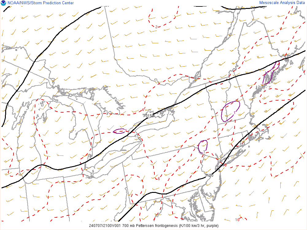
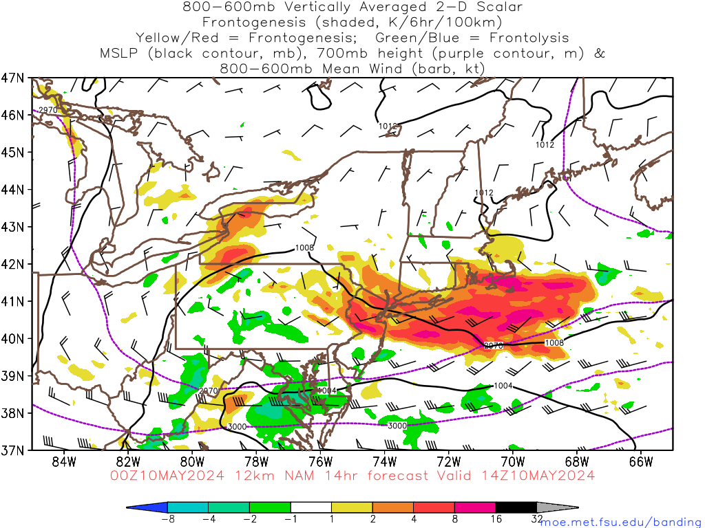
Look at that fronto already!
-

General Severe Weather Discussion 2018
in New England
Posted
maybe this will be a situation where the radar doesn't look impressive but trees are toppling over left and right.