
weatherwiz
-
Posts
81,946 -
Joined
-
Last visited
Content Type
Profiles
Blogs
Forums
American Weather
Media Demo
Store
Gallery
Everything posted by weatherwiz
-
Yeah Euro would be some big winds along the CT shore
-
LLJ looks a bit more robust on the 18z NAM
-
just wear a goalie mask and wear a baseball glove just in case. Personally though I'd be playing dodge that apple and if I get hit...so be it
-
More an Oceanstwx question but I believe the biggest reason for that is radar coverage. We have a unique terrain and lots of trees and objects. This is much easier to see visually but when watching convection, Albany's radar gets Litchfield County better while BOX gets Hartford, Tolland, and Windham better, and OKX gets the southern 4 counties better. Though I will say...I think OKX actually does better for at least the southern half of Hartford county but with BOX now having a 0.3° slice, it may be much better with Hartford county. There are still definitely some gaps though in a portion of Litchfield/Fairfield/Hartford county that all 3 kind of don't sample well
-
Yeah SSTs really drop off with northward extent and models don't seem to hang this over the Gulf Stream very long so I am shocked at how long guidance is maintaining this as a warm core system. Like Scott said this morning though, it terms of sensible weather this has really has very little impact on the sensible weather side of things. Maybe one thing it influences is the overall strength of the LLJ. If you're able to maintain a 70-75 knot LLJ and push that to the coast...would be some problems
-
There seems to be a trend to keep this warm core much longer and a slower occlusion. Very curious what the Euro is like
-
There may be two local max areas within the region. Even some of these heftier models with rainfall totals, I'm a little worried they may be underdone. You get a scenario where that mlvl warm front sits over the region and you push the llvl warm front or sfc front towards the coast and there is going to be some substantial rainfall totals and the rainfall rates will be quite intense. Flooding could end up pretty significant
-
Definitely can't rule out 40-50 mph gusts inland yet, especially if we get that LLJ overhead during the day versus at night. Also will depend on if we are getting heavy precip or not. Its going to be quite windy because of the gradient but if we get more banded precip versus a rain shield, that is when we'll rip good gusts.
-
You can see a subtle inversion just above the sfc at BOS but thats pretty well mixed at HVN and GON
-

Septorcher 2026 Discussion - Endless Summer
weatherwiz replied to Damage In Tolland's topic in New England
Polo is just something else. Jaw dropping satellite imagery this past week. Also seems like Nolo may be become better organized too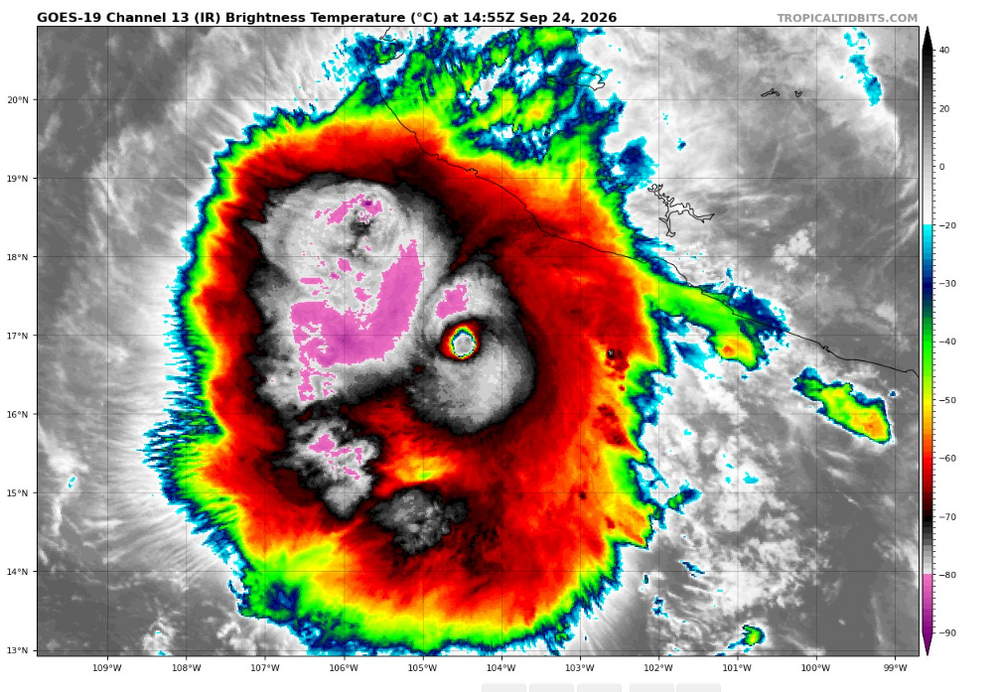
-
NAM deepens this so much and so quickly that we probably just end up with bands of heavy rain and gusty winds versus a widespread heavy rain shield. Would greatly reduce flooding risk and even wind risk (especially inland). Core of the LLJ never really gets into the region and its quite inverted. But not totally sold on this being as intense as the NAM has it...but this does illustrate such a scenario should that occur
-
If there are trees or limbs hanging over an area where kids play, such as a playscape, and there is signs of tree rot or tree damage you could certainly make a case for negligence on the property owner. No different if you say hurt yourself walking through a parking lot of an establishment because of torn up pavement or concrete
-
Have to wonder if the NAM is going a bit too wonky with the deepening but it keeps this warm core for some time
-
That would be some good wind on LI and NJ tomorrow afternoon...probably some significant coastal flooding too
-
Septorcher 2026 Discussion - Endless Summer
weatherwiz replied to Damage In Tolland's topic in New England
Noticed a pretty significant increase in tree color with the tree out front and neighbors yard from a few days ago. -
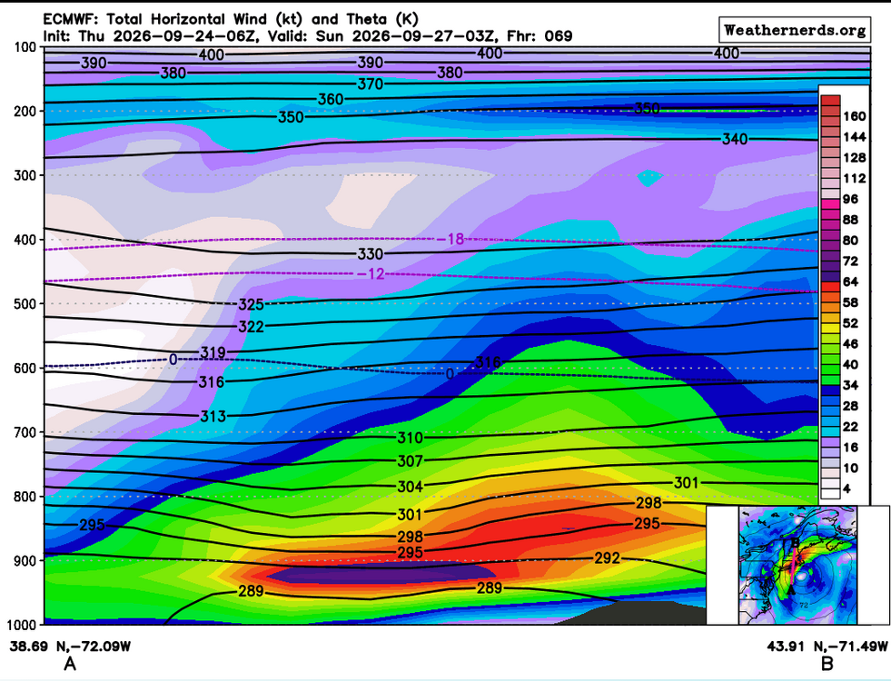
6z Euro definitely an issue with winds, particularly for the coast
-
The wind aspect inland is still quite challenging. Coast should gust 50-60+ mph but inland its a bit more complicated (as always). Winds not far off the deck are quite strong and even if inverted a bit, it might not take much to bring some stronger gusts down. One potential thing to watch though is when the core of the strongest LLJ arrives...very possible this happen overnight which will make it a bit more difficult to tap into it. But if we can sustained a period of 50-60+ gusts inland there certainly will be some issues
-
That is a heck of a mlvl warm front that will be draped within the region with PWAT values > 1.50". The rain is going to be nuts. There is bound to be significant flooding somewhere. Some areas could probably get 6-10"+ but really need to wait and narrow down the mesoscale details better
-
do vertical cross sections not work on TT anymore? EDIT: working, had to refresh the page several times
-
some days it feels like it
-
No, it destroys them
-
Folks complain when there is no weather and complain when there is weather to talk about lol. It's almost as if every single weather phenomenon has to be extreme or bust. Everything is meh, meh, meh unless there are 20 tornadoes, trees get blown down all over, snow accumulations exceed 2 feet, winds gust above 60, or half the region is under water.
-
Pretty stout LLJ.
-
I think Oct. 6 unless its been pushed back again.
-
Septorcher 2026 Discussion - Endless Summer
weatherwiz replied to Damage In Tolland's topic in New England
Looks like Hawaii will get hit AGAIN. Rainfall forecast of 15-30"+ across the Big Island...yikes