weatherwiz
-
Posts
79,817 -
Joined
-
Last visited
Content Type
Profiles
Blogs
Forums
American Weather
Media Demo
Store
Gallery
Everything posted by weatherwiz
-
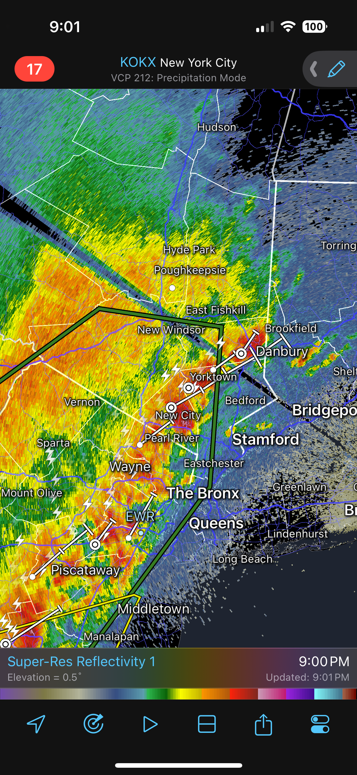
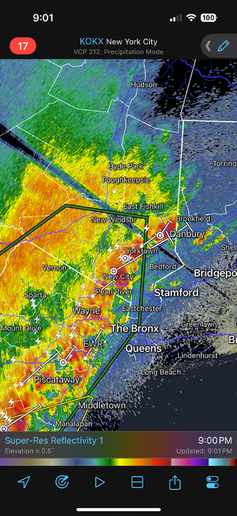
Probably small hail falling between New Fairfield and Brookfield
-
nahh just a pre-cursor
-
We going out like a lion
-
Turned into a great late afternoon. Now time for some thunder later
-
I couldn't agree more with this post. I exhaust myself big time with composites and I need to move away from that because otherwise I am never going to get to the level I want just because I don't have the time to really do so. I only really do that to develop a fundamental background in understanding but it is extremely, extremely time consuming. But I think over the years I've developed enough knowledge/understanding that I don't need to do this anymore but If I knew how to program/code this could be done in a way more productive manner. But I try too much to break things down so much and try to get as close to a linear correlation as possible which is stupid because when it comes down to it, there really is no or are no linear correlations. And this is what makes the science so difficult. As humans, we are equip to understand/handle linear correlations pretty easily, but getting outside of linear correlations and we struggle...its a skill that can be taught but the path is difficult.
-
I find the ENS-ONI intriguing, though I think its more designed to highlight ENSO events pre-1950. But it wasn't until I came across the ENS-ONI that I realized there are a ton of different methods and metrics to define ENSO events. Maybe this is good...maybe this is bad but I think this helps us to "think about the box". I debate though how much I want to involve ENSO events pre-1950. I don't think that data should be discounted, however, when creating composites and assessing it must be understood this data is all re-constructed and there are caveats. While it does seem like there has been a huge change in how ENSO events behave lately its very difficult to make this assertion because data coverage/collection is worlds better now...but even with this there could be inconsistencies, especially with satellite data/measurements.
-
Great thread, hoping to get more involved with the seasonal forecasting this year. I did last year but 2025 was pretty wild. Part of the problem is I get too much into my head. Anyways, I've gone back to the drawing board when it comes to creating ENSO composites. I've read made my lists of EL Nino, La Nina, and ENSO neutral using the ENSS-ONI, ONI, and RONI, however, I am not sure I want to go ahead and create a list breaking down by strength. Through the journeys and research and studies, there is a whole world of accepted definitions when it comes to ENSO and classifications beyond the typical ONI and SSTA thresholds we're all familiar with. When digging into strength classification I would like to incorporate more of the SOI and MEI into the classifications.
-
Even a quick look at some mesoanalysis products such as sfc obs/theta-e you can easily see the sfc warm front is well south of there. At least the kink in the warm front is correct
-
Hoping to see a strong wind gust this evening
-
well at least it a NW flow and not off the ocean
-
Only a few weeks away from the 384th hour of the GFS getting into May
-
There is no more ice storm watch, just right into ice storm warning. I don't think there are any other advisories tied into solely freezing rain (though winter weather advisory could cover minor glazing).
-
I think it will be very difficult for much of Connecticut to really warm sector (outside of Fairfield County).
-
could see some strong storms into southwest CT tomorrow. maybe some transient supercells
-
Looks like we're going out like a lion!!!!!
-
maybe some localized strong storms Monday for western areas
-
quite unstable too
-
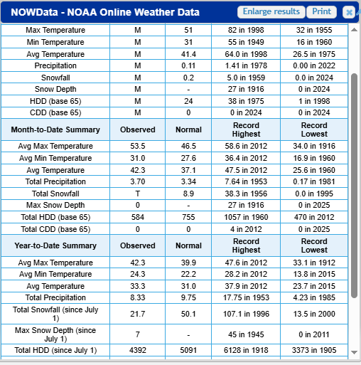
The Daily Climate Reports I think may have that info. EDIT: I meant NOWdata https://www.weather.gov/wrh/Climate?wfo=box Here's BDL
-
This is a pretty complex situation. Almost looks like the wedge of cold is more focused up around 925mb and not even much wedging at the sfc. Hi-res has the coldest temperatures in the higher elevations versus within the valleys...opposite of what you would expect. Big key may be what happens with temperatures Friday night because there doesn't seem to be much room for temperatures to rise at all north of the boundary.
-
If there are maps worse than snow maps...it's ice maps I would actually much rather snow maps than ice maps....ahhh I can't believe I said that. Someone put soap in my mouth
-
@40/70 Benchmarknot sure hw much you're into datasets/updates but ERSSTv6 data has been released. Read through a good bit of the paper...really interesting stuff. I know you don't do much with ENSO pre-1950 but it seems this version helps greatly with some of the uncertainty and error with SST data pre 1950.
-
Yup. My aunt lives like a 1 minute drive from the airport. When I was living with her I used to go on walks and walk along 75 briefly and then turn towards Old County Rd. You could easily feel the difference in temperatures from some of those side roads versus along 75.
-
A good portion of Windsor Locks right along 75 there is nothing but concrete and pavement lol.
-
Yup...not looking forward to them pulling off 83 while its 52, cloudy, and drizzle here
-
Never!!!