Jump to content

Floydbuster

NO ACCESS TO PR/OT
  • Posts

    2,832
  • Joined

  • Last visited

Posts posted by Floydbuster

  1. 5 hours ago, TheWeatherPimp said:

    The Winchester Tornado hit very close to home (well it was my home). The house I grew up in was destroyed and my family's houses were less than 2 blocks from the tornado. They were very lucky and I feel extremely relieved. I was on the phone with them yelling at them to get in the bathrooms and cover themselves with blankets and pillows. It was nauseating. But I'm so thankful they are all okay. 

    It sounds like the NWS Indianapolis has finalized the rating of the Winchester tornado as an EF3. To be honest, I truly thought they might push it over the threshold based on some of the photos I've seen but I haven't seen the damage in person and won't until later this week. 


    Thank God your family is alright. Here's hoping we luck out and avoid severe weather as much as possible the next few months. 

  2. This pattern is tiring folks out here in Northern Ohio week after week. It's like every two weeks it's the same thing. First we get beautiful weather, then a cold front ruins it but stresses us all out thinking we're gonna have bad storms. Then they usually aren't half as bad as the local mets think (atleast near Cleveland area), and then it's cold for a week. Rinse and repeat.

    • Like 1
  3. Our Cleveland mets forecast seem off this morning. They showed the potential for heavy storms/precipitation around this time and it's quiet as a mouse on the entire radar of the whole state of Ohio.

    My guess is that this event is much further south and not as significant as expected.

    Snapshot-240227052727.png

    The severe weather folks on Twitter were going crazy and I thought it was a bit too much hype. The forecast models simulated radar showed what is currently near Evansville would be 10x worse and over Mansfield at this time. I don't know what implications this may have on the forecast the next 24 hrs for Northern or Central Ohio.

    • Like 1
  4. 1 hour ago, OHweather said:

    I agree with many of your points here...yes, that short burst of heavy snow last Friday heading into the evening rush was impactful and I would agree that peak rates (if they last any amount of time) are more important to the impact than the final storm total at the end of it. 

    As for the weather app only showing 50/50 precip chances...I don't know what to tell you. I don't know who the provider is or how they come up with their forecasts. Seeing as though it's currently snowing everywhere it is garbage. I can see how 5-10" of snow on 50/50 chances for snow is confusing but the app appears to be bad.

    I usually advise people to pick a couple sources for weather information and stick to them..."shopping around" just gets confusing. I would suggest checking the NWS webpage (weather.gov/cle/winter) and social media (if you're on it) as those forecasts are what drive the watches/warnings/advisories...and we're certainly not perfect, but you're not going to get something there that's completely out of left field. You'll also be able to see the gridded snowfall forecast for the whole area, so you don't have to guess. There's collaboration that occurs shift to shift, between offices, and with the Weather Prediction Center (WPC) on things like QPF and snow so it's hard for a forecast that's entirely unreasonable to come out.

    And to be honest, I don't think our TV mets are bad in general, especially if you find a channel or met you like. I didn't catch all of them yesterday but I didn't see anyone hyping any crazy snow amounts, especially in Summit. I think people tend to run with the worst number they hear...and I do think it's a struggle to message storms like this where it won't be a heavy snow amount outside of the lake enhancement...and where the snow won't all fall at once. We never had 10" amounts listed in Summit County's warning, although if you told me that the warning probably doesn't apply to the southern half of the county I'd agree. 

    We do attempt to keep these messaging/perception things in mind. This was posted to the NWS social media yesterday morning and emailed out to "core partners":


    It's not going to be perfect. The synoptic snow has trended down a good 1-2" farther south and west (and I hate that amounts in NW OH of 4-4.5" trigger the 4-6" range for the cities because they're realistically going to get 2-3"). But it also gets across that most areas are not getting 6"+ of snow in any 24 hour period, which was why we broke it down like that and sent it out. The areas that were forecast to get 6"+ in either window were where I did warnings yesterday morning (we no longer have a time constraint for warning criteria...just needs to be 6" for an event...but still wanted to draw a line somewhere). The big error here was the synoptic snow trending down 1-2", and the Erie/Huron warnings are probably not going to pan out. They have had some lake enhancement this morning but the best enhancement has already set up to the east and amounts so far out there appear to be 1-3". 

    As for us farther east, the best lake enhancement is definitely working east now and guidance suggests it will pivot for a good few hours through mid-afternoon over parts of Lorain, Medina, and perhaps northern/western Summit before pushing farther east and transitioning to more traditional lake effect tonight. We still have a chance to pick up a decent amount of snow in parts of Summit through this afternoon. 


    Thank you for the response. The "app" I showed is typing "Cleveland Weather Hour by Hour" into google. The other apps are the "weather" apps that people have on their I-Phones. 

    Of course, I use the official NWS website and read the advisories, but of course I'm far more seasoned in tropical weather and hurricanes despite living in the snowy midwest. 


  5. 2 hours ago, OHweather said:

    But is 4-6" of snow falling in a 36 hour period in Stow, which is what the forecast is, actually hyping it up big time? Can't control that all the schools are closing but the forecast is not for anything your area hasn't seen before. It'll be decent farther north where there's more lake enhancement. 

    389410342_StormTotalSnow(2).thumb.jpg.806f426f4131c8a190b571d556c090e6.jpg


    That's what I'm saying as well. Everyone is acting as if the entire area is in for a wild ride, and I actually don't think it'll be that bad. Last Friday, before the switchover to rain and gusty winds, we had a good 2 inches fall in about an hour and a half. Compare that to perhaps 4 inches in 2-3 days time? That's nothing to me. I certainly think they could have higher accumulations near the lakeshore, but further south, probably not nearly as much.

    Also, everyone has been very confused because we have local weather apps on phones showing no more than 30% chance of precipitation here and there the next two days, yet we have a Winter Storm Warning issued warning people to prepare for "5 to 10 inches" of snow. Lots of conflicting forecasts.


    Look here...Cleveland weather Friday and Saturday....

    Snapshot-240119011216.png


    Friday shows no more than a 50% chance of precipitation around 8am this morning for Cleveland, tapering off.

    Snapshot-240119011226.png


    Then on Saturday, it tapers off further to 0%.


    How the hell does Cleveland get 5-10 inches of snow Friday and Saturday from near zero precipitation chances? Anyone wanna help me out on this one?

  6. 6 hours ago, Snohio said:

    National Weather Service reported gusts over 60 in Cleveland and Parma. 

    Here's a link that hopefully works. 

    https://www.weather.gov/cle/pns_all

    Thanks for the link.

    Yeah, stronger winds certainly hit closer to the lakeshore. The two strongest gusts here near Akron were 51 and 54 mph both gusts within less than twenty minutes of each other around 4:30-5am Saturday morning.

    I guess what made it a little better (atleast down here) was that it wasn't a constant roar with gust after gust after gust. 

  7. 22 minutes ago, WHEATCENT said:

    I'm  less than a mile from the lake in Mentor and the wind has been blowing pretty strong since really early this morning 

    was afraid we'd lose power again after just being without it for 17 hours Tuesday-Wednesday during the 1st wind event. 

    Really? Wow! I'm down in Southern Summit County and it wasn't near that bad.

  8. Welp, that was interesting.

    Here in NE Ohio, everyone I know lost power bad during the straight-line wind thunderstorm that blew through in late August of last year. The forecasts showed winds gusting 50-60 mph, and we have been on edge since Thursday. Every single person I talk to says they're "done with snow and winter", and I personally detest winter weather, so we were happy that we had no snow accumulation. I should note, we had a quick 1-2 inches in an hour around 4pm Friday night before turning to rain and melting away.

    Thankfully, it's past us, so now we just get some arctic air. Overall, the local mets hype about winds didn't get *quite* as bad as we had been fearing.

    For those more seasoned in winter weather than myself, was the storm weaker than expected? Did the winds underperform in NE Ohio or was it what you guys expected?

  9. 1 hour ago, dilly84 said:

    Well, see y'all next year. Barring a monster, I see no reason to continue logging on. Pretty sad when back to back monsters take the exact same path. At this point I'm rooting for a torch after this dry and cold garbage. I really couldn't care less about February/March snows. Even if they do amount to anything, they're melted within a day or 2. Best of luck the rest of the way.

    Atleast we will get the arctic temperature drop....before it warms up again and becomes a rainy four months. :D

  10. I noticed my local NWS forecasts in the short-term are being slowly lowered. Snow totals dropped from an inch or two down to less than a half inch. Wind gusts dropped from up to 50 mph to up to 35 mph. We're actually in a bit of a dry slot now from heavy rain. I'm skeptical of any huge event, especially in the notorious mild El Nino winters.

  11. 14 hours ago, DeltaPilot said:

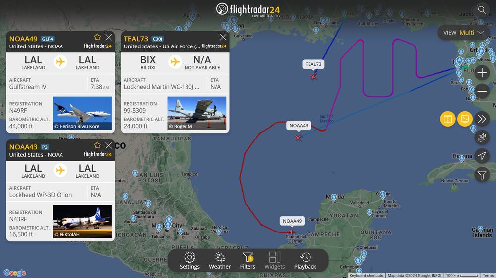
    Did the Hurricane Hunters fly this storm? Seeing a lot of "debate" about what this storm actually was Strength wise when it made landfall. It was obviously undergoing degradation from terrain, but Im curious. Hard to believe the lack of coverage for this event. Damage looks to support at least a high end CAT 3 and easily a 4 from what I have seen so far.

    They didn't have a plane there at the time of landfall. The eye started to lose it's luster right at landfall, but based on the observed damage, my guess is that this came ashore as a Category 5. In fact, I'm guessing the peak intensity offshore was higher than the operational 165 mph. It probably was about 175 mph offshore, and came ashore in the 160-165 mph range.

    A devastating Category 5 strike on Mexico. 

  12. 000
    WTPZ63 KNHC 250626
    TCUEP3
    
    Hurricane Otis Tropical Cyclone Update
    NWS National Hurricane Center Miami FL       EP182023
    125 AM CDT Wed Oct 25 2023
    
    ...CATEGORY 5 HURRICANE OTIS MAKES LANDFALL NEAR ACAPULCO MEXICO... 
    
    Satellite imagery indicates that Otis has made landfall near
    Acapulco, Mexico around 125 AM CDT (0625 UTC). The maximum 
    sustained winds are estimated to be 165 mph (270 km/h), and the 
    minimum central pressure is estimated at 923 mb (27.26 inches). Otis 
    is a category 5 hurricane on the Saffir-Simpson Hurricane Wind 
    Scale.
    
    SUMMARY OF 125 AM CDT...0625 UTC...INFORMATION
    -----------------------------------------------
    LOCATION...16.8 99.9W
    ABOUT 5 MI...10 KM S OF ACAPULCO MEXICO
    MAXIMUM SUSTAINED WINDS...165 MPH...270 KM/H
    PRESENT MOVEMENT...NNW OR 345 DEGREES AT 10 MPH...17 KM/H
    MINIMUM CENTRAL PRESSURE...923 MB...27.26 INCHES
    
    $$
    Forecaster Brown/Kelly

  13. BULLETIN
    Hurricane Otis Intermediate Advisory Number 12A
    NWS National Hurricane Center Miami FL       EP182023
    100 AM CDT Wed Oct 25 2023

    ...EYE OF CATEGORY 5 HURRICANE OTIS ABOUT TO MAKE LANDFALL NEAR 
    ACAPULCO MEXICO...
    ...CATASTROPHIC DAMAGE LIKELY WHERE THE CORE MOVES ONSHORE...


    SUMMARY OF 100 AM CDT...0600 UTC...INFORMATION
    ----------------------------------------------
    LOCATION...16.7N 99.8W
    ABOUT 15 MI...25 KM SSE OF ACAPULCO MEXICO
    MAXIMUM SUSTAINED WINDS...165 MPH...270 KM/H
    PRESENT MOVEMENT...NNW OR 345 DEGREES AT 10 MPH...17 KM/H
    MINIMUM CENTRAL PRESSURE...923 MB...27.26 INCHES

×
×
  • Create New...