

OceanStWx
-
Posts
19,758 -
Joined
-
Last visited
Content Type
Profiles
Blogs
Forums
American Weather
Media Demo
Store
Gallery
Posts posted by OceanStWx
-
-
16 minutes ago, Lava Rock said:
I hope so, but either way not sure about getting the sn cleared off the driveway. Slop fest at the end and looks warm enough Thurs to melt a lot of it, but near our garage barely ever gets sun, so if it freezes, it's a real pain later in the season
Really good consensus around GYX of 4-5 inches before a flip. I'm a little wary because the snow growth zones is so elevated that we can hang on to 15:1 ratios.
-
 1
1
-
-
1 minute ago, Damage In Tolland said:
I may be off, but I am pretty sure that one screamer we all had in 96 had a line of convection where all hell broke loose with massive gusts .. despite 1-4 feet OTG prior
I think this one is going to need convection to help mechanically mix, because I don't see a lot of support for the LLJ alone doing it.
-
1
-
-
13 minutes ago, HoarfrostHubb said:
I don't think it will be anywhere near 12/18 but should be a mess for some
I'm seeing pros and cons. So far the magnitude of LLJ is not as high and not as consistent across the model suite. We have CAD in this event that just wasn't present on 12/18. It's a much more inverted sounding, so mixing will be more difficult.
However, this event has more convection modeled that 12/18, and it could be all it takes to mix out the inversion briefly.
2 minutes ago, CoastalWx said:50-60 isn't a huge deal. Typical. The one on 12/18 was 65+ in many areas. That is when there are issues.
We've also been discussing the impact of where those 50-60 mph winds occur. Relatively speaking we had fewer outages along the coast, where 50-60 mph happens a few times a year. But from I-95 into the mountains the grid was wrecked, because those kinds of wind speeds are not common.
-
3
-
-
17 minutes ago, Damage In Tolland said:
Just got the automated Eversource call warning of outages .
Well a dog fart in Moosup can knock the power out in CT.
-
1
-
 2
2
-
-
All dug out from 16.9" on 1.60" liquid.
-
7
-
-
4 minutes ago, CoastalWx said:
Yep. Last year we were lucky for -1 at 925.
My threshold is below zero at 950. If you have that you'll snow unless it's just mood flakes. So -1 at 925 will usually leave 950 too warm.
-
2
-
-
It's also so cold aloft that unless you've absolutely scorched the boundary layer on easterly flow, it will snow. I mean 950 mb temps around -3 for the GFS and NAM, it's hard to get rain that far away from the shore break.
-
3
-
-
1 minute ago, The 4 Seasons said:
ive already seen articles on MSNBC home page with this graphic in it. Probably auto generated AI written stuff, not sure
The strangest part of the actual image is that it looks like they hit "smooth" with the CWA borders on and blended in a bunch of zeroes because all their neighbors don't have QPF out that far. That's why it goes from 6 inches to nothing so fast as you approach ALY and OKX CWAs.
-
1
-
 1
1
-
-
That's a box roughly north to Juneau, west to the Aleutians, south to SFO, and east to the CA coast.
-
21 minutes ago, OceanStWx said:
It's happening more often, but I don't know for sure where to find reliable information on plans.
https://www.nhc.noaa.gov/text/MIAREPRPD.shtml
Well there we go.
Edit: Now I see that's for Friday, which is probably too late to help with this storm, but will help the 10th.
-
3
-
2
-
-
1 minute ago, CoastalWx said:
I was just thinking.....when have they ever had this so far in advance?
Just now, NorEastermass128 said:Probably a new hire’s slip up as most of the vets are still are on use/lose leave?
I mean sometimes we mess around and create storm total grids to see what we have in the forecast as a baseline. But the automated scripts can grab them and send them without someone physically pushing the button. That's why we have a "work" grid we can create at GYX. Those don't go anywhere, and I'm not sharing the image.

-
1
-
6
-
-
Capital H hate going with a deterministic snowfall forecast at this range. We know it's going to change, we've shown we have low skill getting amounts right this far out, and we just don't have a lot of data to build that forecast with. I have to think this accidentally slipped out to the winter page. We aren't even required to have QPF this far out, and WPC doesn't even provide the probability information to produce the rest of the graphics on the winter page.
-
9
-
-
7 minutes ago, weatherwiz said:
Will they be launching more balloons in that area? That is sparse.
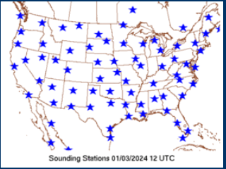
It's happening more often, but I don't know for sure where to find reliable information on plans.
-
1
-
-
1 hour ago, CoastalWx said:
The initial S/W is right on the coast so I think between RAOBs and satellite...probably pretty good there. The others are more tomorrow and tomorrow night. There is ALOT of shit flying around. Even the Nctrl US had a big change from 00z with a small s/w.
The sensitivity is highest tonight around CA and NV, so those raobs will be important.
-
2
-
1
-
-
20 minutes ago, dendrite said:
I made my own cheap cookie tin heater. One round cookie tin, a lamp repair kit from the box store, and a lower wattage skinnier bulb (25-40W).
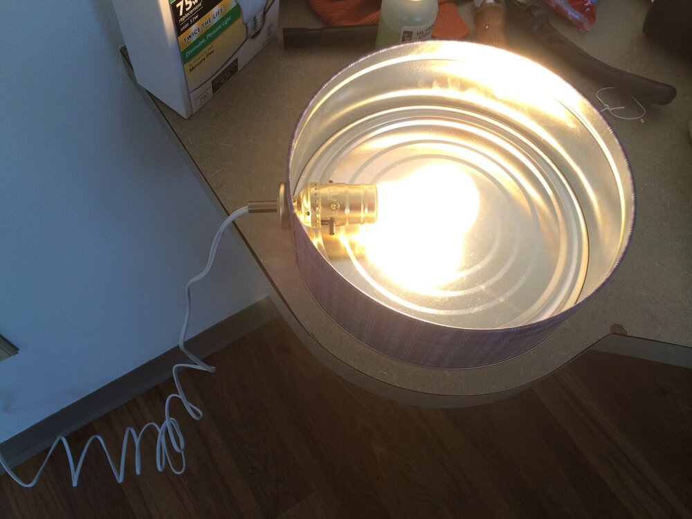
Toaster bath for the chickens?
-
6
-
-
1 minute ago, Typhoon Tip said:
Not to impugn you guys ( seriously ) but that seems kind of questionable as auto practice? Tell me that's not what's happening there.
We can't just dump a bunch of raw output mass into a blender - doesn't that utterly defeat the very real possibility that the nuanced solution is more correct?
I'd argue that latter aspect is pretty prevalent in these fast flows scenarios. Also whence it's become more apparent that telecon correlators seem to skew relative to results
I don't think so. The NBM is pretty sophisticated, bias correcting a lot of variables at each individual grid point. But it can have limitations when ensemble make big swings or you have dramatic pattern changes. It also struggles with mesoscale features at longer ranges (obviously), but that is what the forecaster is for. Make the right adjustments vs messing around with day 7 sky cover and dewpoints.
The problem before the NBM was that each office was starting with whatever they felt like, and for people who live close to the border of two offices you could have wildly different forecasts. It was also pretty poor practice to try and cherry pick the model of the day, nobody is actually any good at that.
-
1
-
-
It will also be interesting to see how the NWS forecasts go today. Primarily starting with the NBM is producing better and more consistent forecasts, but the data is a cycle old. So the afternoon forecasts today will be using mostly 00z data fed into the NBM. That means chances of snow will be lower with this NBM run because of the inclusion of the paltry GEFS/GFS (and at this time range it is almost entirely GFS/Euro based). Blindly populating with NBM may lead to artificially lower snow forecast if the 00z guidance was indeed a burp.
-
1
-
-
6 minutes ago, Ginx snewx said:
Dry members bringing the mean down you mean. We Amp up. Save a horse
I meant what I said.
")
When you have your mean sitting higher than the 50th percentile, you're dragging the mean up. We've actually seen in the regional verification that quite often our (the NWS') forecast is closer to the 90th percentile than the 10th of the forecast spread. We almost always forecast too much snow, except for the picnic tables and First Connecticut Lake.
-
1
-
-
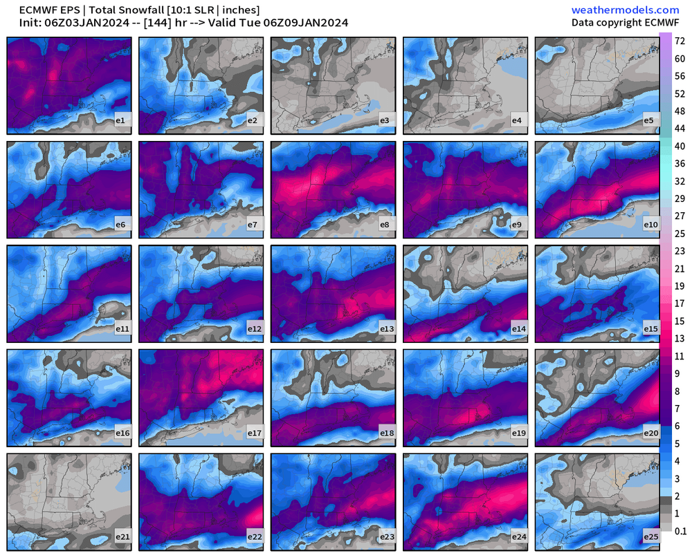
3 minutes ago, Sey-Mour Snow said:
The 6z eps 25th/75th range is 5-6" and 7-8" for a pretty large area of SNE .. It would be a pretty big bust by the EPS to not get plowable ..


Those are pretty tight ranges for 25/75 too. That would suggest high confidence from the Euro.
However, we've seen in the past few years how the ensembles can be underdispersive (i.e. not capturing the true spread of potential outcomes). It's why we tend to see the ensemble mean shift in tandem with the op so often.
-
2
-
-
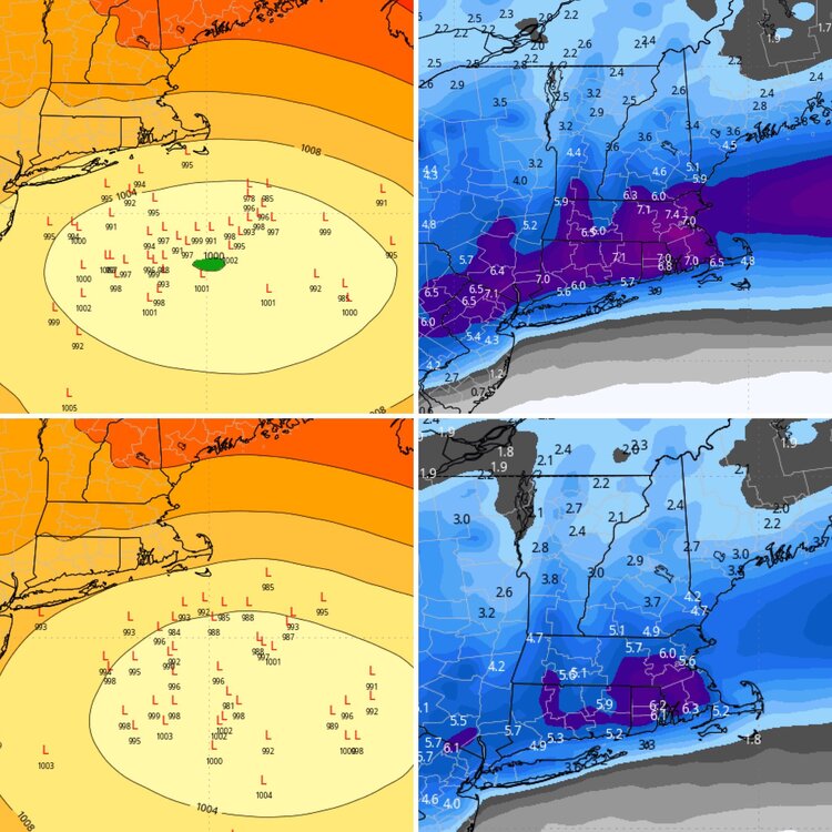
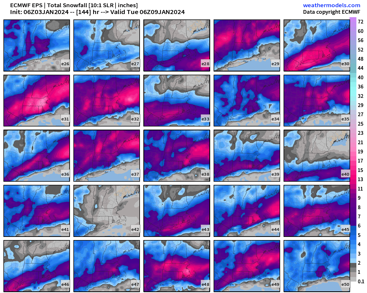
1 hour ago, Ginx snewx said:

It's important to look at these panels like Ginxy has here. The ensemble means may look nice, but don't tell the whole story.
Like for Mount Tolland for instance, the EPS mean is about 5.5 inches. But the 25th/75th range is 1.5 to 8.5 inches. So some bigger members are dragging the mean up, while the floor still remains quite low. When you can start setting the floor higher, that's when you can start honking for a storm.
-
3
-
1
-
-
2 hours ago, CoastalWx said:
Been almost two years since I grabbed a 4 spot lol.
Was that why we stopped having GTGs?
-
2
-
-
2 minutes ago, Damage In Tolland said:
Melts are here
-
1
-
1
-
-
10 minutes ago, CoastalWx said:
Yeah, I mean I'd be happy with 3-6". I think people need to put a little perspective on things.
Two maybe three chances for at least 3-6" for many by the middle of the month? That's pretty much average for an entire month right there.
-
1
-
-
8 minutes ago, dryslot said:
Go to pivotal but you need to subscribe.
9 minutes ago, weatherwiz said:I wish I could see euro soundings. Looks like it may have a funky warm layer in there
I think they have some select locations available for free from the EC site. May be garbage graphics though.
-
1
-


1/9-1/10 Now Morphing to Less-Than-Exciting Power Cutter
in New England
Posted
We can always catch the next cutter.