MGorse
-
Posts
2,255 -
Joined
Content Type
Profiles
Blogs
Forums
American Weather
Media Demo
Store
Gallery
Everything posted by MGorse
-
You might need to take one of these up with you.
-
And the 18z NAM is a tad different. LOL. The main light snow is now focused with the upper-level energy arriving.
-
Bernie is good at what he does. I used to work with him back in the day. Agree that the NAM is probably overdone with the amplification.
-
Or it could be completely wrong.
-
Apparently the 12z NAM (12km) is seeing something for Thursday that all the other models are not. I picked the wrong week to stop sniffing glue.
-

February 15-16 Slop Fest/Rain/Wind OBS
MGorse replied to Mikeymac5306's topic in Philadelphia Region
Surface warm front still to your south and east. -
February 15-16 Slop Fest/Rain/Wind OBS
MGorse replied to Mikeymac5306's topic in Philadelphia Region
Wonderful right? -
He is.
-
-
February 15-16 Slop Fest/Rain/Wind OBS
MGorse replied to Mikeymac5306's topic in Philadelphia Region
Well that did not take long. Some sleet mixed in but now it looks like mostly light rain. 34F -
February 15-16 Slop Fest/Rain/Wind OBS
MGorse replied to Mikeymac5306's topic in Philadelphia Region
It has been snowing here for a while now but only a dusting on mulch areas. The snow is getting wetter so the changeover cannot be far away. Temperature down to 34 from 38. -
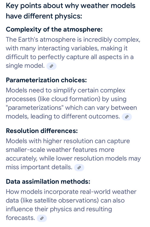
Not all models use the same math and physics equations plus differences in resolution which impacts the model output solutions.
-
Same here. Sounds like the Fourth of July.
-
Congrats to the Eagles! Hell of a game.
-
Ummm…
-
The Birds need to remain focused and not get cocky in the second half. Great first half!
-
Thank God that halftime show is over with. Now back to the game.
-
Temperature still dropping, now 29F. Freezing rain continues with some sleet mixed in.
-
Larger ice pellets coming down now along with still some freezing rain. Temperature down to 30F.
-
Started as freezing rain with a little sleet mixed in. I did not see any snow. 31F
-
I think there will be some snow, although confidence is low given the variability in the model guidance. I recommend checking the latest forecasts again tomorrow before making a final decision.
-
Rain, snow or some other form, we just need the moisture given the ongoing drought.
-
It certainly looks and feels like snow is on the way, but then looking at the radar it does look all that impressive. I noticed the HRRR and the NAM/NAM nest narrowing the precipitation shield especially farther south like in the Philly metro area with it completely ending faster south of there. Radar trends so far seem to be showing that evolution so far. Time will tell.
-
The NAM was heavy on the sleet with the last storm which was overdone. Let’s see if that repeats with this storm later today and tonight.
-
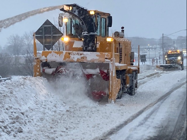
Picked up 0.10 inches of ice due to freezing rain and also a trace of sleet. Next!