OrangeCTWX
-
Posts
5,326 -
Joined
-
Last visited
About OrangeCTWX

- Birthday 07/16/1990
Recent Profile Visitors
13,468 profile views







.thumb.jpg.aec747d13df1d95d5fed34574f74d4fd.jpg)


-
32.7 for the low. Colder than I thought it would get. House is at 59F.
-
Shear was maybe delayed but not denied lol it tore this thing apart upon landfall
-
Most of the latest hurricane models had this around 950mb at its current spot. How much it weakens from here on out is the question. The HWRF actually keeps it sub 960mb at landfall. We shall see.
-
They suck. Invasive bastards that will jump on you for no reason at all. They also love the tree of heaven, which is an invasive plant that outcompetes native plants. I got rid of the tree of heaven in my side yard this spring, and after having tons of lanternflies last year I now have none.
-
Was going to come here to complain about how I haven’t seen sunny skies in over a week but it looks like you all already took care of that for me.
-

Septorcher 2026 Discussion - Endless Summer
OrangeCTWX replied to Damage In Tolland's topic in New England
Better chance wiz gets to see an F5 roll through downtown Hartford. -
It’s been rather calm here the last two hours. Guessing that changes as the storm backs westward and past the area.
-
Seems like the winds sorta dies down when it’s raining, but then start gusting again once the rain passes through.
-
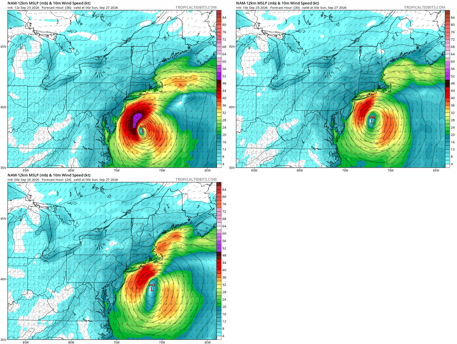
NAM trend
-
Just drove back from Springfield ma today. Saw multiple line trucks coming down this way. They definitely are preparing for this.
-
That would certainly give us the damage Kev is looking for.
-
ICON initialized exactly at 995mb for what it’s worth. Gets it down to 987mb
-
ICON/RGEM both south of 6z, neither “land falling” info Long Island anymore. But RGEM was stronger than its previous run.
-
Did the NAMS initialize way too strong or am I making things up? I doubt this is currently a 988mb storm.
-
0z NAM/ICON/GFS all show this turning left into NJ , sorta similar to what the EURO AI has been showing but slightly more south. Looks like we got our consensus. Congrats NJ