yoda
-
Posts
63,609 -
Joined
Content Type
Profiles
Blogs
Forums
American Weather
Media Demo
Store
Gallery
Everything posted by yoda
-
If I'm the Commanders, I throw 8 in the box every down. Make Hurts throw the ball.
-
Special Weather Statement National Weather Service Baltimore MD/Washington DC 151 PM EST Tue Jan 21 2025 DCZ001-MDZ004-013-014-016>018-503>506-VAZ053>056-501-502-505-506- 526-527-220100- District of Columbia-Frederick MD-Prince Georges-Anne Arundel- Charles-St. Marys-Calvert-Northwest Montgomery- Central and Southeast Montgomery-Northwest Howard- Central and Southeast Howard-Fairfax- Arlington/Falls Church/Alexandria-Stafford-Spotsylvania- Northern Fauquier-Southern Fauquier-Western Loudoun- Eastern Loudoun-Northwest Prince William- Central and Southeast Prince William/Manassas/Manassas Park- Including the cities of Washington, Frederick, Ballenger Creek, Bowie, Suitland-Silver Hill, Clinton, College Park, Greenbelt, Laurel, Camp Springs, Glen Burnie, Annapolis, Severn, South Gate, Severna Park, Arnold, Odenton, St. Charles, Waldorf, Lexington Park, California, Chesapeake Beach, Huntingtown, Dunkirk, North Beach, Lusby, Prince Frederick, Germantown, Damascus, Bethesda, Rockville, Gaithersburg, Silver Spring, Lisbon, Columbia, Ellicott City, Reston, Herndon, Annandale, Centreville, Chantilly, McLean, Franconia, Arlington, Alexandria, Falls Church, Falmouth, Fredericksburg, Warrenton, Turnbull, Purcellville, Leesburg, Ashburn, Sterling, Haymarket, Dale City, Manassas, Woodbridge, Lake Ridge, and Montclair 151 PM EST Tue Jan 21 2025 ...POTENTIAL WINTER COMMUTING HAZARD FOR THE WASHINGTON AND FREDERICKSBURG METRO AREAS THIS EVENING... There is a potential for hazardous commuting conditions for this evening`s commute. Isolated to scattered snow showers (a 20 to 30 percent chance at any one location) are forecast between 5 PM late this afternoon and 10 PM this evening across the Washington metropolitan area, the City of Fredericksburg, and southern Maryland. Up to a half inch of accumulation is possible on area roads and walkways. If this threat materializes during the evening rush hour, untreated roads could quickly turn icy. This could lead to areas of dangerous travel conditions. If commuting this evening, be aware of the POSSIBILITY of travel disruptions. Plan ahead by allowing for extra travel time, and consider using public transportation. $$ BJL/DHOF/STRONG
-
BWI 16 DCA 19 IAD 14 9pm temps
-
Thanks Lions for the 12 men penalty
-
Double lulz
-
Good to go in DC metro lol
-
Giff back in... Gibbs is just unstoppable
-
Well that was a fast answer
-
Looks like Bridgewater is in
-
@stormtracker were you serious or kidding earlier? I missed out on seeing @H2O last year...
-
It's been in the ZPFs since the 633pm issuance for DC metro
-
Are you being serious or joking? I'm wearing the Penguins jacket if you are serious
-
Must admit they do look better than the silly red ones
-
Can you let me know how many Cups you have? I heard Crosby has 3 and the Penguins 5
-
Ah the losing side I see... sucks for you
-
22 away from being the leader I believe
-
Took me a second to realize it, but as a geography major, that is stupid
-
In their zones or in their winter graphics?
-
I'll take pictures of Crosby scoring
-
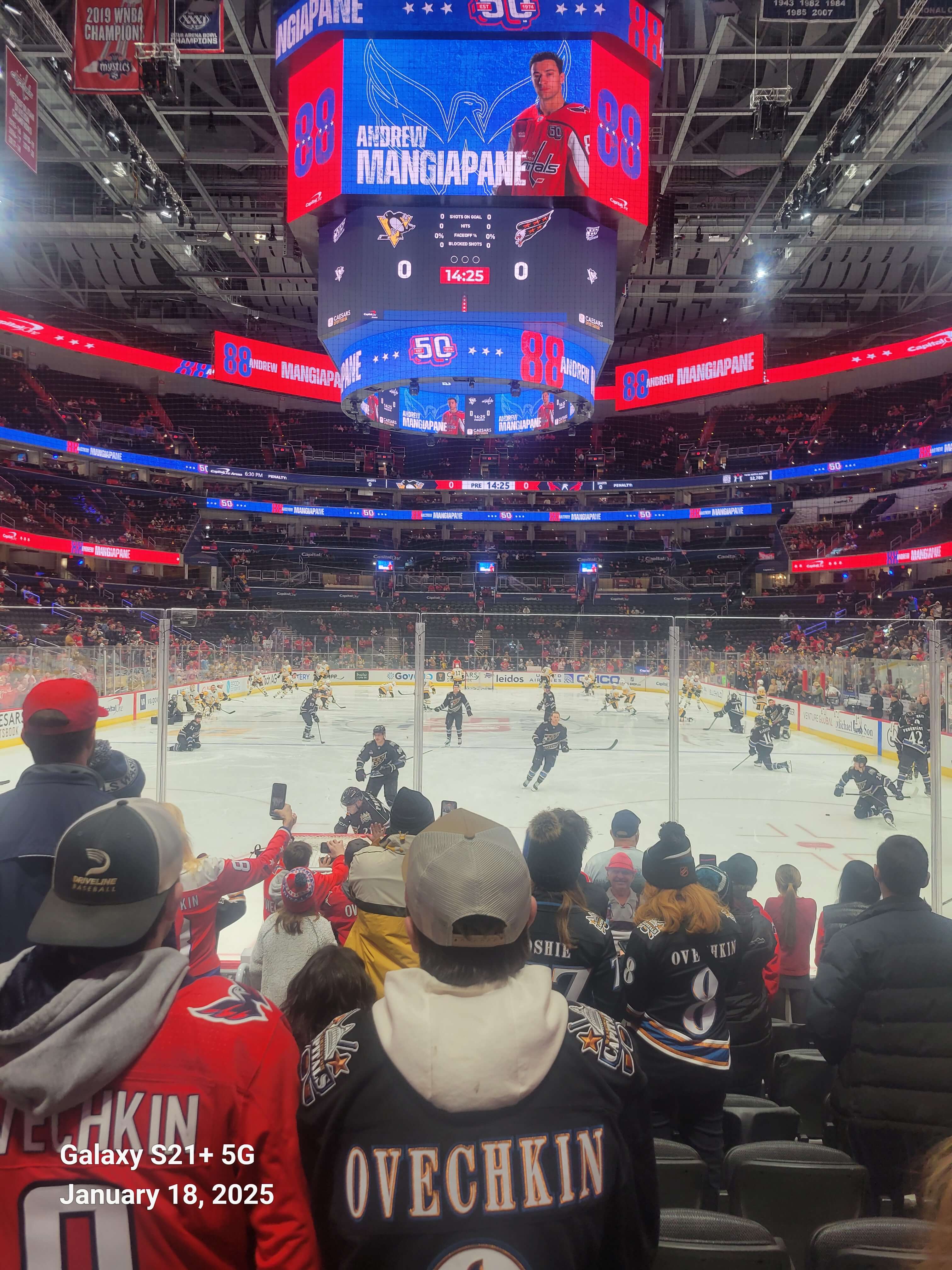
On my way to see my Penguins win tonight
-
247pm afternoon AFD from LWX re the thing tomorrow SHORT TERM /SUNDAY THROUGH MONDAY NIGHT/... Have upgraded the remaining Winter Storm Watch to Winter Storm Warnings and Winter Weather Advisories. Regardless of headline type, a band of heavy snow is expected to move from west to east across the CWA Sunday afternoon. Model soundings are impressive with this frontogenesis band showing plentiful lift and moisture through the DGZ. WPC snowband probability tool shows objects from the HREF of 0.05-0.10" per hour. At a 10:1 ratio, this would equate to about an inch an hour. Given higher ratios in the band as the colder air rushes in, would not be surprised with reports of 2" an hour in this band. Thankfully this band will be rather transient and move eastward quickly as colder Arctic Air rushes in from the NW. Synoptically, an UL trough will move eastward into the Ohio Valley tonight. A piece of energy will move ahead of this feature being one of the parts of this storm. The region will reside in the left exit/diffluent region of a ~100 kt H5 jet. This is favorable for upward motion, as indicated by several methods including the long Q- vectors. Good agreement in FGEN bands forming along the Arctic boundary as well. These bands will yield the higher rates. Snow will quickly end Sunday evening as the drier Arctic air moves in. Upslope snow showers will persist through Sunday night into Monday morning across the Alleghenies. High ratio fluff is expected, with the Winter Storm Warning continuing through daybreak. Given wind gusts of 35-45 mph Sunday night in the mountains, significant blowing and drifting of snow is likely.
-
URGENT - WINTER WEATHER MESSAGE National Weather Service Baltimore MD/Washington DC 1246 PM EST Sat Jan 18 2025 DCZ001-MDZ013-014-VAZ051-053-054-502-527-190200- /O.NEW.KLWX.WW.Y.0005.250119T1200Z-250120T0000Z/ District of Columbia-Prince Georges-Anne Arundel-Culpeper-Fairfax- Arlington/Falls Church/Alexandria-Southern Fauquier-Central and Southeast Prince William/Manassas/Manassas Park- 1246 PM EST Sat Jan 18 2025 ...WINTER WEATHER ADVISORY IN EFFECT FROM 7 AM TO 7 PM EST SUNDAY... * WHAT...Snow expected. Total snow accumulations between 2 and 4 inches. * WHERE...The District of Columbia, central Maryland, and northern Virginia. * WHEN...From 7 AM to 7 PM EST Sunday. * IMPACTS...Travel could be very difficult. The hazardous conditions will impact travel. * ADDITIONAL DETAILS...Snow will overspread the area Sunday morning and continue through the afternoon before tapering off during the evening. Snowfall rates could approach 1 inch an hour at times. Temperatures will fall into the teens Sunday night so any lingering moisture on area roadways will freeze.