

wncsnow
-
Posts
8,827 -
Joined
-
Last visited
Content Type
Profiles
Blogs
Forums
American Weather
Media Demo
Store
Gallery
Everything posted by wncsnow
-
GFS tries to take an upper low and dig it South Monday
-
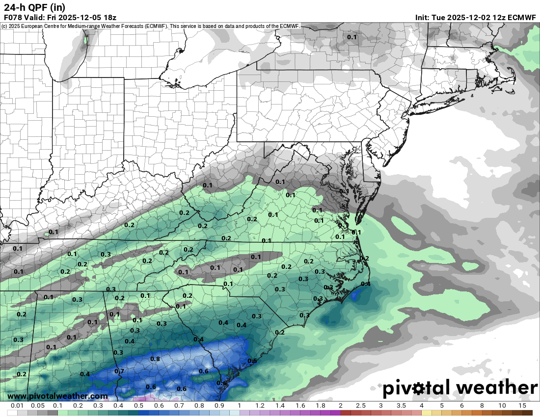
Pretty much every model has increased QPF a lot tonight. We need it just a tick colder for a nice front end thump
-
-
GFS is slightly better this run
-
A good sleet storm is fun
-
ICON juiced up QPF too but too warm for most
-
RDPS is a sleet storm here and has more precip than other models.
-
-
Hi Res Nam is a little more interesting and colder
-
NAM still not showing much
-
Some light rain/snow mix in Asheville. 35.
-
Anyone else miss the DGEX?
-
Its such a marginal setup with temps and precip, you are setting yourself up for disappointment if you expect more than a coating- inch. Of course that can still change but it can also change on the dry side too.
-
We need heavier precip. Light rates= brown ground
-
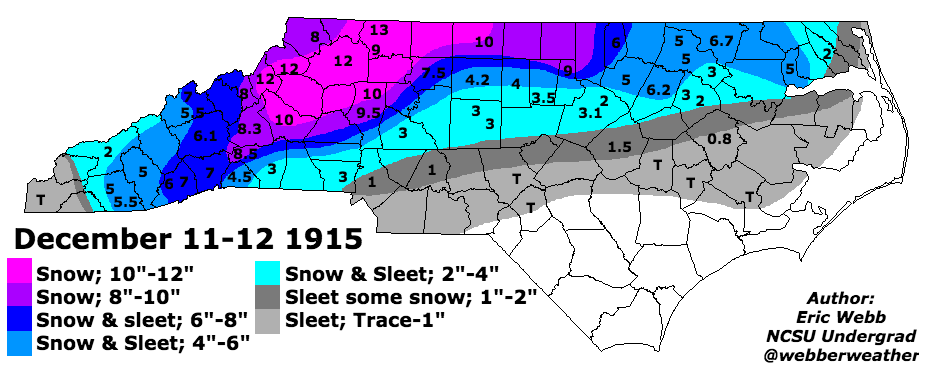
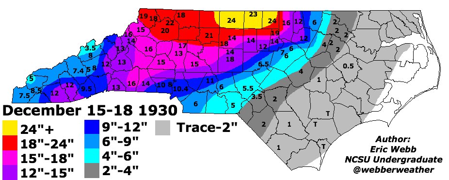
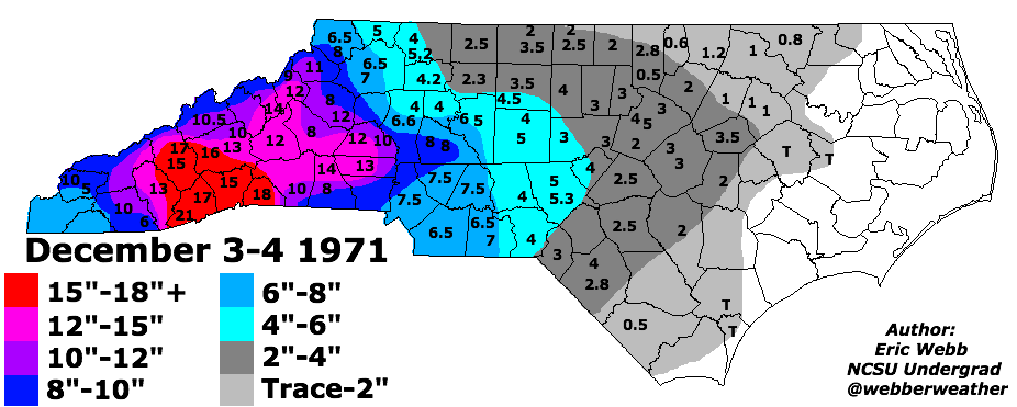
Best WNC December snow storms of all time. Courtesy of webber weather
-
NAM is colder this run but its razor edge
-
I broke it down a bit further and researched winter storms since 2000 in December and this is what I could find for WNC- In December 2000 there was a 1-3 inch snow for most of the foothills west of 77 and mountains In December 2002 there was a nice CAD storm with 2-6 inches for most of the foothills and mountains In December 2003 there were multiple small events/icing events In December 2005 there were 2 icing events In December 2009 there was the big snowstorm on December 19 In December 2010 there were a couple small events and the big Christmas snow In December 2017 there was a big overrunning snow In December 2018 there was a big snow In December 2019 there was a light icing event So thats 9 out of 25 winters with at least small events. There were 4 big snowstorms in that time frame. December has definitely been feast or famine but over the past 25 years it has produced 3 of the 5 biggest snowstorms for WNC.
-
Round 2 on the Euro for Sat night but its mostly rain outside the mountains
-
Even though the amounts could be light, this is our best chance since last January.
-
Meh.

-
.thumb.png.3103deeef22571297e0878cbc8665f10.png)
-
Euro looks similar, a little light on the precip though
-
Yup. Where's @BIG FROSTY
-
Another thing to note is this is less than 70 hours from start time.
-
I expect the Euro to show another nice scenario for NW NC and SW VA. That looks like the best spot to be for now


.png.337379a99d53f0bae31414da23afa6e9.png)