wncsnow
-
Posts
8,859 -
Joined
-
Last visited
About wncsnow

- Birthday 09/05/1987
Recent Profile Visitors


-
Yeah it just trained over them all night. Drought is on life support now for most areas
-
Picked up 1.02 overnight
-
This was the hottest at CAE according to the Euro
.thumb.png.9485de6914cbd33e3e9f1bb0cb326378.png)
-
Models are trending towards another heatwave starting late next week
.thumb.png.3d18bf0876b9f8273ee2d0f4e946a01f.png)
-
Looks like that upper low isnt gonna dig as far south so less rain showing up on most models over the ext 7 days.
.thumb.png.81418c60ad2bbda0d73ec9abbca73451.png)
-
We got the ol Mt Mitchell split but still had some mammatus, a shelf cloud and decent gusts
-
Tornado warning Buncombe. Looks to go just north of downtown Asheville
-
Severe Thunderstorm Watch just posted for entire area
-
I listen to this forum more than Jason
-
Yea most models are dry
-
Severe outbreak in late July?
-
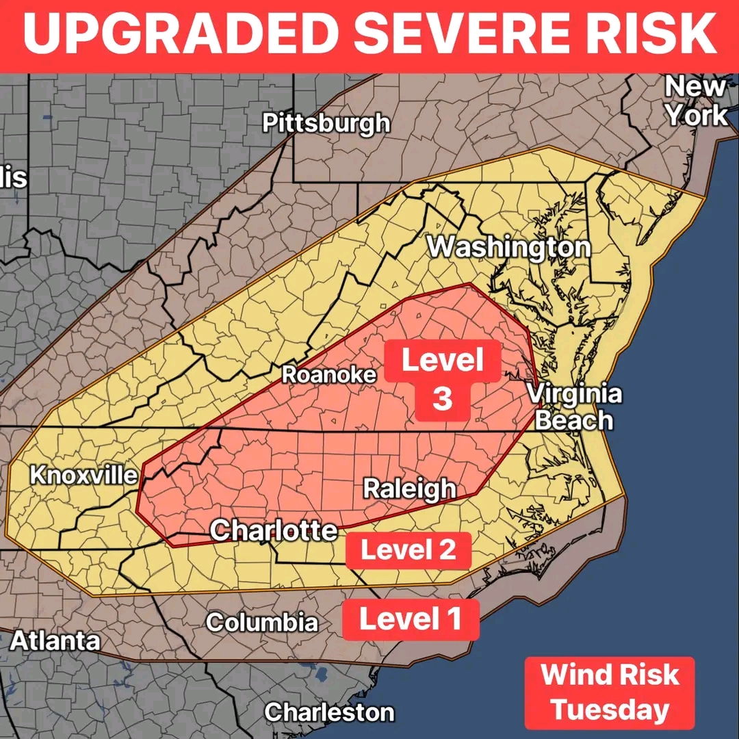
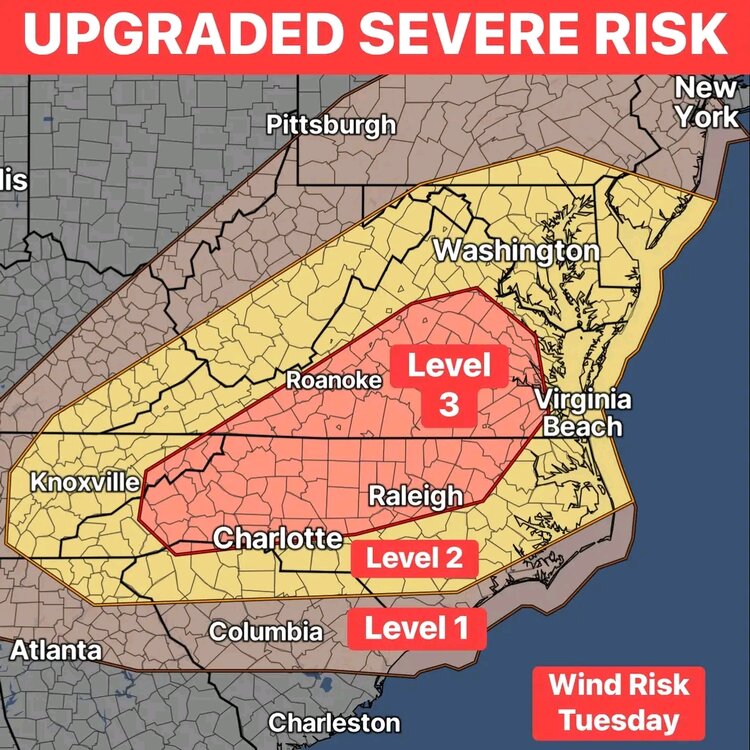
Rare for late July level 3 risk tomorrow
-
My grass is growing like it would in Vietnam at this point
-
1.34 overnight... This week we have had over 4 inches and over 8 on the month
-
Now at 2.75


.png.bf271400265ae3fca65c4a7b4019c105.png)


.png.9ce195db87904ead3fbfa58cdab17e41.png)

.png.14b3d88cafdf1a82ee44978c139cd2aa.png)