MD Snow
-
Posts
1,875 -
Joined
-
Last visited
Content Type
Profiles
Blogs
Forums
American Weather
Media Demo
Store
Gallery
Everything posted by MD Snow
-
Mid January/Mid February Medium/Long Range Discussion
MD Snow replied to WinterWxLuvr's topic in Mid Atlantic
haha...I live east of 95. I know my climo and I've made peace with it. I genuinely would love if areas north and west got crushed with this thing. At the very least, looks like we may have something to track this week. Which is enjoyable. -
Mid January/Mid February Medium/Long Range Discussion
MD Snow replied to WinterWxLuvr's topic in Mid Atlantic
I think I said a couple days ago that this storm has potential for areas north and west. Elevation may really help with this one. I guess we could root for it to get more amped? Might help create its own cold air. -
Mid January/Mid February Medium/Long Range Discussion
MD Snow replied to WinterWxLuvr's topic in Mid Atlantic
Useless outside of 5 days imo -
Mid January/Mid February Medium/Long Range Discussion
MD Snow replied to WinterWxLuvr's topic in Mid Atlantic
Yeah, in my mind this is worth tracking. Wouldn't take much imo to put areas north and west in the game for something. Still a week to go. Plenty of time for just about anything to happen. With all respect to Chill, he was telling us all last week to get some good sleep because by now we'd be up all night waiting for the 0z euro runs with much anticipation. Take it five days at a time in this hobby. I won't start to get depressed until we get to mid-feb without anything. -
Transitioned from light snow to sleet in Glen Burnie, Md.
-
Snowing lightly in Glen Burnie, Md
-
Mid January/Mid February Medium/Long Range Discussion
MD Snow replied to WinterWxLuvr's topic in Mid Atlantic
12z GFS with another coastal threat around Jan 28. -
Mid January/Mid February Medium/Long Range Discussion
MD Snow replied to WinterWxLuvr's topic in Mid Atlantic
12z gfs really isn't too far off from something next week. Wouldn't take much for a rain to snow type coastal storm situation. The block to the north has the potential to slow down whatever forms off the coast. There's a lot of cold to our north. If this could form a little sooner/slightly further east we'd be in business. -
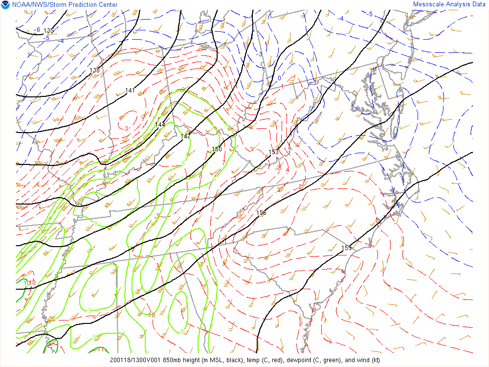
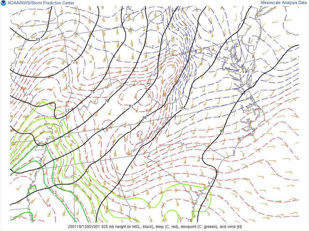
Current 850 and 925 mb temps
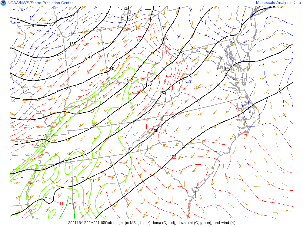
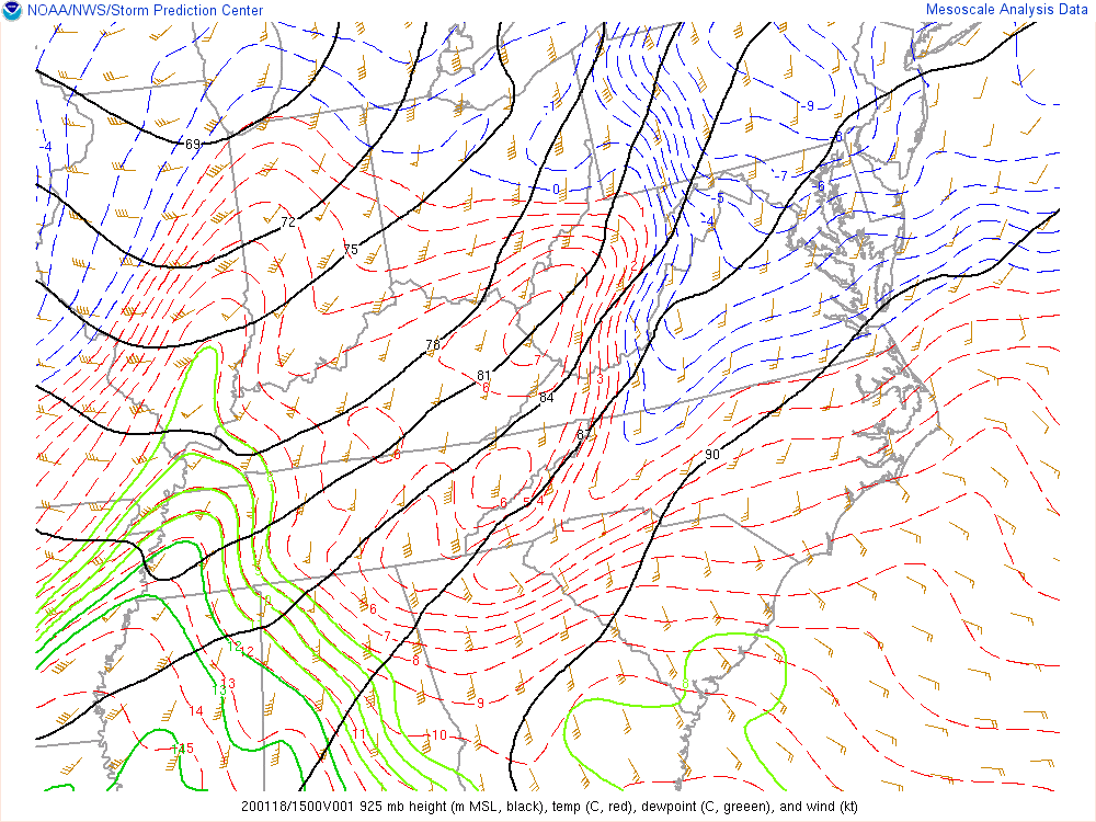
-
Current 850 mb and 925 mb temps
-
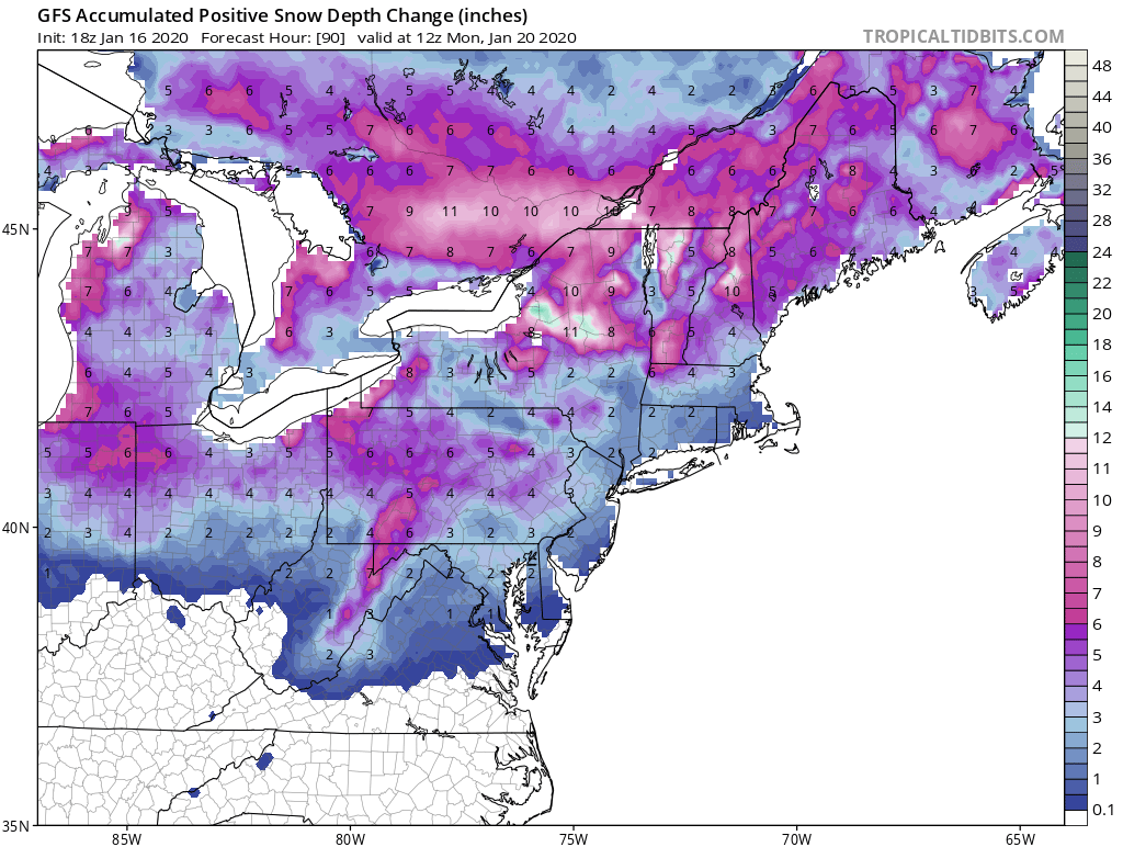
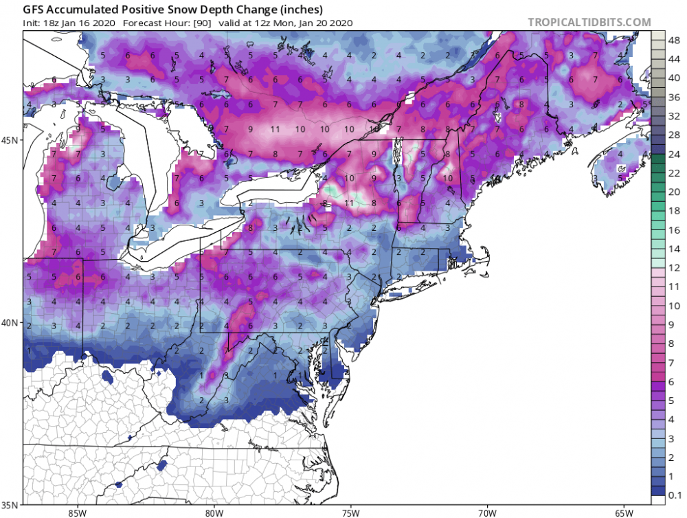
18z solid again for a wintry event on Saturday. This would be another accumulating snowfall in an otherwise flawed pattern. Technically would make back to back weeks of flawed storms/patterns giving us accumulating snow. Nickel and dime.
-
ICON is basically all frozen 95 north and west.
-
I don't really foresee this going much further west than already depicted. Could see runs today and even tomorrow trending the wrong way before an overall positive trend for the final 48hrs, with incremental improvements as CAD begins to be better modeled and the low trends slightly further east in or favor. I'm probably just being optimistic but I've seen it happen plenty of times before.
-
YUP, ICON doesn't show mix. Check surface temps.
-
ICON pretty much whiffs with an all snow start except far northern and eastern areas. Slightly drier to start which allows upper levels to warm enough for mix. Primary stronger and less strung out as well.
-
I'm just excited about extrapolating the NAM this afternoon and tonight. All in all, looks like we'll get some kind of frozen. I think worst case scenario with this will be similar to what the Euro is spitting out. Canadian would probably be best case. Still think there is ample time for a shift or two in either direction. Who would have thought 2 weeks ago that we would have had an accumulating snowfall last week and be able to move almost right on to tracking another threat this week? Fun times.
-
One thing we may be forgetting here is that this probably still isn't the final solution. There is still plenty of time for it to morph into something completely different. The LPC could trend further west still and then back east. Could trend to all rain or more snow. Still 7 days out, which is an eternity in this hobby.
-
That is a big run right there. First global to go big on the coastal enhancement idea.
-
At hr 14 you can already see improvements at h5.