

OSUmetstud
-
Posts
16,433 -
Joined
-
Last visited
Content Type
Profiles
Blogs
Forums
American Weather
Media Demo
Store
Gallery
Posts posted by OSUmetstud
-
-
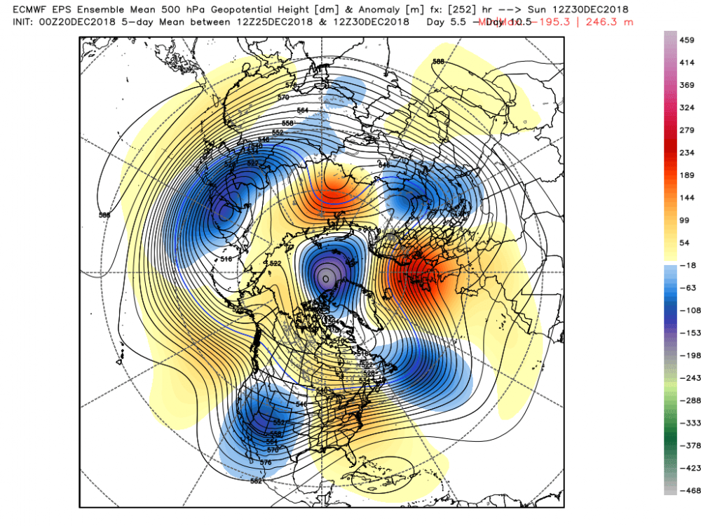
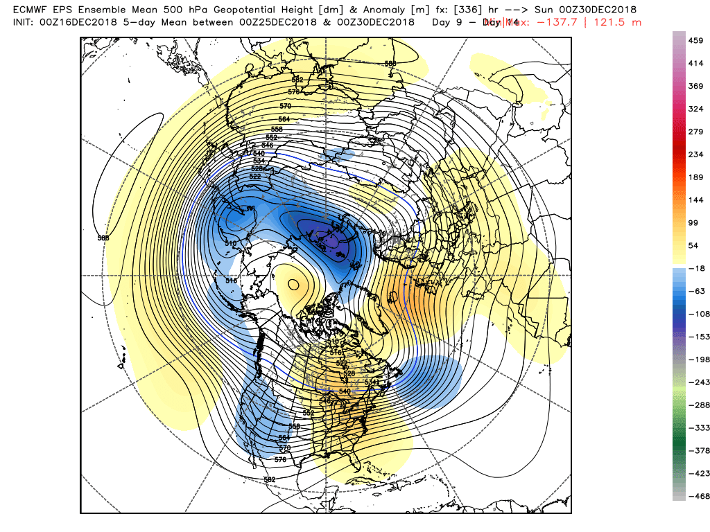
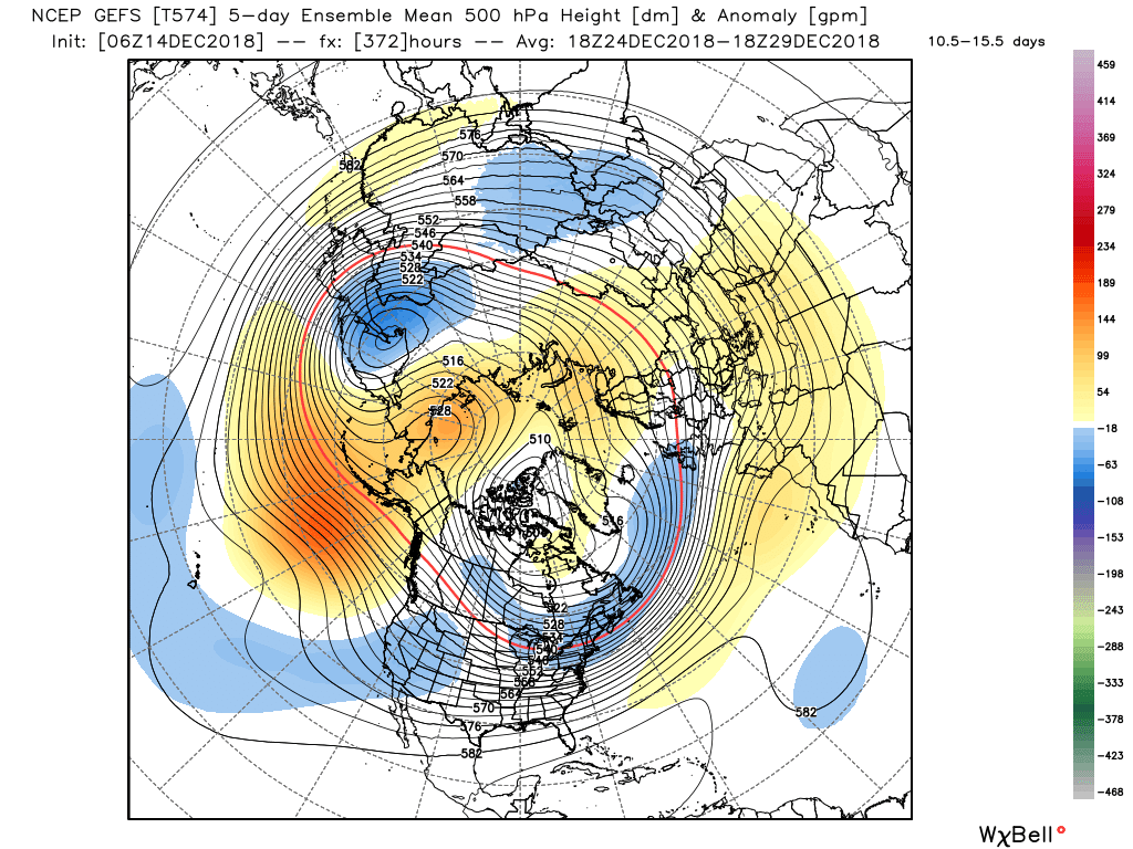
Idk, the -NAO looks fairly real to me on the 500mb charts, but its just east-based. The lower heights over Greenland may be hurting the calculation a bit.
-
2 hours ago, ORH_wxman said:
You can regenerate precip on a stalled system with spokes of vorticity going around the ULL...the precip just tends to be more localized as already mentioned. We saw this in march 2001 in spots in NH that got around 40 inches.
The other way is to basically have completely separate waves along a stalled frontal boundary and in that case, the precip shields would remain much more robust...but then you are almost talking about more than one storm even if the snow is nearly continuous.
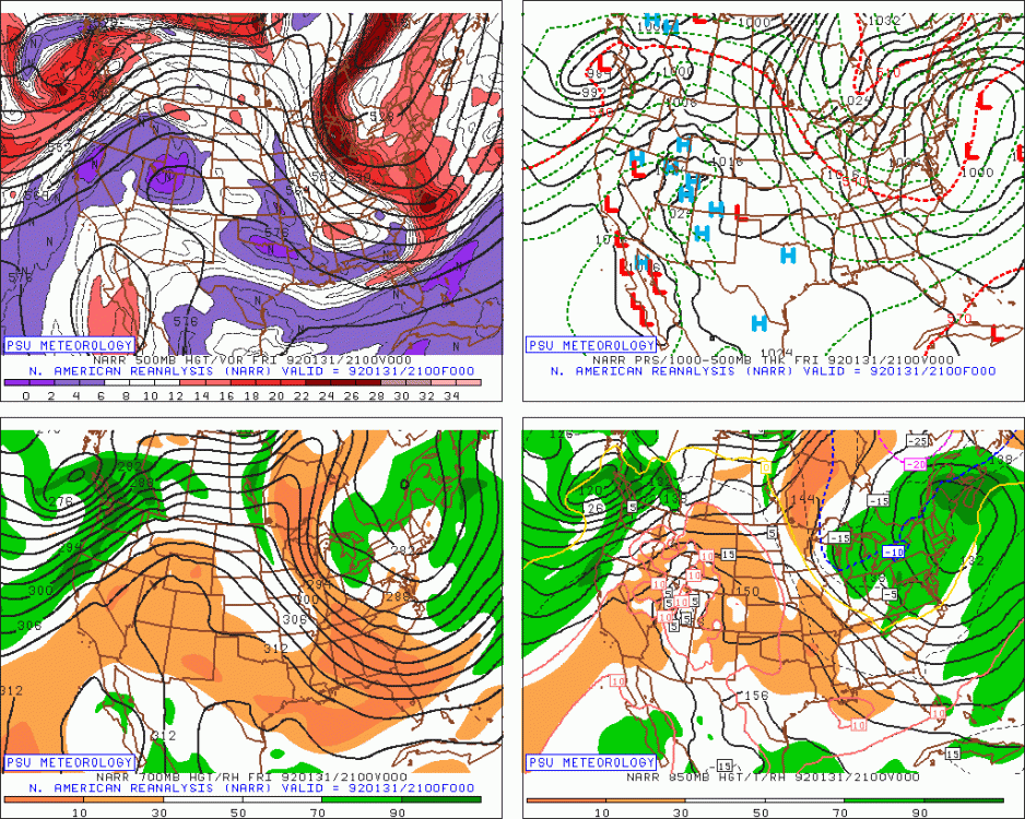
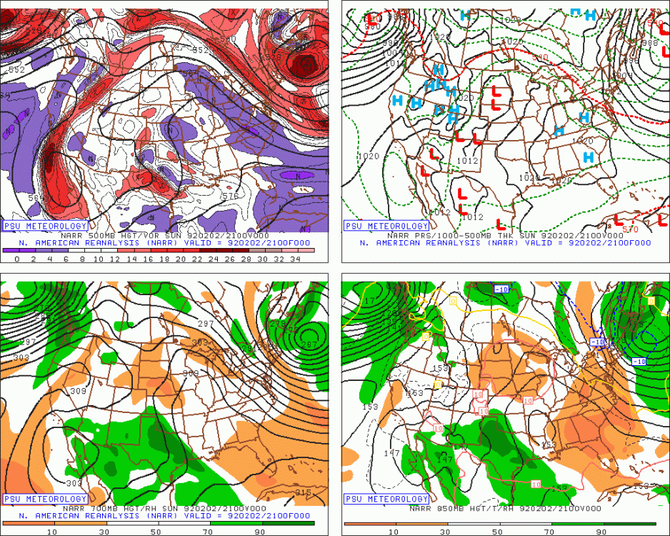
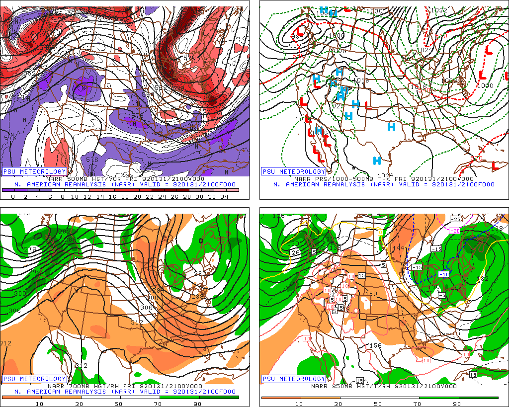
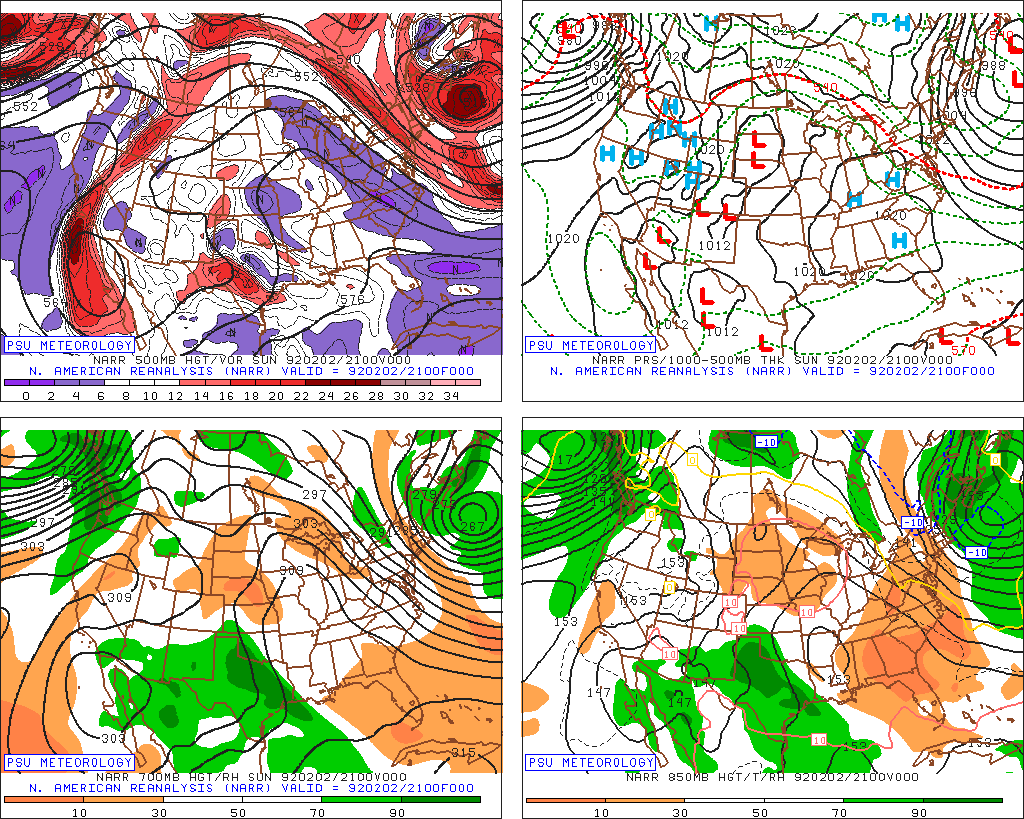
Moncton NB managed 63.4 inches from jan 31st to Feb 2nd 1992. Really cool looking evolution.
.thumb.png.071d93aeb425484b1c0b103290211b7f.png)
-
 3
3
-
-
1 hour ago, OceanStWx said:
Ha, Maue just added 45 day snowfall to his model site now.
He posted a teaser on Twitter that actually supports much of the discussion in here. Disclaimer: snow maps are garbage, BUT they do highlight the potential pattern. The absolute number of snowfall is a WAG from the EPS, but given that little to no snow falls in New England between now and New Years, all of the accumulated model snow is for the month of January. So pointing towards an above normal snowfall month.
I was wondering about those numbers on the wxbell site. Like have they derived some sort of model climatology for the snow being forecasted? Or is it just a thing that throws out number that we just accept to have meaning?
-
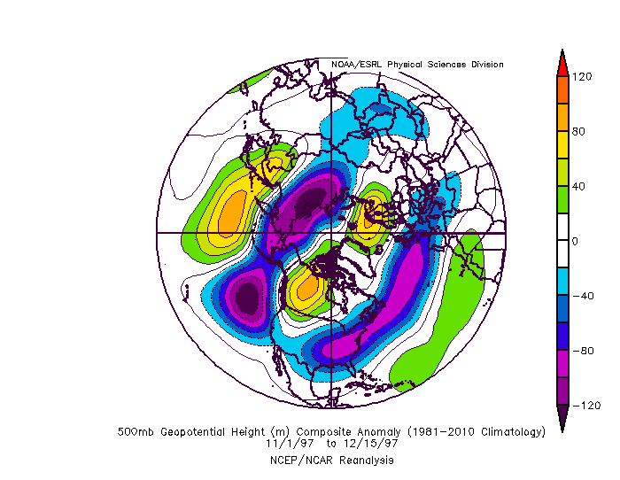
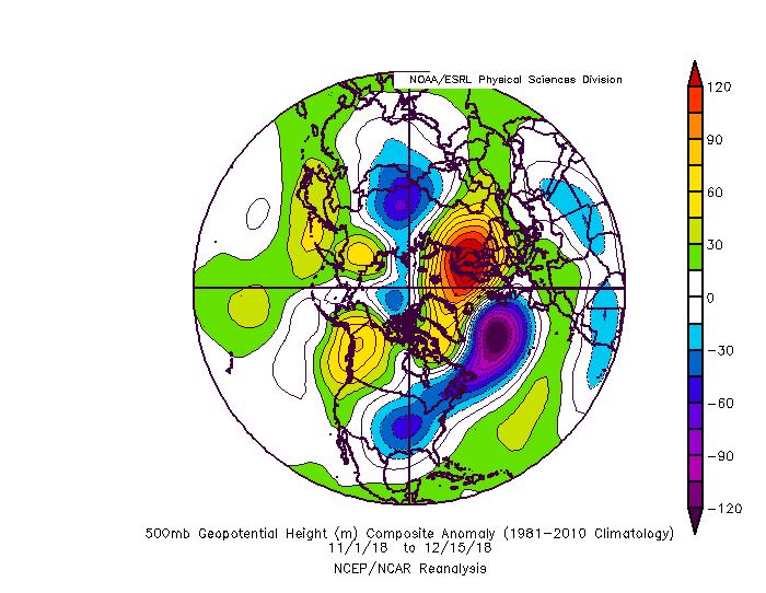
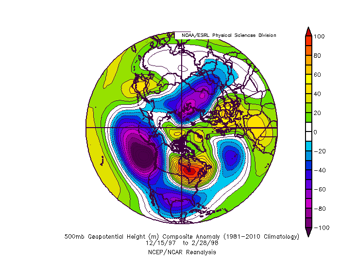
Any year can mimic another year for a little while. The hemispheric state is very different than 97 98. This Nino is pretty weak. That one was the strongest of all time by some measures. It was also the most east-based. Look at the GoAK trough so far in 97 98 compared to now. This is what happened the rest of the winter in 97 98. A very east based GoAK vortex flooding the US with PAC flow as a result of the strong east based Nino forcing.
12DEC2018 23.4 0.8 26.1 1.0 27.7 1.1 29.7 1.2
10DEC1997 26.7 4.2 28.7 3.6 29.2 2.7 29.4 0.9
Given these anomalies it seems pretty unlikely that Nino 1 2 will produce sustained tropical convection (greater than 26c) through the winter to force such an east PAC trough.
-
3
-
-
Just now, JBinStoughton said:
Or is it post NYE? Or maybe MLK? How about Valentines Day? It’s coming!
")
maybe you guys should start a fun panic room thread like they do in the MA.
-
1
-
-
4 minutes ago, moneypitmike said:
My time between Mass and Maine is a bit split. I don't see it until after 1/1. What's 'ffs' mean?
for **** sake.
It doesnt look good before christmas, have you looked at anything to make the judgement about afterwards?
-
Just now, moneypitmike said:
good luck with that. Anything's possible in 2 weeks, but I wouldn't bet on it.
ffs. you're in maine. The pattern looks pretty nice post-christmas.
-
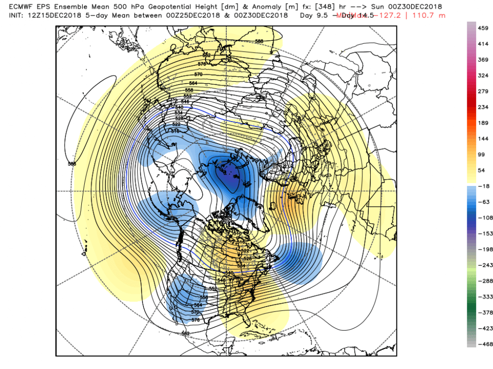
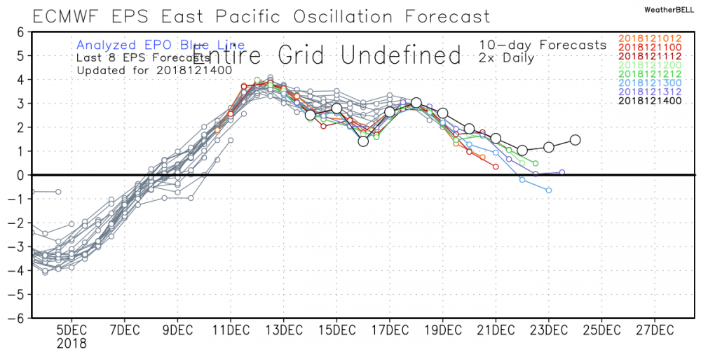
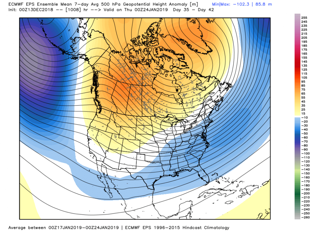
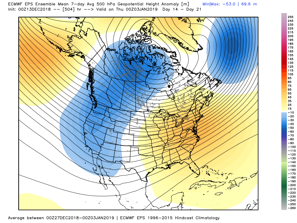
EPS has now gotten a better the last two cycles from christmas onward, a bit less troughing in AK, slightly more negative east -NAO.

-
1
-
-
1 hour ago, RUNNAWAYICEBERG said:
Not that classic. It’s just a stationary shot of a low shooting towards Iceland, not a 50/50. And a neg tilted trough over MO with that Atlantic is no beuno.
It torches Nain. Chuck is a joke.
-
You can the change on the Atlantic side. I think that could save the pattern into something pretty decent.
.thumb.png.80b20519ddcd1e44953ba7e8f980cf74.png)
.thumb.png.dbe7ca6a1f3ac18d49cff46875399c9a.png)
-
EPS looked a bit better on the Atlantic side with some east -NAO stuff with confluence south of Greenland.
-
1
-
-
6 minutes ago, leo2000 said:
I think it's too do with the fact that La Nina never really left. Remember we had a strong La Nina last winter that background state seems to be still there.
None of this is true
-
Just now, weathafella said:
Conventional wisdom suggests that’s too far north?
The confluence being modeled isn't close to that period is what I'm getting at. Could change, of course.
-
13 minutes ago, weathafella said:
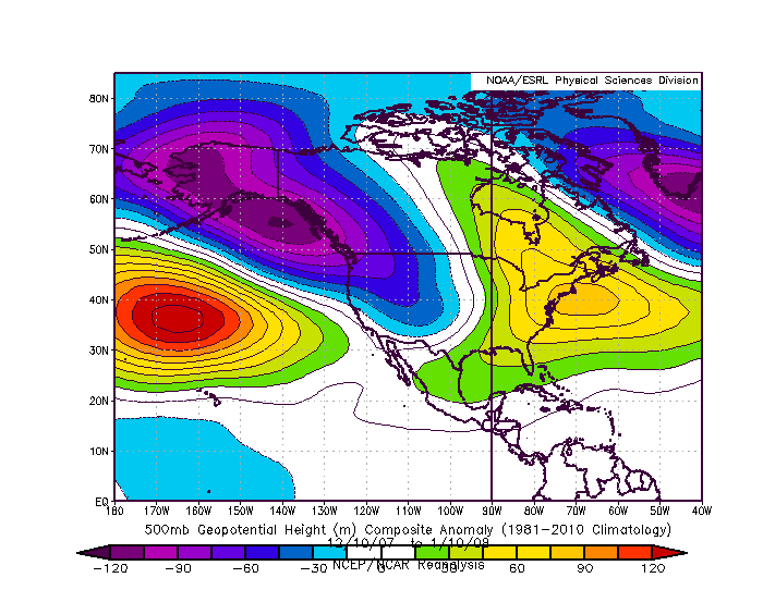
KBOS got about 30 inches in these 30 days.

Strong confluence over Greenland really helped that period.
-
Just now, CoastalWx said:
I don’t think it’s the PV. The origins of he chaos to me anyways, seem to be in the tropics. But, it’s defintely getting punched around. Hopefully that bodes well in January.
eventually it will get into the more favorable phases again lol. Werent some of the more favorable looks when it dove into the circle of death?
-
2 minutes ago, Ginx snewx said:
I must have looked at the wrong data, change maps


There's a lot of datasets out there, so the SST data can be pretty confusing. The CPC data shows a decidely Nino-state. It's pretty weak as everyone knows, so I'm not sure we should be seeing some crazy departures anyway, right?
05DEC2018 23.1 0.8 26.2 1.1 27.6 1.0 29.7 1.2
-
3 minutes ago, Ginx snewx said:
Nino temps dropped a full degree Celcius. Goes to show we don't know sh it
the weekly data is like +1c in all regions and it has been for some time now.
-
 1
1
-
-
Versus this.

-
5 minutes ago, CoastalWx said:
Snow and ice? My shades Have been close for days now and will remain closed until I see Santa sleigh. Did the Home let you walk around again freely?
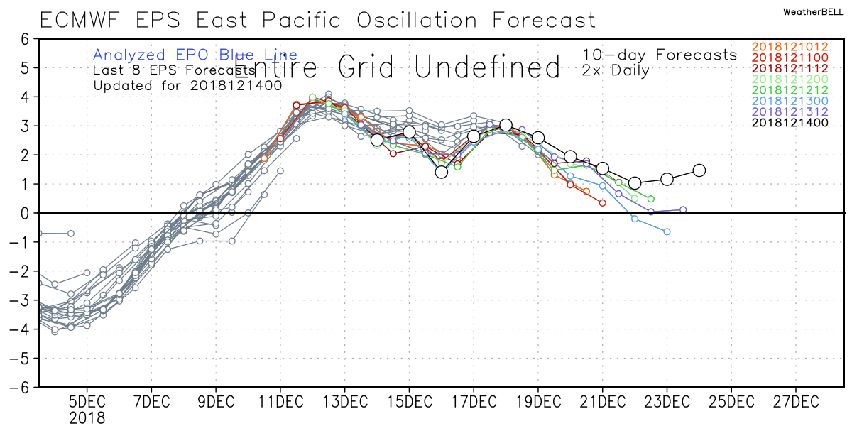
The eps doesn't have an -EPO from what I can see. You have any thought on that?
-
8 minutes ago, Zach’s Pop said:
Really? Your buddy said close the shades for two weeks and some of you may see snow and ice next week. Sadly your EPS hugging buddy will miss it since his shades will be closed
You haven't added a single substantive post since you joined here as a "newb." Maybe try to add something instead of only trolling and being an ass?
-
4
-
 1
1
-
-
The EPO ridging is better on the gefs than the eps. 11 to 15 is a lot colder on the gefs than the eps because of this.
-
1
-
-
Just now, weathafella said:
It’s by no means a furnace it seems
No probably not.
-
1 minute ago, weathafella said:
Thanks Nick! I was reading in the nyc thread where snoski said all of NOAM is torched. Not what it shows.
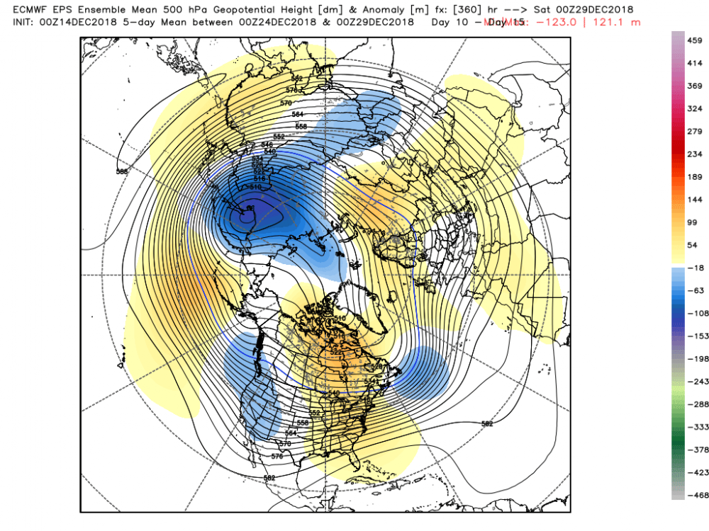
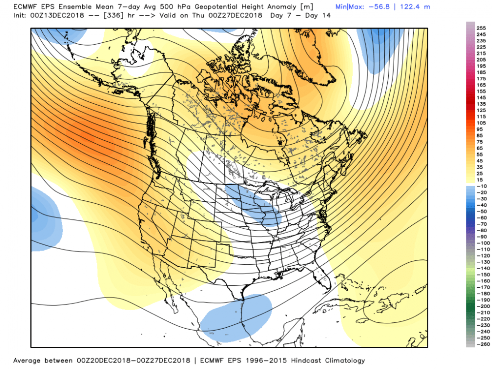
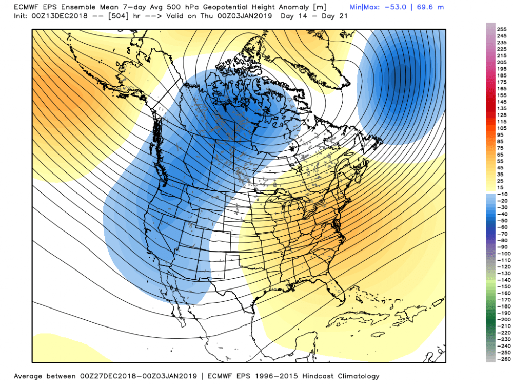
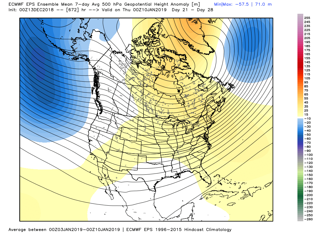
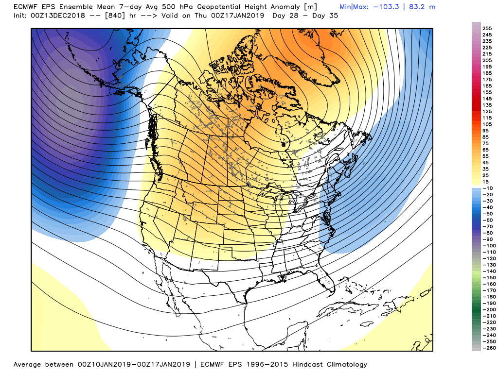
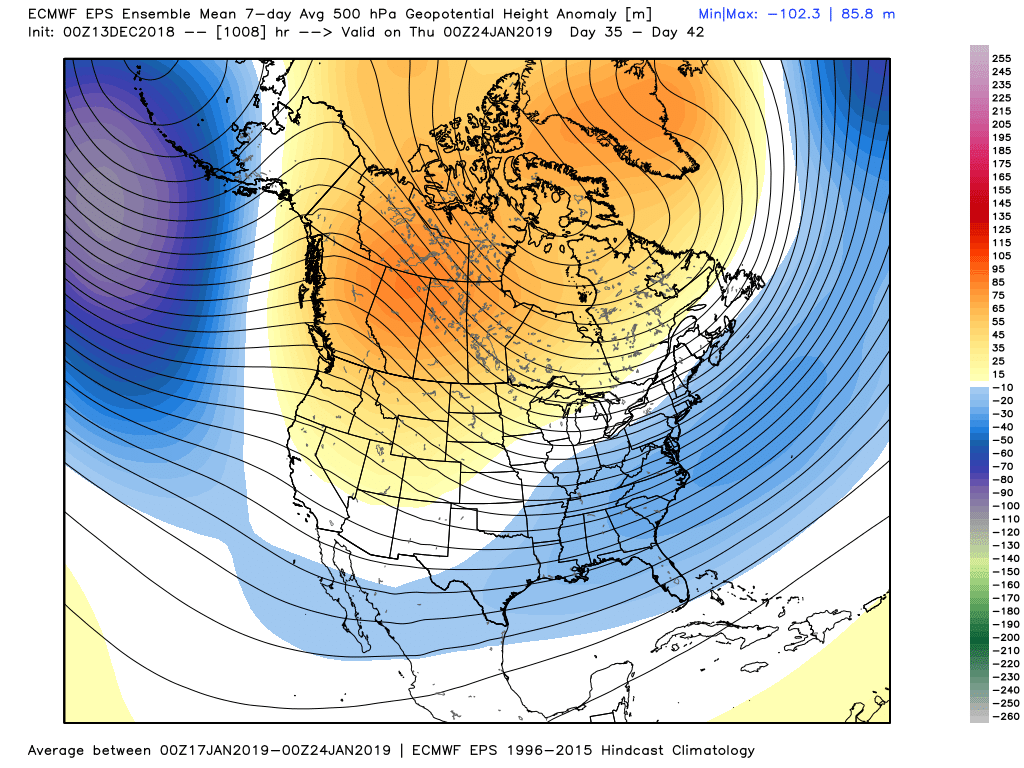
The 850s and 2m are warmer than normal until the day 39 to 46 frame. The gradient look is a bit meager since the ridging in ak/-epo isnt pronounced. The weak -nao as shown could save the pattern without super chilly air in Canada.
-
5 minutes ago, weathafella said:
Can someone post the weeklies? Tyia.


.png.204e835ee810eab6f53d8b33306e6e98.png)

.png.ad8fb0697546fd43e25701f1841463b4.png)
.png.f2611bfe41070facd006c06c457c8527.png)


December Discussion II
in New England
Posted
I dont know if you guys noticed, but pivotalweather now has soundings available for anywhere in north america for the rdps, nam, gfs, fv3 gfs, and GDPS. Pretty cool. GDPS and RDPS soundings have notoriously been hard to come by.
http://www.pivotalweather.com/model.php?m=rdps&p=sfcwind_mslp&rh=2018122000&fh=12&r=ca_e&dpdt=&mc=