

OSUmetstud
-
Posts
16,433 -
Joined
-
Last visited
Content Type
Profiles
Blogs
Forums
American Weather
Media Demo
Store
Gallery
Posts posted by OSUmetstud
-
-
"Everyone knows you never go full NAM"
-
 1
1
-
-
13 minutes ago, CNY-WXFREAK said:
From DR. Maue site, a blog post!
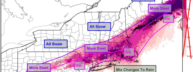
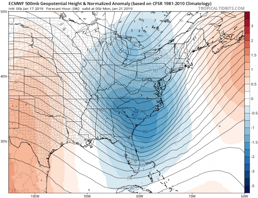
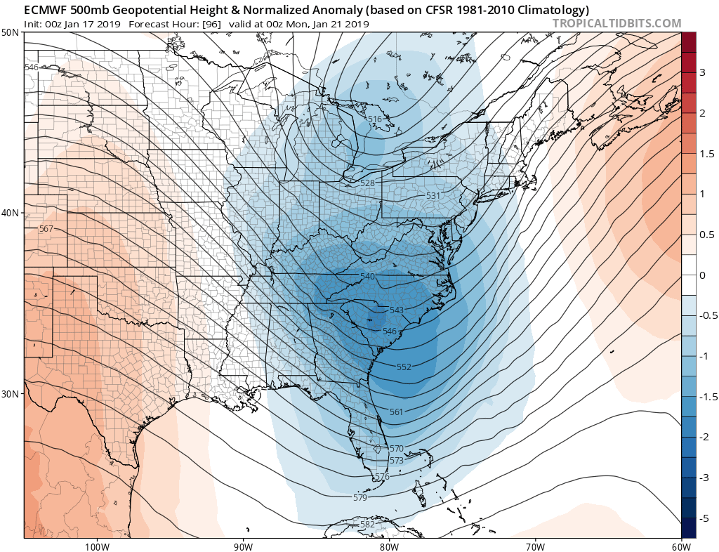
That has to be the Euro for sure so there you go Gorizer so not far off from the Rgem in fact, so something to watch as we get closer.
And you'd think he could build his algorithm to show IP. Those maps annoyingly basically only show snow or zr.
-
 1
1
-
-
Appears that BUF and a few on the forum got NAMMed last night.
-
6
-
-
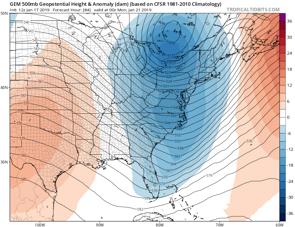
rgem looks nice and amplified

-
2
-
-
Lots of emotions and disappointment over the b team last nignt. Looks like everything is on track. Im a big fan of the rgem/ecmwf combo. Its pretty deadly. Ecmwf was definitely a tick nw regardless of the final qpf output.
Oh and the ssw was effective. Enjoy your cold lol.
-
2
-
-
Just now, CNY-WXFREAK said:
Seriously, did something go wrong during initialization with tonights data points out West or something?
Its just the nam being the nam. Dont bother trying to figure it out
-
1
-
-
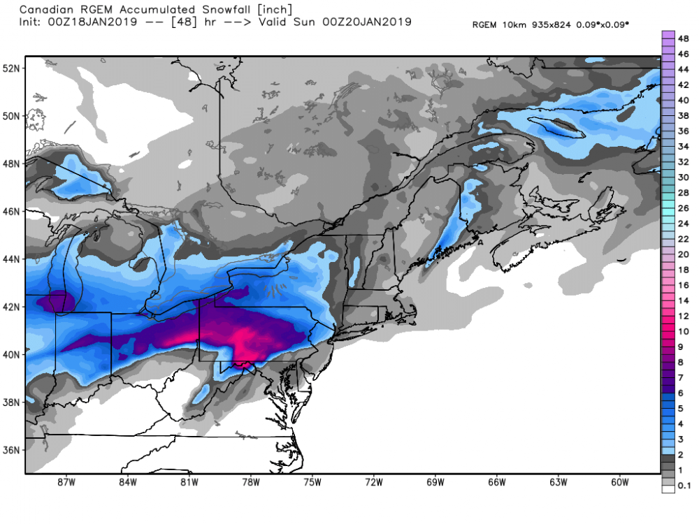
00z Rgem looks nice through through 48...much more amplified than the nam or the icon.
-
12 minutes ago, mississaugasnow said:
About 51" We have a climate similar to Detroit/Chicago. Most of our big storms are terrible for about 90% of this sub because they cant transfer to coast and generally have to pass right over Rochester.
Do those even happen anymore?
-
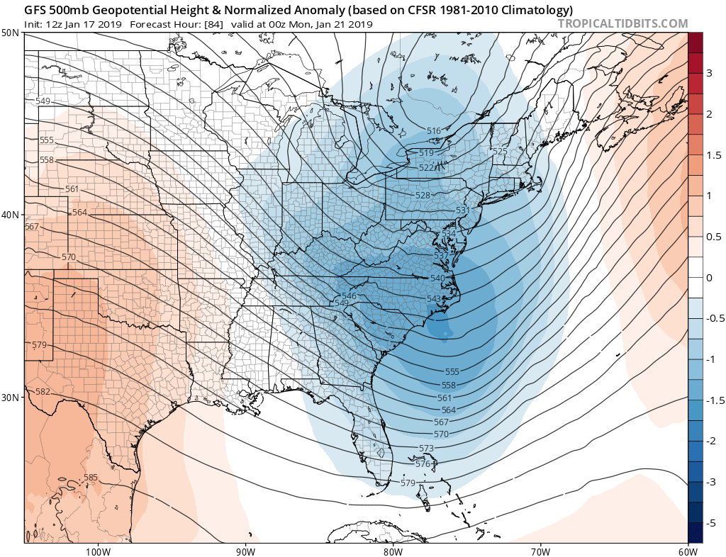
Major change from 00z was a faster and more amplified southern shortwave with less confluence ahead over NE. Also the northern stream shortwave kicker did come in a bit faster like the other 12z models..so the storm ended a bit sooner than earlier runs.
-
1
-
-
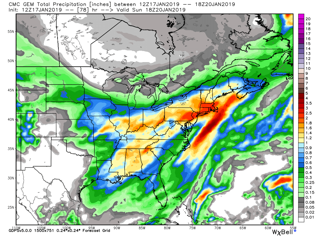
Id say you can add an additional 3 to 6 inches of fluff sunday from niagara to oswego counties that wont be caught well by the ecmwf qpf progs. This isnt a super ideal lake enhancement scenario however since the storm doesnt track in quebec and throw lots of low level rh over the lakes as it departs.
-
Qpf: 0.9 buf 1.0 roc 1.4 syr on ecmwf. Much improved from 00z. In faster out faster.
-
Much of sne wont get plain rain i think maybe just southern ct ri and se ma.
-
Just now, Syrmax said:
I think the Ukie has pretty much finished caving in to the Euro. Maybe that's the "big" news?
Yeah. Bm track is off the table.
-
1
-
-
4 minutes ago, Syrmax said:
Maybe its just me but i'm not seeing a significant difference between the 12z model runs and also in comparison to the small trends/perturbations that exist from each model's run to run. Certainly not from a sensible weather standpoint.
Not too much overall. Just interesting from a met standpoint.
-
00z euro slower with northern stream than 12z gfs or 12z gem.

-
The east shunt is a new trend in some ways. Its not really a cave to the 00z ecmwf. The euro didnt have the northern stream kicker come in as fast.
-
Just now, BuffaloWeather said:
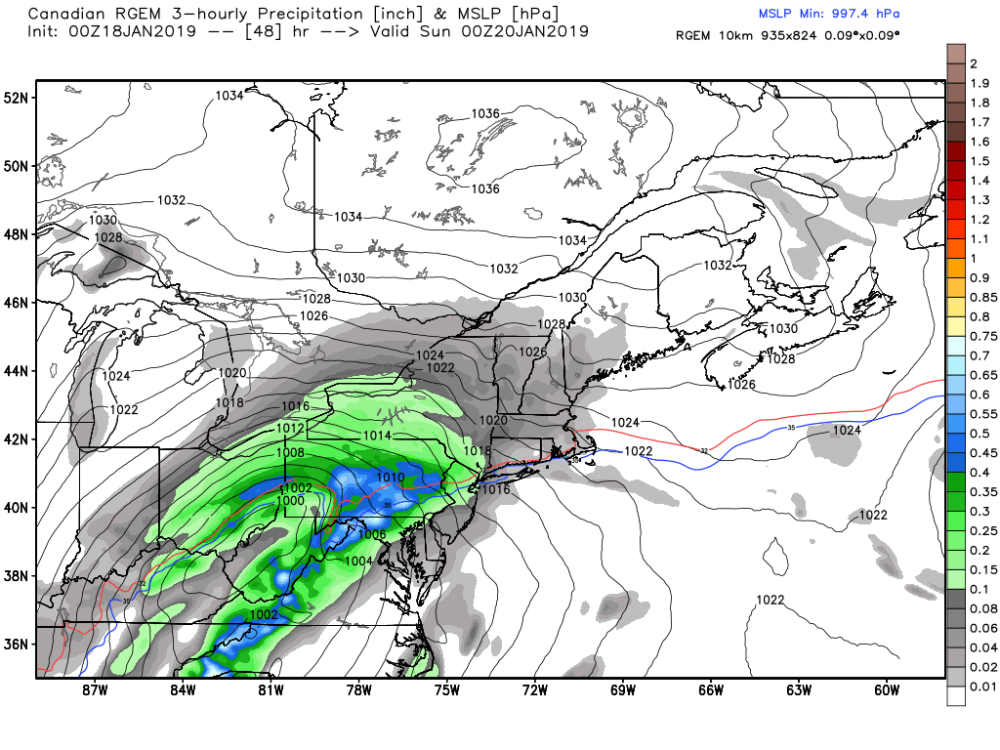
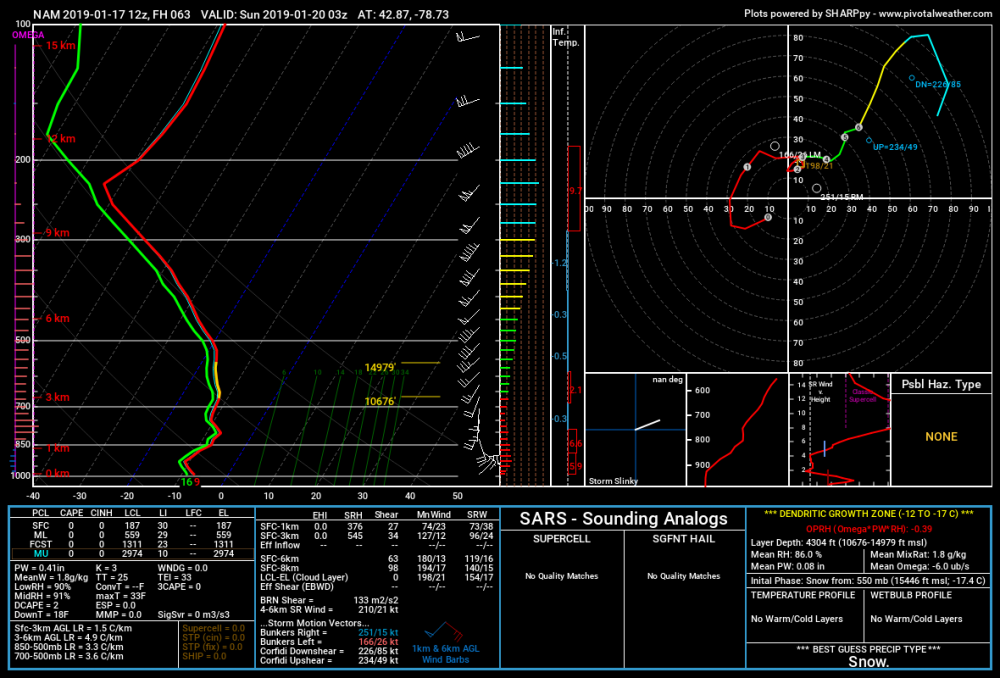
RGEM the battle between that low and high pressure is going to be interesting.

You can look at it out to 84 here. Its experimental and not available elsewhere.
-
1
-
 1
1
-
-
-
4 minutes ago, BuffaloWeather said:
Any worry of a dry slot wherever that primary heads?
Dryslot is not a concern for buf.
-
1 minute ago, Thinksnow18 said:
What's your accumulation forecast???
8 plus. Details to be determined later. I dont think it makes sense to go too high yet especially there.
-
1
-
-
Gem kinda does the same as the gfs. Faster slightly beefier southern shortwave gets farther north initially but then get shunted east faster as the northern stream shortwave kicks it east.
-
5 minutes ago, BuffaloWeather said:
GFS is north, brings mixing potential up to state line.

Yeah then it gets shunted east. The central canada shortwave up near nw ontario on that image comes in faster than the gfs at 00z and 06z.
-
Its not quite sand lol. I think that will be the case more in CNE where you have more defined max lift at warmer 700mb temps.
-
3
-
-
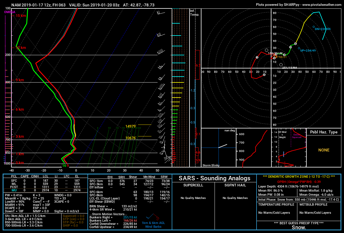
You can see weak lift through the column area here with a relative max near -8c/800mb. Its where methods like max t in profile and kuchera fall short. They only take into account temperatures, not rh or omega.
-
1
-
2
-


Upstate/Eastern New York
in Upstate New York/Pennsylvania
Posted
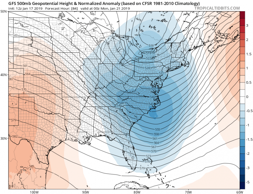
In all seriousness, that was a pretty abrupt amplification of the southern stream on the 12z models. You can see snow developing much further into the midwest.