nj2va
-
Posts
15,205 -
Joined
-
Last visited
Content Type
Profiles
Blogs
Forums
American Weather
Media Demo
Store
Gallery
Everything posted by nj2va
-
RGEM lost all credibility for me when it showed like 65” in MD a few years ago about 6 hours out from storm start.
-

January 24-26: Miracle or Mirage JV/Banter Thread!
nj2va replied to SnowenOutThere's topic in Mid Atlantic
Great times! Looking forward to the next one. -
January 24-26: Miracle or Mirage JV/Banter Thread!
nj2va replied to SnowenOutThere's topic in Mid Atlantic
Don’t worry, all we did was gossip about everyone here -
January 24-26: Miracle or Mirage JV/Banter Thread!
nj2va replied to SnowenOutThere's topic in Mid Atlantic
What in the actual fuck is this? At first I thought you superimposed it. This looks terrible lol -
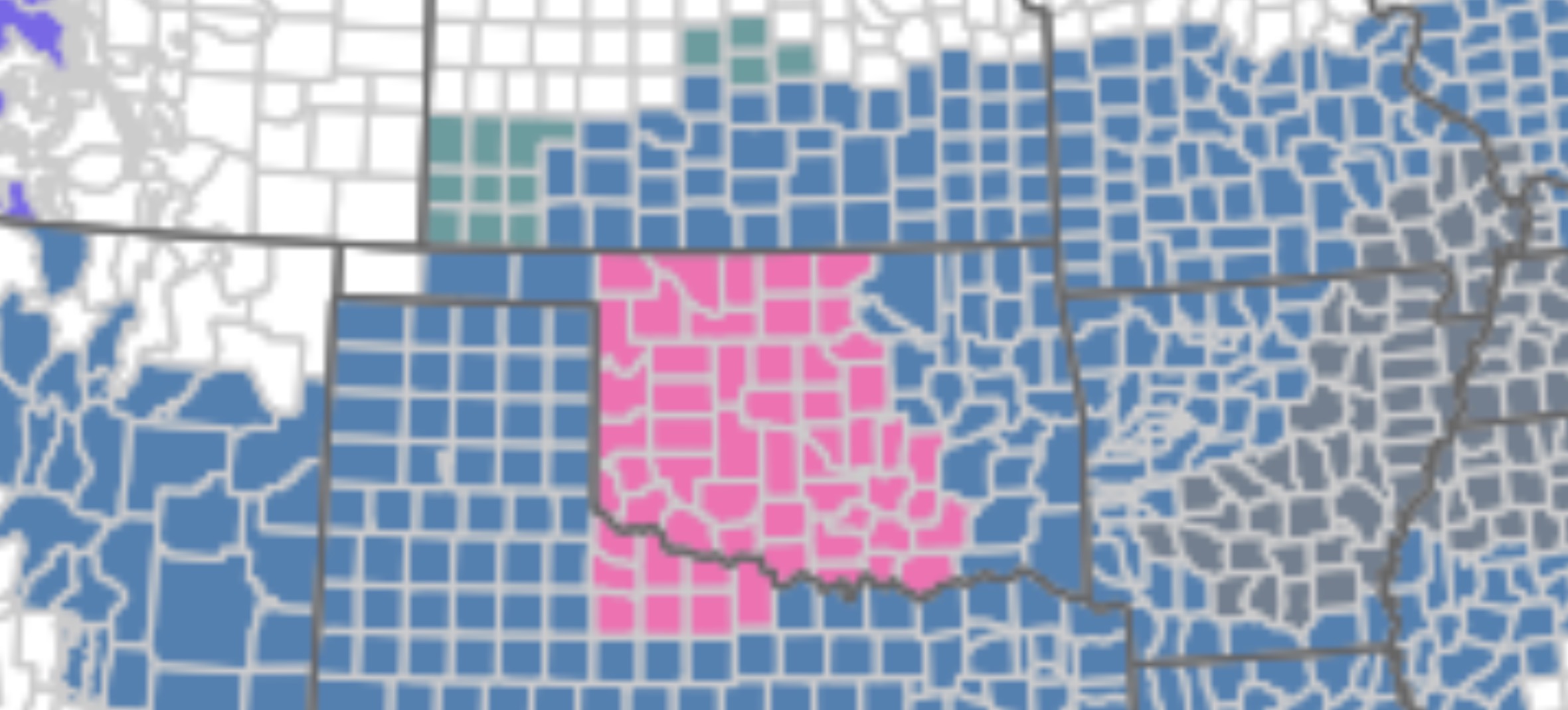
3-6" for half of DC? I'd be surprised if we don't clear 6". I'd bump that 6-8" line SE.
-
This is a crazy map
-
January 24-26: Miracle or Mirage JV/Banter Thread!
nj2va replied to SnowenOutThere's topic in Mid Atlantic
Can I send you my grocery list? K thanks -
January 24-26: Miracle or Mirage JV/Banter Thread!
nj2va replied to SnowenOutThere's topic in Mid Atlantic
They’re absurd. 85% chance DC gets 1”? -
January 24-26: Miracle or Mirage JV/Banter Thread!
nj2va replied to SnowenOutThere's topic in Mid Atlantic
Keep us posted each model run please! -
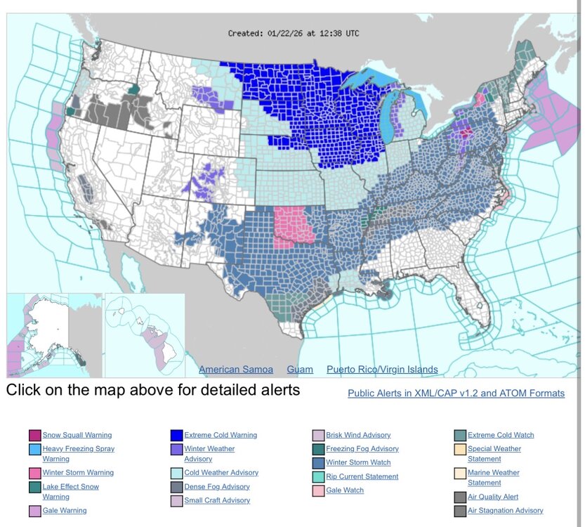
The first swath of watches are being upgraded to warnings back in OK/TX.

-
January 24-26: Miracle or Mirage JV/Banter Thread!
nj2va replied to SnowenOutThere's topic in Mid Atlantic
Big PK on the 2 man adv for the Caps -
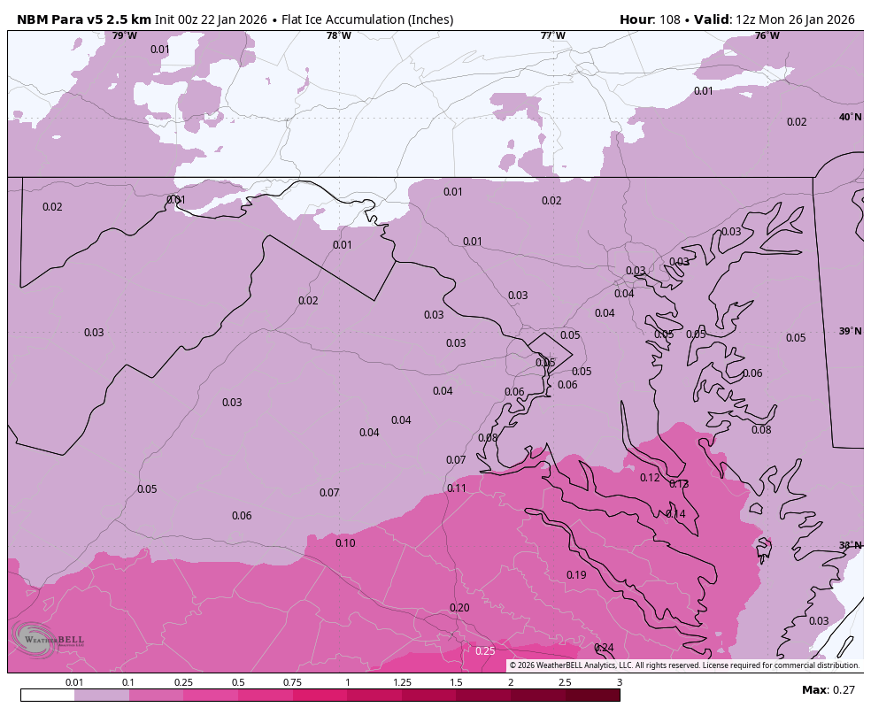
That is a beat down for NVA/CMD on that panel.
-
No, it does not. Probably right at 96 or so.
-
Huh?
-
Just lock that GFS run in, it was basically perfect IMO for DC.
-
Still snow 18z Sunday in DC. Mix line looks to be near RIC.
-
Yeah this is the only thing jumping out to me through 48. Maybe the Baja vort is a touch east but minute.
-
January 24-26: Miracle or Mirage JV/Banter Thread!
nj2va replied to SnowenOutThere's topic in Mid Atlantic
I don’t know, that seems groundbreaking -
I don’t see much of any change in the early GFS hours (which has the new data).
-
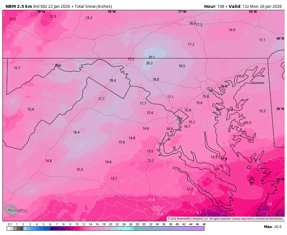
It seemed way more reasonable than the ‘regular’ NBM. Are they retiring the ‘regular’ in favor of the parallel?
-
January 24-26: Miracle or Mirage JV/Banter Thread!
nj2va replied to SnowenOutThere's topic in Mid Atlantic
They just need to ingest new data -
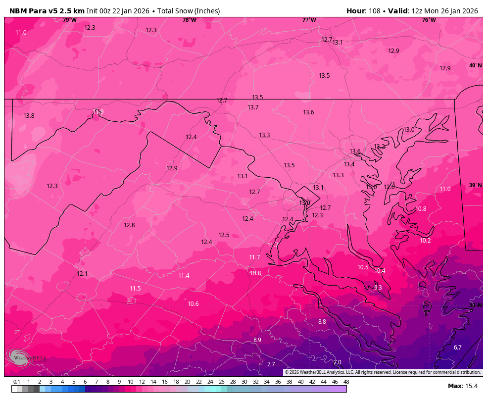
Actually that was the NBM Parallel, so many models geez. Here’s the ‘regular’ NBM…never knew there were multiple NBMs.

-
00z NBM Paralell, highest snow totals N/W of 95 which matches climo/sensible outcomes in these setups. LFG!


-
January 24-26: Miracle or Mirage JV/Banter Thread!
nj2va replied to SnowenOutThere's topic in Mid Atlantic
Boom! 2-0 -
January 24-26: Miracle or Mirage JV/Banter Thread!
nj2va replied to SnowenOutThere's topic in Mid Atlantic
Sick passes there on the PP leading to the Strome goal!