

CoastalWx
-
Posts
175,992 -
Joined
-
Last visited
Content Type
Profiles
Blogs
Forums
American Weather
Media Demo
Store
Gallery
Everything posted by CoastalWx
-
Dec 5/6th major coastal/ west Atlantic cyclogenesis ...?
CoastalWx replied to Typhoon Tip's topic in New England
Yeah it did imo. -
Dec 5/6th major coastal/ west Atlantic cyclogenesis ...?
CoastalWx replied to Typhoon Tip's topic in New England
Maybe we'll just have upright convection through the slot. -
Dec 5/6th major coastal/ west Atlantic cyclogenesis ...?
CoastalWx replied to Typhoon Tip's topic in New England
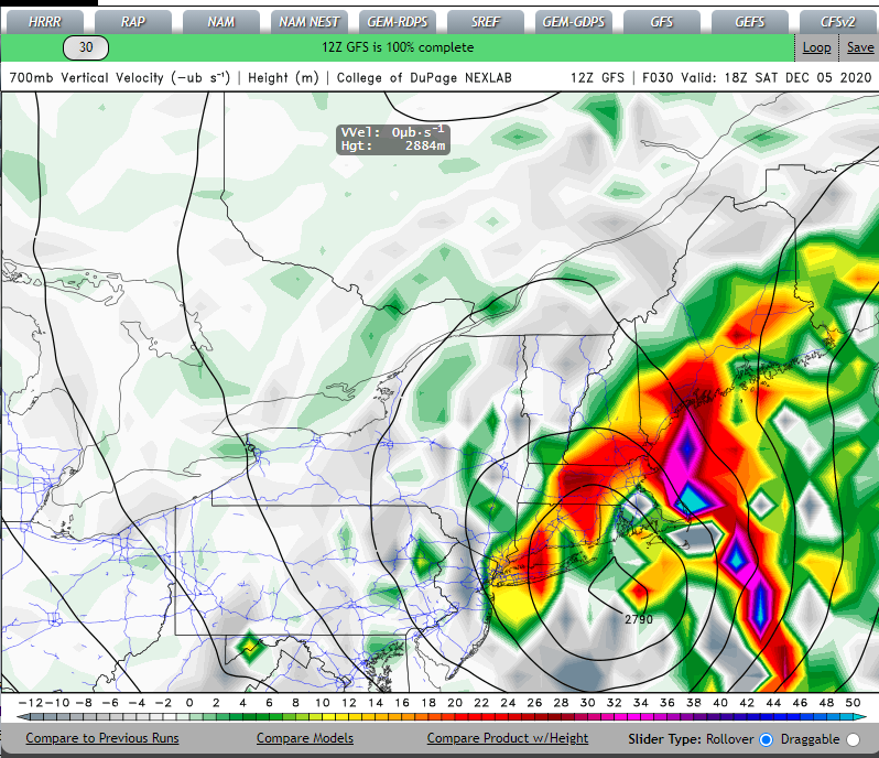
MInd you 700 is a little mild, May have to look closer to 500-600mb. -
Dec 5/6th major coastal/ west Atlantic cyclogenesis ...?
CoastalWx replied to Typhoon Tip's topic in New England
-
Dec 5/6th major coastal/ west Atlantic cyclogenesis ...?
CoastalWx replied to Typhoon Tip's topic in New England
That's what I see. -
Dec 5/6th major coastal/ west Atlantic cyclogenesis ...?
CoastalWx replied to Typhoon Tip's topic in New England
The soundings were sort of eh near the city. I would like to see the lift smack into the DGZ when the column is cool enough. You can see prior to the flip, there is good lift in the DGZ which likely helps to top down cool. But as the low intensifies, the lift lowers a bit. Maybe it bombs and contracts everything near the center. That would help. -
Dec 5/6th major coastal/ west Atlantic cyclogenesis ...?
CoastalWx replied to Typhoon Tip's topic in New England
We'll need it to really go to town. Any showery crap near the dryslot and forget it. That storm had a much better airmass. Hate to see it. -
Dec 5/6th major coastal/ west Atlantic cyclogenesis ...?
CoastalWx replied to Typhoon Tip's topic in New England
I don't think BOS is seeing 4-7. -
Dec 5/6th major coastal/ west Atlantic cyclogenesis ...?
CoastalWx replied to Typhoon Tip's topic in New England
Euro was a little less there. Looked a hair warmer aloft. -
Dec 5/6th major coastal/ west Atlantic cyclogenesis ...?
CoastalWx replied to Typhoon Tip's topic in New England
hOLY HELLACIOUS THUMP. -
Dec 5/6th major coastal/ west Atlantic cyclogenesis ...?
CoastalWx replied to Typhoon Tip's topic in New England
Mini 12/92 maybe tomorrow. -
Dec 5/6th major coastal/ west Atlantic cyclogenesis ...?
CoastalWx replied to Typhoon Tip's topic in New England
Brian is all excited now, but then those little chicken legs stick out of collapsed coops like the wicked witch of the east, he won't be happy. -
Dec 5/6th major coastal/ west Atlantic cyclogenesis ...?
CoastalWx replied to Typhoon Tip's topic in New England
Total spring feel. In fact when the sun comes out in the aftn over western new england, the snow will start melting like it's April LOL. -
Dec 5/6th major coastal/ west Atlantic cyclogenesis ...?
CoastalWx replied to Typhoon Tip's topic in New England
But if I can't have your snow, I will watch the 5 day outage develop over Raymond ME. -
Dec 5/6th major coastal/ west Atlantic cyclogenesis ...?
CoastalWx replied to Typhoon Tip's topic in New England
I'll gladly take that from you. -
Dec 5/6th major coastal/ west Atlantic cyclogenesis ...?
CoastalWx replied to Typhoon Tip's topic in New England
Yeah...I had to laugh at his post. -
Dec 5/6th major coastal/ west Atlantic cyclogenesis ...?
CoastalWx replied to Typhoon Tip's topic in New England
Was thinking that. If you get to like 31.8 and slam the DGZ...ratios would be better than 10:1. -
Dec 5/6th major coastal/ west Atlantic cyclogenesis ...?
CoastalWx replied to Typhoon Tip's topic in New England
I feel like this has NW tics coming. -
Dec 5/6th major coastal/ west Atlantic cyclogenesis ...?
CoastalWx replied to Typhoon Tip's topic in New England
Luke, take your lips off the pipe. -
Dec 5/6th major coastal/ west Atlantic cyclogenesis ...?
CoastalWx replied to Typhoon Tip's topic in New England
That's a little mild even inland ern ma. So close. -
Dec 5/6th major coastal/ west Atlantic cyclogenesis ...?
CoastalWx replied to Typhoon Tip's topic in New England
Right over the Cape. -
Dec 5/6th major coastal/ west Atlantic cyclogenesis ...?
CoastalWx replied to Typhoon Tip's topic in New England
GFS probably ticks west it looks like. -
Dec 5/6th major coastal/ west Atlantic cyclogenesis ...?
CoastalWx replied to Typhoon Tip's topic in New England
12/9/05 definitely had a better airmass all around. This has a strong vort, but garbage air all over. -
Dec 5/6th major coastal/ west Atlantic cyclogenesis ...?
CoastalWx replied to Typhoon Tip's topic in New England
3K NAM snow amounts look more reasonable compared to 12k NAM -
Dec 5/6th major coastal/ west Atlantic cyclogenesis ...?
CoastalWx replied to Typhoon Tip's topic in New England
I like nrn CT on N and NE. Hasn't changed.


