RitualOfTheTrout
-
Posts
3,690 -
Joined
-
Last visited
Content Type
Profiles
Blogs
Forums
American Weather
Media Demo
Store
Gallery
Everything posted by RitualOfTheTrout
-
 Nowcast / obs from around our area should be fun, someone in western Allegheny might be ripping sleet or snow while its raining in Monroeville. (Sorry Meatwad )
 -
Still well within model error though, where that zone sets up could be off by 25-50 miles even as we get close to game time. Unfortunately the direction of the error is probably NW given we still seem to be bleeding that way. Now if we see a SE tick to the track and infiltration of warm air as we close in then maybe you can hedge that will continue through the storm. One other thing to note though is that the snow maps can be really misleading in the transition zone, so it's hard to tell if we are really that close or not just based off that.
-
Yeah I'd rather have a sleet bomb if we can't get snow if I had the choice although those aren't very enjoyable to go take a walk in like a heavy snow unless you like the sensation of being sand blasted.
-
That will help a little, but I just don't get excited over ice depicted unless it's at least in the 20s. Ice formation releases latent heat too so you need some mechanism to replenish the cold. Don't get me wrong even a tenth of ice on an untreated surface can be a disaster, but you won't be seeing trees snapping and power outages if the NAM temperature profile verifies.
-
NAM is the warmest model, 32-34 during bulk of the precipitation and gets into the upper 30s before the cold swings back through. Even if we stay at 31, ice accretion will not be efficient. Sure there will be a glaze but it's not a 1:1 ratio like those maps project.
-
Taking the NAM verbatim there would be a brief period of ice but surface temperatures are 32-34 during the heaviest part, very little ice will form in that scenario. If the 12z NAM is right we go from light snow to sleet to ZR then mainly rain for the bulk of it.
-
3k NAM brings plain rain all the way to I80 nearly on the second wave.
-
Be careful with UK snow maps, I think it counts sleet and zr as snow but I could be wrong.
-
Yeah... This winter is a total disaster dumpster fire. I know you're just kidding, so am I. If we bust on these next 2 storms hard to be bitter over it given totals to date even if we don't see another flake til next season. I don't think this shifts much more one way or another now. I'd guess 50-75 miles, if it's all further NW we see more sleet and rain then dry slot, the other way and its more snow, I think either option is still within the model error at this time.
-
Yeah this is my thought too, nobody should jump off the ledge over the NAM the same way you shouldn't be dropping the "It's Happening Meme" when it bullseye's you. Now if other 00z guidance follows then backs it up at 12z tomorrow that's when I'll start to be concerned. Need to see at least 2-3 runs to establish a trend vs a wobble one way or the other.
-
I'd sleep a little better with another SE tick..

-
NAM still looks good, but we can't afford many ticks NW from here.
-
I won't feel good till I see 35dbz radar returns over my house Monday night lol. No, but really all the guidance has the storm and show a narrowing goal post, so I'm starting to have confidence but models have relatively dramatic changes over shorter leads than we are used to due to handling of the PV etc. thus far this season.
-
I agree, it has the same general idea / track the GFS had. Also, PARA GFS looks pretty similar to the OP. Given how quick the storm is moving though and the threat of sleet / mix I think it's going to be tough to get 10-12 inches even in a perfect track scenario, but plenty of time to see how it plays out.
-
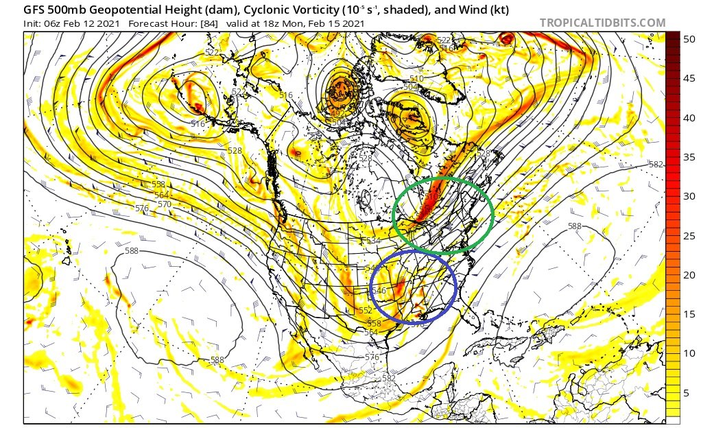
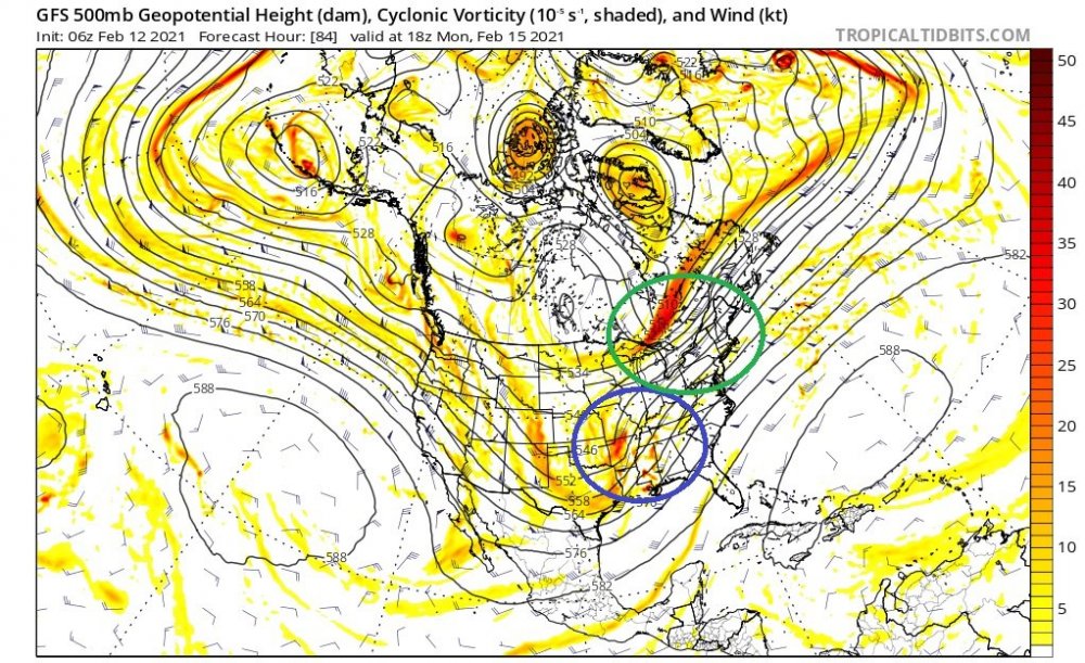
I'm sure I'm going to oversimply or partially misstate something here, but an area of high pressure in and of itself will not necessarily "block" a storm from cutting into it. Now if it's strong enough and has a solid depth of cold air with it that will offer some resistance and will help to funnel cold air down into the storm possibly extending the amount of time an area stays frozen. The other thing to look at is how blocked the flow is, if you have a ball of low pressure stuck under a block at the 50/50 Longitude / Latitude (What some refer to as a 50/50 Low) that also helps slow the flow down so a high will have more staying power. The other than that really matters though is to look at 500, to block a storm from cutting you want confluence and you want the trough to not go negative to far to the West. So in the 500mb map below, the green circle you can see a piece of energy swinging by pushing the height lines in a more West to East (Compressing the flow between that and the ridge in the SE), that would imply once a storm gets to that point it's going to feel pressure to either move in a more Easterly direction or jump to the coast. The area circled in blue is the trough orientation, in this example its positive (height lines lean towards the right) This is indicative of a more progressive system still at that point and it would be less likely to cut and pump heights and subsequently flood us with warm air. As those lines become more straight up and down with a deepening storm, that's referred to neutral, and if they band to the left negative tilted trough. Also, pay attention to the colors, dark red would indicate there is a lot of energy in the trough, then do comparisons to previous runs to see if as we get closer in time there is more or less energy to discern a trend. In a simplified way, just imagine those lines as like a roadway or path of least resistance, and that is the track a storm will want to take. Looking at this level of the atmosphere its really interesting and obvious how other down / upstream features will effect the track of a storm.
-
Yeah that's a good look, given the speed hard to imagine it could get much better, hopefully we won't lose to much ground as we close in. I'm
-
18z uses the 6 hour forecast from the 12z run as the initial data point, likewise 6z uses 00z 6 hour forecast for it's initialization where as 12z / 00z use fresh data from observations for the initialization. I thought though that the off hour runs get some new data, but I can't say for sure as it's been awhile since I looked into this and things may have changed.
-
It's a message board for discussing weather, I never understood why people get so emotional over snow maps being posted. Use at your own risk, but they are like the cliff notes if I don't have time to look into things closer. Most should know they aren't to be trusted verbatim. Plus who doesn't like seeing that bright pink over your house?
-
When the GFS and EURO show a snow storm at day 9... Scrolling through today's models and this song came on and my brain just connected it to this hobby... I'm wondering why do all the ̶M̶o̶n̶s̶t̶e̶r̶s̶ MODELS come out at night..?
-
Yeah another jump SE, I still think a miss in that direction is more of a threat than rain from this one, but still 5 days out so alot yet to be resolved. Don't forget just a few days ago the Saturday / Sunday storm was cutting west too.
-
Looks like this one is wrapping up. One band to the north that should pivot South overnight but I think the bulk of our accumulating snow is about done for the city and north. Saturday keeps trending East with one low and the northern energy looks to barely hit us. Hopefully another 1-2 type deal at least but will have to see how it look once in the short range.
-
LaNina typically favors cold out west / central US due to tropical forcing that favors SE Ridge. The models want to push it East but as we get closer the effects of the ridge are better resolved. By all rights a Nina Feb is usually warm, but we have the extreme blocking and piece of the PV squishing the ridge keeping us in the game.
-
Measured a hair over an inch of new snow. I've been on the northern fringe of the better returns but finally pushed a bit North, currently getting the best rates of the event so far.
-
Moderate burst here right now. Roads look like they are a mess already.
-
That's been the theme this winter though, more NS interaction, only to see less as we near in time.That said can't dismiss out of hand GFS depiction, but I'd hedge towards some sort of compromise between GFS / CMC solutions following the seasonal trend until proven otherwise. Agree with analyzing thermals at this juncture, if you do it's for pure entertainment purposes. The Euro depicting zr with temperatures in the low to mid 20s is not something we see around these parts very often so I thought it was interesting to point out.