Voyager
-
Posts
12,367 -
Joined
Content Type
Profiles
Blogs
Forums
American Weather
Media Demo
Store
Gallery
Everything posted by Voyager
-
Yup, April can be a real sucky month. But...without April, we wouldn't have April showers, and without April showers, we'd have no May flowers. Without May flowers, the pilgrims couldn't have come, and then we'd all still be in Europe. So I guess there's that...lol
-
What a shit show...
-
Lol.... Tuesday Mostly sunny, with a high near 39.
-
The closer we get to Tuesday, the colder my forecast high gets... Tuesday Mostly sunny, with a high near 40.
-
0.06"
-
I just got the answer to my question this morning from the NWS... Sunday Night Rain showers before 2am, then a chance of rain and snow showers. Low around 33. Chance of precipitation is 80%. Little or no snow accumulation expected.
-
We got nothing... All the good stuff stayed south of I-78 again.
-
And a bunch of crappy days for nothing.
-
Part of me says "bring it" and part of me says "keep that crap out of here, it's April, dammit".
-
Got to love the up and down temps lately. It was summer on Monday, fall on Tuesday, winter-like (at least in Hazleton) yesterday, and close to summer-like again today. When does it snow...
-
Delivering here in Hazleton and it's just a cold, cold rain. Temp's only 41...
-

E PA/NJ/DE Spring 2025 Obs/Discussion
Voyager replied to PhiEaglesfan712's topic in Philadelphia Region
I'm really close to my first mowing even up here in Tamaqua. Well, where the grass actually grows. I need to fix the spots our dog killed off -
Yes. If it's going to be a weekend washout, at least give us good amounts. Sucks, though, that my grandson's HS baseball game will likely be postponed.
-
And the wind has arrived....again
-
Yup. It was pretty close.
-
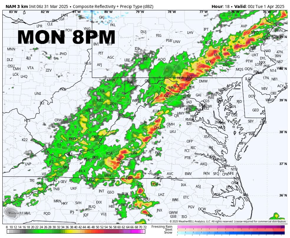
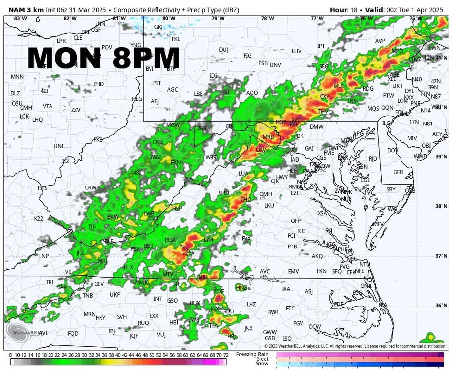
NAM 3k for what it's worth.
-
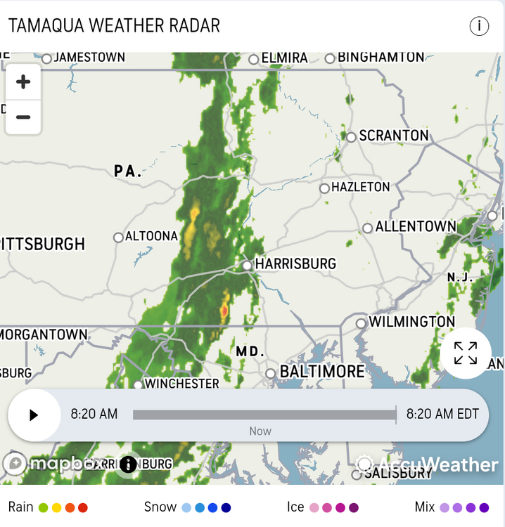
Is this the line associated with the FROPA? It's AccuWeather's future radar and appears to be what's left over from yesterday's line and action in Ohio. If so, it appears to be a 9am to noon passage for eastern PA which seems early.
-
It's ok. You still helped out with the screenshot post.
-
I actually was just going to ask if anyone knew if we might see some clearing skies this afternoon to fuel the storms, as there was no mention of sky conditions in my forecast.
-
Here we go again. 30 mph gusts on Tuesday... Tuesday: Mostly sunny, with a high near 49. Northwest wind 8 to 10 mph, with gusts as high as 30 mph.
-
-
Don't you dare step aside. Your input is valued here. If he got offended by that post, it's on him. I won't speak for all, but those "Day in the Life" posts to me are funny. I take no offense if I'm parodied in them. It's good natured fun among friends. And you did step up and apologize, even though it wasn't really necessary.
-
80.2 right now after a spike to 81.5, so it appears that 82 might be my high for the day.
-
Wow!!! 10:25AM and I'm already up to 70 in the backyard.
-
Who drove them out? I hope it wasn't me with my warmanista posting tendencies. Most of the time, even though I am a warm, summer lover, I'm just joking.