
Sey-Mour Snow
-
Posts
6,995 -
Joined
-
Last visited
Content Type
Profiles
Blogs
Forums
American Weather
Media Demo
Store
Gallery
Everything posted by Sey-Mour Snow
-
 Really hope you do well
 -
I'm stating the obvious here, not going out on a limb.. It's not a forecast I said if it ticks like that again ..
-
Might want to take off the weenie goggles.. You need a new prescription ..
-
As expected the HRRR went well south east about 50 miles with the accumulating snow.. Still hits the south shore hard but one more shift like that and its game over for everyone..
-
HRRR coming in much less amped compared to 12z.. Will still be a hit for some, but if you continue that trend one more time for 00z its a shut out for all of SNE.. Also as many as said a light to moderate event wont accumulate with this crap air mass. Lost for words right now ..
-
Rolling with the 700mb goodies but the cutoff will be sharper than that
-
lol what the hell is going on? From a rt 2 jack to MJO jack in 18 hours on day 2! Congrats to MJO for joining the party let’s hope it stops trending south this is absolutely wild!
-
NYC metro is a nightmare forecast 0 or 12” in spots with urban heat effect
-
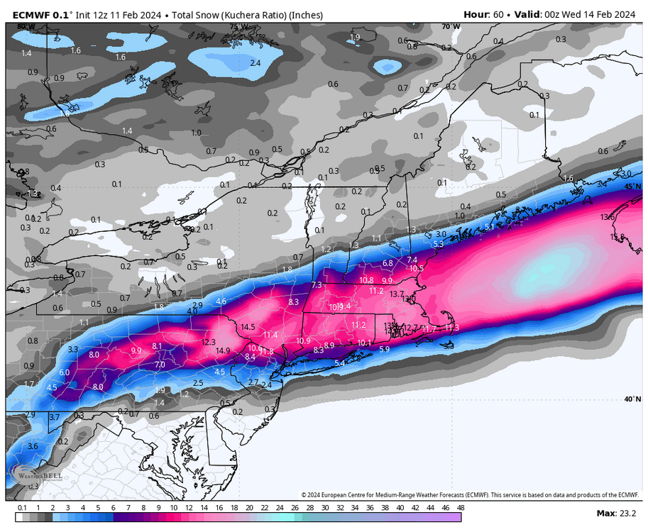
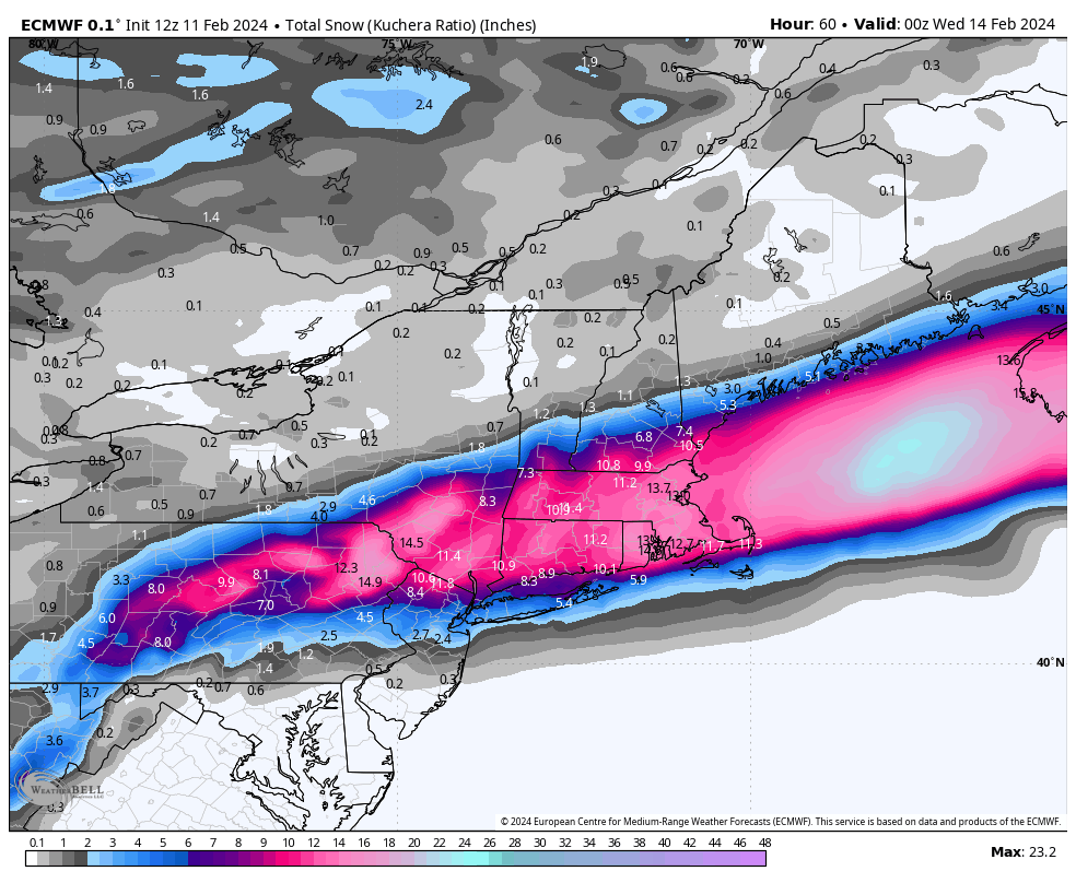
Kuchie will be less than 10:1 in rain/snow situations ..
-
Could be a reason for lower heights on east coast . Earthlight mentioned it earlier and now I’m seeing how the tornado outbreak is busting
-
Wild the run to run differences on eps is the timing slowed down a lot for 36 hours out. The colder trends coincide with the slower trends. Also the warm front and tornado outbreak being shunted south today helping us out?
-
Ya it’s colder and slower that’s it
-
We replaced toasters with smiles
-
True so the smaller synoptic changes in the icon at a glance normally wouldn’t warrant the shift we are seeing in terms of precip and snowfall output you are saying?
-
Icon has trended significantly south in 36 hours steadily it’s about 200 miles south with all features. GFS has been pretty steady with some north and south waffling currently in a south tic trend.
-
Think too warm boundary layer there?
-
I can’t stop smiling since I saved Ginxys horse
-
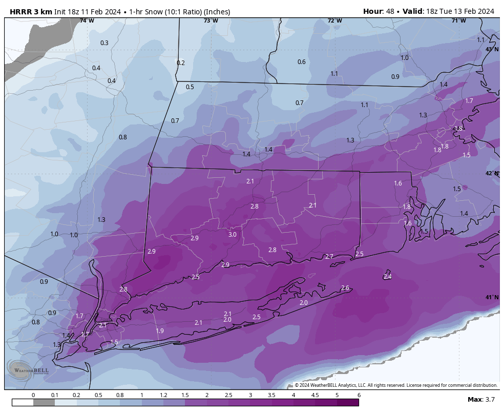
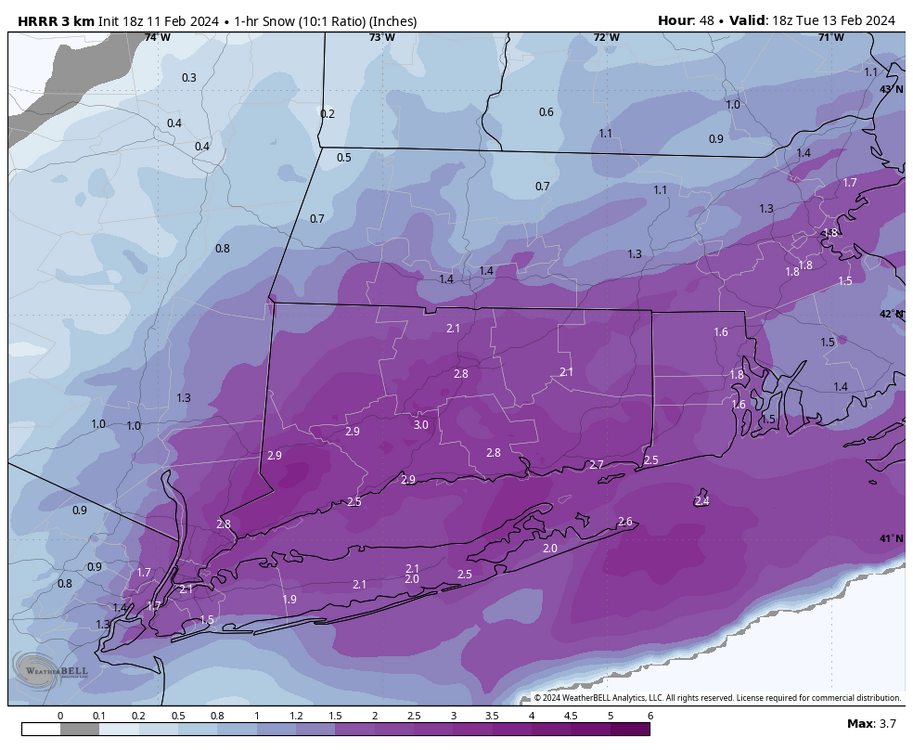
Thats 1 hour snow at 10:1 with a 3” band over the entire state of CT. That will never verify just fun to look at
-
@RUNNAWAYICEBERGcheck out long range hrrr . We’d make up for the past 10 years with that. Quasi stationary band setting up for our hood with 3-4” per hour rates at 10:1 lmao we will never see this again what’s weenie run
-
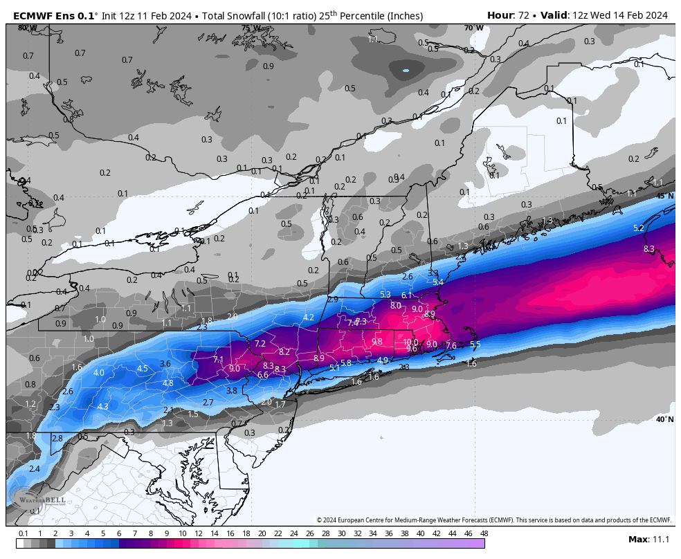
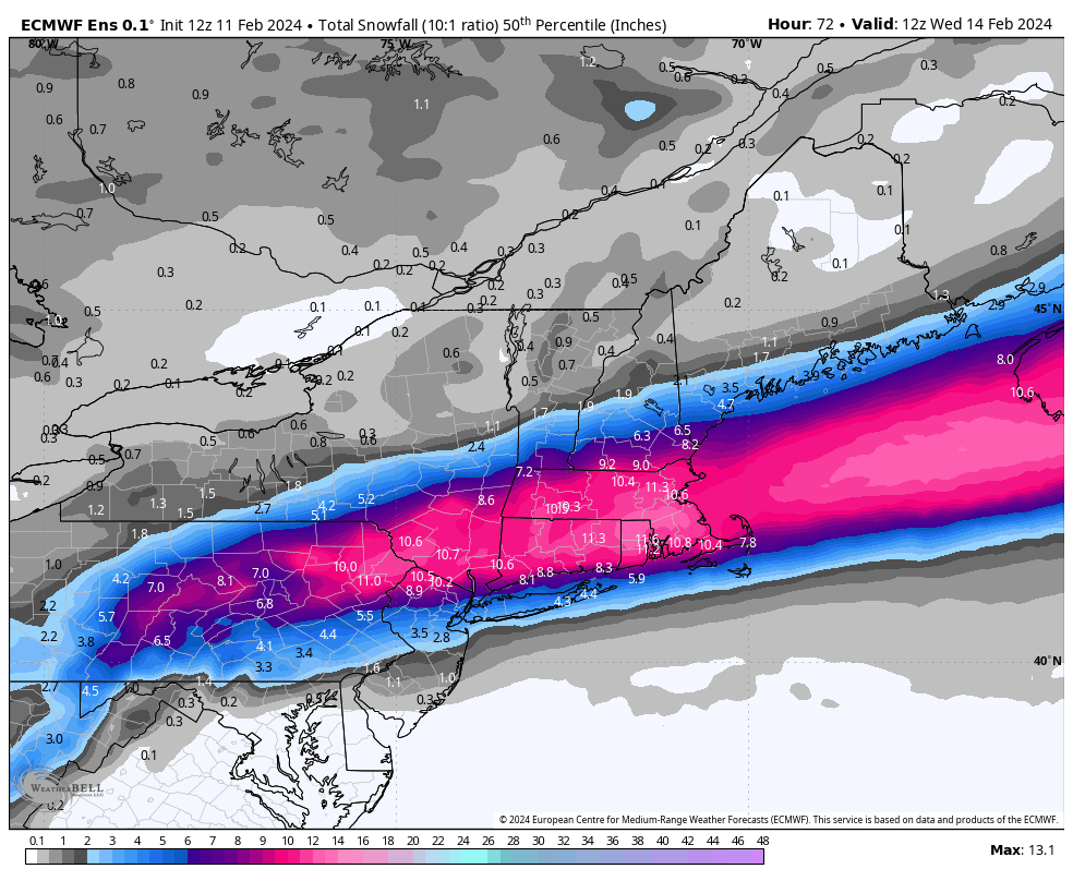
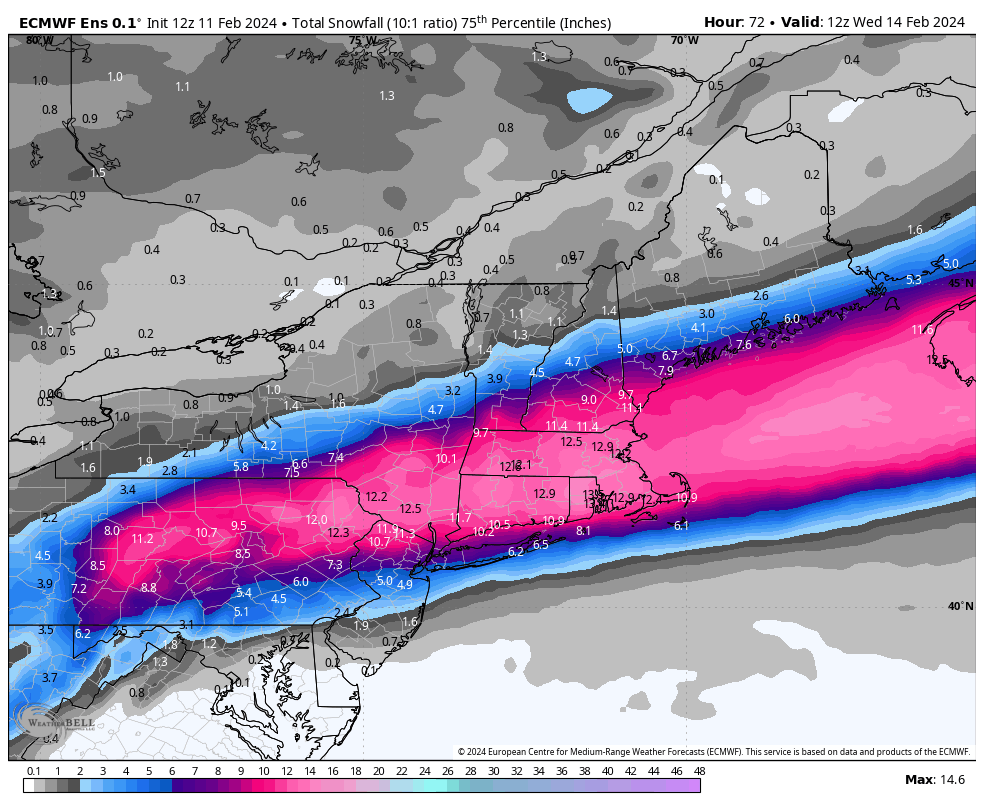
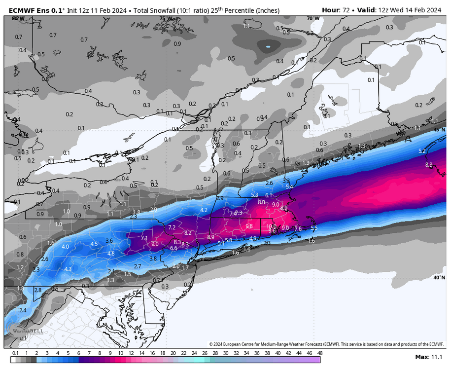
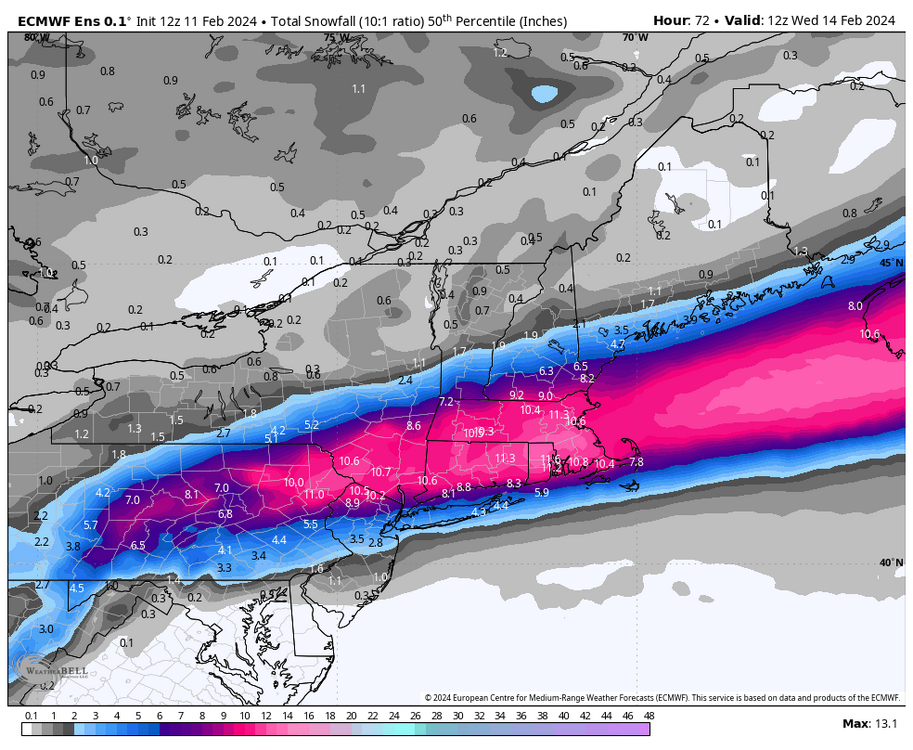
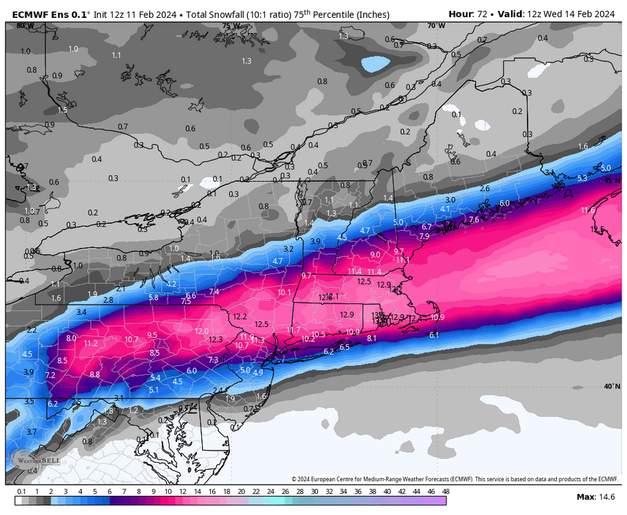
EPS much improved as well for SNE everything south again and delayed which has correlated to colder.. Kev to Scott 11-12" mean .. Posted is 25th / 50th / 75th percentile .. That's about the least amount of variance I've seen in those for 48-60 hours
-
Ya 700 moved south again by 50 miles
-
Nice move south again.. Close to much more out east as it explodes a touch too late ..