Sey-Mour Snow
-
Posts
6,822 -
Joined
-
Last visited
Content Type
Profiles
Blogs
Forums
American Weather
Media Demo
Store
Gallery
Everything posted by Sey-Mour Snow
-

Saturday February 16th - Another CT/ Cape special?
Sey-Mour Snow replied to Sey-Mour Snow's topic in New England
Wow, with some decent ratios, that would get warning criteria in NYC metro suburbs.. We have some big accounts there, might have to bump up there this evening if this does actually bump north.. This was congrats DC to Philly yesterday -
Saturday February 16th - Another CT/ Cape special?
Sey-Mour Snow replied to Sey-Mour Snow's topic in New England
Idk how to edit, I can't get tomorrows date right, called it Jan 17, then deleted and did Feb 16 lol -
Saturday February 16th - Another CT/ Cape special?
Sey-Mour Snow replied to Sey-Mour Snow's topic in New England
Main band in the morning.. Midday Snow showers and squalls behind the intial band of snow .. HRRR with TTs in the 40s and even some 50s across SNE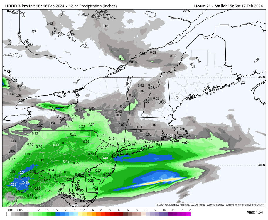
-
Saturday February 16th - Another CT/ Cape special?
Sey-Mour Snow replied to Sey-Mour Snow's topic in New England
HRRR a slight tic south and and tic less amped with the northern banding of snow, but still loves some good snow squalls that move through with the back edge of the main band of snow. -
Saturday February 16th - Another CT/ Cape special?
Sey-Mour Snow replied to Sey-Mour Snow's topic in New England
Ya gfs ramped up again, hrrr was wild here, will be something to watch closely down here, all of our clients are right along coast. -
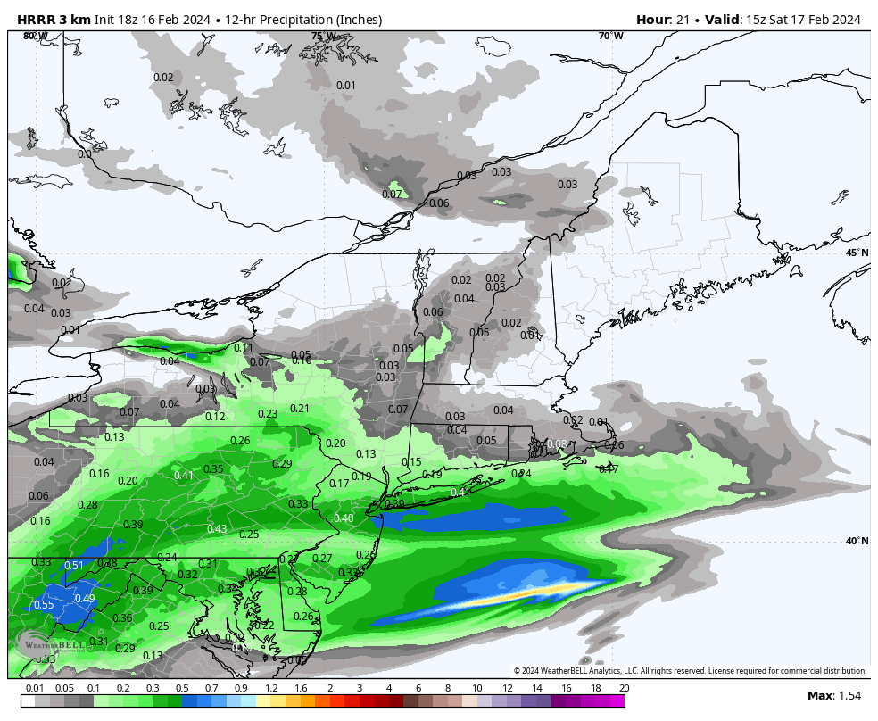
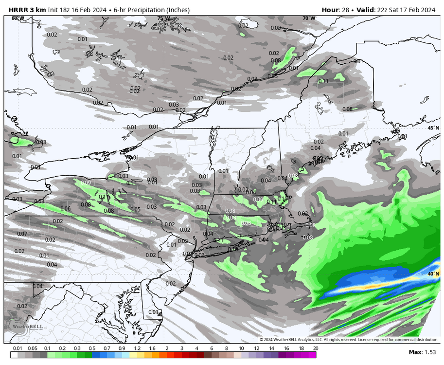
All 12z guidance ramping up a bit with HRRR most impressive. 1-3” to 84 possible, with some iso 3”+ on the south coast. Rhode Island and SE MASS look to get in on the action as well with a dusting to an inch up to the pike? Haven’t had much of a chance to dig in yet. Let’s discuss here and free up the other thread?
-
Wow that's a lot of liquid ..
-
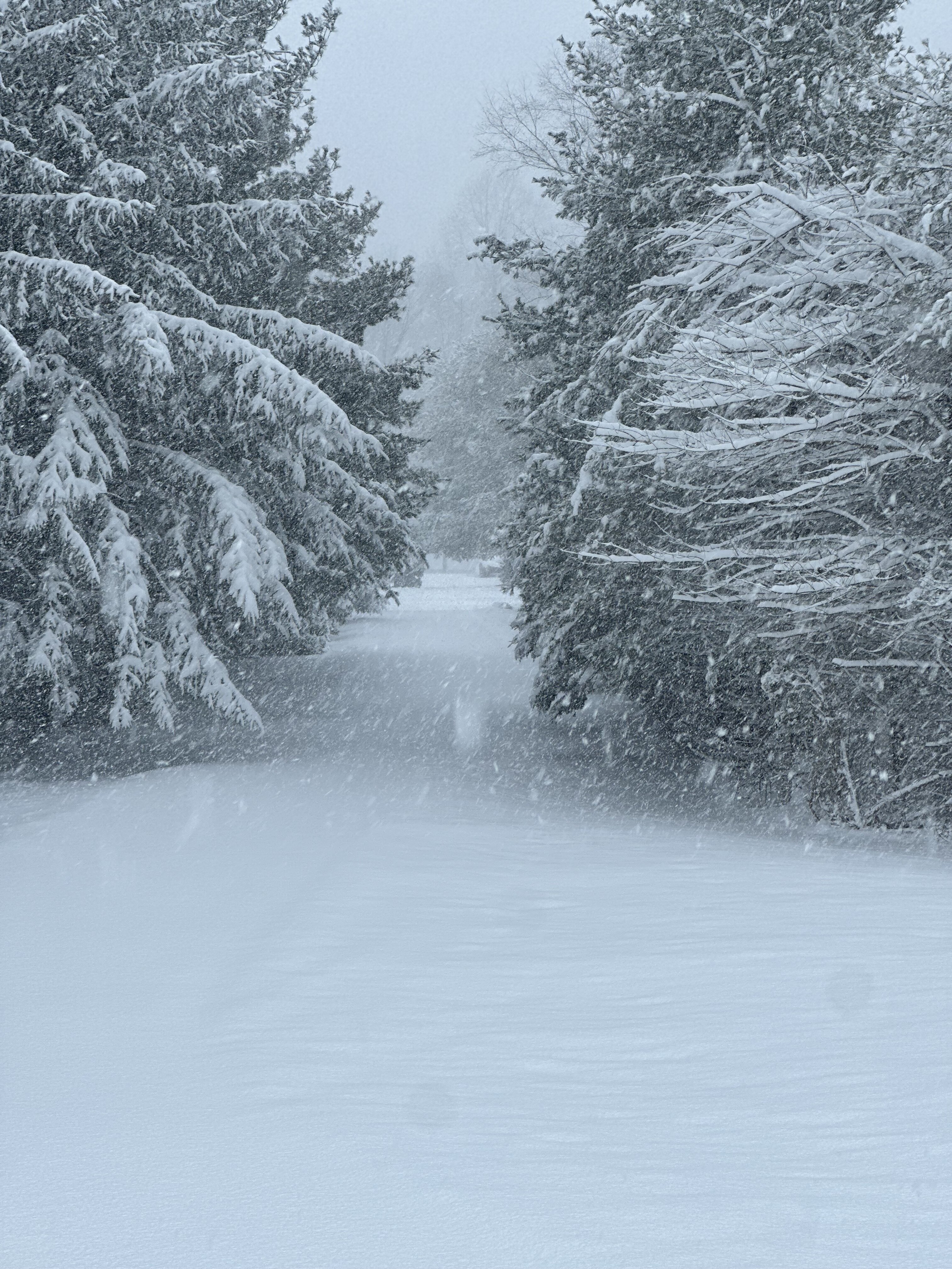
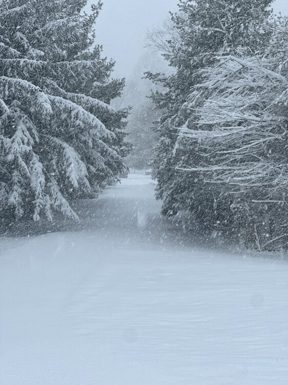
Absolute paste a ton of liquid in this. Has that blue tint to it. Def over an inch liquid. About 90 min in clearing still another hour to go.
-
10.5" Storm total here .. Nice positive bust ..
-
That stinks sorry, I was on the southern edge of the fronto band earlier and also I have about 600 more feet elevation than a lot of Derby, was 29 degrees for the first 5" every flake accumulated.
-
I'd guesstimate 10 million people in the North East United States have 6.0" + but it's only a rural CT storm
-
Halfway done clearing still moderate lot heavy snow another 45 min to go .. 9.0” depth 10.0” total 8.0” before clearing another 2.0” since
-
Closing in on 9” trees sagging
-
what do you have
-
Central park has plowable 2" plus based on live video that I see
-
6.8" snowing 2"+ per hour last 30 minutes
-
Hanny with an 11" report damn
-
What are you at
-
Burlington to Windsor Bloomfield and Ellington getting 2-3" per hour rates as that band is blowing up
-
Ya it's enhancing rates here , peak is next 2 hours .. should be some insane rates
-
First 10" report Farmington from Twitter
-
cams are wild along 84.. you must be 8" by now with 10" to your SW along 84 in Litchfield county
-
MESO issued for heavy snow for SE mass.. Not a shit storm for CT, biggest storm in 3 years for many ..