
Roger Smith
-
Posts
5,927 -
Joined
-
Last visited
Content Type
Profiles
Blogs
Forums
American Weather
Media Demo
Store
Gallery
Everything posted by Roger Smith
-
The August 21, 2017 Great American Eclipse
Roger Smith replied to ice1972's topic in Weather Forecasting and Discussion
April 8, 2024 ... long totality from west TX northeast to upstate NY and Quebec. Bound to be some cloud along that line but should be within reach of most people on the forum with a bit of planning (my target would be west TX, unless a week in advance it looks like a big high over Quebec then I can go there instead). -
Guess The Date Of The Next 12"+ Snowstorm In The OKX Zones
Roger Smith replied to bluewave's topic in New York City Metro
Feb 3rd 2019. -
So 18z would be about 1-2 hours before sunrise there? Damage will be enormous from the looks of those images.
-
Looks like the eye is headed for either eastern Shikoku or the strait between that island and Honshu but in any case a second landfall will occur near Kobe just west of Osaka. Given the populations and port infrastructure of the two landfall areas, the second one will be more problematic. Hoping the first one weakens the storm enough that the second landfall will be less intense, perhaps a strong cat-1 as opposed to 2. Well it won't be long now looking at radar and satellite animations, the thing is accelerating NNE-ward. Roughly 15-20 million people live in the Osaka region then there's Nagoya one bay east, five million more there.
-
Since it's 945 mb out in the open Pacific now, more likely to be around 950-955 at landfall perhaps? Seems to be only a strong cat-2 or weak cat-3 at present.
-
Will have some on-scene reports from my travelling friends who are going to ride this out in Kyoto, supposed to be within 50 miles of the eye around 06z to 08z (Tuesday afternoon JST). This is a radar I will be watching to check the exact track of Jebi. http://www.jma.go.jp/en/radnowc/ Good satellite imagery here: http://www.jma.go.jp/en/gms150jp/ It is midnight in the region now so about 12-15 hours to landfalls and impacts (first Shikoku Island, eastern half, then near Kobe west of Osaka, storm accelerates and moves across Honshu in a few hours and then at TS intensity up the north coast as far as western Hokkaido). My friends are in a modern style hotel that is a smaller building than some nearby, and the whole area is flat but 45 metres above sea level so I'm thinking no real flooding or tsunami potential, they are also on the west side of the building so much of the storm will be producing east to south winds and they are relatively sheltered from those. If the track stays a bit west, should be close to remnants of eyewall during height of storm, hoping for some interesting accounts if not pictures. Told them to expect a bit of a cleanup day outside on Wednesday then back to normal.
-
12z GFS shows Jebi striking the central Honshu coast on Tuesday around 10-12z (late evening Japanese time) with central pressures remaining sub-920 mb. Looks very similar to Katrina on these maps. The current landfall zone is south of Osaka placing Nagoya and Chita in the forward sector but Osaka and Kyoto very close to the fast-moving eye as it swerves northeast. I've been advising travelling friends who at this point are booked into hotel in Kyoto 1st to 4th but main point being this could shift either way so at this point just as safe to be there as Tokyo or far western Honshu. The models have been fairly consistent for days although speeding up the landfall, with respect to central Honshu as the target. Could be a high impact storm for any of these large cities or even Tokyo especially if track shifts east at all. On this track looks like Tokyo would see cat-1 conditions while Nagoya and Chita could see as high as cat-4. You also have to wonder if a significant earthquake would be imminent given these approaching tidal stresses.
-
March 12/13/14 Blizzard/Winter Storm/WWA etc
Roger Smith replied to Bostonseminole's topic in New England
You people throw some mighty fine snow parties. I had two weeks like you're having now, back around end of December and into New Years. That snow is still in my back yard today despite the past five days being sunny and around 40-45 F. -
March 12/13/14 Blizzard/Winter Storm/WWA etc
Roger Smith replied to Bostonseminole's topic in New England
Seems like a movie in the making ... SNOW WARS Long long ago in a snowstorm far away different measurement techniques came into conflict "Luke, where is your snowboard?" -
March 12/13/14 Blizzard/Winter Storm/WWA etc
Roger Smith replied to Bostonseminole's topic in New England
He tried to jump but missed the window wide right. -
March 12/13/14 Blizzard/Winter Storm/WWA etc
Roger Smith replied to Bostonseminole's topic in New England
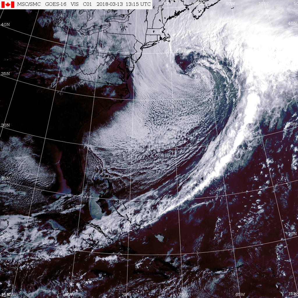
With this appearance, storm should have been Feb 14th perhaps ..
-
March 12/13/14 Blizzard/Winter Storm/WWA etc
Roger Smith replied to Bostonseminole's topic in New England
Strong pressure falls at 44008 (54 se ACK) to 975.7 mb at 1250z ... estimate center 965 mb at 39.5 N 68.8 W, appears to be phasing with upper low. This will soon overcome the slight warmth left in boundary layer near sea level and become a raging blizzard (where it is not already) in e MA and some parts of RI, e CT. Air temp only 34 F out in Mass Bay over 39 F water, likely to stabilize at about 31/31 at KBOS, S to S+ depending on banding location. Enjoy. -
Southern MD / Lower Eastern Shore weather discussion
Roger Smith replied to AnEndlessMaze's topic in Mid Atlantic
SBY snow reports are not always very timely (from their CF6) so I'm wondering what you think was the actual snowfall at SBY on Wednesday 17th? (data needed for snowfall contest). Thanks. -
The August 21, 2017 Great American Eclipse
Roger Smith replied to ice1972's topic in Weather Forecasting and Discussion
Just wanted to put one thought "out there" for April 8, 2024. I would be very reluctant to put much money down on cheap accommodations anywhere along that track except possibly south Texas, because of the high risk of large swaths of frontal cloud. My research would suggest the strong chance of low pressure being present somewhere near the NY-PA border with widespread frontal bands. I was very happy with the research indicators for the August 21st event, low pressure was very close to the most likely locations in both western Canada (not interfering with viewing) and central plains (enough patchy holes in that pattern to give a lot of folks a last minute reprieve, but the research did indicate the least likely spots for good viewing). Much work remains to be done on this research but there is a definite spike in both precip and cloudiness at new moon events in both March and April for Toronto, the primary research location. And a total eclipse is the newest moon you're ever going to see. Of course reality will be a mix of good and bad viewing but I would put little faith on options in upstate NY or w PA, OH. -
The August 21, 2017 Great American Eclipse
Roger Smith replied to ice1972's topic in Weather Forecasting and Discussion
(b) The crowd in a municipal park in Baker City awaits the total spectacle, many using their eclipse glasses. I was thinking of going around the park selling eclipse crackers and eclipse corn chips.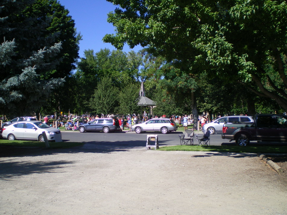
-
The August 21, 2017 Great American Eclipse
Roger Smith replied to ice1972's topic in Weather Forecasting and Discussion
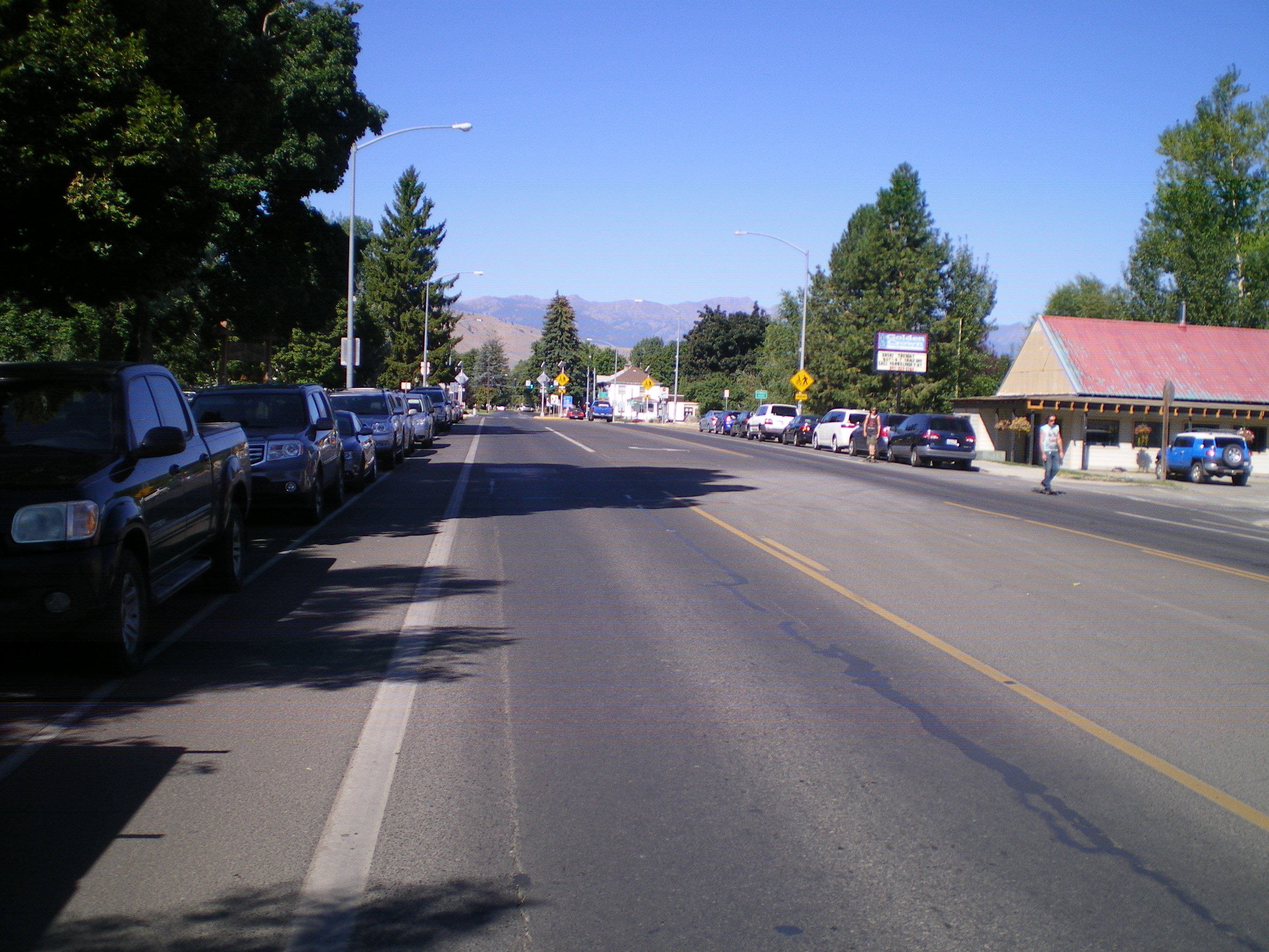
Some images from Baker City in eastern Oregon. Looking west towards the approaching "dark spot" -- the hills are already a bit darker than the town. This would be about four minutes before totality, when the western inland counties of Oregon had totality. May have to load these one post at a time, having issues.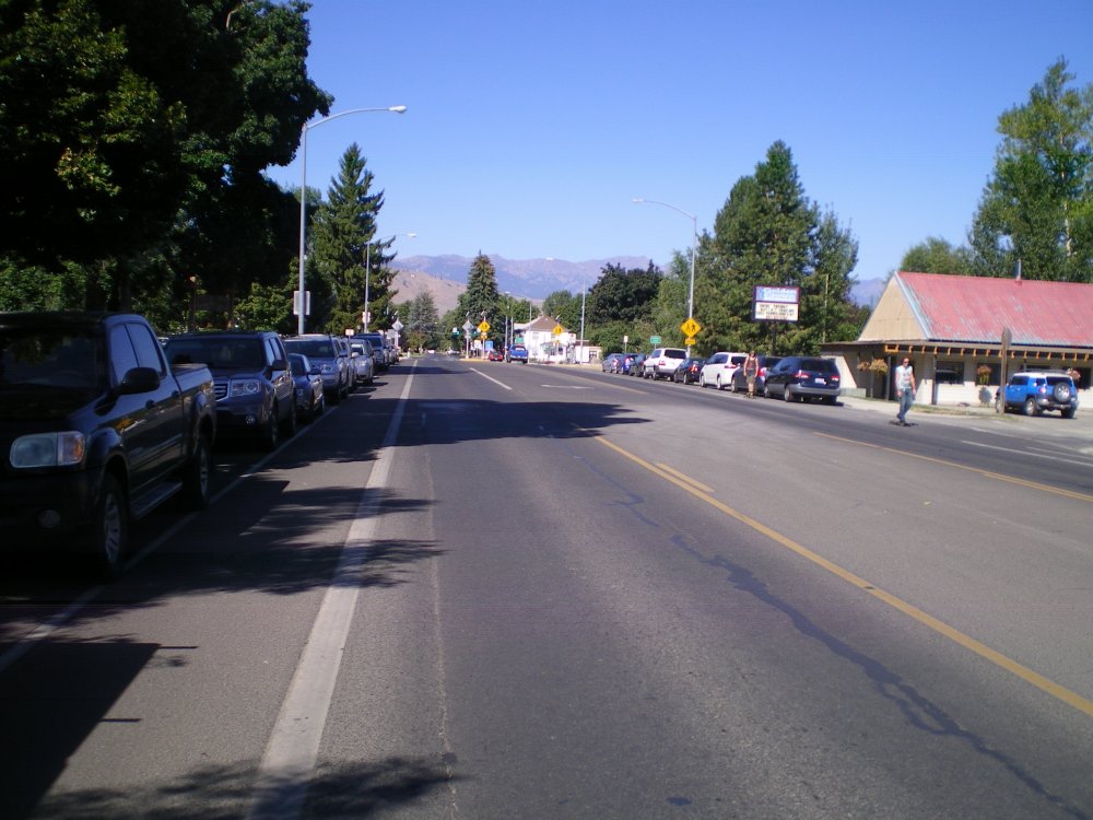
-
The August 21, 2017 Great American Eclipse
Roger Smith replied to ice1972's topic in Weather Forecasting and Discussion
Astronomy notes: For anyone looking at their pix and wondering what they captured near the eclipsed Sun, a bright star (Regulus) was located just above and to the left of the eclipsed disk. The Sun moved just below Regulus at 22:06z and I think that appears in at least one posted picture above. Regulus is a "first magnitude" star and about as bright as the less prominent corner stars of Orion, or Castor and Pollux in Gemini, or Spica which these days is just to the left of Jupiter in the evening sky. Mercury was located below the eclipsed Sun about twelve solar diameters away (Regulus about two), and would appear about as bright as Regulus. Mercury was on its way to "inferior conjunction" or the point in its orbit between Earth and Sun which it reaches on 26th around 06z. This would leave Mercury at a rather average brightness as almost five-sixth of it would be in darkness (the Sun shining mostly on its far side, offset by closer distance to earth than most non-eclipsed views we get). Mercury is currently near its aphelion meaning it is closer to earth than at most inferior conjunctions. Venus was very easy to see but very high almost overhead in western states, probably high to west-south-west for eastern watchers. You may have missed it if you didn't scan a wide portion of the darkened sky but to my eye it looked about half as bright as it had earlier in full pre-dawn darkness. Mars might have been observable by some, it was located about one-fifth of the way from Sun-moon disk to Venus. Mars was basically behind the Sun back on July 28th and is still over 2.5 a.u. distant from Earth, so a lot less bright than when we see it near opposition in the night sky. Mars is currently approaching its aphelion. It is in the part of its orbit that lies off beyond where earth will be in the first week of February. Jupiter would have been visible to eastern viewers, rising in the east at eclipse time. Currently working on my pictures. -
The August 21, 2017 Great American Eclipse
Roger Smith replied to ice1972's topic in Weather Forecasting and Discussion
The models kept giving me a peaceful, easy feeling for Oregon-Idaho from about two weeks back, and by the weekend it was pretty obvious that Oregon would be cloud-free. So we moved up from our week's tour of NV-UT to the hills south of Baker City, OR on Sunday night and had an astounding view. We chose to go down into Baker City, sacrificing 30 seconds of totality for various other gains, but in reality I think 2 min or 2 min 30 sec would be about the same experience. This is my second time in the total zone with visibility and then there was one cloud-out (so 2-1 for those keeping score at home). Quite the meteorological day -- at 0400, with Venus so bright it was casting shadows in the forestry clearing, temperature felt like about 35 F. By 0800h in Baker City it was maybe 65, then by 0930 about 80 (all under clear skies with the exception of one large contrail). By 1000 (PDT) it was falling back from 80 and by 1015 it was maybe 70 and getting a little less bright by the minute. It then looked like a nice day in January (in terms of ambient sunlight). By 1020 it was 65 degrees and as many of you experienced, the light just went out so fast that a crowd of several thousand people went from awed silence to various shouts of amazement. Then the diamond ring effect flashed on and it was late twilight dark. Venus was now visible again almost directly overhead. I tried to spot Mars closer to the Sun-moon and failed. During the two minutes of darkness, the corona was quite delicate compared to the 1970 eclipse that I saw (a higher solar count then). I would describe it as two equal portions on the solar equatorial plane and a third one pointing upwards (so at about a 45 degree angle to that plane which at 1022 PDT was oriented "NE-SW" against the eclipsed Sun. At mid-eclipse I spotted a red prominence near that offset portion. The crowd at this point was hooting and hollering encouragement (I assume 90-95% had never seen this before). It was chilly now, maybe 58 F. Then the second diamond ring appeared and the light came back on as abruptly as it had vanished earlier. At this point there was a round of applause mixed with the odd "too soon" commentary. I think the temperature minimum came about 1-2 minutes after totality ended (estimate 55 F) then the temperature began to soar back towards its interrupted progression to the ultimate high of about 95 F. An interesting visual phenomenon was that all the tree shadows on the sidewalk moments after the total eclipse had images of the 99% eclipsed sun embedded. I did not spot any ground interference patterns as I had in 1970 at Virginia Beach, and I did notice bird activity consistent with evening. Dogs were going nuts at various times but then big crowds of people can set dogs off as much as strange changes in the light. The USPS were delivering the mail across the street from the park right at totality so you can add that to the list of things that will not prevent the mail (I guess the internet is the only thing that can). Pictures are still in my camera (and wife's camera also), not sure if any of my astronomy shots will be all that good but I have some nice views of the approaching darkness on western hills, and of the crowd (which was quite a mixture of ordinary folk, new age types, obvious eclipse-chasing maniacs, and a couple dressed up as court jester and clown). Well, it's the Pacific northwest man. Then of the traffic home I shall not speak, except to comment that interstate construction zones forcing three lanes into one are not welcome sights post-eclipse and to rub salt in the wounds, no construction was taking place in most of the blocked off lanes. Oh well, home at last. -
The August 21, 2017 Great American Eclipse
Roger Smith replied to ice1972's topic in Weather Forecasting and Discussion
Some of the logistical problems to consider: Main routes will become clogged with traffic and distracted drivers will add to the chaos. No doubt thousands of people will leave too late for the conditions, become stranded on the road rather than in a good place to view, and will get out of their vehicles when they think they must. This will not blend in well with the normal use of interstate highways as fast arteries for interstate commerce. Gas supplies may run low, especially in the 3-6 hours after the eclipse as everyone tries to gas up to go home. Try to plan your eclipse encounter so you are as full as possible just before you need to deploy. There could be long lines at gas stations even just before the eclipse as people think of gassing up then. My plan is to make a right-angle exit on the least travelled road I can find and get 200 miles from the track before needing to fill up. I think that unless you have a very secluded target, you should count on a lot of road congestion even on secondary routes, and keep in mind that it will be very dangerous driving with so many distracted people thinking mostly of where they should stop and where they should turn, etc. From what I'm hearing, avoid western Oregon, it sounds like it will be wall to wall with west coast travellers, the I-5 is a nasty road to drive even in average conditions and this won't be average. If it's hot in the west, as it has been all summer so far, the bottleneck effect will be made worse by overheated vehicles. I am hoping to find that east-central Oregon has a good forecast 36h before the event, and position myself in a remote area of that part of the track, then fine tune my location if mountain effect cloud can be anticipated and avoided. We get a lot of clear weather before noon in the Pacific northwest region so fingers crossed this day will follow the trend. -
The August 21, 2017 Great American Eclipse
Roger Smith replied to ice1972's topic in Weather Forecasting and Discussion
I tried for the 1984 total eclipse in northern NC (something like late May, can't remember now) and got mega-clouded-out, pre-internet so not much chance of fine tuning but it was deadly overcast and raining everywhere along the track -- so that was interesting too, it gets extremely dark under cloud cover for two or three minutes. Anyway, saw the Blue Ridge parkway on that trip so not a total bust. (hoping to go 2 for 3 on this one) -
The August 21, 2017 Great American Eclipse
Roger Smith replied to ice1972's topic in Weather Forecasting and Discussion
Will be there, night of August 19th probably in Utah finishing up a few days of holidays, make a decision where to see it, find a remote campsite within 2-3 hours of track Sunday 20th, and hit the best view weather forecasting can provide (Monday August 21) at 10:22 a.m. PDT around Baker City OR or 11:32 MDT Rexburg ID (times approx). Other locations being considered range from Madras OR to Casper WY. Would avoid the Oregon coast even if skies clear, traffic congestion around Lincoln City OR is always a problem and with half of Portland there to see this, a no go zone. Would also not be leaving a location to the last minute near I-5 (Albany OR) as it could get very congested along the interstate. Best bet for clear skies by climatology is the OR-ID border near Huntingdon OR (last exit in Oregon from I-84, 70 miles northwest Boise which is just outside the path, 70% chance). The good thing about a morning eclipse is, afternoon convection over the inland western valleys and ranges not yet underway and if a bit of that has started, the cooling effect of the eclipse will suppress it further. In Nebraska by the way, Grand Island is near the center line (2 min 30 sec totality) and that's right at 1:00 p.m. CDT. Casper WY is around 11:45 MDT and it's also right on the line. Nebraska chasers are probably going to be dealing with a frontal system somewhere in that state, would not be too fixed on one location and time (it moves very fast, takes about 15 minutes to cross each state). Definitely check the latest guidance morning of, and avoid obvious frontal cloud zones. Saw a total eclipse in Virginia Beach in March 1970, awesome display, the diamond ring effect is stunning (at both ends of totality). Also quite awe-inspiring is the rapid descent into darkness and natural signs on display such as birds calling. Don't miss this one if you have a chance (but don't take my campsite). Motels in the totality path and nearby are already fully booked and charging astronomical rates. Not sure how far outside the zone this now applies, a month ago the rates were holding near regular prices at 100 miles outside the zone (not a bad option given the late morning to afternoon timing). You need a plan where you camp outside the zone or cheap motel well outside the zone, and drive in to make it feasible. Helps if you live in that nearby stretch, I suppose worst case scenario would be to pull an all-nighter (from almost anywhere in the U.S.A.) and just be there, you'll get your sleep in a rest stop and then figure out the details of getting home again. -
Haima the official name, Lawin used by Philippines. Just in case there's news, same typhoon. Where did Josh set up?
-
While we were all watching Matthew, a super typhoon erupted over the southwestern Japanese island chain (Chaba) and it is now in the East China Sea heading due north (center 915 mb, peak winds 105 kt gusting 150 kt). It more or less missed Okinawa but nailed a smaller island in the chain, no casualties reported (have posted a link). It will weaken to about cat-2 before skimming northern Kyushu and coastal north Honshu as well as outer parts of South Korea. http://www3.nhk.or.jp/nhkworld/en/news/20161004_07/
-
Eye has moved back over water, rainfall now about 39 inches at Taipingshan (985 mm in 24.5 hours to 1630z) and over 24 inches at several locations in the central highlands.
-
Reports of 21 inches of rain already (in about 14 hours) at Taipingshan, just inland from landfall zone, eye is close to east coast now.