dendrite
-
Posts
73,521 -
Joined
Content Type
Profiles
Blogs
Forums
American Weather
Media Demo
Store
Gallery
Everything posted by dendrite
-
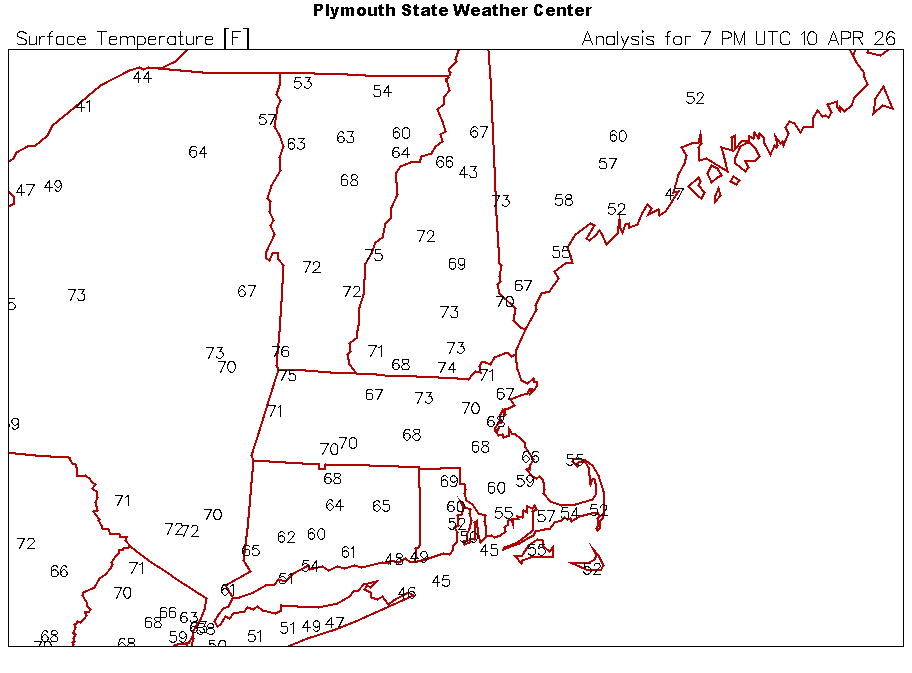
12z gfs ruins Thu and Sat for here and ENE.
-
You would’ve liked it in the 1500s when there was actually vegetation there.
-
28.9° Glad I brought the plants in.
-
My yard

-
The only thing that sucks is we get near freezing tonight up here so I have to play the potted plant shuffle again.
-
41° and blowing pretty hard. I probably shouldn’t have taken any of the panels off the run yet…the chickens are getting buffeted.
-
Enjoy your light jacket while we t-shirt.
-
66° and breezy Beautiful evening
-
GWDLT
-
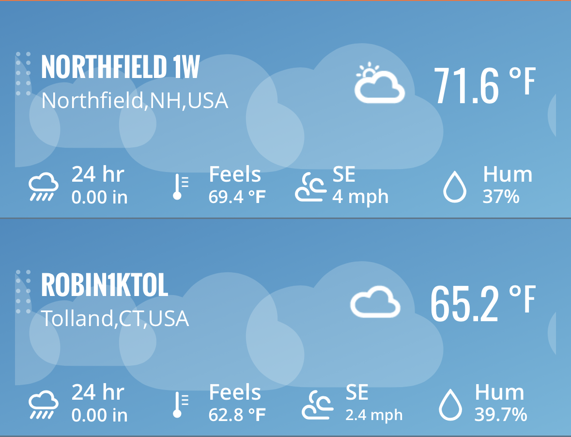
73.2° for a high. Still 71° despite clouds.
-
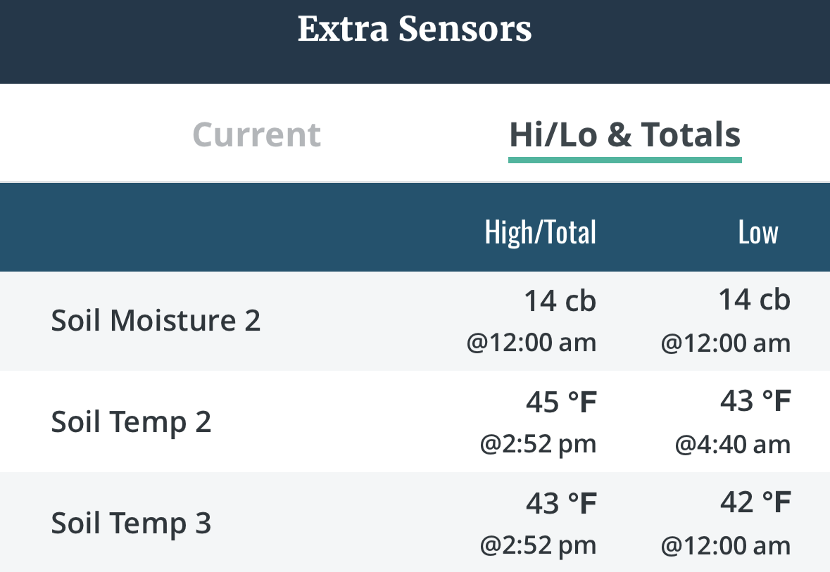
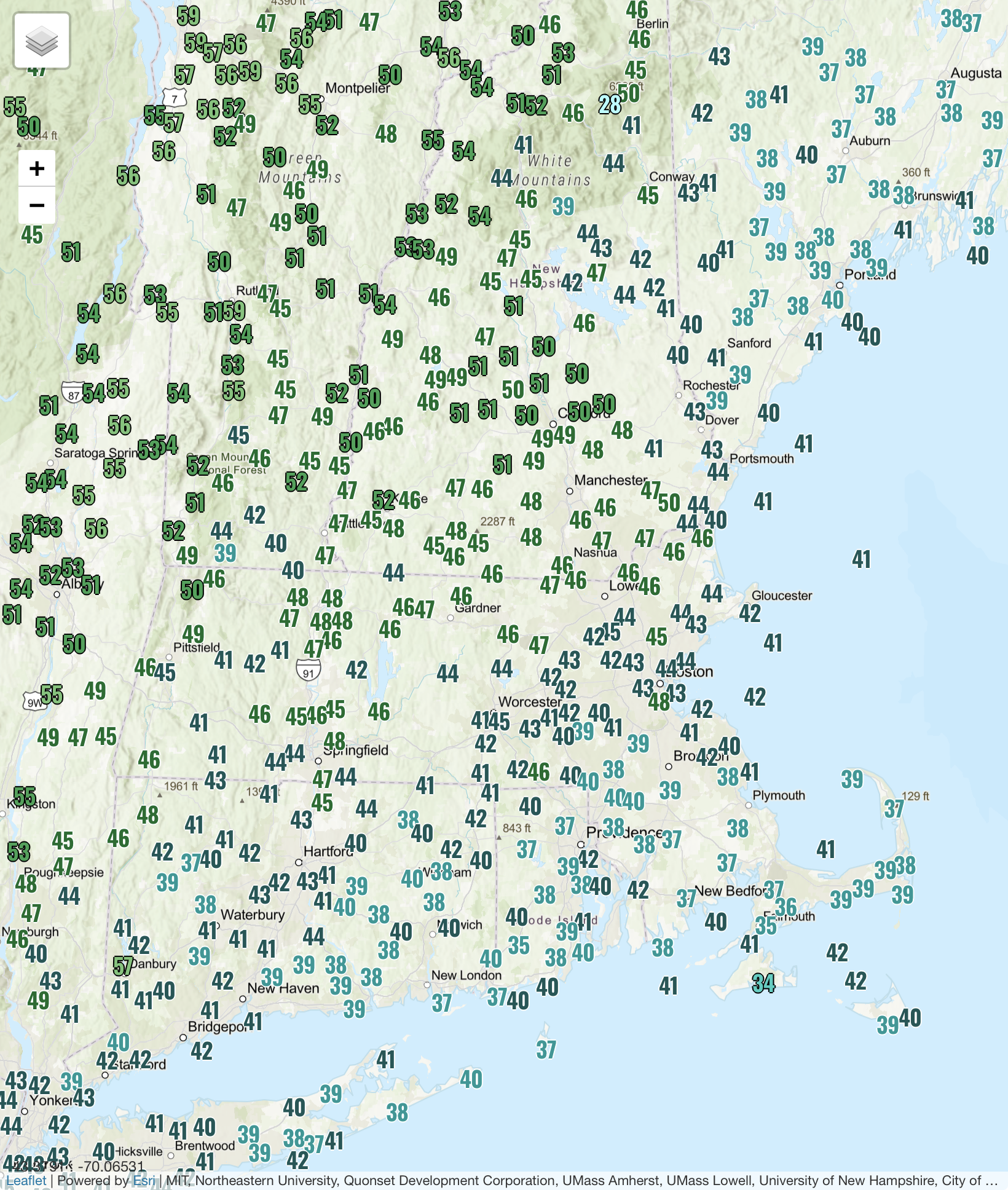
I may be running a little high on the Davis, but the backyard is just beginning to dry out. Most of the area is U30s.
-
+1
-
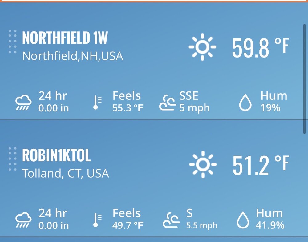
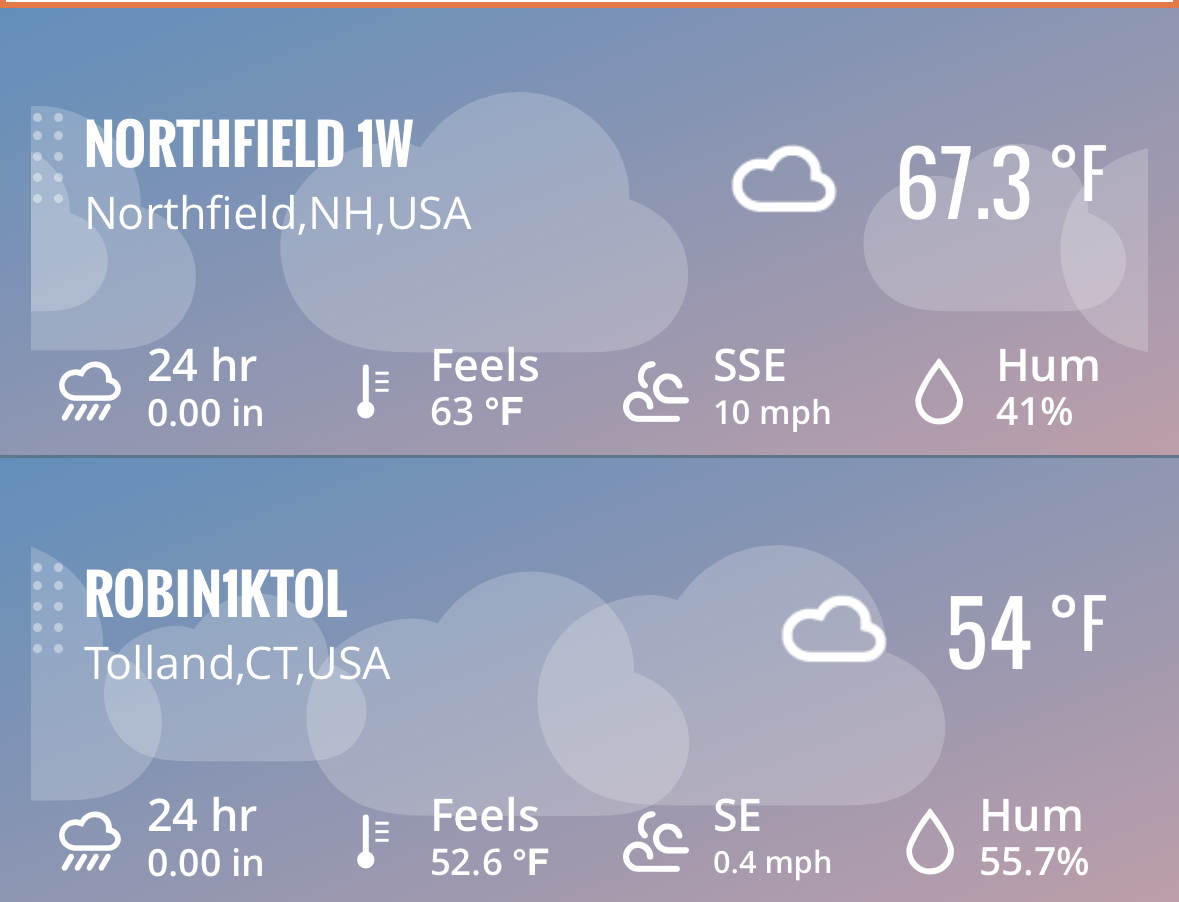
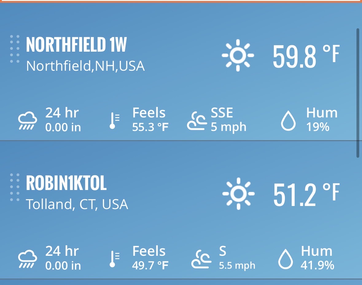
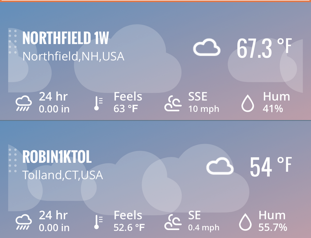
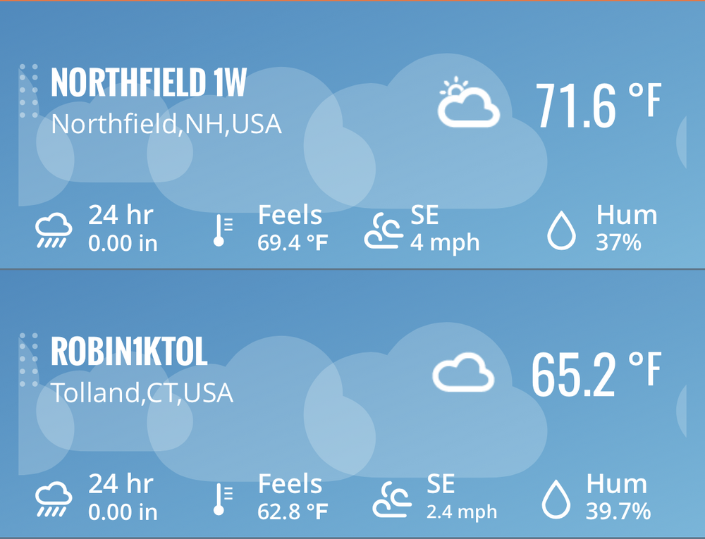
72.0/43
-
Look at those d10 and d14 graphs...they've been verifying on the upper end of the model spread for awhile now.
-
Iran doing their best to reverse the Keeling curve
-
Fossil Fuel Fridays! LFG

-
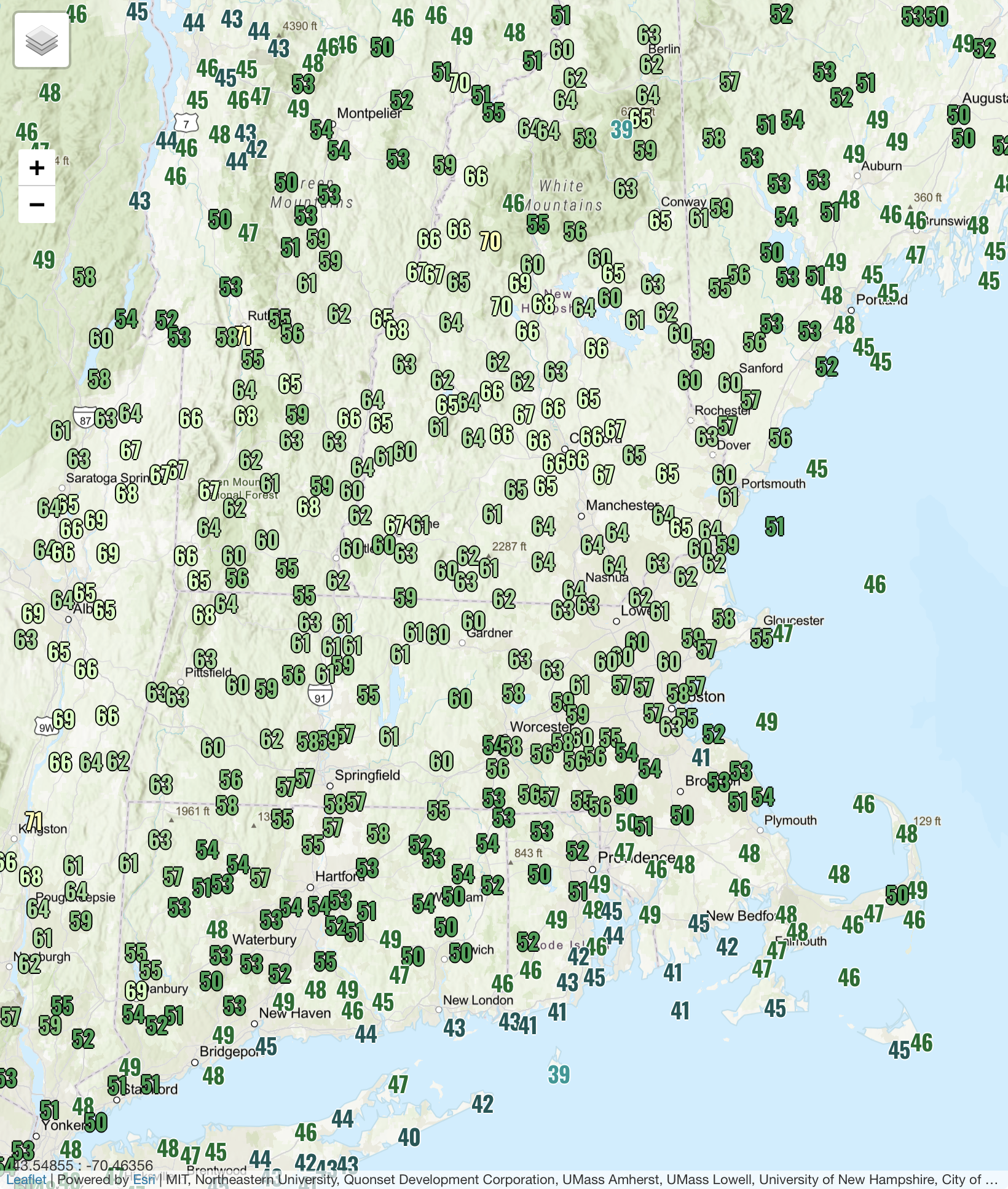
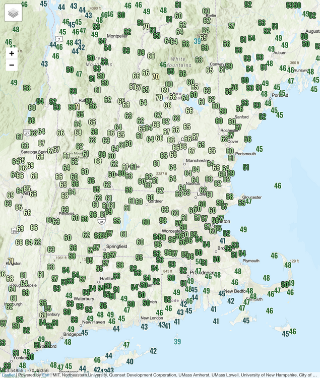
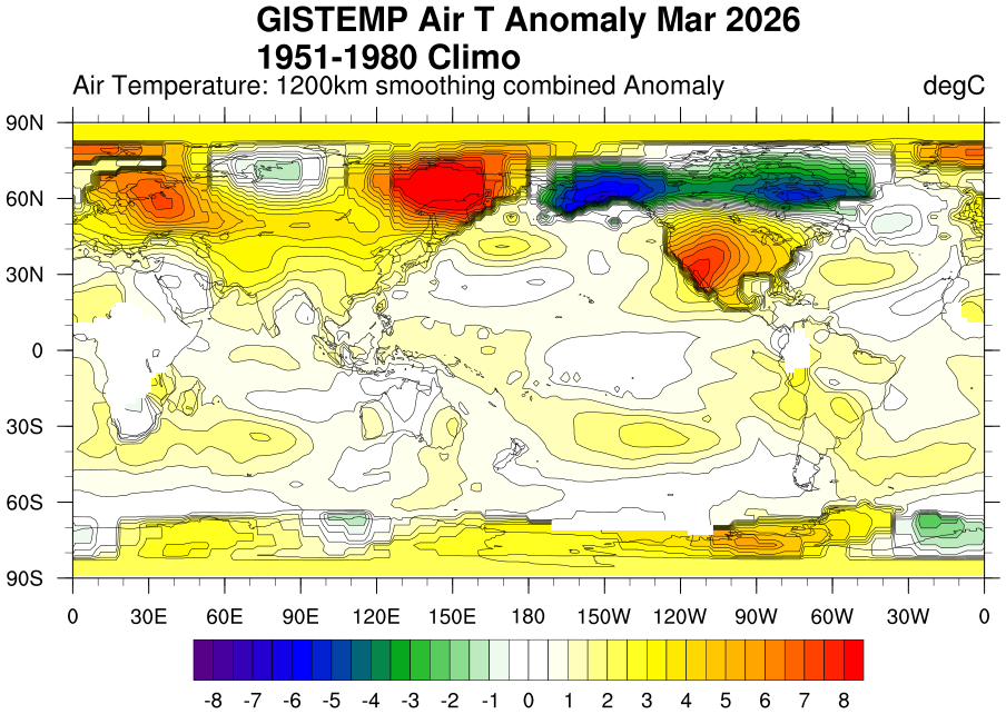
A fixed, even (0.5C) scale shows our “cooler” area a little better.
-
Euro is still a little wedgy up here Wed. Hopefully the gfs wins that.
-
Min 32.9° 2023, 2012, and 2010 were pretty warm early off the top of my head.
-
Nice evening. 50° and breezy.
-
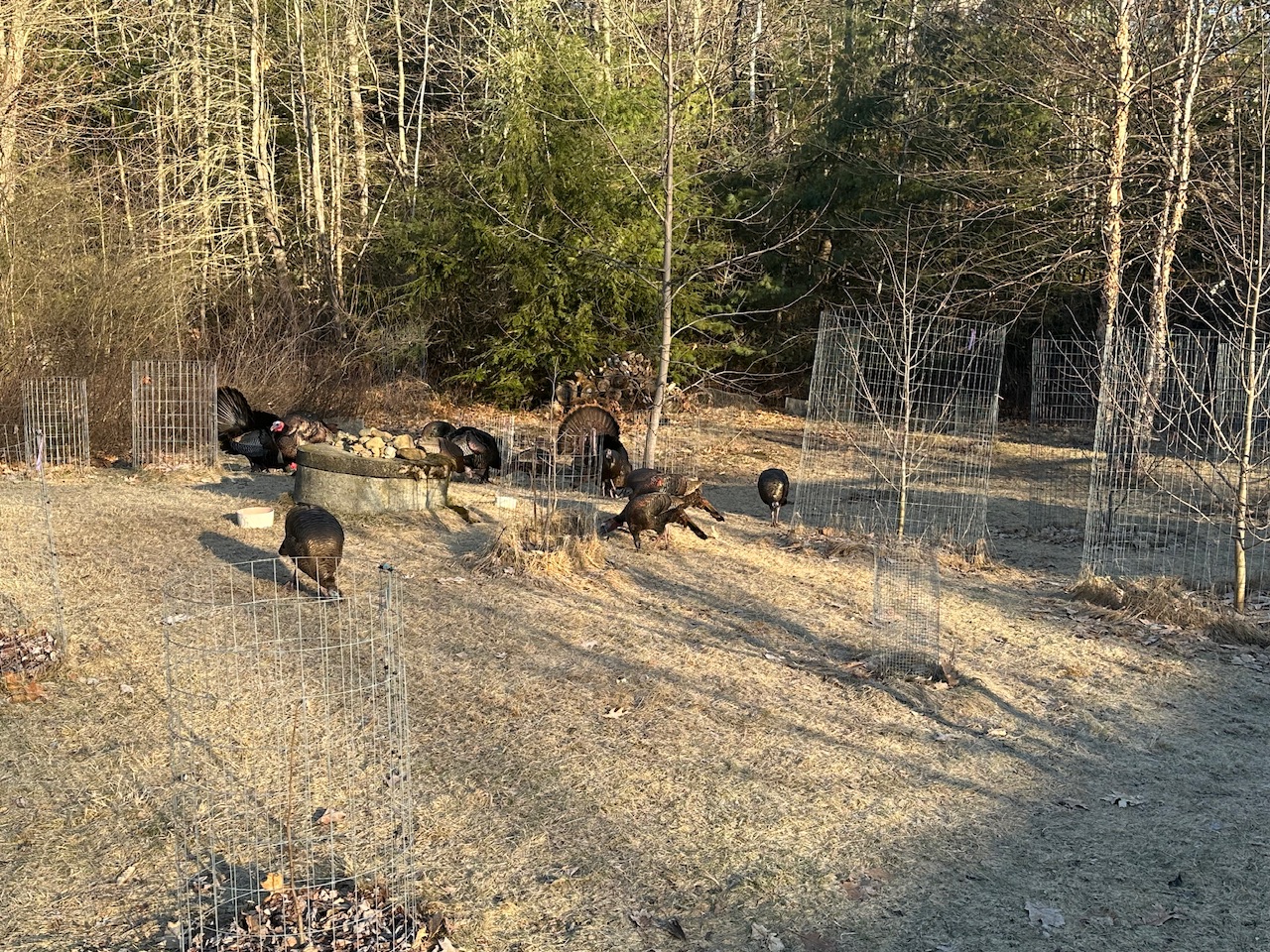
I’m encouraging these guys to take care of them

-
1st place problems
-
+1