dendrite
-
Posts
75,069 -
Joined
2 Followers


About dendrite

Recent Profile Visitors


-
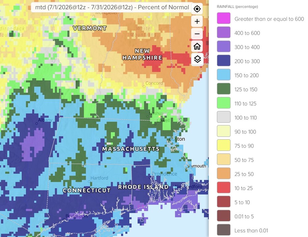
Grass looks good. The Davis siting does not.
-

Augdewst 2026: Summer's Last Stand
dendrite replied to Prismshine Productions's topic in New England
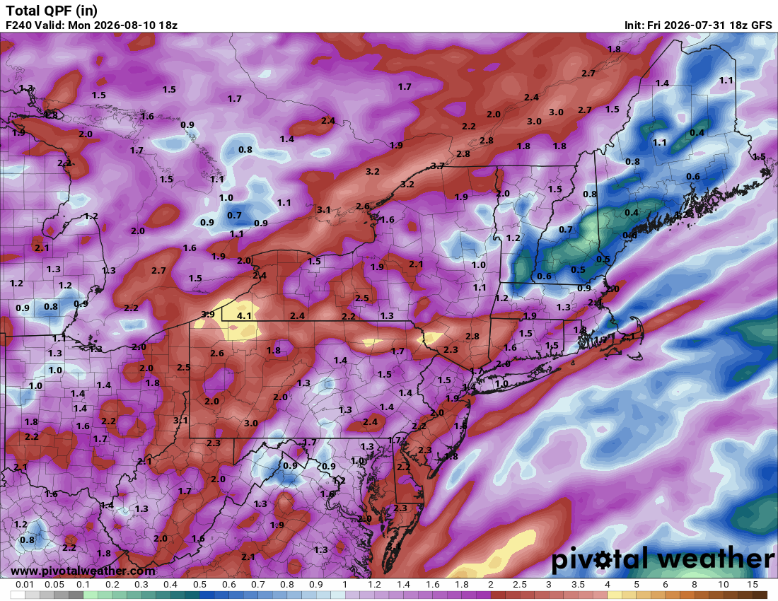
18z models are pretty wet here. We pray. -
Augdewst 2026: Summer's Last Stand
dendrite replied to Prismshine Productions's topic in New England
There’s a large maple down the road here that gets 1/2 color in July and loses most of its leaves by the end of August. -
Augdewst 2026: Summer's Last Stand
dendrite replied to Prismshine Productions's topic in New England
Some weenie in NY ridin’ along in his automobile trolling mPing with 5” hail obs, blowing dust, and overflowing rivers. Hate to see it.
-
Augdewst 2026: Summer's Last Stand
dendrite replied to Prismshine Productions's topic in New England
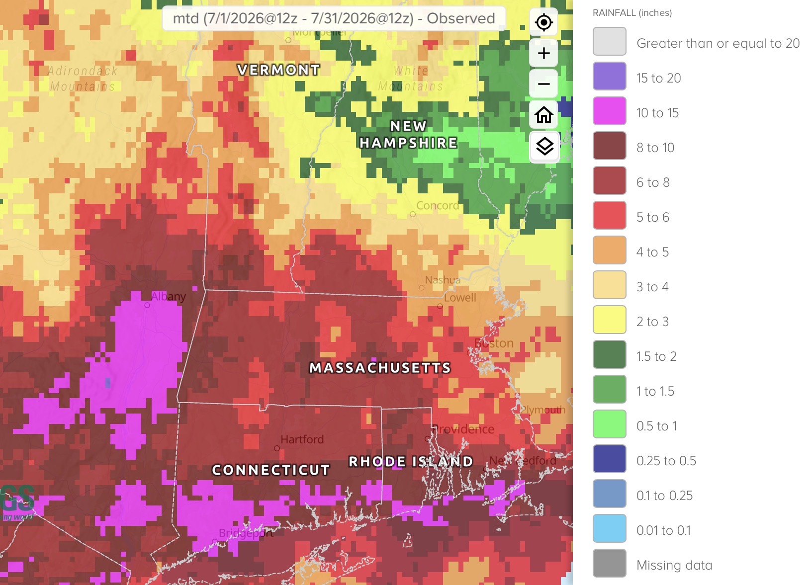
1.5” is a seasonal total here -
Augdewst 2026: Summer's Last Stand
dendrite replied to Prismshine Productions's topic in New England
81.6/71 Dewtylicious -
Augdewst 2026: Summer's Last Stand
dendrite replied to Prismshine Productions's topic in New England
Hope the HR^3 is right -
Augdewst 2026: Summer's Last Stand
dendrite replied to Prismshine Productions's topic in New England
How are there any trees left? -
Ber is coming but Brr is not
-
Augdewst 2026: Summer's Last Stand
dendrite replied to Prismshine Productions's topic in New England
Fan is back up and running 78.4° and dewy -
Augdewst 2026: Summer's Last Stand
dendrite replied to Prismshine Productions's topic in New England
Min 60.5°….I think Damn deer tripped over the wire to my FARS fan and ripped the splice apart. -
Onto Ughust

-
What in the sam hell is going on

-
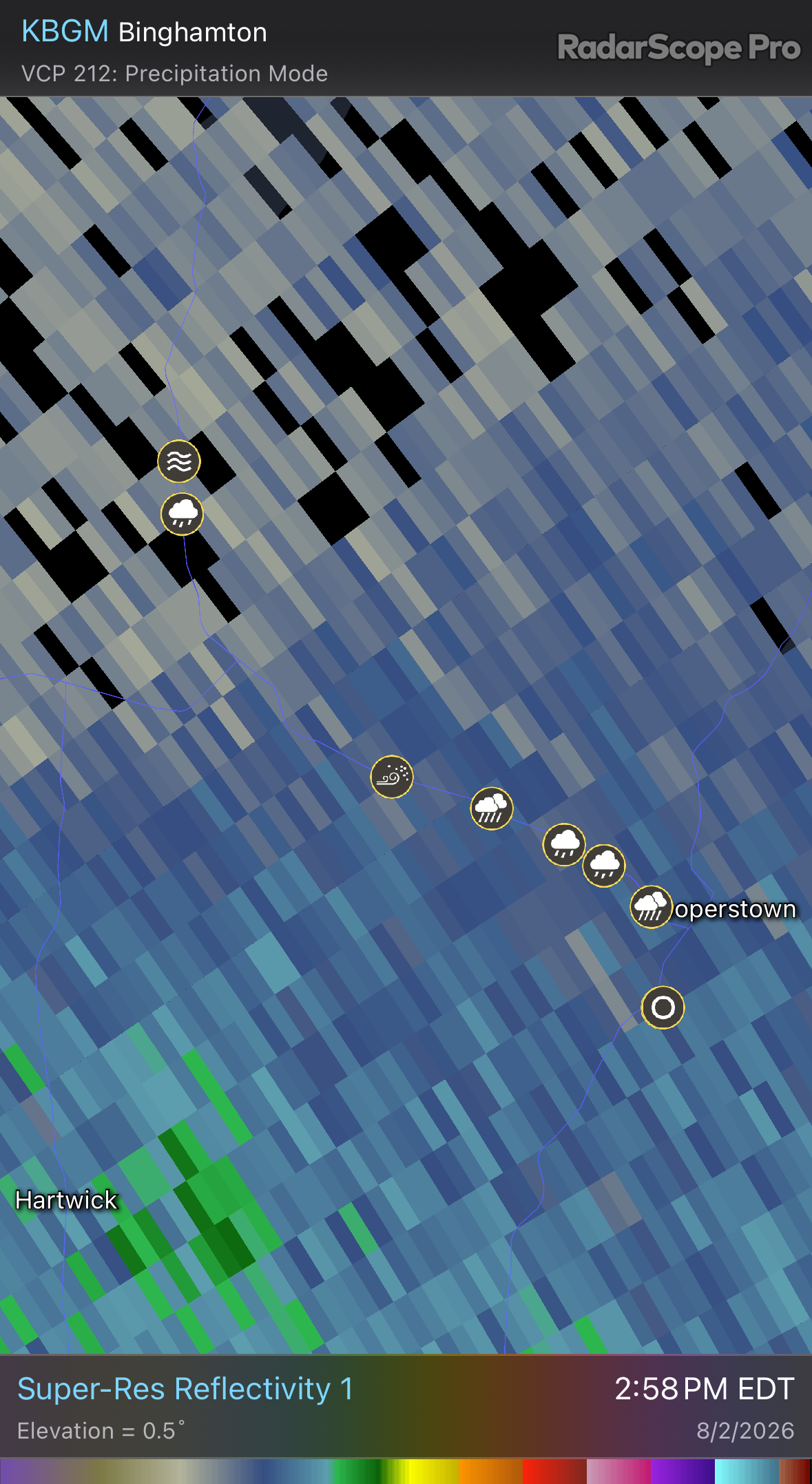
Just got 5 drops
-
Augdewst 2026: Summer's Last Stand
dendrite replied to Prismshine Productions's topic in New England
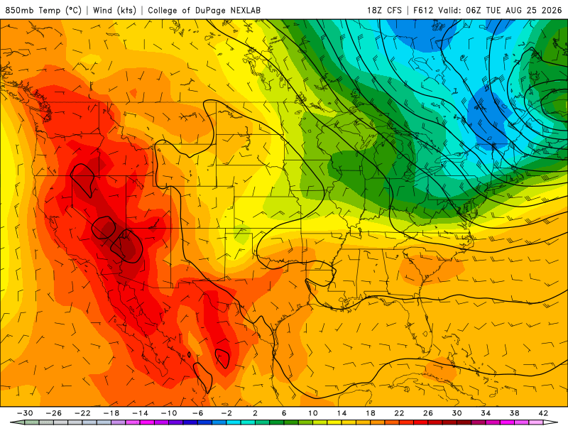
Surprised INS didn’t post the CFS