

SACRUS
-
Posts
13,077 -
Joined
-
Last visited
Content Type
Profiles
Blogs
Forums
American Weather
Media Demo
Store
Gallery
Posts posted by SACRUS
-
-
-
93/ 73 Dew point temps up a bit
-
1 hour ago, LibertyBell said:
I'm thinking 100 is possible though. Like in July 2011, July 22, 2011 was best case scenario when I reached 105.6 and still got to 101 in slightly less ideal conditions on July 23, 2011. I think that was the last time the entire area reached 100+ two days in a row.
RIght. If you account for the Park's tendency Jul 2013 was also. We'll see how strong the heat can get with the next ridge later next month / Aug.-
 1
1
-
-
Outside a rogue storm in CPA , quiet.
-
31 minutes ago, LibertyBell said:
Sunday looks fine.
Front nearby - think it'll be a game time forecast - sun is out it heats up quickly - Florida style weather after the 36 hour Friday's So-Cal June gloom style weather.
-
00z runs
7/2 - 7/3 : Hot/Humid Upper 80s/ low 90s
7/4 : Both models are dry with highs near normal 80s to approaching 90
7/5 - 7/6 : Caught between the ridges with boundary layer - wetter - 256 hours to go. -
Records:
Highs:EWR: 100 (19433)
NYC: 99 (1952)
LGA: 99 (1952)
JFK: 94 (2003)
Lows:
EWR: 53 (1932)
NYC: 53 (1873)
LGA: 55 (1940)
JFK: 54 (1965)
Historical:1749 - A general fast was called on account of drought in Massachusetts. It was the year of the famous dry spring in which fields and villages burned. (David Ludlum)
1925 - The mercury hit 101 degrees at Portland, OR, their earliest 100 degree reading of record. (Sandra and TI Richard Sanders)
1953 - The temperature at Anchorage soared to 86 degrees, their hottest reading of record. (The Weather Channel)
1957: Hurricane Audrey moved northward, slowly strengthening until the 26th. At that time, a strong upper-level trough led to its acceleration and the hurricane deepened rapidly on its final approach to the Texas/Louisiana border. Audrey became the strongest hurricane on record for June upon landfall, as it reached category four strength. Its acceleration was unanticipated, and despite hurricane warnings in place, 418 people perished in the storm, mainly across southwest Louisiana.
1981: Late afternoon violent thunderstorms moved across the region. Allentown, PA recorded a gust to 77 mph, with quite a few roofs blown off, chimneys toppled, windows blown in, several barns blown over, and innumerable trees felled. Power was interrupted to almost 100,000 customers, some without power for several days. Heavy rain caused flooding and mudslides. Philadelphia, PA received 1.91 inches of rain. (Ref. Wilson Wx. History)
1983: A quarter of an inch of early summer snow was reported near the towns of Sharon and Hartford in the higher terrain of central Vermont. (Ref. Wilson Wx. History)1987 - Afternoon highs of 97 degrees at Miami, FL, 107 degrees at Medford, OR, and 111 degrees at Redding CA were new records for the date. It was the third of six straight days of record heat for Miami. Thunderstorms produced wind gusts to 70 mph at Austin, and gusts to 75 mph at Tulsa OK. (The National Weather Summary) (Storm Data)
1988 - Fifty-two cities in the central and eastern U.S. reported record high temperatures for the date. Highs of 100 degrees at Erie, PA, and 104 degrees at Cleveland OH established all- time records for those two locations. Highs of 101 degrees at Flint, MI, 105 degrees at Chicago, IL, and 106 degrees at Fort Wayne, IN, equalled all-time records. Thunderstorms in Idaho produced wind gusts to 100 mph west of Bliss and north of Crouch, injuring 29 persons. (The National Weather Summary) (Storm Data)
1989 - Tropical depression Allison, the remnants of what was earlier Cosme (a hurricane over the Pacific Ocean which dissipated as it crossed northern Mexico), began to spread heavy rain into southeast Texas and southwest Louisiana. (The National Weather Summary)
1990: Borrego Springs, CA hit 122°; their hottest temperature on record. Phoenix, AZ set a daily record high of 120°. (Ref. Wilson Wx. History)
1994: Blistering heat prevailed across the southwest deserts as many daily record highs were set including: Yuma, AZ: 119°, Tucson, AZ: 115° and Winslow, AZ: 103 °F. (Ref. Wilson Wx. History)
1995: Flood in Orange, Madison, Green, & Culpeper Co. as they had between 13.00 and 15.00 inches of rain.
A lifeguard at a camping resort S of Myrtle Beach, SC, was hit by a lightning bolt as he was in the process of clearing the beach due to an approaching storm. He survived. Several people nearby noted “tingling sensations” when the bolt struck. (Ref. Weather Guide Calendar with Phenomenal Weather Events 2011 Accord Pub. 2010, USA)
2006: The precipitation total on June 25th was 5.31 inches, a new 26 year MAXIMUM precipitation record for a day. The old record was for a calendar day was ONLY 3.86 inches on October 8, 2005.2006: The maximum one hour rainfall intensity was 2.35 inches on the 25th which shattered the previous record not only for June but for any month. The previous 26-year record was 1.74 inches on July 28, 2000. (Annandale Weather Records)
2008: Missouri:
Thunderstorms deluge northern Missouri and sections of central Illinois with 6 to 8 inches of rain. Linneus, Missouri was hardest hit with 8.61 inches while nearby Ethel reported 7.88 inches and Gallatin 6.80 inches. (Ref. WxDoctor) -
85 / 70. Strong heat for the next 28 - 32 hours. More mid - upper 90s and hotter locations may touch the century mark. Ridge pushed south tomorrow with clouds and onshore flow becoming established - if enough sun some placed will extend the heatwave to 5 days / 4 days. Showers storms Thu pm / evening. Friday 30-40 degrees cooler with onshore flow cooled highs approaching 70 or upper 60s, with some showers/storms around.
The weekend looks to continue the wet streak although there should be periods of drier / in/out Florida style sunshine. Sun gets it hot quick and upper 80s - low 90s. More of the same Sun - Mon. Loclized storms 1 - 2 inches.
Drier by Tue (7/1) and through the end of next week.
Beyond there may be caught between the ridges for a period so perhaps a bit unsettled before ridge build heights and heat north and east beyond.
6/25: Strong heat
6/26 - 6/27: Cool down - onshore clouds - showers-storms
6/28 - 7/1 : Steam warm - hot , storms each day
7/2 - 7/4 : Drier near normal
7/5 - 7/8 : Wetter / caught between ridges
7/9 beyond : Hotter - ridge heat building north - east
-
4
-
-
Wild how JFK went up to 90
-
11PM
EWR: 93
NYC: 91
LGA: 90
JFK: 84
New Brnswck: 83-
1
-
-
On 4/26/2011 at 9:17 AM, SACRUS said:
2025:PHL: 5 (Apr: ; May: ; Jun: 5 ; Jul: ; Aug: ; Sep: )
EWR: 7 (Apr: ; May: ; Jun: 7 ; Jul: ; Aug: ; Sep: )
TTN: 3 (Apr: ; May: ; Jun: 3 ; Jul: ; Aug: ; Sep: )
LGA: 5 (Apr: ; May: ; Jun: 5; Jul : ; Aug: ; Sep: )
ACY: 6 (Apr: ; May: ; Jun: 6 ; Jul: ; Aug: ; Sep: )
TEB: 7 (Apr: ; May: ; Jun : 7 ; Jul: ; Aug: ; Sep: )
NYC: 2 (Apr: ; May: ; Jun: 2; Jul: ; Aug: ; Sep: )
JFK: 4 (Apr: ; May: ; Jun: 4; Jul: ; Aug: ; Sep: )
ISP: 3 (Apr: ; May: ; Jun: 3 ; Jul: ; Aug: ; Sep: )New Brunswick: 4 (Apr: ; May: ; Jun: 4 ; Jul: ; Aug: ; Sep: )
BLM: 4 (Apr: ; May: ; Jun: 4 ; Jul: ; Aug: ; Sep: )89 Degree Days:
New Brnswck: 2
TTN: 1
TEB: 1
BLM: 1
------------------------------------------------------------------------------------------------------------------------------------------------------------------------------------------
Highs:
EWR: 103
JFK: 102
ACY: 102
TEB: 101
ISP: 101
LGA: 101
PHL: 101
BLM: 100 *(no intra hours readings)
New Brnswck: 100
NYC: 99
TTN: 98-
1
-
-
10 PM
EWR: 96
NYC: 91
LGA: 91
New Brnswck: 86
JFK: 86 -
Highs:
EWR: 103
JFK: 102
ACY: 102
TEB: 101
ISP: 101
LGA: 101
PHL: 101
BLM: 100 *(no intra hours readings)
New Brnswck: 100
NYC: 99
TTN: 98-
1
-
-
38 minutes ago, LibertyBell said:
How many times has Westhampton hit 100 but Central Park did not?
Heat like the old days liberty. 100. 4 here. 97 now had about 4 clouds pass through all small.
-
1
-
-
-
1 minute ago, FPizz said:
From what year was that?
2021
6-30
-
 1
1
-
-
New Brnswck: 100 broke the record 97 (1923)
-
4
-
-
Fa caldisimo just touched 100
-
2
-
-
-
33 minutes ago, LibertyBell said:
after Wednesday no sun until Sunday
I think it'll be more in/out of the sun come Sat.
-
2
-
-
2 minutes ago, SnoSki14 said:
Some models brings us down to the 60s Friday (for highs) which sounds nuts with the heat now
If it stays cloudy that E/ENE flow will do it, just like last week when we had 3-4 days of 60s low 70s.
-
1
-
-
11AM Roundup Summer time and the livin's easy
EWR: 97
ACY: 97
JFK: 96
New Brnswck: 95
ISP: 95
PHL: 95
TEB: 94
TTN: 92
BLM: 92 * nearby station
LGA: 91
NYC: 91 -
First of the season a short lived fish storm - Andrea has formed in the central atlantic

-
94 / 72 here bright sunshine
June 2025 discussion-obs: Summerlike
in New York City Metro
Posted
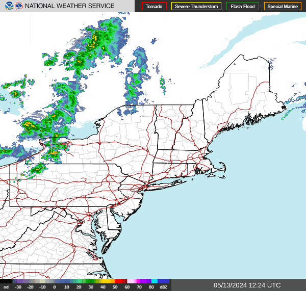
Not ideal when dealing with convective rains but you can see as the ridge pulls back it'll turn wetter with frequent storm chances starting Thu - jul 2 then again jul 5 -7