SACRUS
-
Posts
15,435 -
Joined
-
Last visited
Content Type
Profiles
Blogs
Forums
American Weather
Media Demo
Store
Gallery
Everything posted by SACRUS
-
Extreme Cold, Snow & Sleet: SECS 1/24 - 1/26
SACRUS replied to TriPol's topic in New York City Metro
Yeah sleet is increasing and now mainly sleet - right down the road from you closer to Jamesburg -
Extreme Cold, Snow & Sleet: SECS 1/24 - 1/26
SACRUS replied to TriPol's topic in New York City Metro
Suspect we'll teeter between mix / snow - sleet before becoming mainly sleet here in the next hour. Vrery good overrunning performance. -
Extreme Cold, Snow & Sleet: SECS 1/24 - 1/26
SACRUS replied to TriPol's topic in New York City Metro
Anod now 50 / 50 Snow/ Sleet. Close to 8.5 9 -
Extreme Cold, Snow & Sleet: SECS 1/24 - 1/26
SACRUS replied to TriPol's topic in New York City Metro
Trying to squeeze as much of the anticipated 1.4 LE as snow - up to 0.46 now. -
Extreme Cold, Snow & Sleet: SECS 1/24 - 1/26
SACRUS replied to TriPol's topic in New York City Metro
-
Extreme Cold, Snow & Sleet: SECS 1/24 - 1/26
SACRUS replied to TriPol's topic in New York City Metro
85/90% snow -
Extreme Cold, Snow & Sleet: SECS 1/24 - 1/26
SACRUS replied to TriPol's topic in New York City Metro
more to show extent of precip not the mix line -
85 - 90% snow here and +SN
-
Extreme Cold, Snow & Sleet: SECS 1/24 - 1/26
SACRUS replied to TriPol's topic in New York City Metro
Heavy rates counter acting the sleet progression here in Monroe, CNJ -
-
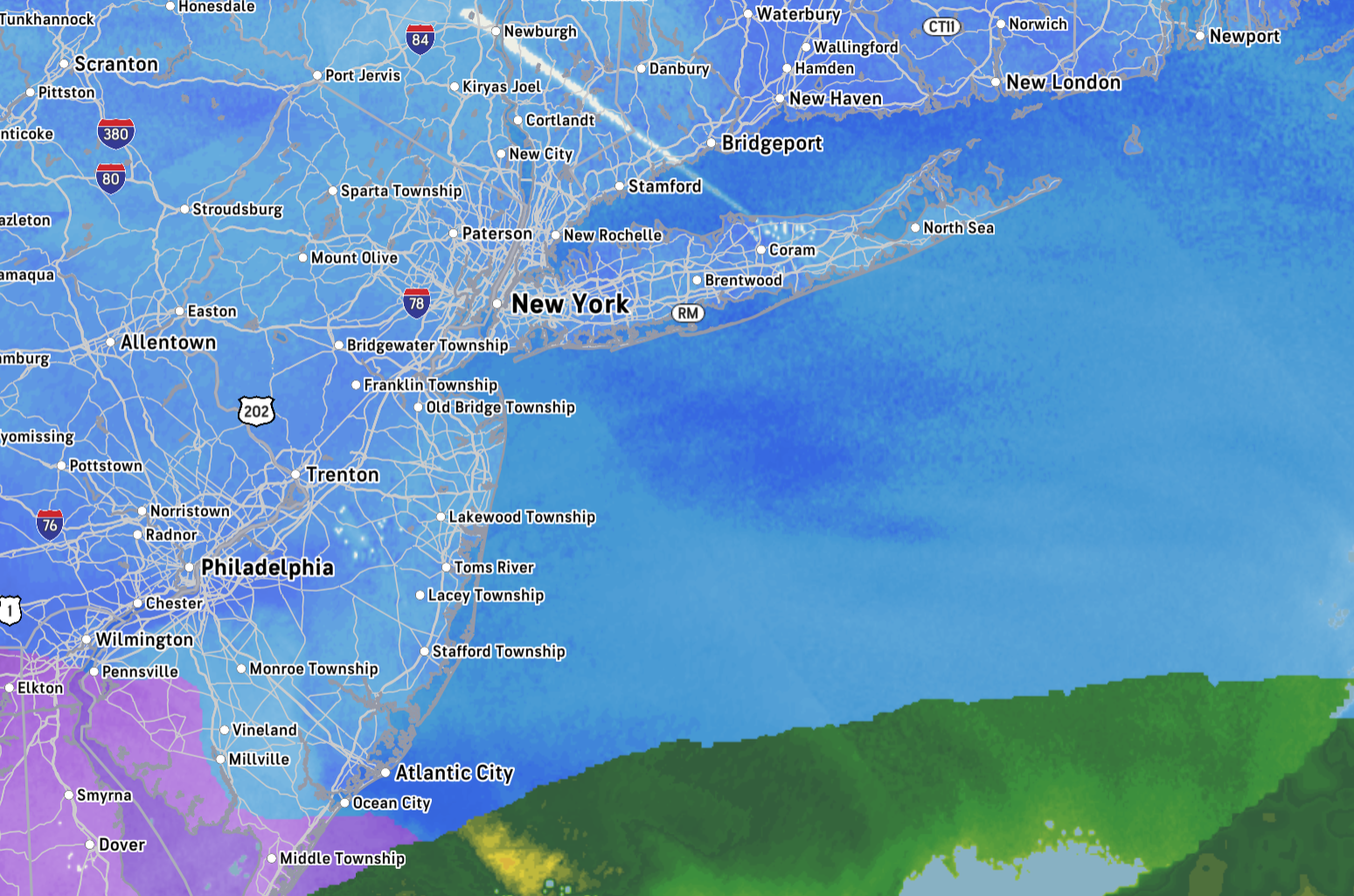
Mesoscale Discussion 0058 NWS Storm Prediction Center Norman OK 1055 AM CST Sun Jan 25 2026 Areas affected...northern Pennsylvania...southern New York...northern New Jersey...Connecticut...Rhode Island...and southern Massachusetts. Concerning...Heavy snow Valid 251655Z - 252100Z SUMMARY...Heavy snowfall is expected through the afternoon with rates up to 2 inches per hour. DISCUSSION...Widespread heavy snow is already ongoing across Pennsylvania and New Jersey this morning. This heavy snow will shift northeast through the afternoon. In addition, very heavy rates are expected to develop across far southeast New York, Connecticut, and Rhode Island. In this region, very strong 700mb frontogenesis is forecast between 18Z and 21Z amid strong isentropic ascent. In addition, amid strong warm-air advection, the transition zone from snow to sleet is moving rapidly north across eastern Pennsylvania and New Jersey (as sampled by KDOX Correlation Coefficient). Expect this transition zone to continue to advect north during the early afternoon before stalling near the Connecticut shore by mid-afternoon.
-
sleet line visible on the above loop pushing around i-195
-
-
12/ 8 mostly snow here w/ some IP about 7.5 on the ground on 0.38 LE. Seems like 0.75 - 1.00 more to go which might be primarily sleet here so a total of 8 - 10/11 of accumulation and by that point concrete
-
to Freehold / Princeton mixing with sleet.
-
Sleet reports to about i195 closing on
-
SLeet line working north on the west flank into PA slower in SNJ
-
Extreme Cold, Snow & Sleet: SECS 1/24 - 1/26
SACRUS replied to TriPol's topic in New York City Metro
Hearing its still mainly snow in those areas to about Vineyard. -
Extreme Cold, Snow & Sleet: SECS 1/24 - 1/26
SACRUS replied to TriPol's topic in New York City Metro

-
Extreme Cold, Snow & Sleet: SECS 1/24 - 1/26
SACRUS replied to TriPol's topic in New York City Metro
There is also IP (PL) and SN mix at 5:1 or 7:1 pending on the mix which may occur in the borterline areas. -
11/ 8 SN 6.5 - 7 on the ground off 0.30 LE let it snow
-
arent you a month into vacation or 11 months into work?
-
6 - 6.5 on the ground 0.27 LE 22:1