NorthShoreWx
-
Posts
5,498 -
Joined
-
Last visited
Content Type
Profiles
Blogs
Forums
American Weather
Media Demo
Store
Gallery
Everything posted by NorthShoreWx
-
Def band over central LI modeled on the NAM around noon has my attention. Not holding my breath but it'll be worth a look out the window.
-
November 2020 General Discussions & Observations Thread
NorthShoreWx replied to Rtd208's topic in New York City Metro
Cool. I never saw the LSR before because we had no power for a couple of days. Two of those storm reports are from within a block or two of here. It was quite a scary wakeup alarm. It sounded like rocks being blasted at the house which I took to be hail, but some of it was branches blown out of trees. -
November 2020 General Discussions & Observations Thread
NorthShoreWx replied to Rtd208's topic in New York City Metro
31 here this morning up on the ridge in north Smithtown. We've been as low as 29.8 this fall but it wasn't for long enough to kill much. -
November 2020 General Discussions & Observations Thread
NorthShoreWx replied to Rtd208's topic in New York City Metro
Extensive damage on the north shore in August 2015 too. Insane storm (including hail) at 5AM. I forget if it was a microburst or a full blown Derecho. It affected a considerable area. -
November 2020 General Discussions & Observations Thread
NorthShoreWx replied to Rtd208's topic in New York City Metro
Appropriate that you mentioned Elko as the example because I was thinking high desert as I was posting. -
November 2020 General Discussions & Observations Thread
NorthShoreWx replied to Rtd208's topic in New York City Metro
Impressive diurnal swings for sure. Must be even more impressive in the center of the island, but here's the last 3 days at my hacienda about a mile from the sound: 11/7 43 76 11/8 44 77 11/9 42 77 This afternoon's 77 degree high a couple of hours ago is already down to 59 here. You can be sweating and then a half hour later around sunset be freezing. -
We can alway reminisce: WEATHER MAP DISCUSSION FOR EXTREME SOUTHEASTERN NEW YORK..NORTHERN NEW JERSEY AND LONG ISLAND NATIONAL WEATHER SERVICE NEW YORK NY 400 AM EST WED NOV 22 1989 ...FIRST REAL SNOW EVENT ON THE WAY... HIGH PRESSURE MOVING ACROSS THE AREA WILL GIVE US FAIR SKIES FOR A SHORT PERIOD AND QUICKLY MOVE OUT TO SEA. THIS WILL BEGIN THE CHANGE IN OUR WEATHER PATTERN AS CLOUDS MOVE INTO THE AREA DURING THE AFTERNOON. A LOW PRESSURE SYSTEM DEVELOPING OVER THE GULF STATES WILL BE THE DRIVING FORCE TURNING A SOMEWHAT TAMED WEATHER PATTERN INTO A RAGING EVENT LET LOOSE. THE STORM CENTER WILL MOVE RAPIDLY TOWARD THE NORTHEAST AND SPREAD MOSTLY SNOW AHEAD OF IT. THEREFORE THIS WILL GIVE US OUR FIRST REAL SNOW EVENT THIS SEASON. THE SNOW SHOULD BEGIN AROUND MIDNIGHT AND CONTINUE THROUGH THE MORNING HOURS BEFORE TAPERING OFF TO FLURRIES DURING THURSDAY AFTERNOON. THE STORM WILL REACH THE CAROLINA COAST EARLY THURSDAY POSSIBLY DUMPING 2 TO 4 INCHES OF SNOW OVER MANY AREAS BEFORE RUSHING TOWARD THE NEW ENGLAND COAST. HOPEFULLY THIS SYSTEM WILL MOVE AS RAPIDLY AS PROJECTIONS CALL FOR..OTHERWISE IT MAY TURN INTO A MAJOR EVENT. IT WILL REMAIN CLOUDY AND COLD THANKSGIVING DAY BUT TIS THE SEASON TO BE THmANKFUL. MJW
-
Snow in October, winter is over. It just takes a flake. This applies to the entire sub-forum except the north shore.
-
remnants of zeta and potential first flakes for some areas
NorthShoreWx replied to forkyfork's topic in New York City Metro
Sleet mixing in Smithtown. -
October 2020 General Discussions & Observations Thread
NorthShoreWx replied to uofmiami's topic in New York City Metro
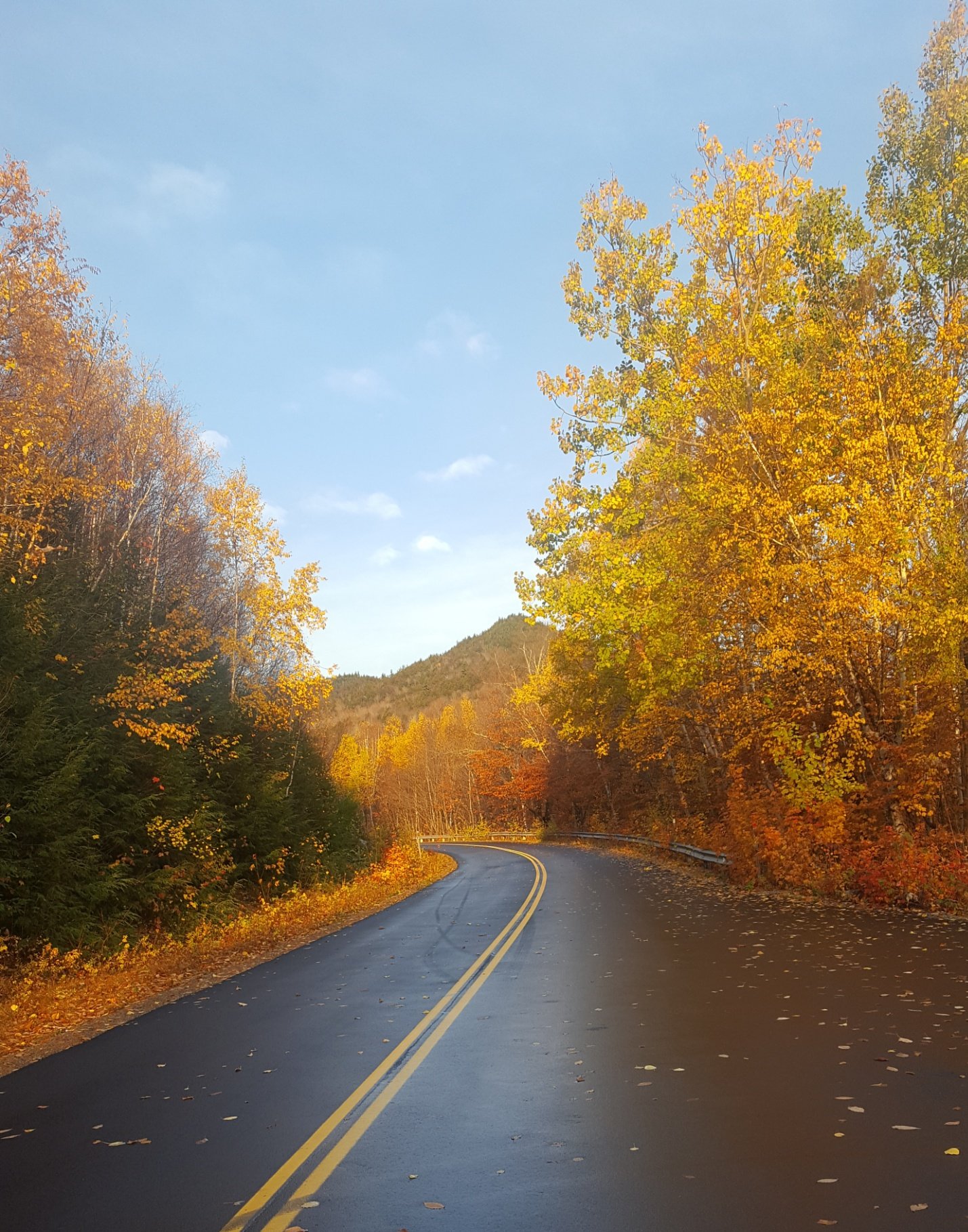
Doesn't sound like an apple's to apples comparison. Depends on the kind of trees. Near here, trees along RT 25 in Caleb Smith and 25a north of the bull are past peak and shedding leaves. Where there are primarily oaks still lots of green. I just got home from the North Conway area and it was surprisingly similar in places. As you head up the notches it looks more winter like. This is from Bear Notch Road near Bartlett on Thursday.
-
I just saw a great shooting star to the west heading roughly from south to north. I wouldn't call it a fireball, but like someone threw a sparkler close by. Definitely one of the better ones. Anyone else catch it?
-
December 25 - 26, 1976 snow totals. In addition to the Christmas night fun, this was significant because for most locations it established a snow cover that persisted well into February:: Patchogue 2 N 7.0 Syosset 5.8 Mineola 5.0 Holbrook 5.0 Islip LI Macarthur AP 4.0 Riverhead Research Farm 4.0 Setauket Strong 4.0 New York JFK Intl AP 3.9 Greenport 3.5 New York La Guardia AP 3.2 NY City Central Park 3.1 Bridgehampton 0.1 Montauk 0.1 Bensonhurst 3.0 Westerleigh (SI) 5.2 Dobbs Ferry 4.6 Scarsdale 5.0 Yorktown Heights 5.0 West Point 3.5 Poughkeepsie 2.7 Walden 4.0 Gardnerville 4.0 Port Jervis 4.0 Bridgeport 5.0 Danbury 5.0 Woodbury, CT 4.0 Stamford (5N) 5.0 Groton 3.5 Middletown, CT 4.0 Newark 4.6 Canistear Reservoir (NJ) 3.5 Charlotteburg Reservoir (NJ) 3.3 Oak Ridge Reservoir 4.0 Sussex 4.0 Cranford, NJ 4.8 Freehold Marlboro 5.0 New Brunswick 6.5 Plainfield 6.0 Boston 2.6 Taunton 1.0 Providence 1.0 Philadelphia 1.7 Baltimore (BWI) Trace Syosset, NY 8AM 12/26/1976: And yes, that pine tree is flipping you the bird
-
In spots yes. 2/78 was more widespread and a lot windier. I was near the epicenter in 2/13 and we had nearly 4" LE in the snow and sleet that fell (some high profile roof collapses in my town from that). 78 had less water, but gigantic drifts. Roof problems in 78 were more isolated because most of the snow blew off of roofs. Closest thing I have seen to the 78 wind was December 2010 but 78 had higher winds and the winds and snow lasted a lot longer too. Actually, 2010 was somewhat of a dud here (barely made 12" imby), but the winds made it worthwhile. Edit: Anticipating that someone will ask, we had a couple of hours of rain or rain/mix midday on 2/8/13, but it only totaled about a tenth of an inch of liquid. The precip started as snow in the morning, flipped to some light rain and drizzle for a short time, then the snow went bonkers after about 3pm. We did have a period of mix with sleet in the evening, but mostly heavy wet snow transitioning to a drier powdery snow after about 10 pm or so. I'll have to check, but I think I had 3.87"LE for the storm and almost all of it was frozen. I've never seen that much from one storm, even in '78. I suspect that something similar may have happened in February 1961, but not certain. '78 was windblown powder from curtain to curtain. We stayed on the cold side of the coastal front that got parts of the island up near freezing. When that was happening, we were positively ripping overnight with temps in the low - mid 20s.
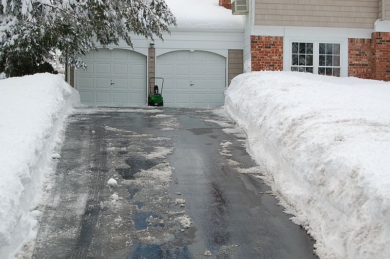
-
I remember the media forecasts (880, 1010) saying "a foot or more" as early as Saturday 2/4/78. I had about 1 snow day before that winter (2/2/76) and we had full school days during all day snowstorms in 2/74 and 2/75 (both were around 9"). It wasn't a district that liked to close and people weren't as touchy feely about driving in snow as they are now (rear wheel drive and all). But they closed school Monday 2/6 in anticipation of the storm. Big time forecast that was actually taken seriously. Then the storm exceeded the high expectations. This after a colossal forecast bust 2 1/2 weeks before when expected overnight rain was actually a 17" blizzard. Good times that winter. 72" season total in NE Nassau County. A friend lived in a split level across the street from the old Sod farms near the high school (now Stillwell Woods) and the drift there was up to the roofline on the tall side of the house. We didn't go back to school until 2/13 (then had regular classes as another 5" fell on Valentines Day). The NSP was closed for days and I saw these giant snow throwers that they brought down from somewhere upstate clearing drifts on the parkway. Here is a photo from one of the industrial parks in Syosset in February 1978:
-
Nala Repsak ... I literally remember him saying his name backwards on the air. No idea what the forecast was that day, but I remember the name My guess is he'd get a chuckle out of anyone remembering that.
-
February 1978 was one of relatively few forecasting successes on big northeast snowstorms prior to 1980. I was in HS and remember being wound up about that storm by the prior Friday. I had an indoor track meet in the Nassau Coliseum all day on Saturday 2/4 and brought a portable radio so I could keep track of what was going on. There are old case studies you can find about the successes in modeling that storm well in advance. I think the model was called LFM or something like that. It might even be a pre-historic ancestor of the GFS.
-
That probably had a lot to do with it. We had a lot of white rain before it started sticking. Also I think points farther west did better. I think NE Nassau had up to 8 or 9 inches. The Sound helps for most of the winter, but being within a couple of miles of the Sound also gives us a longer growing season kind of like parts of CNY near Lake Ontario (but not as pronounced). We had nothing but a few wet flakes here in October 2011. A couple of miles south there was snow on the ground. An interesting quirk is radiational cooling at night. We are often one of the cold spots on the island a day after Westhampton records some crazy low. Once the breeze begins to shift as high pressure starts to pass to the east, we are effectively far from the water and decouple well while the South shore maintains an onshore breeze. During the "best" radiation nights we sometimes keep a light northerly breeze going all night. Even so, we can be several degrees colder than a mile north of here on those nights.
-
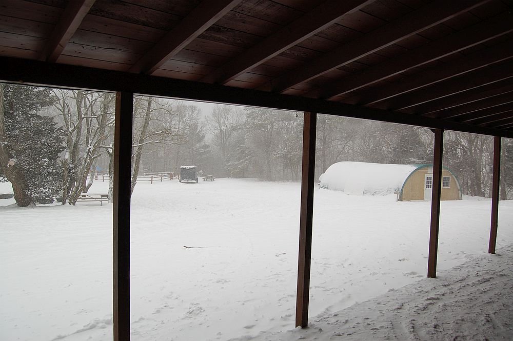
7 years ago this morning in Smithtown. We got about 3.5" in the post-Sandy noreaster.
-
It was a good run for the coast. 2 months of 10"+ @ KMGJ is a nice winter. 2011, 2014, and 2015 were good snow cover winters here. I'll run those stats when I get a chance. This winter, we wait for the MJO to find it's MoJO
-
No such luck. From 12/26/2010 - 1/27/2011 we had 51.4" (33 days). We only had 12" in the 12/26 blizzard. 2010-2011 Snow cover (2N Smithtown): 1" or more from 12/27 - 2/28. At least a trace from 12/27 - 3/6. 20"+ from 1/26 - 2/3. 10"+ from 1/12 - 2/17. Max depth 27" early on 1/27 (not recorded...was 25" at 9AM obs time). 1/27/11:
-
January 26, 2011 (before the big snowfall). The first 6 weeks of the 2010-11 winter were great.
-
I recall January 21 from that winter. For some reason I have no memory of the rest of it.
-
One of the more memorable flash freezes of the past half century. This one was pretty extreme:
-
I assume it did not get that cold.
-
Not the first place I'd think of for the LI cold spot, although they were probably already iced in prior to that outbreak. I'll dig up what I had found if I get a chance later.