michsnowfreak
-
Posts
17,980 -
Joined
-
Last visited
Content Type
Profiles
Blogs
Forums
American Weather
Media Demo
Store
Gallery
Everything posted by michsnowfreak
-
What a nice Christmas surprise. After 2 days of nonstop blowing snow, the winds calmed down and we picked up 1.5" of snow overnight via Lake MI. The fluffy topping on the drifty snow makes for an absolutely beautiful white Christmas
-

Winter 2022/23 Short/Medium Range Discussion
michsnowfreak replied to Chicago Storm's topic in Lakes/Ohio Valley
DTW finished at 47.1" last winter. Not sure what you mean 79%. That is an interesting thought though, it condensed Winter. Winter lasts so long overall but it's not continuous. Would be interesting if we crammed everything into a couple months. -
Winter 2022/23 Short/Medium Range Discussion
michsnowfreak replied to Chicago Storm's topic in Lakes/Ohio Valley
I think mimillman was being sarcastic lol. Last 3 winters have been around average at Detroit snowfall wise, and the last 2 near average snowcover. Just very Feb based (ie much snowier/whiter in Feb than avg to counter the dull parts of winter). I, like you am a snowcover person. There is no longterm decline in snowcover at all, but of course we are still fairly fresh off the record snowcover 2013-15. -
Winter 2022/23 Short/Medium Range Discussion
michsnowfreak replied to Chicago Storm's topic in Lakes/Ohio Valley
@Mimillman, here's the graphic. Wonder when they will release 1991-2020. -
Winter 2022/23 Medium/Long Range Discussion
michsnowfreak replied to Chicago Storm's topic in Lakes/Ohio Valley
January has been more the wild card. Certainly snowier tham Dec, but we are due for a snowy Jan. The theme hast been AN snow in November, February, & April and BN in December and March. But as hoosier said, we can't always count on Feb to be rockin. One of these years it won't be (likewise one of these years we will get a snowy December again). -
The location is perfect, the price was beyond reasonable, and I have a view of lake superior from my backyard.
-
I'm staying in a vrbo near L'anse Feb 16-20. Can't wait! An additional mood dusting today but the LES is just dust here. At least it's a White Christmas!
-
It's a cold white Christmas in the Midwest, but whatever the weather, may all my fellow weenies and their families/friends have a very Merry Christmas!
-
Winter 2022/23 Short/Medium Range Discussion
michsnowfreak replied to Chicago Storm's topic in Lakes/Ohio Valley
Hmm where did I hear "anyone can paint brush their own snow map". That map doesnt include most of yesterday's snow actually. Not sure why you follow maps anyway. You are proven wrong time and time again with them and then when you are, you simply resort to a generic "we suck". Over the years youve managed to find something wrong with every snow record, snowstorm, etc that occurs, and usually your gripe is with the conditions. Well yesterday the conditions were legit. When it's pointed out how Detroit has had more 6"+ storms last 20 years and a higher average than most non belt Midwest cities, you have to go back to the big dog obsession which no one outside buffalo has had. -
Pre-Christmas (Dec 21-23rd) Winter Storm Part 2
michsnowfreak replied to Chicago Storm's topic in Lakes/Ohio Valley
I agree. The constant drifting is just insane. While it's impossible to be precise due to the flash freeze and temperature drop, I'm thinking the ratios were less than 10 to 1 on the snow here. I got a total of 0.57" liquid snowfall of 2.4", but the rainfall portion was approximately 0.25-.30". Were going on 30 hours now where "blowing snow" has been a part of nearly every observation. Official totals were 2.2" at Detroit and 4.5" at Flint. -
Pre-Christmas (Dec 21-23rd) Winter Storm Part 2
michsnowfreak replied to Chicago Storm's topic in Lakes/Ohio Valley
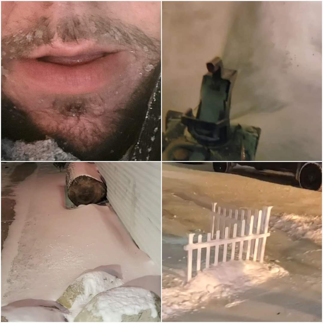
Per friend in Livonia it seems like you guys got a little less snow than here. But conditions were just brutal all day. Havent seen constant blowing/drifting like this in years. It definitely made for a "North Dakota" like day as was joked about earlier. Going with storm total of 0.57" precip on 2.4" snow here. Some very impressive drifts while driving around, Some of the roads that have been plowed have big snow banks that would make it look like a big snowstorm, but then you see the fields that are scoured of snow. Winds gusted between 45 and 50 miles per hour all day, temperature hovered right around 0 and wind chills hovered around 30 below. Again, give me a run of the mill 6 to 10" snowstorm any day over this, but it was definitely a fun and unique weather day. Snow blowed some of the drifting out of my driveway and ended up with icy facial hair.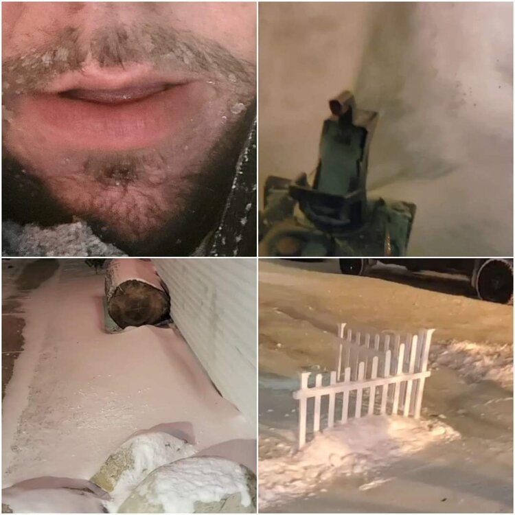
-
Pre-Christmas (Dec 21-23rd) Winter Storm Part 2
michsnowfreak replied to Chicago Storm's topic in Lakes/Ohio Valley
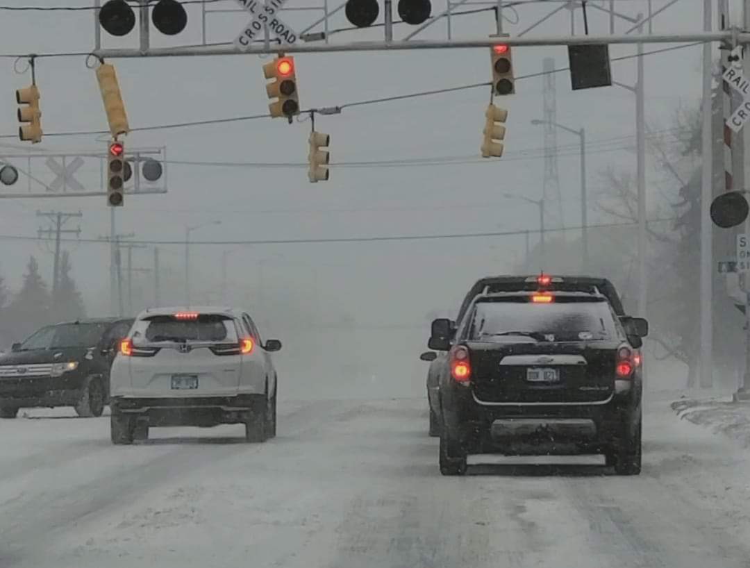
Very interesting. Most of the roads here are snow covered/drifted/rutted and slippery -
Pre-Christmas (Dec 21-23rd) Winter Storm Part 2
michsnowfreak replied to Chicago Storm's topic in Lakes/Ohio Valley
Bingo. My sister went out to pick up a piece of her mailbox that flew off in the wind lol, and discovered she had quite the artistic decoration in front of her house. Like I said. It is really cool to see the wind and the constant blowing snow, but next time just giving me an even deep blanket. -
Pre-Christmas (Dec 21-23rd) Winter Storm Part 2
michsnowfreak replied to Chicago Storm's topic in Lakes/Ohio Valley
Grass would be poking through no matter how much snow you've got. It's legit outside. It's cool to see but I'm definitely more of an even blanket of snow type of person then these blizzardous winds. My backyard has grass tips in spots and 3 to 6" in other spots -
Pre-Christmas (Dec 21-23rd) Winter Storm Part 2
michsnowfreak replied to Chicago Storm's topic in Lakes/Ohio Valley
I was out and it's brutal out, but i love it. Snow rutted streets and drifts everywhere despite around 2" of snow having fallen. Can only imagine the drifts if we had a few more inches of snow. The constant blowing snow and wind chills of -30 definitely give it a true tundra feel.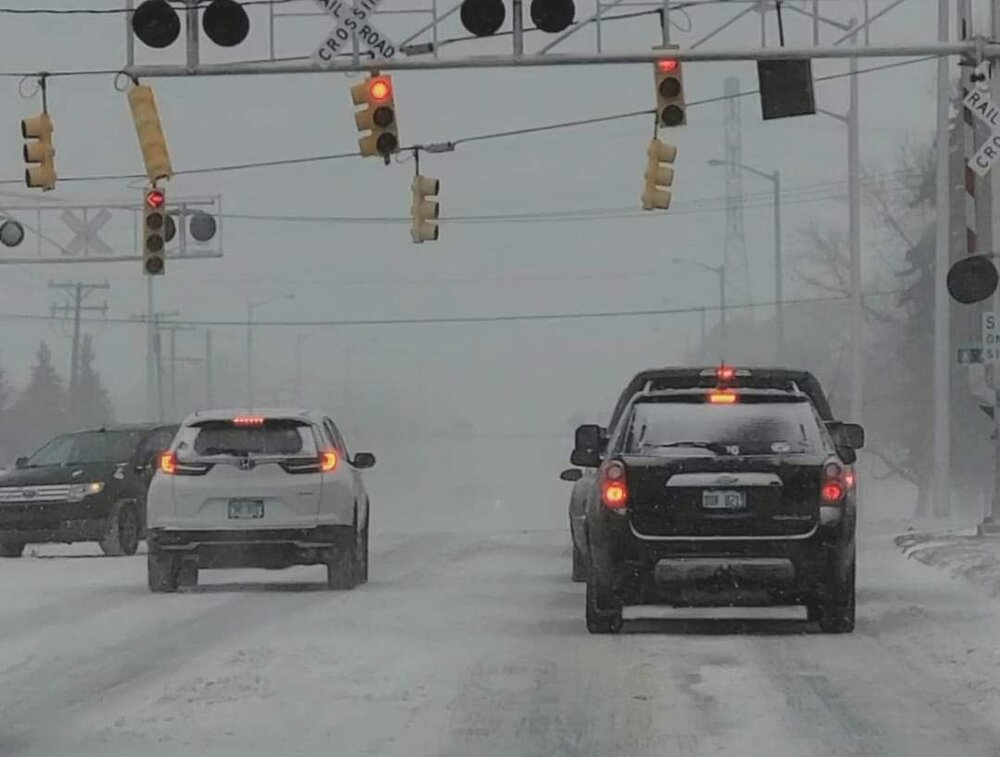
-
Pre-Christmas (Dec 21-23rd) Winter Storm Part 2
michsnowfreak replied to Chicago Storm's topic in Lakes/Ohio Valley
Nice you got some concrete. That will freeze up instead of being carried away in the wind. We went straight from rain to powder here. -
Pre-Christmas (Dec 21-23rd) Winter Storm Part 2
michsnowfreak replied to Chicago Storm's topic in Lakes/Ohio Valley
Temp just keeps dropping. Snow swirling and drifting. Obviously model porn amounts in the days leading up were pathetically off, but the actual weather is pretty neat. If I can sit next to my Christmas tree on Dec 23 and watch mini snownadoes swirling out the window in a winter wonderland, it's not a bad thing. -
Pre-Christmas (Dec 21-23rd) Winter Storm Part 2
michsnowfreak replied to Chicago Storm's topic in Lakes/Ohio Valley
It's already below 0 on Monroe County. The wind chills are already 20 below. Pretty much happened as I expected it would yesterday. We'll probably end up around 2" from the "storm" here and then you once again will probably get more lake effect tomorrow than you got from the actual storm. -
Pre-Christmas (Dec 21-23rd) Winter Storm Part 2
michsnowfreak replied to Chicago Storm's topic in Lakes/Ohio Valley
Brutal outside. It was raining and 38 at 11 PM and now it's 5° and falling and the wind takes your breath away. Probably 1.5-2" of snow but it's a sea of drifting blowing and swirling. -
Pre-Christmas (Dec 21-23rd) Winter Storm Part 2
michsnowfreak replied to Chicago Storm's topic in Lakes/Ohio Valley
Interesting. Winters of the 2000s/10s were far snowier that the 1990s in SE MI. -
Pre-Christmas (Dec 21-23rd) Winter Storm Part 2
michsnowfreak replied to Chicago Storm's topic in Lakes/Ohio Valley
Yup. It was incredible. Even once the snow did melt in April the remnant piles were like something you would see up North by that time of year. And actually, although the main show started New Year's, don't forget snow was actually on the ground since December 8th. We had a horribly timed melt off down to patchy trace snow depth December 23rd through 25th and again the 28th through 30th, but we actually never were completely bare ground since December 7th. -
It does look interesting. But I thought we would keep everything in the other thread. Doesn't matter to me though.
-
Pre-Christmas (Dec 21-23rd) Winter Storm Part 2
michsnowfreak replied to Chicago Storm's topic in Lakes/Ohio Valley
Nothing could go wrong that Winter lol (not thst there werent, amazingly, the usual complainers). We had a long duration 11" snowstorm December 31st to January 2nd, then a short duration 11" snowstorm January 5/6th. And it was only the beginning. -
Pre-Christmas (Dec 21-23rd) Winter Storm Part 2
michsnowfreak replied to Chicago Storm's topic in Lakes/Ohio Valley
With the wind I would expect low ratios -
Pre-Christmas (Dec 21-23rd) Winter Storm Part 2
michsnowfreak replied to Chicago Storm's topic in Lakes/Ohio Valley
Looking like some good banding of snow squalls into Saturday via Lake MI after the main event, but position of banding TBD. Either way looks like a fun but couple days. I probably won't get a liquid equivalent total til Saturday. Rain gauge can will likely freeze solid with flash freeze of rain to snow.