wxeyeNH
-
Posts
9,835 -
Joined
-
Last visited
Content Type
Profiles
Blogs
Forums
American Weather
Media Demo
Store
Gallery
Everything posted by wxeyeNH
-
39.1F Light rain and snow shower. It seems that the snow falling and changes to rain shafts right at my elevation of 1100 feet. Some mangled big flakes. It only lasted 5 minutes and now the sun is coming out.
-
39F Cloudy with a few breaks. The mountain tops in the Cardigan range are obscured from time to time in light snow showers. Nothing here. Why is the wind almost non existent? A gentle NW breeze 5 to 10mph but I won't consider it a windy morning. Is there a follow-up push or trough expected today?
-
About 1" of rain from the last system. Foliage is at peak here. A super peak! It will all be over by the weekend.
-
Wow, what a beautiful day. The foliage this year is amazing in the Whites. If you any of you can get up there tomorrow, this is the day. Monday's fropa will take down many leaves but what a year this is.
-
.30" ish. Most was yesterday.....
-
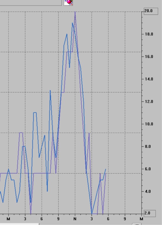
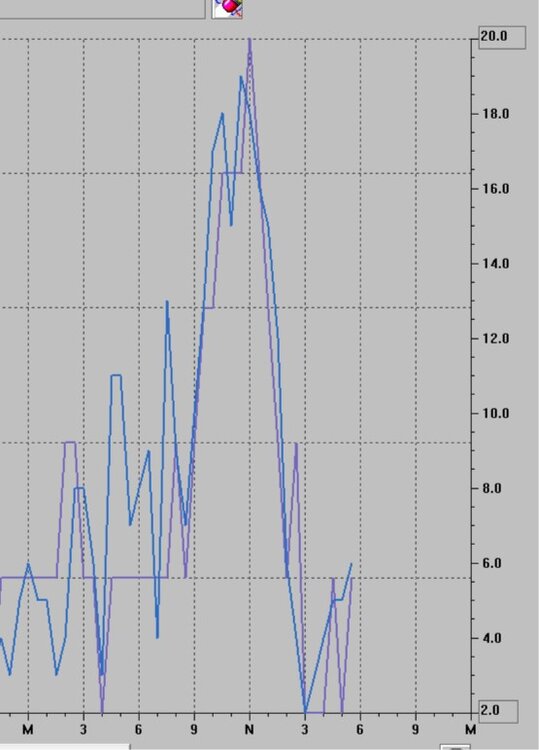
While you all get the action down there the weather is interesting here. After some gusty breezes mid day and one light rain band the wind is basically calm. Why? My Davis anemometer is at 10 meters without any trees nearby. Here is the Davis graph.
-
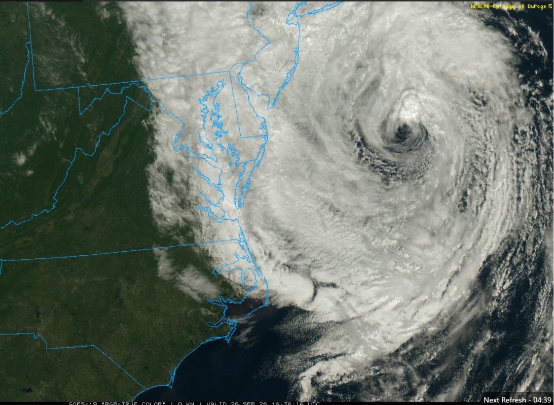
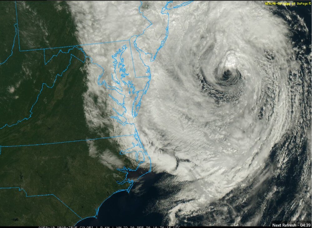
I'm certainly not a Met but the satellite view right now doesn't look like a typical cold core system. Deep convection trying to fire near the center. Seems hybrid to me??
-
With the clear skies to the west, a large part of New England was treated to an epic sunset. Similar to an off short hurricane with a big cirrus shield. Up here in Central NH it was high cirrus but as you got into the deeper moisture and virga I guess rainbows were an added bonus.? Enjoy your storm down there. The Whites to my northeast should keep me in some type of orographic shadow as it usually does with strong NE flows. Maybe this will be more easterly winds? I will take any rain I can get.
-

Septorcher 2026 Discussion - Endless Summer
wxeyeNH replied to Damage In Tolland's topic in New England
Hope everyone is good. I have not been too active on the forums.. We are finally getting some beneficial rain up here. 3.25" so far this month. About .30"ish today. This makes me a happy camper for sure! Also of note I was just looking at the astronomical tides for the 25-27th. They are quite high. With the warm gulf stream I wonder if any nor'easter getting captured could become hybrid or tropical? It will be interesting to see what unfolds. -
Septorcher 2026 Discussion - Endless Summer
wxeyeNH replied to Damage In Tolland's topic in New England
Finally a beneficial soak. .65" last night. -
Septorcher 2026 Discussion - Endless Summer
wxeyeNH replied to Damage In Tolland's topic in New England
.03" so far with this system -
For a couple of nights around 9/11 two strong light beams will be lit on the summit of Mt Washington. Similar to what they do in NYC. This will be an interesting experiment to view. Supposedly, the beams will reach 3 or 4 miles into the sky. I wonder how far they will be able to be seen? Of course this all depends on weather. It could be a cloudy stretch and no one will be able to see anything. It could also be clear with good visibility. I don't know if the beams will be the same strength as NYC but I guess those could be seen from around 60 miles away. So adding the extra mile of elevation I assume these beams will be seen at least that far away. The one interesting caveat is that years ago on one of the overnight Eco tours they had I was able to spend a nighton the summit. A coastal storm was forming way down the coast and New England had a high cirrus layer. I could make out the glow on the underside of the cirrus from Boston to the south to Montreal to the northwest. So my assumption is that the best condition would be a very high overcast at 20 or 30,000 feet. Then perhaps the glow could be seen throughout much of New England?
-
Perfect weather day. 74/51F. Great vis. Drought situation. Assuming we don't get a shower tomorrow night the grand August total is 1.66". For July it was 1.64". Amazingly dry. Thankfully we did get .80" on August 23rd. In my general area I know Brian has been extremely dry too. He got a nice thunderstorm a little while back that I missed. Brian, what is your total for July and August?
-
I guess it's official. Within 30 days all federal agencies must refer to Lake Ontario as Lake America. I would assume the NWS and NOSS must follow this rule. Any employee that disregards it I would also assume could or would be fired. More stupidity and confusion for the public.
-
Not really totally weather related but wow. I very seldom go down to the Boston area. It's been many years. We went down yesterday and it amazing to see how much solar is down there compared to up here in Grafton County NH. Is it we are cloudier and further north or politics? We love our solar roof and have had credit electric bills the past few months. Sunny weather is boring but it does help the mood when the meter is "spinning" backward.....and with my electric car we were able to make it back on electric. So I'm glad it's a sunny day to charge the car back up. I try to charge on sunny days. Ok, back to weather...
-
Finally, a beneficial rain yesterday. .83" So August is now up to 1.66" which beats July's total of 1.62"!
-
Another miss of rain today. I'm at 1.66" for July and .87" for August. That is from the Davis Vantage Pro 2. During one brief heavy downpour it did rain extremely hard so it might have missed a slight bit. Still it is extremely dry! Watch what happens this weekend. I just looked at the 18Z GFS. Things fall apart yet again for me? Arrgghhh...
-
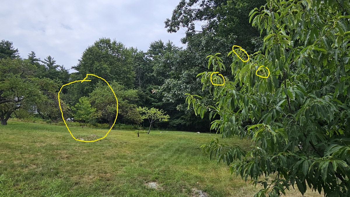
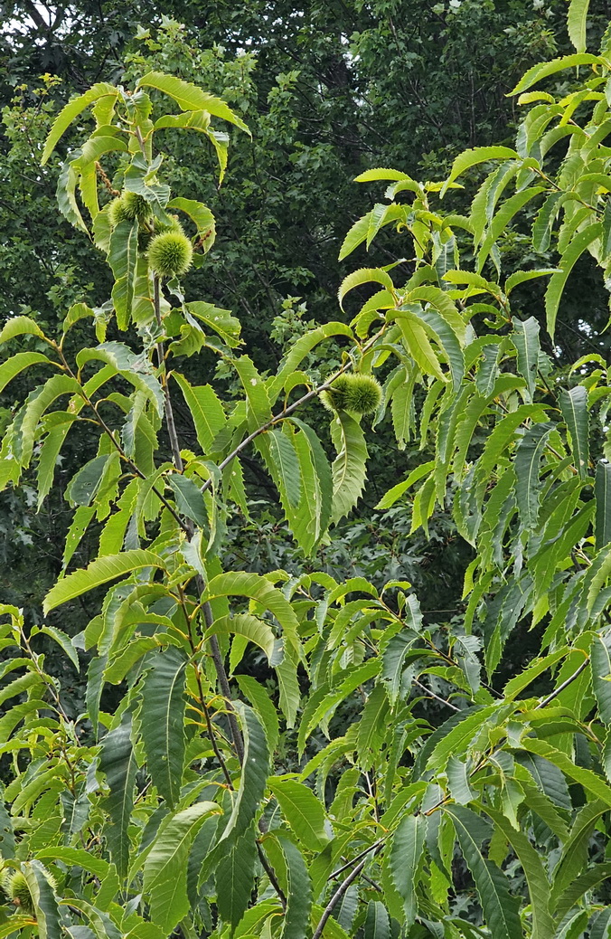
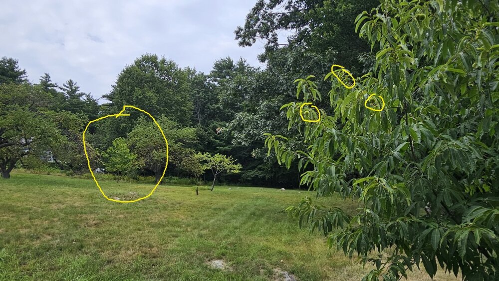
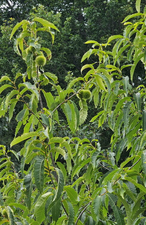
Quite a few years ago (maybe 8ish?) Brian found a place that was selling American Chestnut seedling. About a foot tall at best. I don't remember (Brian do you?) who we got them from but they said they were breed to be blight resistant. I got 4. I planted them and 3 are doing very good. For the first time this season one is producing nuts. I counted about 20. American Chestnuts need pollen from another tree and as you can see in these pictures I do have 2 of them a couple of hundred feet apart. We will see what happens. The drought up here is taking a toll on young trees. I have been trying to water these as the leafs are starting to wilt. We have had less than 2.5" of rain since August 1rst. Missing out again today. Arrgghhh...
-
Yep, I am at 2.20" since June 30th. I live about 10 miles south of Rattlesnake. The surface is very dry. I thought we would finally get some real rain tonight but it looks like that won't happen. Arrggghhhh
-
Congrats Brian. Nice lightshow to my south early this morning. Between a shower yesterday and a light shower as the storm passed to my south a big .17"!
-
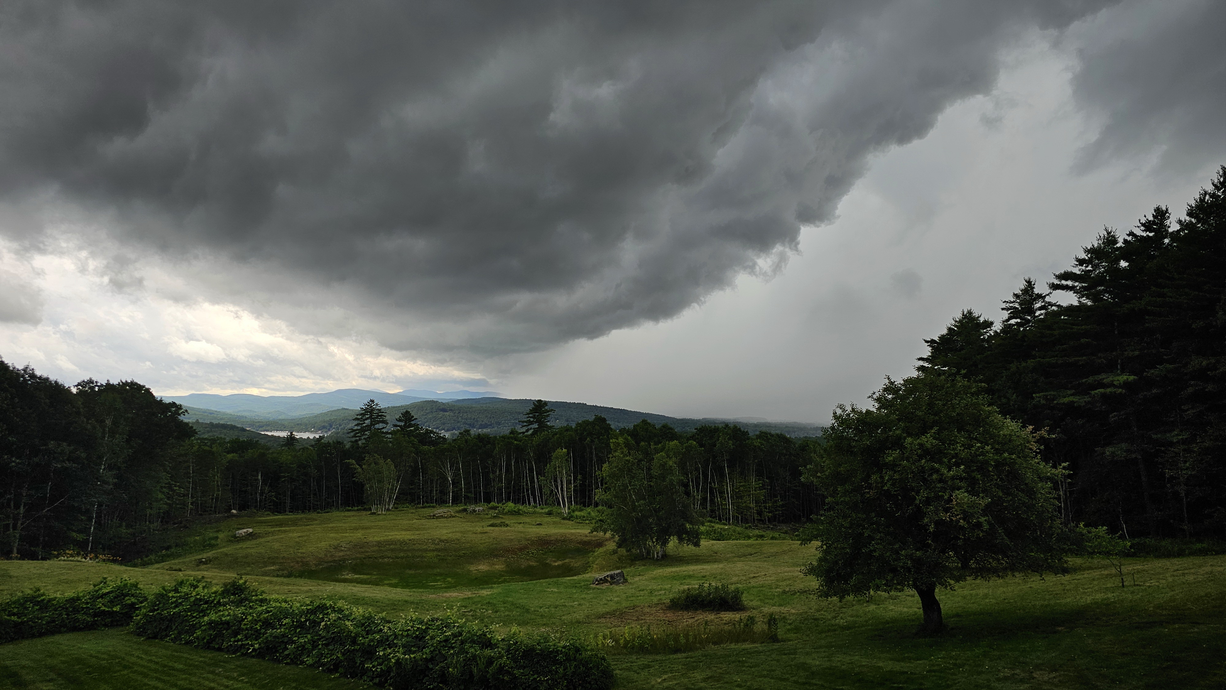
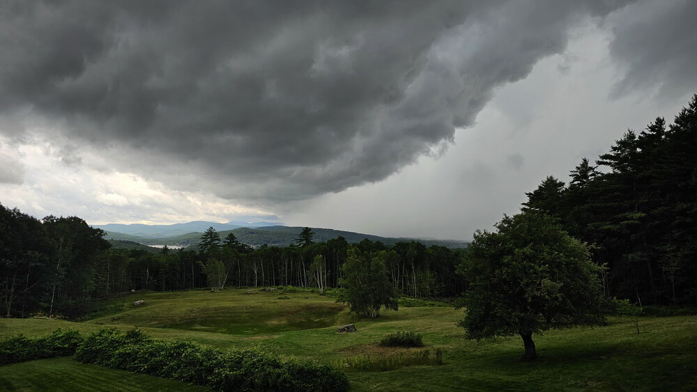
The line of heavy showers quickly moved through. It is still raining lightly. About .30" About the same amount earlier. It helps but we need much more. I uploaded this picture but it seems slightly under exposed. The line looked menicing but I don't think the underbelly of line was quite this dark.
-
Line of showers/storms about to move across Newfound Lake. My webcam site should be fun to watch. https://www.bridgewaternhweather.com/
-
64/56 Very light rain. Late yesterday and last night we had some nice downpours. Got .80". It's been dry today, a bit of sun earlier. Sprinkles resumed an hour ago, enough to wet the ground. 0.01"
-
2 rounds of showers/thundershowers now through. One earlier and one more recent. Total .86" so far. Looks like the heaviest rainfall for storm totals will be SW of me. I will be happy if we end up 1-2".
-
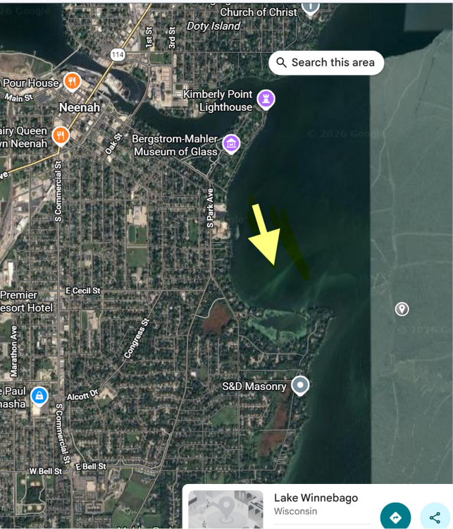
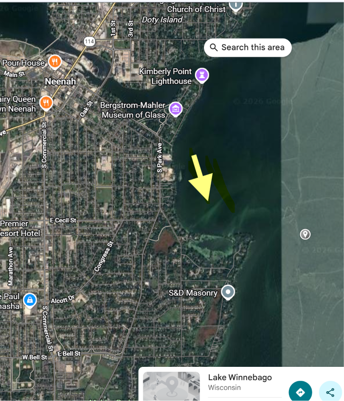
I followed the major tornado that hit the area along Lake Winnebago in Wisconsin. It moved north to south. I just watched a really interesting video that was taken along the lake. It looks like as the winds shifted from the east the lake rose several fee. Watch the lake water level. Was it just the wind? Was it the rapid pressure rise? I have never seen something like this. Attached is the general area and direction. Thoughts?