Freezing Drizzle
-
Posts
227 -
Joined
-
Last visited
Content Type
Profiles
Blogs
Forums
American Weather
Media Demo
Store
Gallery
Everything posted by Freezing Drizzle
-
Yes. I only got down to 22 F, but some impressive regional lows that morning. ---- Per Don, on December 5 -- Some 6 am temperatures: Albany: 2° (tied record set in 1886 and tied in 1926 and 1989) Binghamton: 5° (tied record set in 1971 and tied in 1989) New York City-LaGuardia Airport: 20° (old record: 21°, 1942) White Plains: 14° (tied record set in 1966) Albany has its coldest temperature so early in the season since 1989. Also, NYC-JFK tied record low at 20 F.
-
"The spring forecast also suggests an active backdoor potential with the Northeast being the coolest relative to other areas." Yeah, springtime can be overrated in this area. smh When my son moved to Philadelphia, I told him. "At least you'll have milder springs." He does. Blooms of the same plants run a week or two earlier there.
-
The article says it was not as tall as today's power lines, but it was still a deep drift deep. Did you see the photo of the guys house?
-
Post a photo!
-
Great Dakotas blizzard of 1966 Click on the highlighted link, in this link, for cropped black and white scans to see some images. www.accuweather.com/en/winter-weather/1966-blizzard-provided-north-dakotas-most-famous-photo/1868770
-
I would think that a radar simulation would be possible interpolating known data points from reporting stations as well as surface maps.
-
Be darned, snowing here after a half hour of sprinkles. 34 F
-
Chilly air hanging in roughly west of the NJTP, and into LI. Up to 35 F, here.
-
That's very close. I'll look it up.
-
Well, there, you have it.
-
Hi Don, if you are in the Travis section of Staten Island, then I am 6 to 7 miles to your southwest. I live across the Arthur Kill from Tottenville, Staten Island; directly across from the historic Conference House (Billop House), there. You are across the Arthur Kill from Carteret, NJ. ps - I am at 49.4 inches for the season-to-date. I see you are at 53.9. 4.5 inches above my total. I often get less accumulation from marginal events due to a slightly warmer micro-climate here. @doncat
-
Remember that month of May, over half dozen years ago that it rained (and was cool) every day in May? During the cool, wet spell, I potted up my young tomatoes, peppers, and eggplants and kept them in the back of my van, worked like a greenhouse. lol
-
Impressive weather records!
-
Certainly a good possibility of a cold period, following. In simple terms, spring warmth waxes and wanes as it "battles" the last cold air of the season. Early warm weather is bad for flowering fruit trees and flowering trees like magnolia. Flowering trees are particularly vulnerable during bloom. In a recent April, my neighbor's gorgeous magnolia bloomed one (1) day. That night went to 24 F and every bloom withered. A freeze during bloom kills the entire peach, apple, pear crop.
-
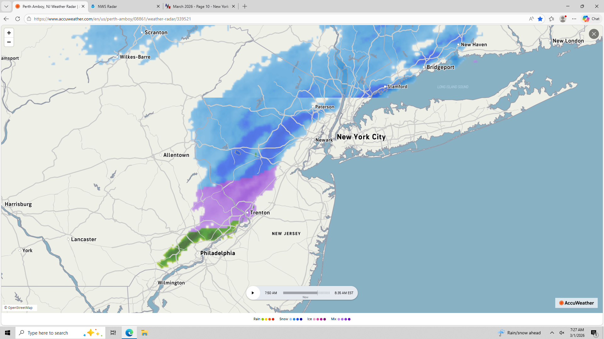
True. Still some moderate echoes left in northeast Jersey; and a small, aggressive band has formed in northern Monmouth County now.
-
Seems to be one last band coming through your area. After that, not sure if much will develop.
-

-
There are a couple narrow, strong bands of snow or mix showers in western NJ moving rapidly eastward. Some of us will see a strong snow shower or two. They seem to be aimed at Metsy.
-
February 2026 OBS & Discussion
Freezing Drizzle replied to Stormlover74's topic in New York City Metro
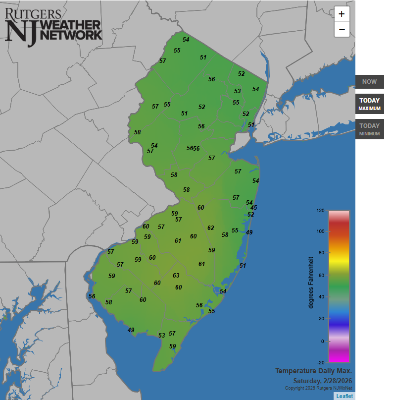
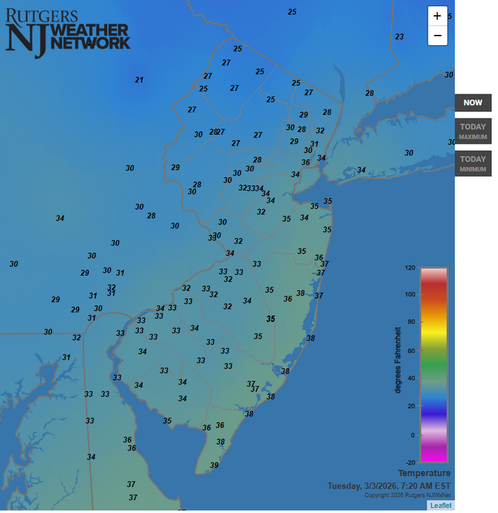
Maximum NJ temperatures, today. (For some reason, the maximum map does not snow the readings in adjacent areas.)
-
Lol Odd. See corrected post above.
-
@steve392 @Amped @North and West Here's the March 7-8, 2018 event maps, with the radar for the duration of the storm. Look at the deep, orange-toned echoes over parts of NJ at noon. Corrected link: www.jdjweatherconsulting.com/mar-7-8-2018
-
I don't remember this one. How much did area locations get? Superstorm of 1993??? That snowfall was on a Saturday morning though.
-
February 2026 OBS & Discussion
Freezing Drizzle replied to Stormlover74's topic in New York City Metro
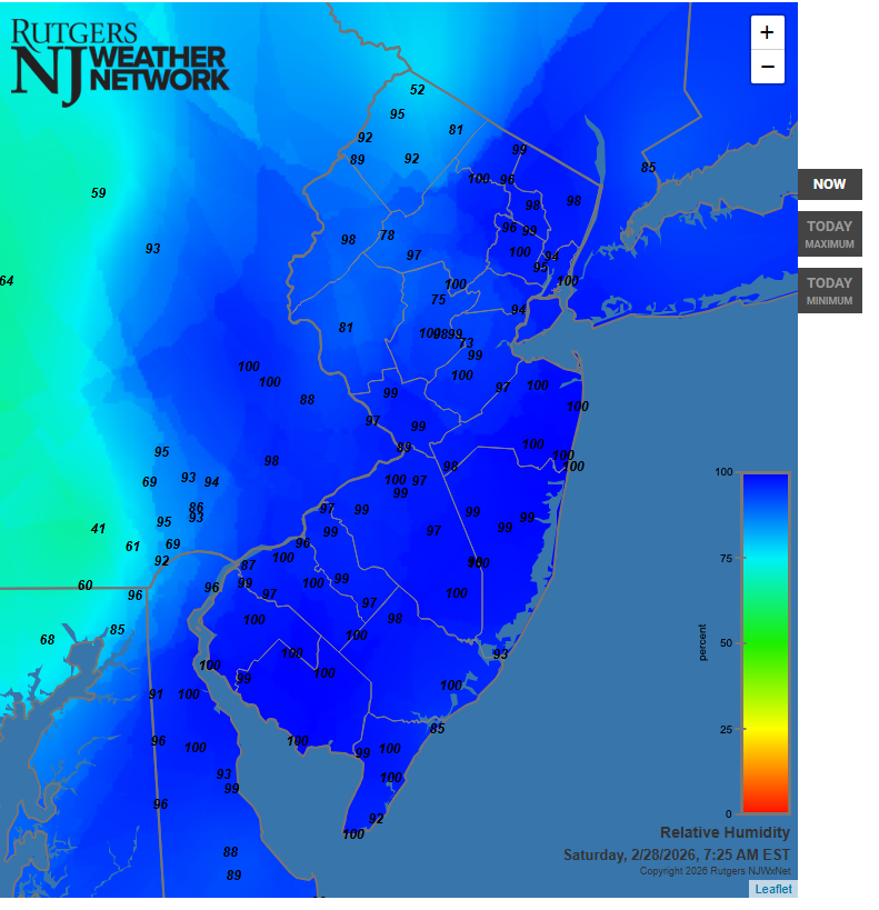
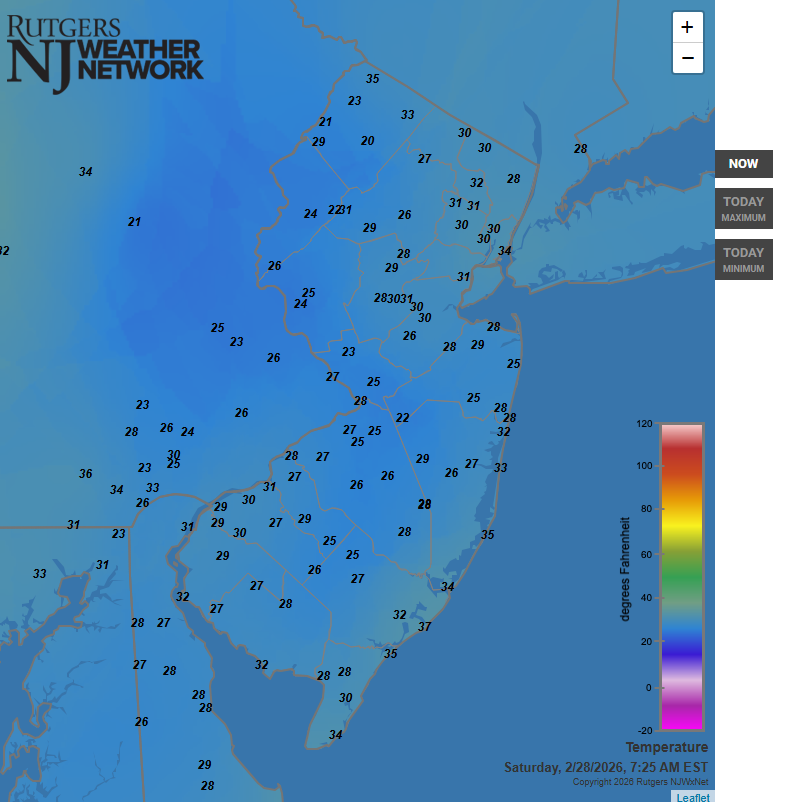
Recipe for freezing fog with these current temperatures (above) and RHs.
-
February 2026 OBS & Discussion
Freezing Drizzle replied to Stormlover74's topic in New York City Metro

-
February 2026 OBS & Discussion
Freezing Drizzle replied to Stormlover74's topic in New York City Metro
Rare freezing fog at my location. Glaze on all surfaces. 31 F with 99% RH.I get fogs here by the bay, but rarely at or below freezing.Anyone else getting this?