Terpeast
-
Posts
6,649 -
Joined
-
Last visited
Content Type
Profiles
Blogs
Forums
American Weather
Media Demo
Store
Gallery
Everything posted by Terpeast
-
44 now Edit 1 min later: make that 43
-
48.9, still a ways to go
-
RI and SE MA jacks again. Atmospheric memory
-
2026-2027 El Nino
Terpeast replied to Stormchaserchuck1's topic in Weather Forecasting and Discussion
So your analog is showing a huge aleutian low with a ridge over the rockies (again). How does it look over the polar domain though? If we get a -WPO/-EPO or -NAO along with that aleutian low, we just might avoid a wall to wall torch. If we get a well-timed STJ wave with cold air lurking nearby, we could score and big. -
Cold chasing precip, let’s hope a better defined wave develops along that boundary.
-
Good one, only thing is whoever made this image didn’t make the scales consistent with all the seasons
-
Outta gas and Outta Time: Early March Winter Storm finale
Terpeast replied to Ji's topic in Mid Atlantic
Doh! You’re right -
Outta gas and Outta Time: Early March Winter Storm finale
Terpeast replied to Ji's topic in Mid Atlantic
Eh, idk. This winter has been pretty dry. Maybe tack on a few extra inches Actually (nerding out for a minute), 30 years ago was 1985-86, a backloaded nina winter. IAD got 15.6" total. I've already beaten that -
Outta gas and Outta Time: Early March Winter Storm finale
Terpeast replied to Ji's topic in Mid Atlantic
Was in between bands, first the northern one that got me good… and then the second one that got fairfax county/I-66 -
Outta gas and Outta Time: Early March Winter Storm finale
Terpeast replied to Ji's topic in Mid Atlantic
Eh, idk. This winter has been pretty dry. Maybe tack on a few extra inches -
Outta gas and Outta Time: Early March Winter Storm finale
Terpeast replied to Ji's topic in Mid Atlantic
Think mby is done for today, 2.1” final. Brings me to 17.4”, close to my median climo (which is lower than mean climo). Beating last year’s 16.9” by a hair.- 959 replies
-
- 16
-

-
12/5: 1.5” 12/14: 1.0” 1/1: 0.2” 1/17: 0.3” 1/25: 9.5” (5.5 sn 4.0 ip) 2/6: 0.3” 2/22: 2.5” 3/2: 2.1” Total: 17.4”
-
That was awful. Mountains from SC north got buried
-
Outta gas and Outta Time: Early March Winter Storm finale
Terpeast replied to Ji's topic in Mid Atlantic
Every month from dec-mar yielded more than 2” imby -
Outta gas and Outta Time: Early March Winter Storm finale
Terpeast replied to Ji's topic in Mid Atlantic
2.0”, still snowing lightly. Above freezing now so some melting and compaction. Just got back from sledding with daughter!- 959 replies
-
- 11
-
-
Outta gas and Outta Time: Early March Winter Storm finale
Terpeast replied to Ji's topic in Mid Atlantic
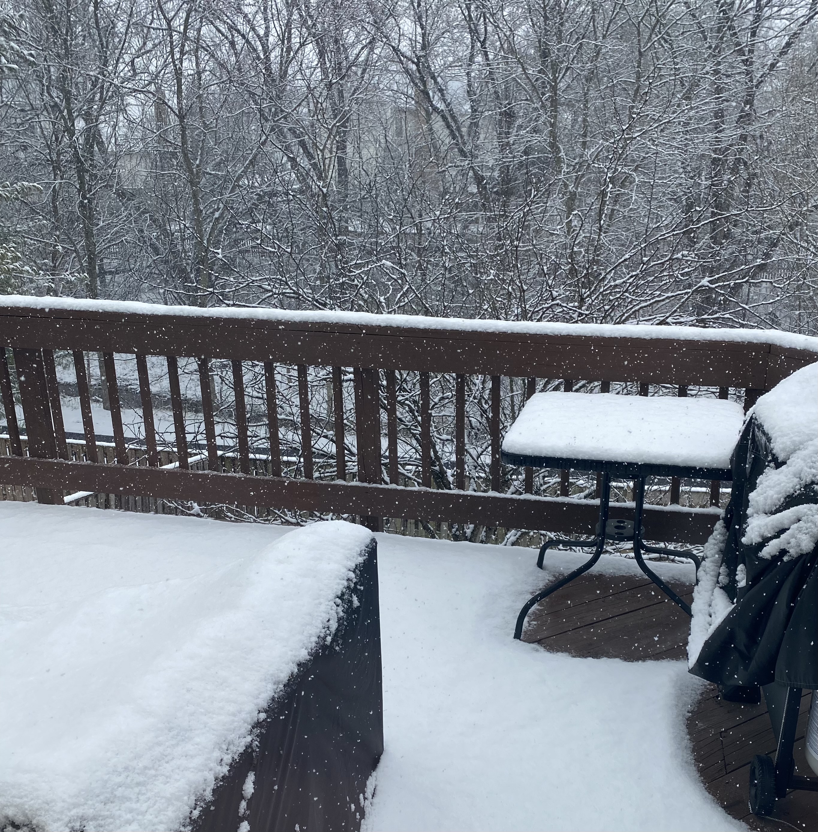
Looks more like a winter wonderland than feb 22 ever did -
Outta gas and Outta Time: Early March Winter Storm finale
Terpeast replied to Ji's topic in Mid Atlantic
Haven’t officially measured, but eyeballing close to 1.5”, finer flakes falling
- 959 replies
-
- 22
-

-
-
Outta gas and Outta Time: Early March Winter Storm finale
Terpeast replied to Ji's topic in Mid Atlantic
Moderate snow, looks like radar backfilling to the west, not as heavy as initial band. Close to 1" at 30.6- 959 replies
-
- 12
-
-

-
Outta gas and Outta Time: Early March Winter Storm finale
Terpeast replied to Ji's topic in Mid Atlantic
Half inch already. I may break 16" on the season if this continues for another 30 min -
Outta gas and Outta Time: Early March Winter Storm finale
Terpeast replied to Ji's topic in Mid Atlantic
Now it is coming down heavy, big fatties! -
Outta gas and Outta Time: Early March Winter Storm finale
Terpeast replied to Ji's topic in Mid Atlantic
Now below freezing at 31.8, mulch and car tops caving. Grass getting dusted too -
Outta gas and Outta Time: Early March Winter Storm finale
Terpeast replied to Ji's topic in Mid Atlantic
Snow coming down nicely -
Outta gas and Outta Time: Early March Winter Storm finale
Terpeast replied to Ji's topic in Mid Atlantic
Light snow, good flakes. 33.8 and falling -
Outta gas and Outta Time: Early March Winter Storm finale
Terpeast replied to Ji's topic in Mid Atlantic
I'm at 35, but dews at 19. Wet bulb temp is still below freezing -
Outta gas and Outta Time: Early March Winter Storm finale
Terpeast replied to Ji's topic in Mid Atlantic
28.8/17. Guess this time we’re not chasing moisture with cold air