.jpg.2573028626d558966424be2bdf9b8490.jpg)

Buckethead
-
Posts
2,551 -
Joined
-
Last visited
Content Type
Profiles
Blogs
Forums
American Weather
Media Demo
Store
Gallery
Everything posted by Buckethead
-

2019/2020 Mountains and Foothills Fall/Winter Thread.
Buckethead replied to Tyler Penland's topic in Southeastern States
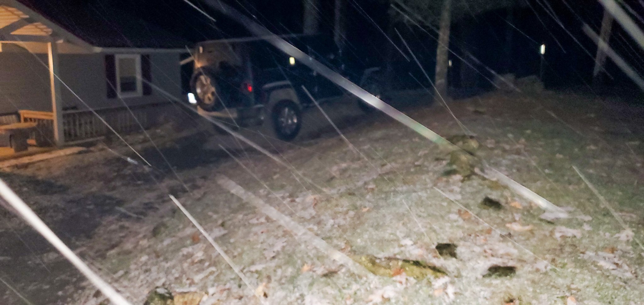
Right at an inch on the ground at 7am. Still coming down pretty good. I thought there'd be more overnight but I'm not complaining. -
2019/2020 Mountains and Foothills Fall/Winter Thread.
Buckethead replied to Tyler Penland's topic in Southeastern States
This stuff is like fat little snowballs falling from the sky. Everything is coated and its pouring.
-
2019/2020 Mountains and Foothills Fall/Winter Thread.
Buckethead replied to Tyler Penland's topic in Southeastern States
Moderate snow now. 33.8°/28. Should whiten up pretty quickly.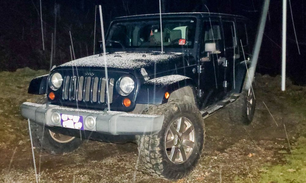
-
2019/2020 Mountains and Foothills Fall/Winter Thread.
Buckethead replied to Tyler Penland's topic in Southeastern States
32.4° and flurries here currently. -
2019/2020 Mountains and Foothills Fall/Winter Thread.
Buckethead replied to Tyler Penland's topic in Southeastern States
WWAs are up for the border counties. It wouldn't surprise me if they eventually get upgraded to WSW's by tomorrow morning.
-
2019/2020 Mountains and Foothills Fall/Winter Thread.
Buckethead replied to Tyler Penland's topic in Southeastern States
Currently have my third thunderstorm of the day. This one is pretty loud...saw a little graupel on my deck. -
2019/2020 Mountains and Foothills Fall/Winter Thread.
Buckethead replied to Tyler Penland's topic in Southeastern States
https://www.star.nesdis.noaa.gov/GOES/sector_band.php?sat=G16§or=umv&band=09&length=12 Impressive water vapor loop this evening of the low. I'm pretty optimistic about what it could mean tomorrow night into Monday morning. -
2019/2020 Mountains and Foothills Fall/Winter Thread.
Buckethead replied to Tyler Penland's topic in Southeastern States
Gsp mentioning the slight possibility of thundersnow early Monday morning.
-
2019/2020 Mountains and Foothills Fall/Winter Thread.
Buckethead replied to Tyler Penland's topic in Southeastern States
Something I read in the GSP AFD yesterday about the ensembles not matching the operational runs. I haven't been able to get my link for the gefs to work in a few weeks. Perhaps I misread something... That's good to hear though, thank you! Edit:cleared my browser and now my links are working. Yeah, I obviously misread something. -
2019/2020 Mountains and Foothills Fall/Winter Thread.
Buckethead replied to Tyler Penland's topic in Southeastern States
The overeating has already begun. It's my wife's fault for putting the pumpkin pie in the fridge last night lol. That stuff is irrestible cold! Has anyone had a look at the ensembles? Can't really look right now, just wondering if they still aren't agreeing with the operational models on the nwf event Sun/Mon.. Happy Thanksgiving, y'all! -
2019/2020 Mountains and Foothills Fall/Winter Thread.
Buckethead replied to Tyler Penland's topic in Southeastern States
I hope you don't take me as questioning your expertise man, I'm a nerd that likes to read and was curious if you knew how to find that data lol. And please don't tone yourself down, it's not like you're Mike Seidelling it lol. Thanks for the info as always! -
2019/2020 Mountains and Foothills Fall/Winter Thread.
Buckethead replied to Tyler Penland's topic in Southeastern States
Do you have any data on the top 5 NWF events in the past decade? -
2019/2020 Mountains and Foothills Fall/Winter Thread.
Buckethead replied to Tyler Penland's topic in Southeastern States
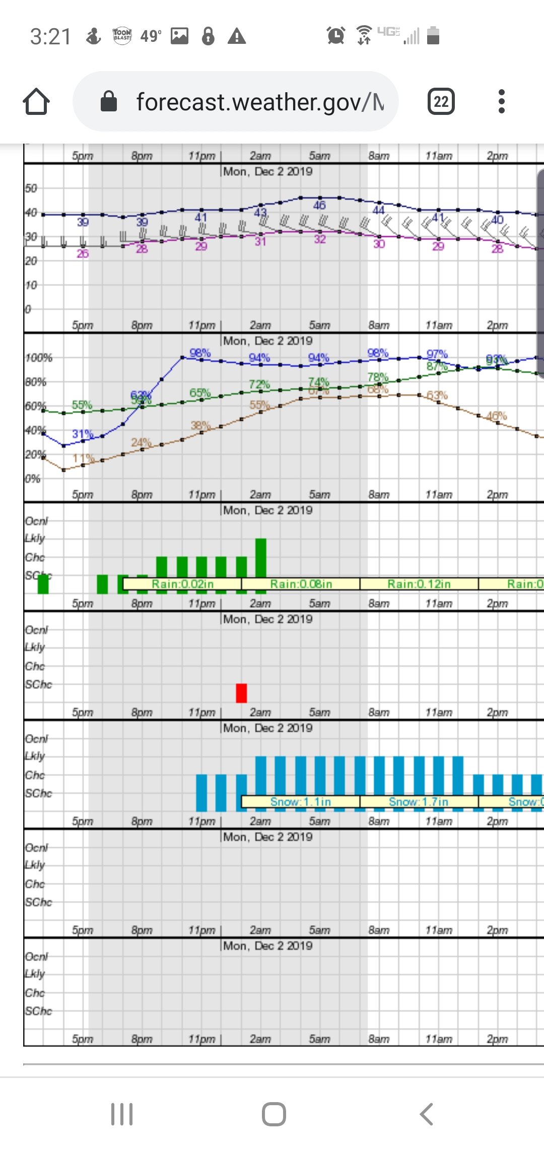
Not when GSP is saying this like this in the AFD! "Deep moisture wrapping around the back of the low is reflected in basically all guidance, and deep cold air will be ushered into the area quickly behind the main front late on Sunday, with anticipated fetches off the Great Lakes. The details aren`t all that well-resolved, and seem to disagree especially in ensemble guidance, but the general pattern seems to be shaping up nicely for the season`s first big NW flow snow event Sunday night into Monday." -
2019/2020 Mountains and Foothills Fall/Winter Thread.
Buckethead replied to Tyler Penland's topic in Southeastern States
Now that's my type of problem! Looks like there'll be a great lakes connection. -
2019/2020 Mountains and Foothills Fall/Winter Thread.
Buckethead replied to Tyler Penland's topic in Southeastern States
Right on queue! That would be a great start to meteorological winter. -
2019/2020 Mountains and Foothills Fall/Winter Thread.
Buckethead replied to Tyler Penland's topic in Southeastern States
I got another inch overnight, but I'm with Joe. I'm ready for a decent snowfall. Edit: forgot to add that light snow is still falling. -
2019/2020 Mountains and Foothills Fall/Winter Thread.
Buckethead replied to Tyler Penland's topic in Southeastern States
Currently sitting at 30.8° with moderate snow. Already picked up a dusting. -
2019/2020 Mountains and Foothills Fall/Winter Thread.
Buckethead replied to Tyler Penland's topic in Southeastern States
When you're originally from Columbia, SC, there is no such thing as a minor accumulation. -
2019/2020 Mountains and Foothills Fall/Winter Thread.
Buckethead replied to Tyler Penland's topic in Southeastern States
Last night wasn't a total bust even though the meteor "storm" was. Caught an amazing lenticular that just hung out in the same place in shot after shot. Really had that flying saucer look!.thumb.jpg.7b0ab85d898598273874734bf9511a90.jpg)
-
2019/2020 Mountains and Foothills Fall/Winter Thread.
Buckethead replied to Tyler Penland's topic in Southeastern States
34 with light snow falling here currently. Picked this dusting up in about 15 minutes.
-
2019/2020 Mountains and Foothills Fall/Winter Thread.
Buckethead replied to Tyler Penland's topic in Southeastern States
Could be a little NWF action later tonight along the border above 3500'. Doesn't look like it will amount to much but I'll take it! -
2019/2020 Mountains and Foothills Fall/Winter Thread.
Buckethead replied to Tyler Penland's topic in Southeastern States
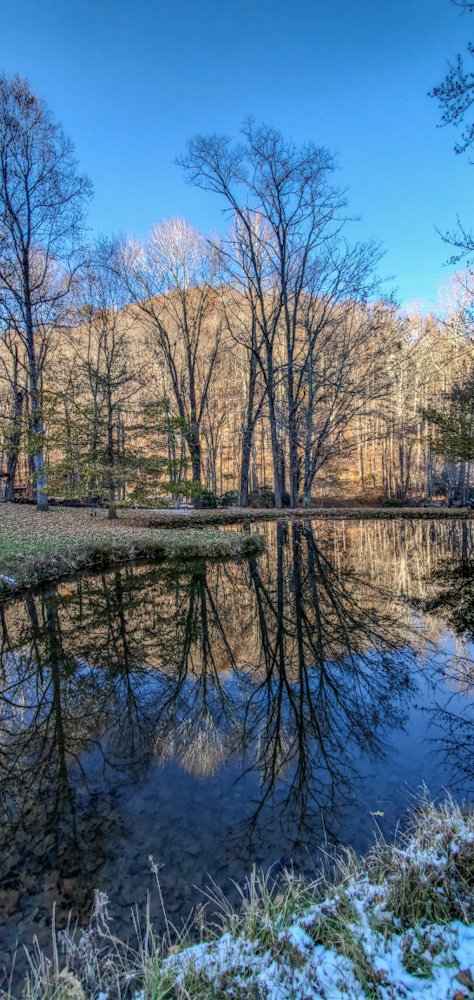
It was dead calm today, like Joe said. Took another shot of the pond after it thawed this afternoon. It turned into a mirror. I love reflection pics like this...it looks even better upside down. That's not a long exposure...1/500. (Really low resolution version)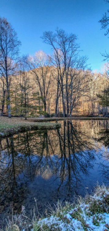
-
2019/2020 Mountains and Foothills Fall/Winter Thread.
Buckethead replied to Tyler Penland's topic in Southeastern States
The is the first time I've seen a pond freeze over in the south so early in the season. Impressive start to the cold season for sure!.thumb.jpg.f69e31050e333c9de4c192977f5b357e.jpg)
-
2019/2020 Mountains and Foothills Fall/Winter Thread.
Buckethead replied to Tyler Penland's topic in Southeastern States
We actually bottomed out at 6° right around 2am but since then have warmed back up to 21.6° currently. That actually happens a good bit here. January 2018 we got down to -9° here and had a high that day right around 0. That was the same time period when the rivers froze over around WNC. -
2019/2020 Mountains and Foothills Fall/Winter Thread.
Buckethead replied to Tyler Penland's topic in Southeastern States
Down to 7.6° here at 4400'. It's surreal outside with the clouds racing by the moon and everything glowing. I wore flip flops out there a minute ago...that was a miscalculation.


.jpg.498662cbdb7887f63b31c5414b778532.jpg)
.jpg.df86d93a6f681e9399a98e7e9915d2ca.jpg)