

tavwtby
-
Posts
2,814 -
Joined
-
Last visited
Content Type
Profiles
Blogs
Forums
American Weather
Media Demo
Store
Gallery
Everything posted by tavwtby
-

Wounded Duck Strikes Back: Dec 26 & 27th Winter Storm Obs
tavwtby replied to WxWatcher007's topic in New England
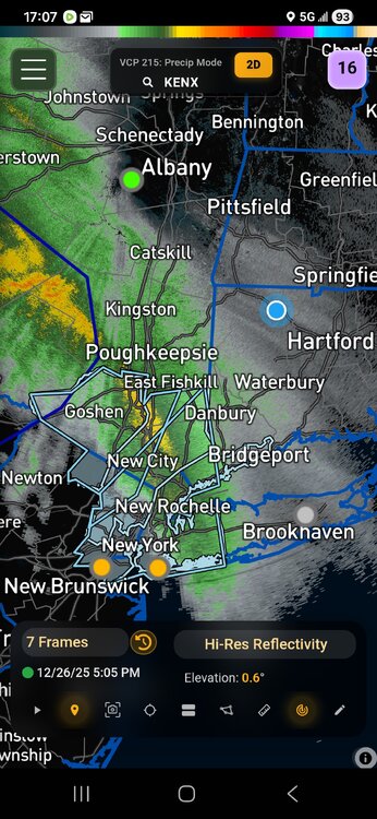
flakeage... you can see the heavy rates on CC, pretty cool -
Wounded Duck Strikes Back: Dec 26 & 27th Winter Storm Obs
tavwtby replied to WxWatcher007's topic in New England
21/4 nada here yet, looks like pound town SW of my area tho. -
Wounded Duck Strikes Back: Dec 26 & 27th Winter Storm Obs
tavwtby replied to WxWatcher007's topic in New England
-
Wounded Duck Strikes Back: Dec 26 & 27th Winter Storm Obs
tavwtby replied to WxWatcher007's topic in New England
man this is going to be a cold one, if it's snowing in Greenwich at 23/14, that's some good rates. -
Wounded Duck Strikes Back: Dec 26 & 27th Winter Storm Obs
tavwtby replied to WxWatcher007's topic in New England
23/0 here with lowering clouds, have to overcome the dry air before it comes down, I think we're going to wind up with two bands, one major and a secondary NE of the main one, who's in between is sucking exhaust imho... we'll see how it pans out, point and click has me at 9 now and ALY right there too, up from 5 yesterday.. go time! -
26th-27th event, coming at us like a wounded duck.
tavwtby replied to Go Kart Mozart's topic in New England
yeah there's a lot of convective energy there definitely -
26th-27th event, coming at us like a wounded duck.
tavwtby replied to Go Kart Mozart's topic in New England
we take! -
26th-27th event, coming at us like a wounded duck.
tavwtby replied to Go Kart Mozart's topic in New England
I agree with the low end criteria for warning at least being met for one to be hoisted, however I think it's because there may be so many people traveling, especially 84-81 and points west and south, maybe they want to get attention, a watch may be just ignored, just my thoughts on the reasoning -
26th-27th event, coming at us like a wounded duck.
tavwtby replied to Go Kart Mozart's topic in New England
ALY took em up over an inch since the 1245 update to warning.
-
26th-27th event, coming at us like a wounded duck.
tavwtby replied to Go Kart Mozart's topic in New England
bit shocked they went straight to warning, but I guess they are figuring in travel etc., I'm expecting low end of that 5-7", but we'll have to see where the banding sets up, should go to town for a few hours overnight anyway. -
26th-27th event, coming at us like a wounded duck.
tavwtby replied to Go Kart Mozart's topic in New England
straight to warning here -
26th-27th event, coming at us like a wounded duck.
tavwtby replied to Go Kart Mozart's topic in New England
ALY will probably hold, or at least a WWA...no watch yet I don't think here, maybe south Litchfield cty. -
26th-27th event, coming at us like a wounded duck.
tavwtby replied to Go Kart Mozart's topic in New England
yeah I would think watches for at least wor counties, CT is such a weird state with 3 offices covering such a small area. -
26th-27th event, coming at us like a wounded duck.
tavwtby replied to Go Kart Mozart's topic in New England
I wanna say that March storm in 17 or 18, can't remember but 2015 was frigid, that I recall -
I'll take Jan 2011 for the win please...
-
26th-27th event, coming at us like a wounded duck.
tavwtby replied to Go Kart Mozart's topic in New England
can we please get a bump NE, I'd love to end December with at least close to double digit snowfall... -
just had a nice burst of snow, too bad temps are marginal everything that fell and falling is melting.
-
I can't remember what year, 92/93 maybe, we had a solid sleet storm with inches of it, I remember driving around like a fool with like 3-4" of sleet, crazy time. But it was early 90s, I thought 93/94 was the really cold year, no? perhaps it was that year.
-
I think from 83-87 we had maybe one storm over 6", just going off memory but that was Waterbury not Winsted, and then I don't remember much else big until 95/96.
-
those off hour runs tend to do that it seems 6z, 12z show one thing, the others something else, weird trend I've noticed.
-
December 14th - Snow showers or Plowable snow?
tavwtby replied to Sey-Mour Snow's topic in New England
1" here and still pixie dust flying...congrats South folks on getting some white finally! -
December 14th - Snow showers or Plowable snow?
tavwtby replied to Sey-Mour Snow's topic in New England
yeah I still have a couple inches from the 12/2 event, only got like a half inch on 12/10. -
December 14th - Snow showers or Plowable snow?
tavwtby replied to Sey-Mour Snow's topic in New England
over 6" in unity twp PA outside pitt -
December 14th - Snow showers or Plowable snow?
tavwtby replied to Sey-Mour Snow's topic in New England
might be some sublimation issues north where it's cold up there under the DGZ, we'll see if we can get a good burst of nice rates and accumulate a couple/three inches. -
December 14th - Snow showers or Plowable snow?
tavwtby replied to Sey-Mour Snow's topic in New England
I wouldn't be shocked if someone in SE areas of SNE saw 6" of fluff, column will be plenty cold in the DGZ for so good growth, a few more tics north we can all be in business


