

tavwtby
-
Posts
2,446 -
Joined
-
Last visited
Content Type
Profiles
Blogs
Forums
American Weather
Media Demo
Store
Gallery
Posts posted by tavwtby
-
-
Albany kept the Warning for here, for now but has downgraded all the advisory except my cty and south Berks and adjacent NY ctys
-
2 minutes ago, 78Blizzard said:
Imagine someone who signed off here late this morning and came back to see all these pages, picking up where he left off. His joy turned into bitter disappointment as he began reading.
yeah I'm one of those...
-
 1
1
-
-
Just now, Damage In Tolland said:
I think we may be F’d HFD north
12-18 to 2-4 in 12 hours...wow...who knows, maybe get a lucky mid-level band that puts some rates, but garbage antecedent airmass and now this? it's amazing
-
we need a last minute jump north or there's going to be a lot of toaster baths, what a difference 12 hours has been since I last checked, wtf...ALY not too concerned about my area and immediate Berks, but has taken amounts way back points NW, stating big gradient as this now looks to pass SE of the BM
-
18 minutes ago, RUNNAWAYICEBERG said:
I still think the highest amounts will be in a 25mile stripe nw of 84 like new fairfield through nect/ema. Similar to what @weatherwizmap looks like.
said earlier looked like a nice stripe from dxr up to ORH, appears legit still, +/-20mi, we take, nice regional event for SNE/CNE incoming!
-
 1
1
-
-
outta here in a hurry huh? looks like all done by 1700hrs, quick hitter
-
3 minutes ago, Snowcrazed71 said:
How much are they going to reach criteria. You have to be in the 20s as well if I'm not mistaken, and I don't think that's going to happen.
thought they got rid of temp criteria a while ago?
-
1
-
-
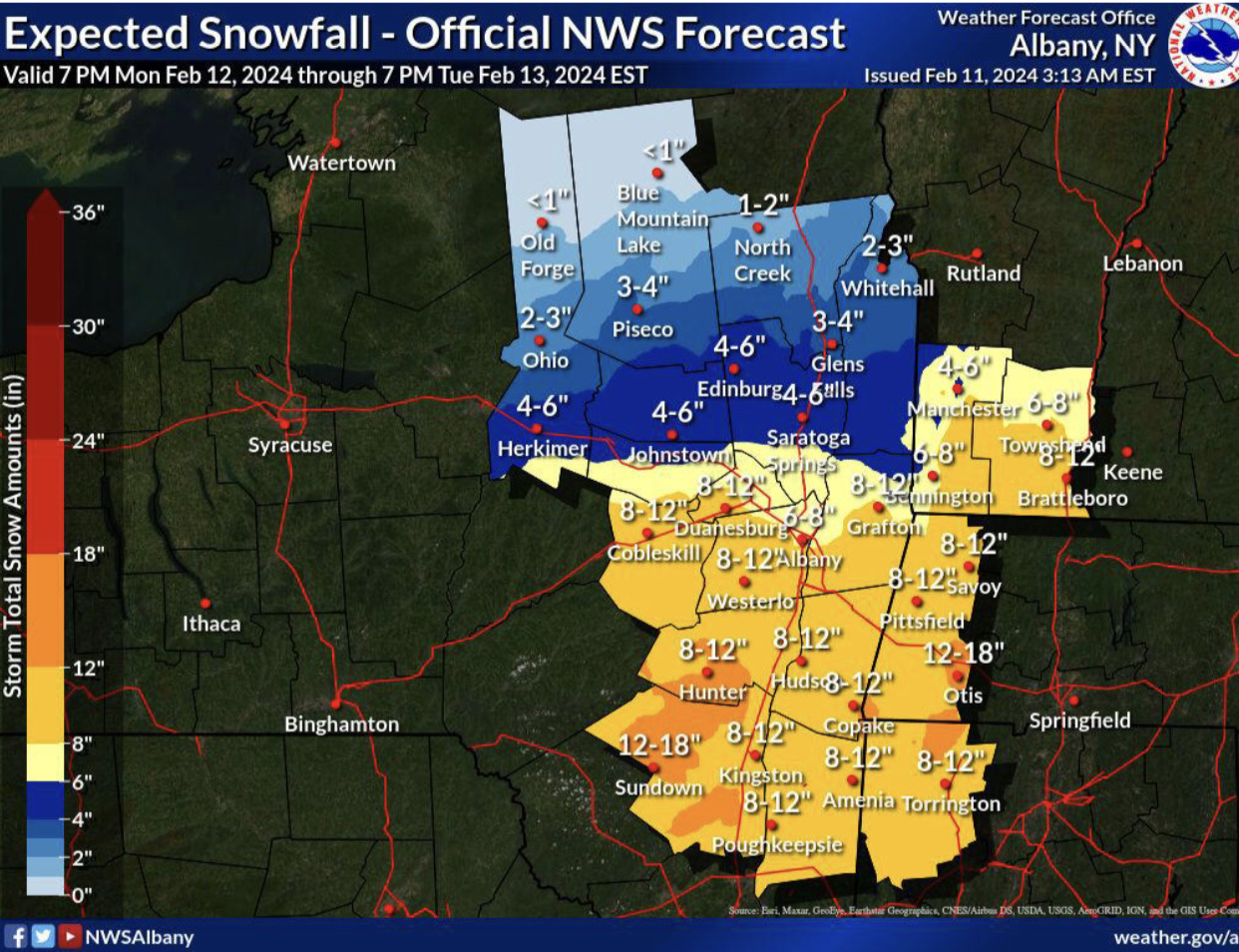
nice AFD... wait for warnings to be hoisted this afternoon!

Deterministic and ensemble guidance(especially GEFS/EPS) have
come into better agreement regarding the significant winter
storm approaching from the central Appalachians and mid Atlantic
region Monday night into Tuesday. Surface cyclone deepening to
~980 mb or even sub-980 mb is expected as the cyclone center
tracks E-NE from near the Delmarva Mon night off the coast to
just south of Long Island and southern New England on Tue. While
still a progressive system, the upper trough is forecast to
become negatively tilted at 500 mb as the storm tracks just SE
of Cape Cod. Significant F-Gen NW of the cyclone should result
in pronounced mesoscale banding. Local CSTAR research from
UAlbany on mesoscale band movement resembles characteristics of
a pivoting band with a closed upper low and dual upper jet
structure. Typically pivoting bands can result in extreme
snowfall. However, the greatest challenge with this storm is the
anticipated relatively fast movement of this system, so extreme
snowfall rates would have to be realized for higher end
accumulations to occur since the residence time will not be as
long as storms with slower movement. Where the banding sets up
will be the location of the heaviest swath of snow, which could
be in the 12+", as evidenced by the high end (90%)
probabilities. The most favored areas are south/east of Albany.
Time frame is still just outside the scope of hi-res guidance,
so mesoscale details such as max snowfall rates will come into
better focus later today into tonight.
-
19 minutes ago, Sey-Mour Snow said:
Canadian still not biting fully, heavy snow up to pike only.. Weird how slow it's been to buy in
I get weary when there's an outlier that is stubborn like that, almost like it's onto something
-
9 minutes ago, HIPPYVALLEY said:
NWS Albany pretty aggressive into S VT. I don’t get it? I’m skeptical.

thinking the pivot sets up around the berks into SVT down to WCT perhaps
-
1
-
-
not sure why this doesn't match the box map fully, has a little 12-18 streak from say Beckett down to maybe Norfolk or me? thought they collabed on these maps... regardless I take
.thumb.jpg.30669582c3750688575aeb2f13305c95.jpg)
-
what's causing the north tics, confluence weakening or the N stream pulling and phasing more?
-
8 minutes ago, 40/70 Benchmark said:
Its a better storm overall with more N stream insert, but its just that the very best shifted north.
we don't want too much more N stream interaction though, could really cause some issues, no? bring it north, but possibly slow it some?
-
looks like a good band from say dxr up to orh, could see some nice lollies in there somewhere where it goes to town with rates... although does appear in line with H7, shouldn't the best lift be just NW of that? that would put it in Berks to SNH
-
1
-
-
it'd be nice to have the airmass that follows this system in place before it gets here for a change, looks like another toe the line temp system, and it's moving, so ceiling ain't too high here, maybe a bit east up through ORH will be better, ALY is weary with pops at this time, don't blame em, within 4 days and still very flip floppy, at least something is there to track...
-
1
-
-
My second all time favorite storm, 78 still holds the top spot because as a kid it was like a crippler for a week, but 2013 I owned a house in Waterbury and was awake almost the whole night, filming and watching the incredible band rotating through...my avatar is that, most intense snow I've ever seen
-
1 minute ago, Ginx snewx said:

seriously starting to think that op is working, this one is everywhere!
-
2 minutes ago, AstronomyEnjoyer said:
Nope!
it's crazy though, what are the odds, he works Flight controls MEFP mainly JSF, at Edwards and PAX, for us and has the same hobbies...if you used to be there, you probably know him
-
4 minutes ago, AstronomyEnjoyer said:
I wish, still hold a TS clearance.
Zach?? I know a guy who has clearance, used to work at Edwards and is into astronomy and photography, very coincidental.
-
4 hours ago, wxsniss said:
For any newcomers looking for great summaries of climate data including monthly / seasonal snowfall:
http://climod2.nrcc.cornell.edu/
Quick eyeball: 1957-58 had one of the best turnaround of snowfalls for KBOS: 6.7" Nov-Jan, then 38" Feb-April. I'm curious what teleconnectors were at play in the switch if anyone knows.
Also, not a formal statistical analysis, but the most prominent trend is just all the higher maxima beginning 1992-93 (incidentally, the year I arrived in Boston, skewing my expectations forever
") ):
):
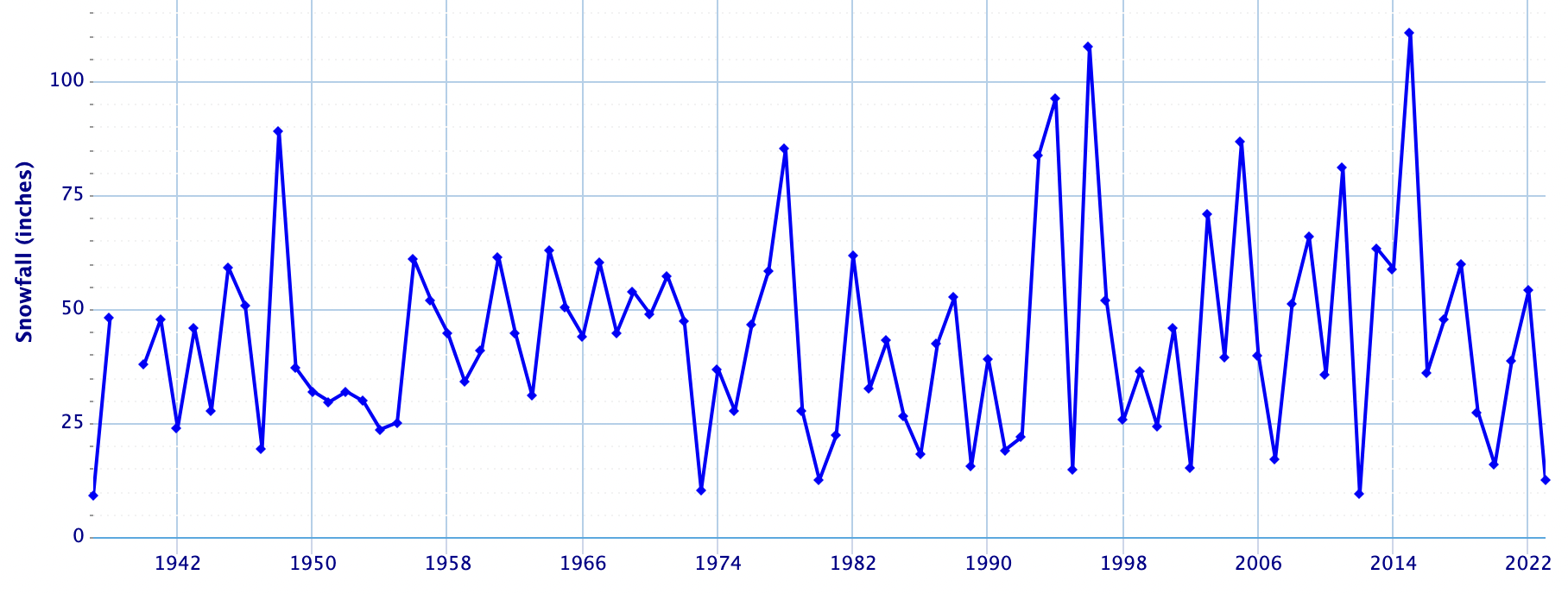
Seasonal snowfall for KBOS:
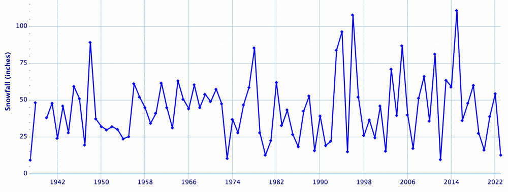
if you go through most of the years, at least for my closest stations, the majority of the snowfall happened from late January to April 1st, the great winters did have a good Dec/Jan... and even some Nov snows, but just at the dozen or so I've looked at, I'd say 70% of the season snowfall happened after 2/1... not saying that'll happen here, but it is a trend... now I've got another project to do, seeing how much fell post 1/31 as a percentage of season snowfall.... that'll be interesting
-
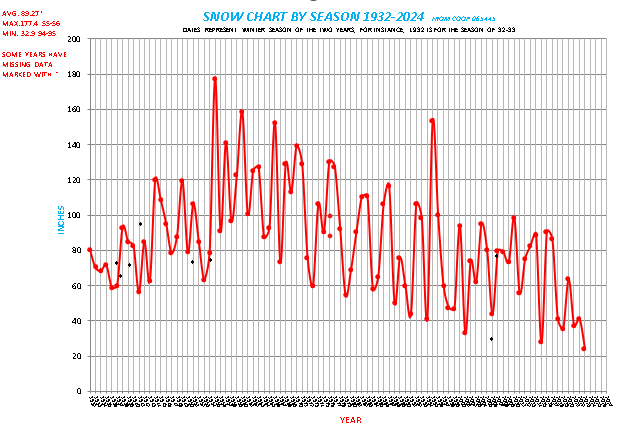
Definitely 50's to early 70's was a great run on winters...I am slowly working on going back to 1878, since discovering some new data, and also working on some temp trends as well as precip.
-
2
-
 2
2
-
-
looks like 30s/40s and basically nothing for a couple weeks, unless something changes, but around Vday looks interesting, but that is a long way out
-
2 hours ago, The 4 Seasons said:
If anyone has any final totals from CT, MA, RI let me know. I got a feeling that additional 1-2/1-3 was probably more like C-1.

total from event, 2.8...it snowed fairly well from about 1800 yesterday to now, still snowing... and it basically melted or sublimated as fast as it fell, so only about a half inch since then...if it was a little colder we'd probably have about 6 out there
-
and just like that it's ripping again, nice band filled in west and moved in
-
1
-
.jpg.5288fc6cdd93c17c44dd260c8d2aeeb8.jpg)


Following a Miller A/B hybrid type coastal potential, Feb 13th ... As yet untapped potential and a higher ceiling with this one
in New England
Posted
such a tough job right now for something that looked pretty locked for a while, and a sig for a couple weeks now, hard job