tamarack
-
Posts
16,409 -
Joined
-
Last visited
Content Type
Profiles
Blogs
Forums
American Weather
Media Demo
Store
Gallery
Everything posted by tamarack
-
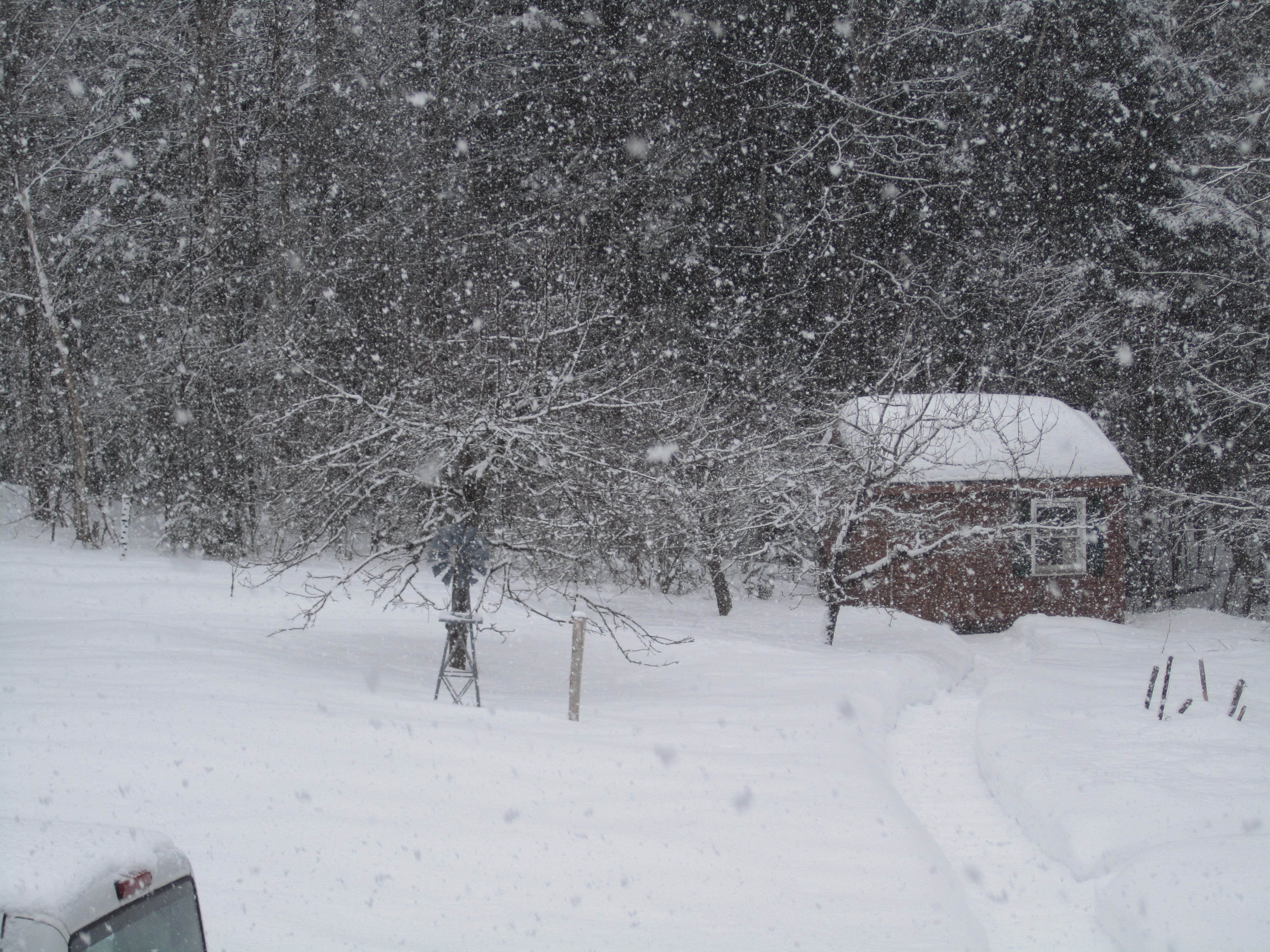
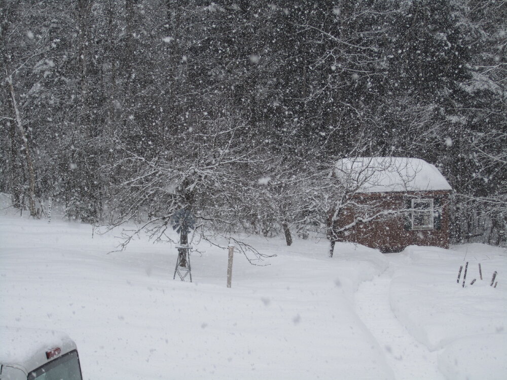
Light wind and 8" here, passing 33" at the stake. Good accumulation despite small flakes and modest ratio. At 4:30 there was <1/4" with lgt snow then S++ 5:30-7:15, probably 4" during that period. Reported 4.7" with 0.44" LE at 7, another 3"+ since then, currently high-end moderate with vis. ~3/8 mile. Was 1/8 mile at 7.
-
P&C for my area currently is 6-12; the issue here is a sharp qpf cutoff as temps should be fine. The 90/50/10% totals for Farmington are 5/9/17, a wide span for about 12 hours before first flakes. However, just 65 miles north in Jackman those numbers are zero/3/7. Would only take a relatively small wiggle to create a bust - in either direction. I'm glad I worked with trees, as they tend not to move around as much as snowfall bands.
-
Not always bad - Jan '15 dumped 20" of that stuff on our driveway, 9:1 snow at single-digit temps. (Not that the coming event bears any resemblance to that monster.)
-
Cat 4?
-
Odd little 2.7" storm yesterday, but nicer than the forecast 2 days earlier - snow-to-rain and 40°. Snow became light bout 11 AM, beginning a 6-hour period of continuous snow with no accumulation, including 2 hours of lovely nickel-dime feathers 12:30-2:30. Had the temp during those hours been 20s rather than 32-33 (and if it was January not March), we'd have gotten about 2" more. Towns just to our west - Farmington and Temple - had 4-6" but maybe not as pretty as here.
-
Saw noon news snow maps on 2 channels. Both had 8-12 as tops and for much the same area. However, one had my area centered in the 3-5 color while the other had us in the middle of 5-9. GFS vs. Euro?
-
Last bit of decent echoes about to move away here. Pic taken 10:45 this morning. May reach the low end of the 3-5 forecast though it's settling as it falls.
-
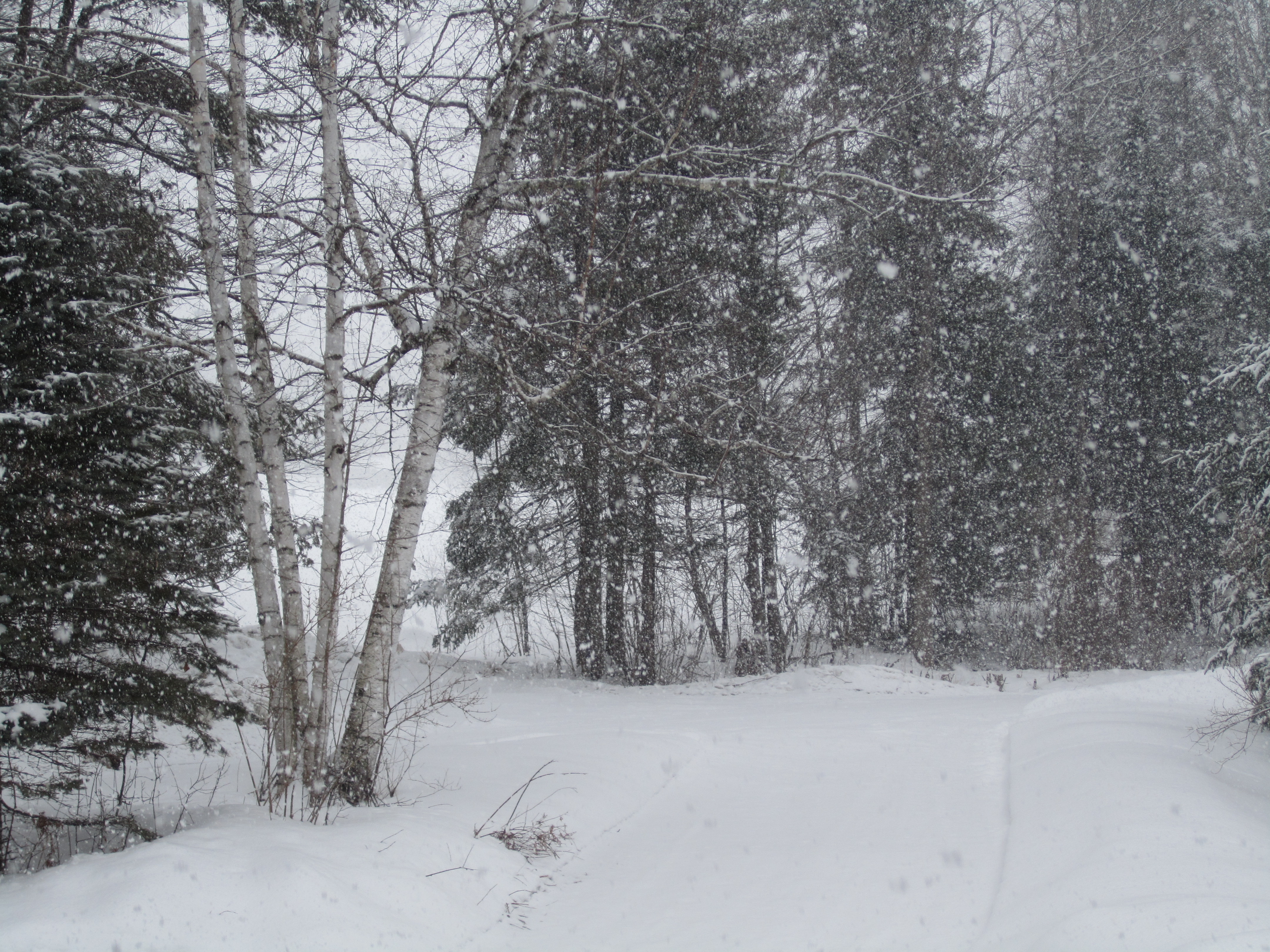
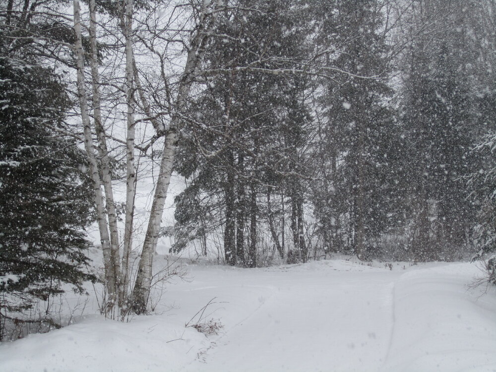
Wet snow equals grabby slush piles and when packed it behaves like Crisco. 2" here. Snow had become very light until a good band about 10:45. The view beyond the birches is about 1/4 mile, and the trees across that field are barely there.
-
Mildest DJM here, only 25 years POR and just 0.2° above 15-16. March 16 was +3 so if this month is +2 or cooler the DJFM (the snow months) record stays with 15-16.
-
Not winter's biggest (It's currently 3rd) but perhaps the nicest to clear since the 8.0" had only 0.51" LE, ratio 15.7-to-1. 22-23 is now ahead of the previous 2 winters (52.5, 67.1) with 73.3". Maybe we break the 3-winter run of BN snow? Only need about 15" more. February 2023: Avg Max: 30.4 +1.2 Highest: 49 on the 16th Avg Min: 8.0 +1.8 Lowest: -22 on the 4th, also lowest max at 1°. Avg Mean: 19.2 +1.5 Precip: 1.73" 1.32" BN Most in a day: 0.39" on the 28th. Snow: 16.3" 6.3" BN Most: 6.5" on the 28th. Have not had all 3 met winter months AN since 2008-09. Avg Depth: 21.1" 1.7" AN Ranged from 19" mid-month to 27" as the month ended. The month was characterized by frigid wx at start and finish but substantially AN temps between. The Arctic blast on 3-4 set some WCI records, in particular at MWN. The other character was a bunch of tiny to small snow events during the first 27 days - 9 separate events totaling only 9.8" with none greater than 2.5". Temp whiplash: 1-7: 6.3°, 9.1 BN 8-22: 29.1°, 10.9 AN 23-28: 9.7°, 11.3 BN
-
Exactly - for about 20 hours.
-
1.5" between 9 PM and - 1 AM? Total is 8.0" with 0.51" LE, 15.7-to-1 fluff. Now 28" at the stake, will probably settle 2-3" by this evening.
-
Approaching 4" with moderate snow and mid 20s, should easily hit the 5-9 forecast, nicer than the recent bunch of underperformers.
-
1/2" of 25:1 fluff at 7 AM, currently lgt SN with about 1". Latest P&C adds up to 5-9" but we remain in the advisory color. Farmington's "most likely" is 7" which is an inch below warning criteria in the foothills/mountains. NNJ town where I grew up reported 6", probably tripling (or more) their season total. Unfortunately, the grandkids in SNJ had only RA with maybe a few IP at the start.
-
That was my ratio, too, but only 0.02 LE. Temps month have run in 3 streaks: 1-7 were all BN, avg 9° BN; 8-22 had only one BN day and averaged 11° AN; 23-27 thru today with its -12 low is running 13° BN and tomorrow's probable near-average will make the month's final 6 days about -11. Month should finish 1-1.5° AN.
-
Feb 28th-March 1st long duration Miller B threat
tamarack replied to George001's topic in New England
We'll take high-end advisory - Farmington most likely is 6". Forecast is 4-8" where I grew up in NNJ, which would quintuple season snowfall there, but zero for the grandkids in SNJ - both storm and season. -
Only 0.4" here but it finished with nice dendrites that really sparkled this morning. Now at 65.3" which is an inch BN for season to date. The 22" dump in Dec pushed the yearly average to 88.6". Feb will finish well BN even if we get 6"+ tomorrow - currently at 9.8" while avg is 22 - but early March offers some good prospects.
-
Forecast was for only 1", received about 1/4". Nine snow events this month and still <10" total
-
Cloudy since 10 AM but subzero dews are eating anything that falls.
-
Feb 28th-March 1st long duration Miller B threat
tamarack replied to George001's topic in New England
Maybe. In 2007-08 we had 12 such events that totaled 44". -
1973 was one of the weirdest storms I've experienced, a coastal that dove inland as it reached Maine. While much of western SNE was in the dark listening to trees being destroyed, and my parent in NNJ had light sleet and low teens, in BGR we had 3" rain and mid 50s. 98 wasn’t a big deal here I don’t think. (From Hubb Dave) That system had one of the most interesting south to north gradient: NYC area had moderate RA and 50s-60s. SNE had cold RA with 30s-low 40s. Southern Maine had a moderate ice storm and low 30s. Central Maine and inland Downeast had their worst ice storm on record, temps upper 20s. Foothills/Mountains had moderate ice and loads of IP, temps low-mid 20s. Aroostook had 5-6 days of modest (9:1) ratio SN, 18-27" total with temps from singles to low 20s. Our two-act snowfall was a double bust, mainly due to lack of qpf. Discussions had qpf at 0.5-0.75 for #1 and about half that for #2. We had 0.17" and 0.12" respectively, thus 2.5" from a 5-9 forecast and 1.3" from 2-4, for a total of 3.8" with combined forecast of 7-13. Consistent underperforming is not the pattern we prefer.
-
My winter grades include temp and snow, with the latter double-weighted, plus some subjective (of course!) for things like retention. Assuming no accumulation between now and tomorrow evening, snowfall to date is precisely on the average, thus a C grade. However, the 22" dump in Dec is the 3rd biggest snowfall in our 25 years here and 5th place for all 50 years since moving to Maine, so that moves the snowfall grade to B. A 30" dump would make it an A even if there wasn't another flake this season. (That would make for a 107% snow season, which normally would rate only a C+.) The temp grade right now is F - DJM will eclipse 15-16 for warmest - but may go up a tick thanks to the frigid howler 3 weeks ago. Pack is running slightly AN so far and having a bit (1") of cover while the snow-loving grandkids were here over Thanksgiving is another plus. I think they've seen about 10 flakes this winter in SNJ, if that much.
-
I feel the same about 1998, especially since it was precisely 45 years from the NNJ ice storm that piqued my interest in both weather and trees.
-
Afternoon max was 13-14" and it's down a couple from that, but the max will be the 24° from 9:01 last evening. 9 hours of occasional S-- since 7 AM has failed to produce measurable snow, but it picked up a tiny bit in the last few minutes. Radar makes the current echoes look more like a forerunner of the evening event than part of last night's snow.
-
Feb 28th-March 1st long duration Miller B threat
tamarack replied to George001's topic in New England
Folks in Lake Wobegon. Overnight event was forecast for lesser amounts in southern Maine, more in central, but verified just the opposite. GXX afternoon discussion leans toward more snow for the southern half of its CWA for Tuesday as well, though the trend might move it right out of the state. 4 days out, so who knows?