

Baroclinic Zone
-
Posts
47,702 -
Joined
-
Last visited
Content Type
Profiles
Blogs
Forums
American Weather
Media Demo
Store
Gallery
Everything posted by Baroclinic Zone
-
Can’t recall multiple days like this with the persistent fog.
-
Nah. 2-20”+ storms a season has been pretty common here over the last 2 decades.
-
It’s NYc. Winter ended there a month ago.
-
Melt it all. Probably lost 18” or more so far since storm.
-
36/31 lets melt this all away
-
Nice synopsis. Forgettable event for me living in Middleborough at the time.
-
56F
-
Torchy out there. 51F
-

2025-2026 New England Snow Recordkeeping Thread
Baroclinic Zone replied to bristolri_wx's topic in New England
Here’s what I came up with for my seasonal total.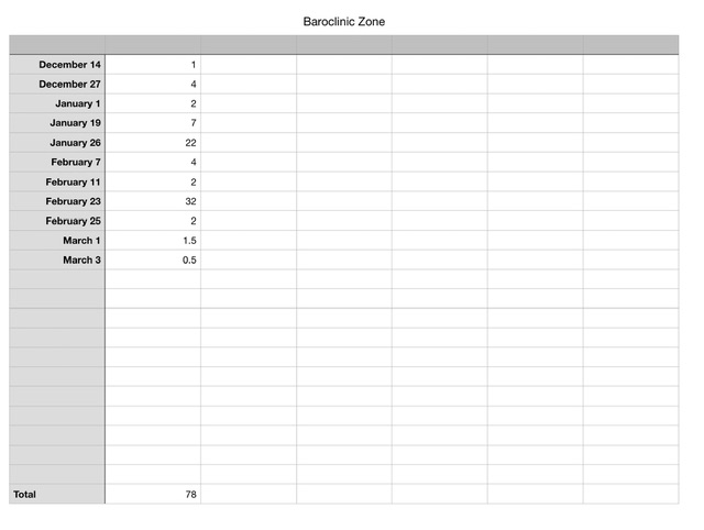
-
About 1/2” of snow/sleet here before transition
-
Yeah, he lived here when he was working at BOX. I picked him up on way to airport when we were heading to one of the Conferences.
-
Attleboro
-
78” here.
-
@dendritebut I don’t want , you can have it.
-
Yeah @CoastalWxwas not expecting this here. Thought a coating would be it. Radar did light up as this moved east. Maybe some influx of southerly flow kicked this up some. Will be in line with @ORH_wxman total here when alls said and done.
-
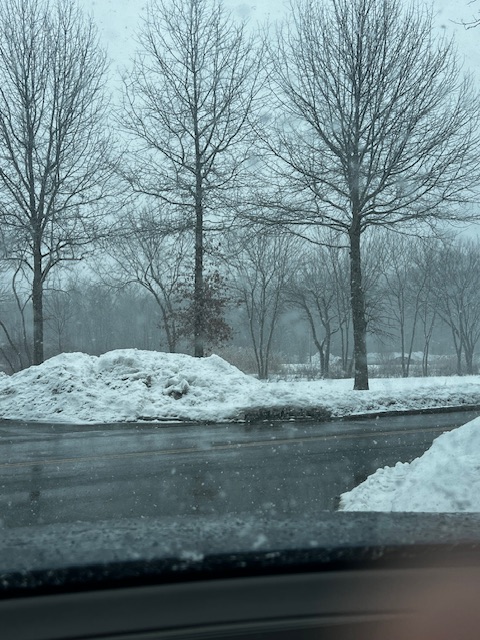
It’s been pounding here for the last hour. Over 1”and still falling moderate/heavy.
-
Crap. It’s snowing.
-
Who is/was saying 70s for here? 60s are a legit possibility. Models doing what models do in transitional periods, Some read the tea leaves and some smoke them.
-
You just contradicted yourself when you supported Will. He’s also talking about a torch next week, not this week.
-
I’ll take 50s in early March. That’s a solid +10 margin for the area.
-
2 to 3 more than I’ve seen.
-
Because is a snowfall graphic, which are POS in general, have no basis in real meteorology, are notoriously south of where actual snows are, and lastly will perform even worse than they already do during transition season when snow ratios tend to be lower.
-
Did Rev check his calendar? It’s March 1st. Winter is over.
-
Is we back? February discussion thread
Baroclinic Zone replied to mahk_webstah's topic in New England
51 -
Is we back? February discussion thread
Baroclinic Zone replied to mahk_webstah's topic in New England
Can go out without a coat in this weather. Gorgeous outside


