Doorman
-
Posts
1,582 -
Joined
-
Last visited
Content Type
Profiles
Blogs
Forums
American Weather
Media Demo
Store
Gallery
Everything posted by Doorman
-
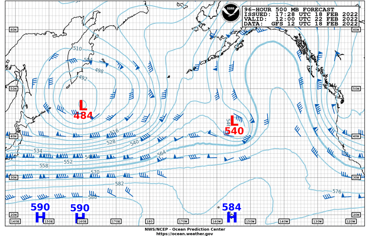
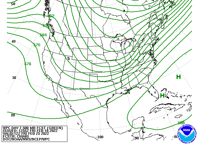
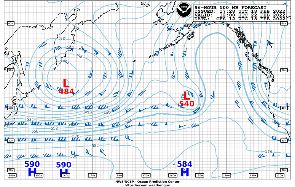
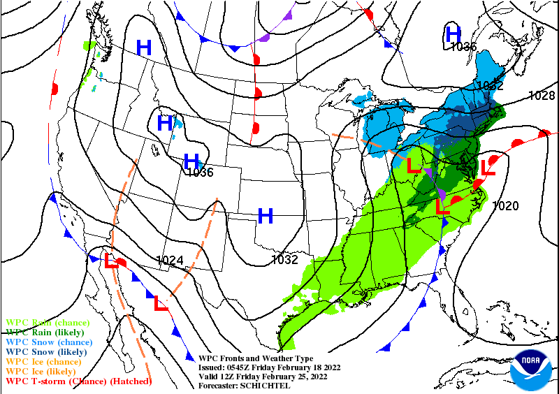
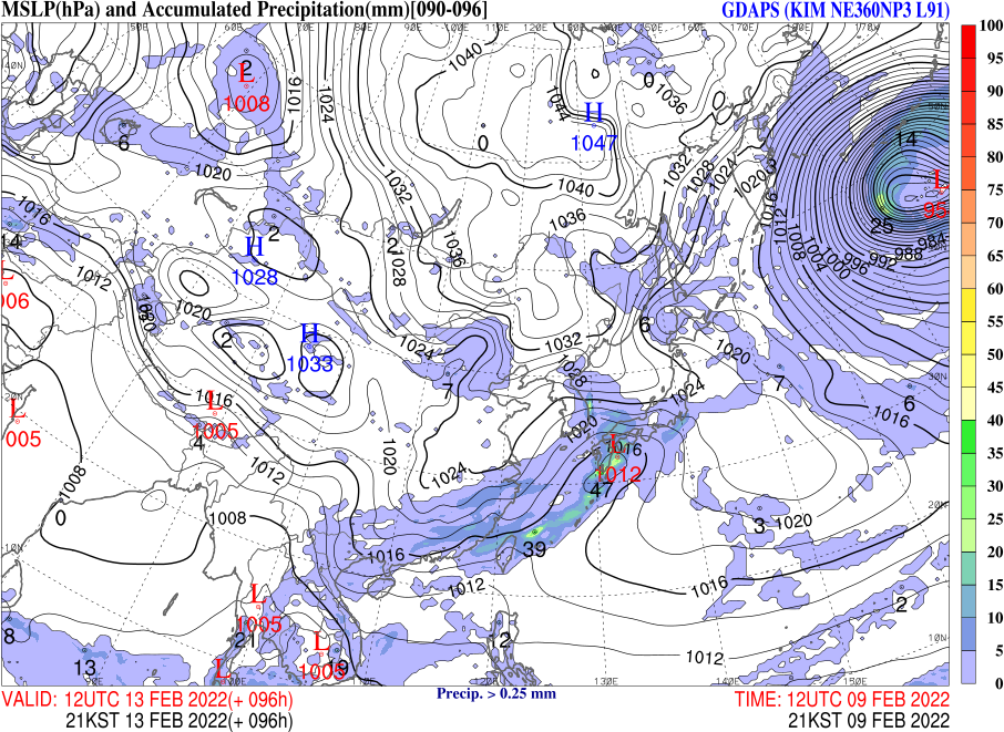
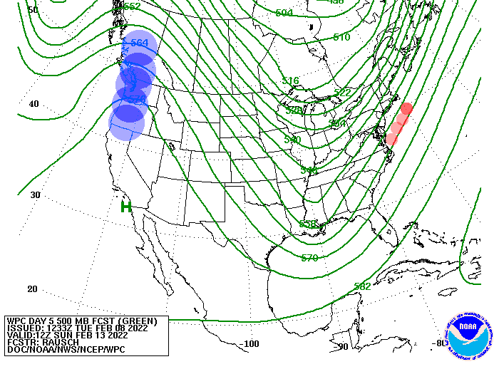
lets take a southern slider track out of the mix (ATM) crazy azz west coast ridge is a solid bet for starters-imho 96 hr OPC (four day) prog clues us in with some validity
-
I misplaced my Etch A Sketch......... Big picture .......old man winter has some cards on the table---or up his sleeve????
-
Excuse me 19...does your mother still make your bed????
-
thread starter

-
Timing is everything as usual HV love these -battle zone - type systems always a big upside imho , within the small scale parameters
-
because we track...and take the smack the takeaway....look at how far south the snow line progresses!
-
Snow Signal Alert can you see the possibilities here???? weenies will be up late this week

-
2/13 Light/Moderate Snowfall Nowcasting & Observations
Doorman replied to Northof78's topic in New York City Metro
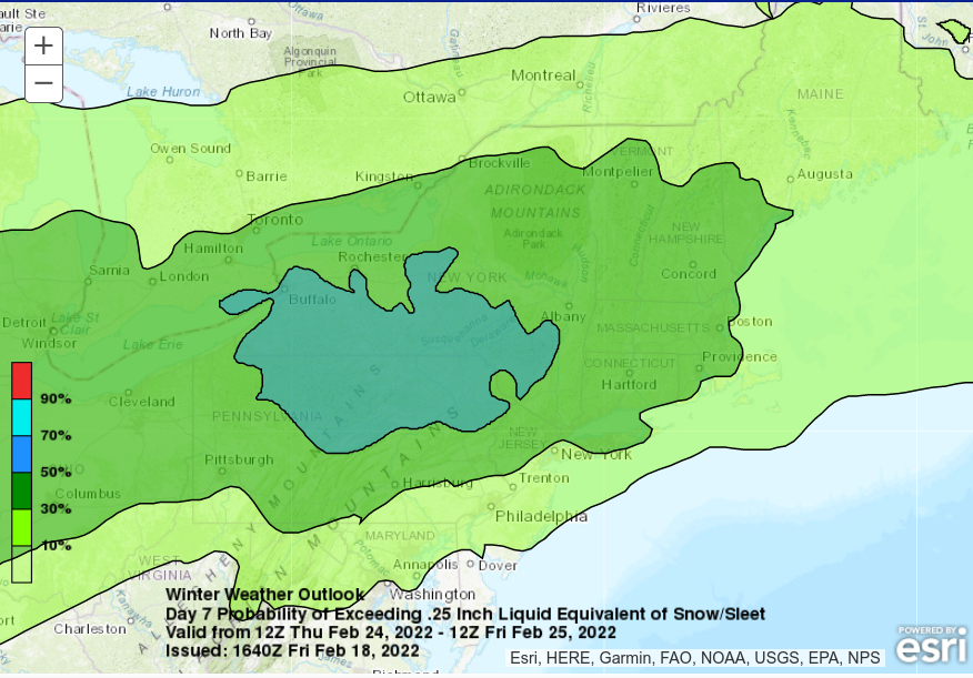
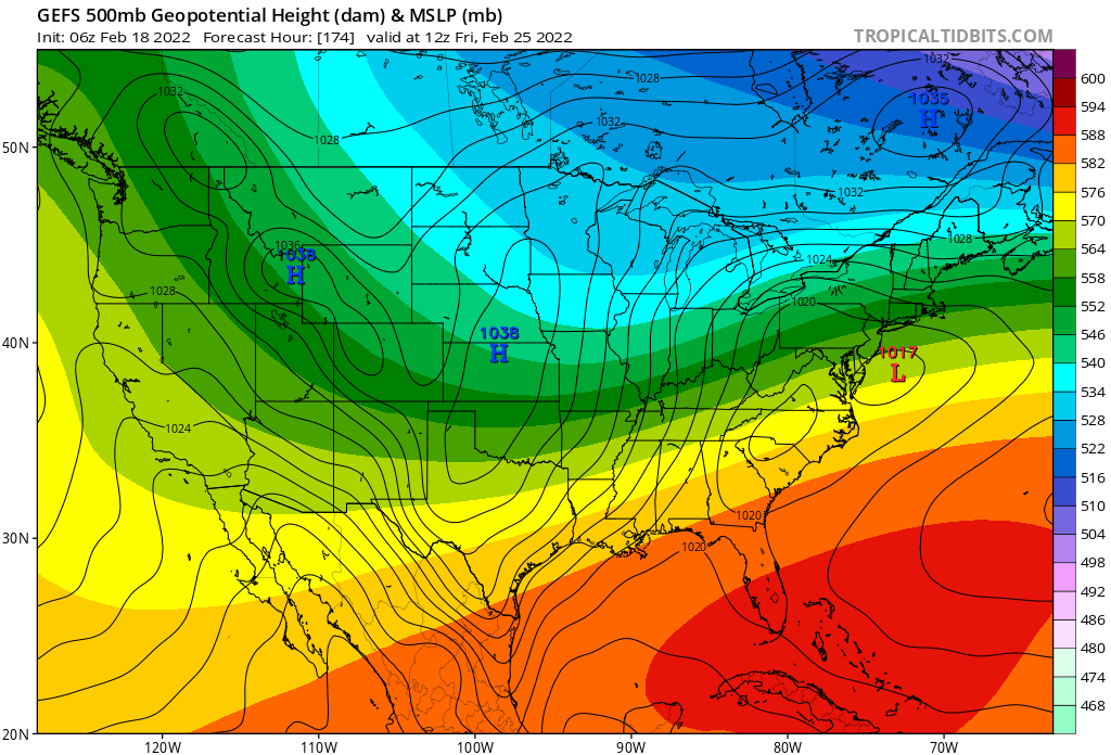
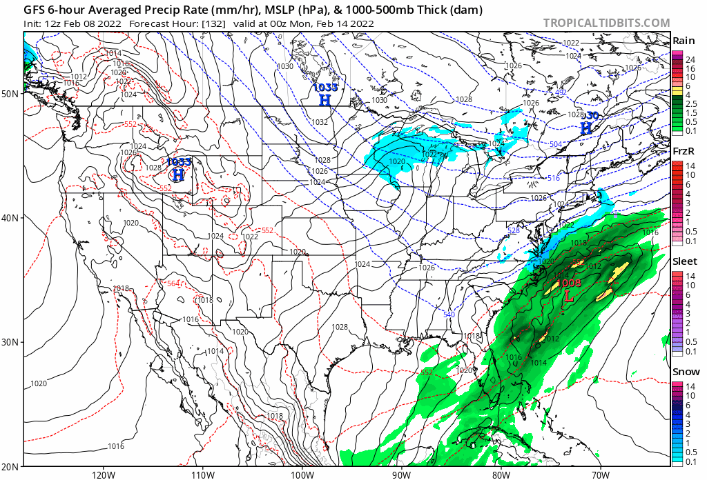
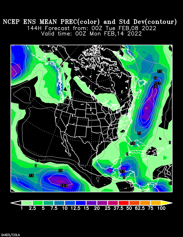
Sunday morning the southern stream energy will begin to eject east and then northeast ahead of the approaching mid-level low pressure. Simultaneously, the upper level low will be approaching from the west with guidance being fairly consistent on FGEN forcing developing Sunday morning. The sloped ascent appears to setup from southeast NJ to eastern PA. The latest run of the GFS and ECWMF have most of the QPF across central NJ Sunday morning while the CMC has the QPF over eastern PA. The other item of related interest here is the development of surface low pressure off the NC coast Sunday morning. The CMC keeps the mid-level low closed off longer and less progressive, allowing for a slightly deeper and further west surface low. Guidance is also showing another wave diving southeast out of south/ central Canada Sunday afternoon. This would favor a slightly more progressive pattern. Taking a look at the latest GEFS/ EPS/ and GEPS, a slightly more progressive pattern appears favored at this time. The precipitation- type for this event will likely be all snow as thermal profiles rapidly cool Sunday morning. I will channel Roger Staubach today.....well just because anyone gives a dang ======= ...Mid-Atlantic/Northeast... Day 3... Digging 500 mb shortwave trough over the Mid-South Saturday evening will move through the Southeast by early Sunday near the entrance regions of the northern (130kt) and southern (110kt) jet. Frontal boundary along the coast may focus an area of low pressure that tracks along or just offshore that would spread precipitation back across portions of the region. There continues to be many uncertainties ranging from track, phasing, and intensity as well as thermal profiles as the precipitation changes from rain to snow. For now, the greatest probabilities for 2 inches lies over the central Appalachians/Blue Ridge in VA (20-40 percent) while lower probabilities of 10-20% exist through the Mid-Atlantic to southern New England.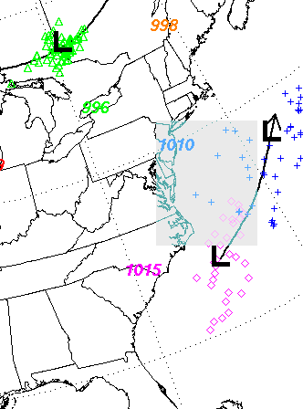
-
betcha no one will even notice Bell but take a look at this.... think I see a few Olympic careers that washed away, in there
-
If we tele-connect to the korean model on sunday a bomb cyclone on the east coast is most likely then???? she is a beauty ,wherever that is
-
2/13 Light/Moderate Snowfall Nowcasting & Observations
Doorman replied to Northof78's topic in New York City Metro
who is jim cantore???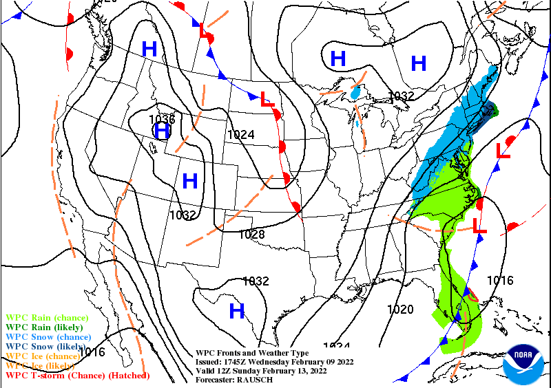
-
last 5 runs

-
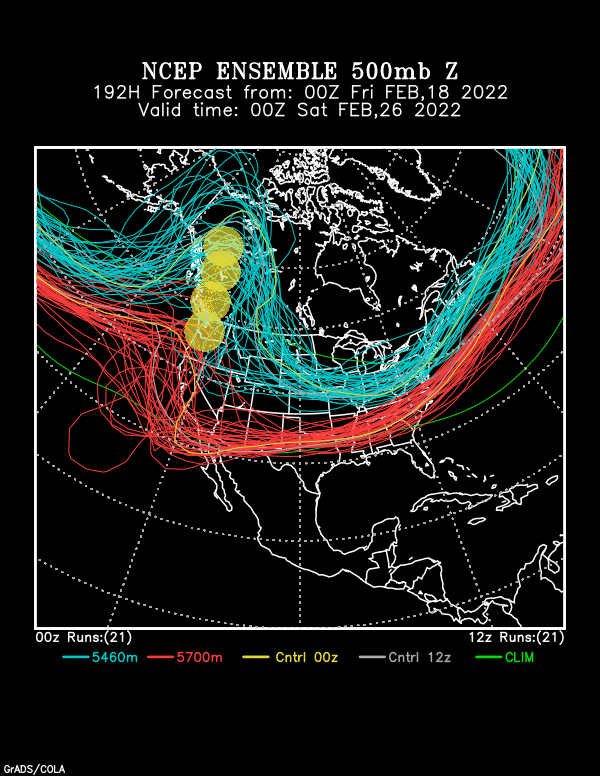
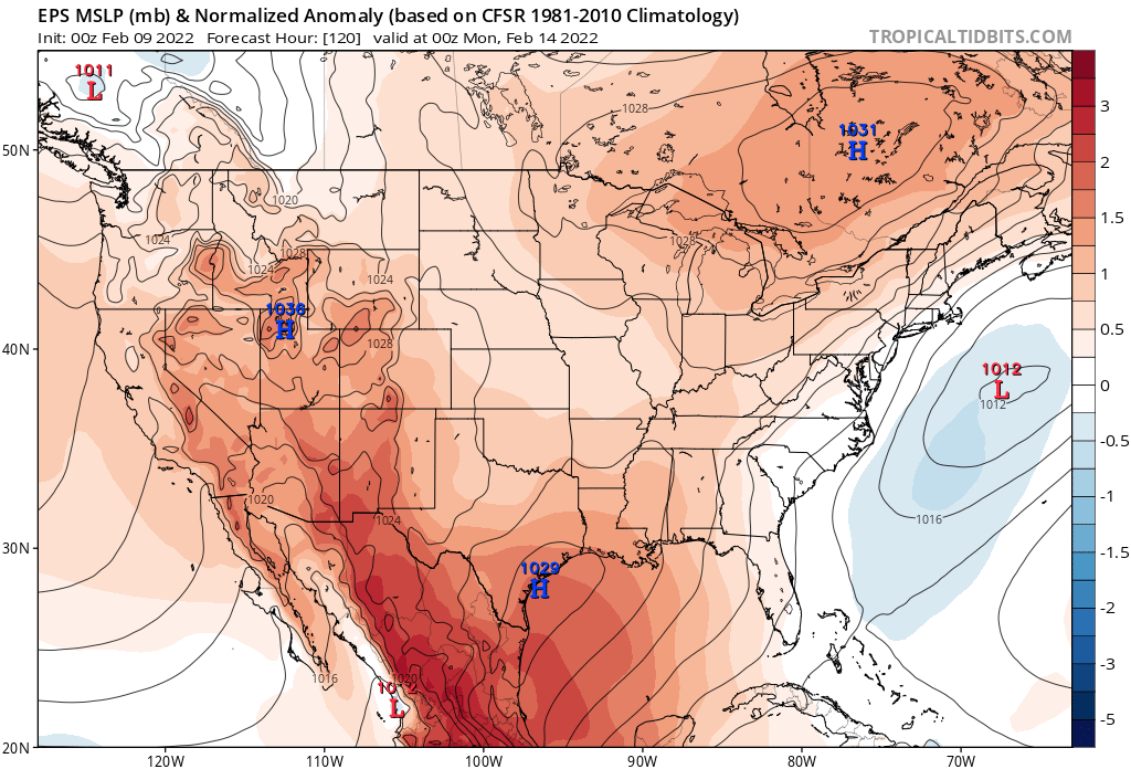
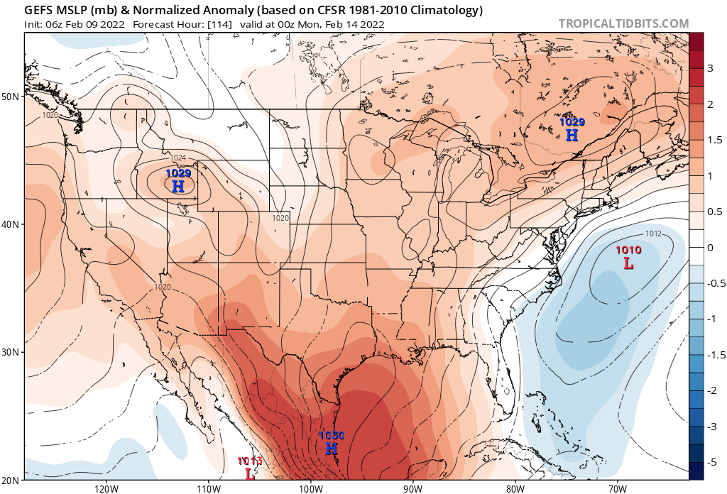
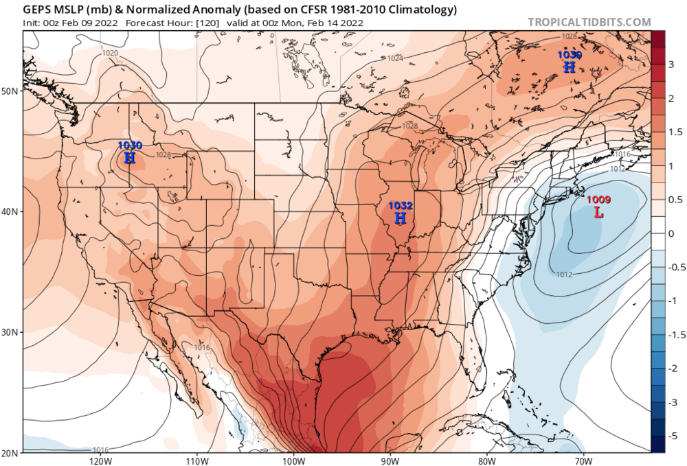
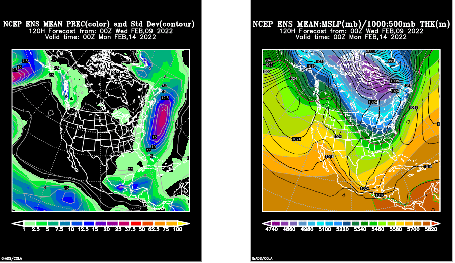
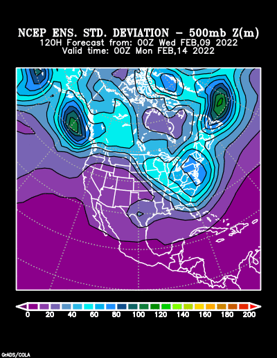
the big three ensembles EPS GFS GEPS that's all folks


-
Cold*** Stormy*** how much snow in your backyard- TBD
-
here we go...... left lean smell the dendrites
-
lets start a thread for this I will call the crew on here at this moment the lucky 13...you saw it first snowstorm on the way!!!

-
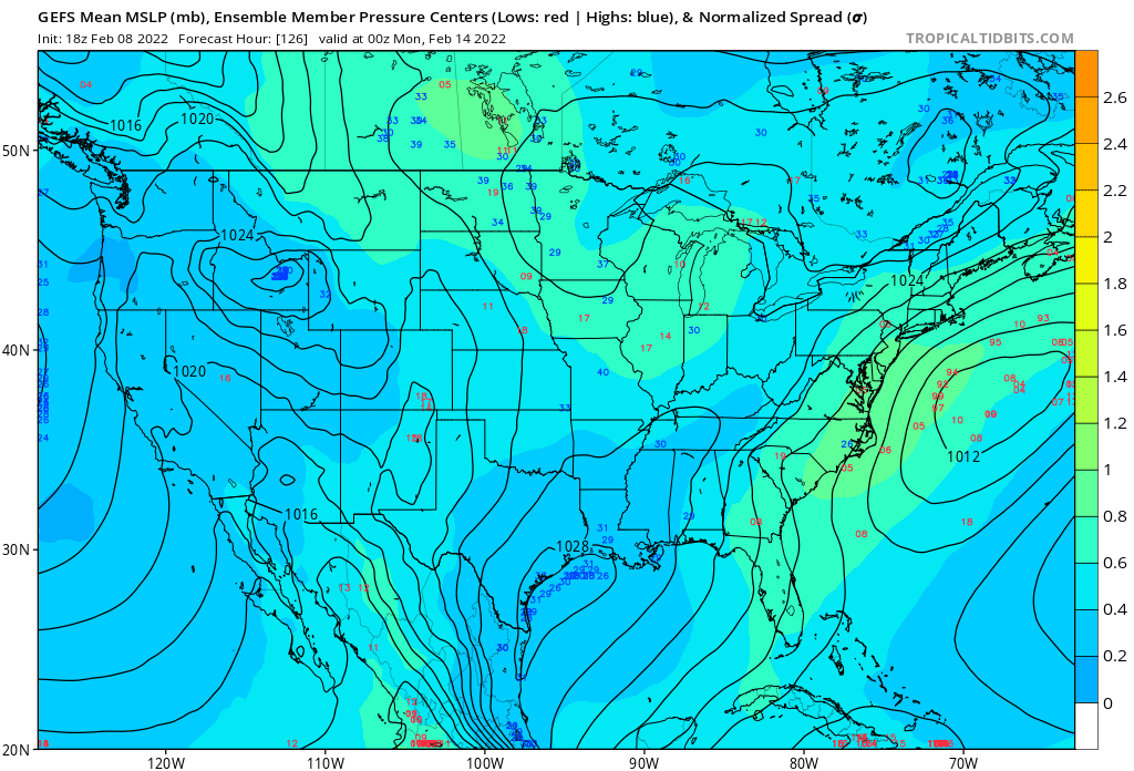
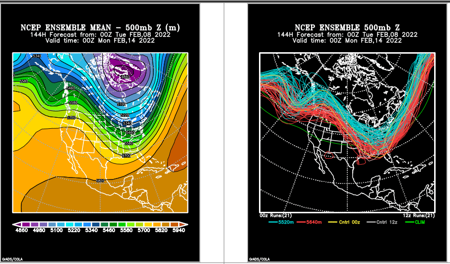
I think we have enough data here atm...to keep things interesting on Sunday Night love the chaotic spaghetti chart let's see

-
cold rain---
-
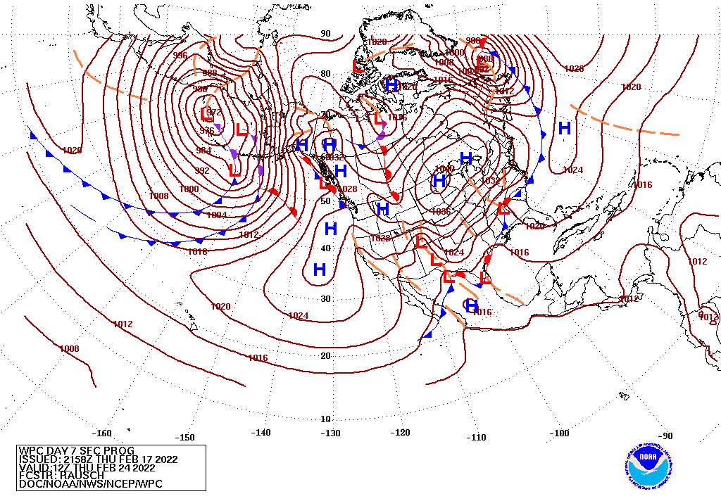
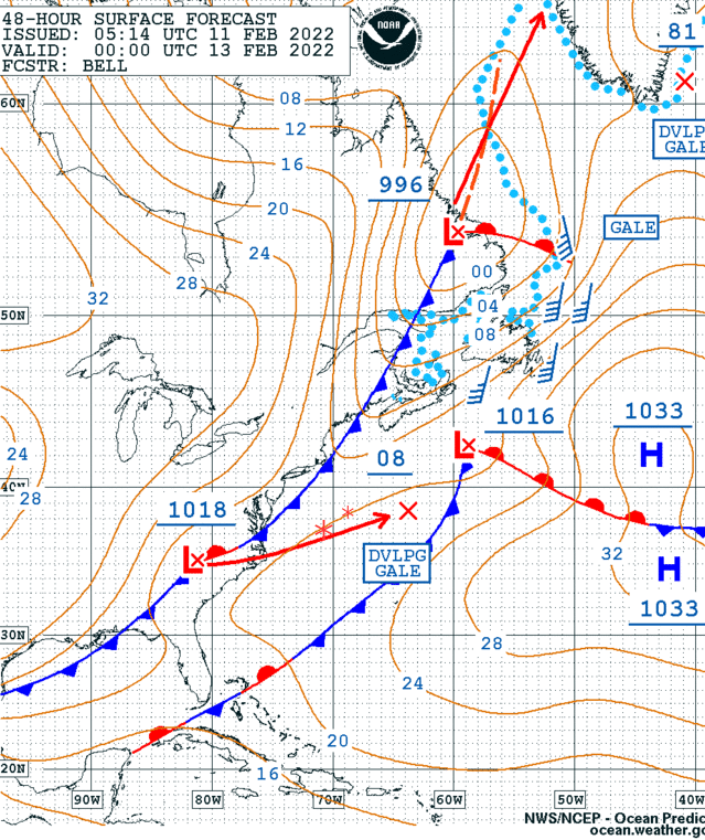
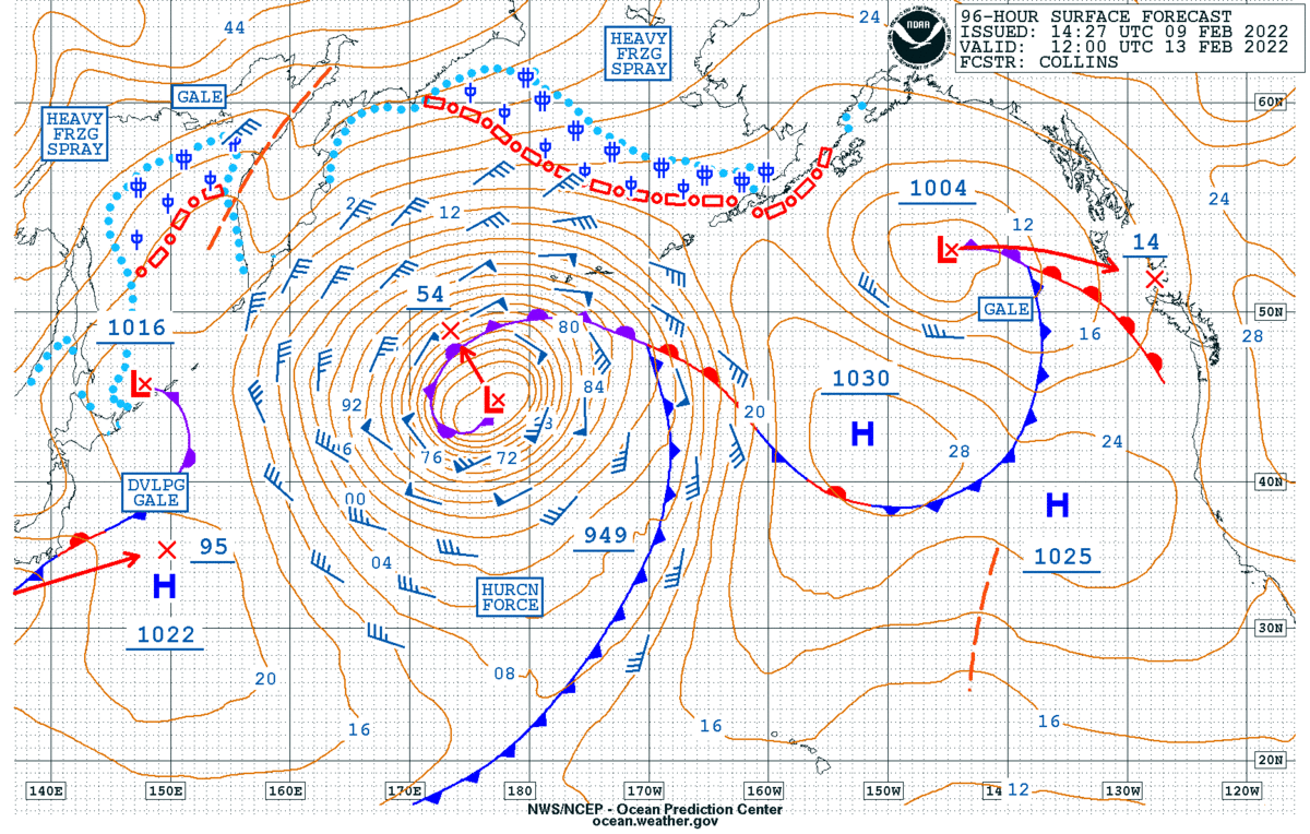
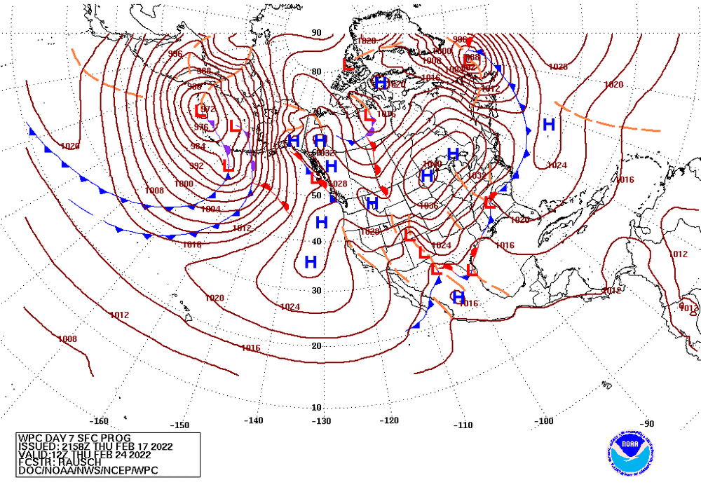
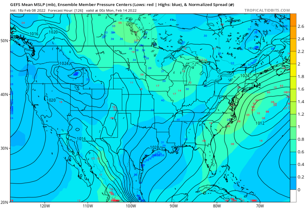
The OPC surface prog may give you an idea why the warmer solutions are in play Dual Lows on the front if you are smart enough to login to the forum you are smart enough to make your own forecast -imho or just follow the smart ass poster you trust
-
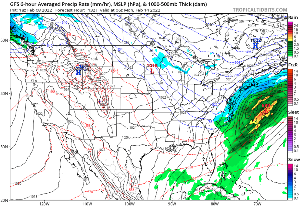
Current Critical Thickness Prog & Intellicast Rain/Snow Radar Overlay matches up nicely... I think most of the metro will warm sector until the bitter end -link to radar for those on the fringe - https://www.wunderground.com/maps/radar/current spc meso https://www.spc.noaa.gov/exper/mesoanalysis/new/viewsector.php?sector=19&parm=pmsl#