Doorman
-
Posts
1,582 -
Joined
-
Last visited
Content Type
Profiles
Blogs
Forums
American Weather
Media Demo
Store
Gallery
Everything posted by Doorman
-
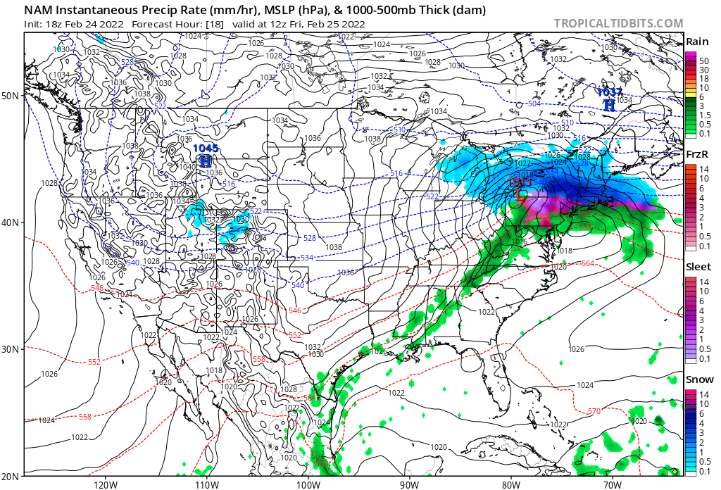
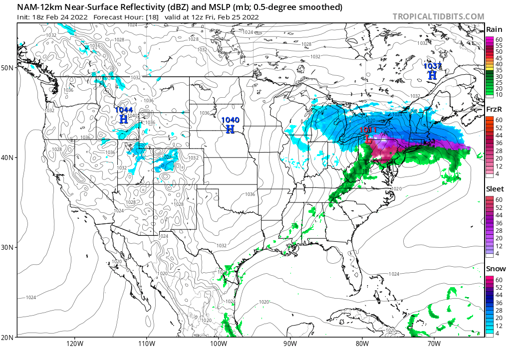
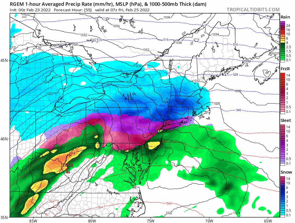
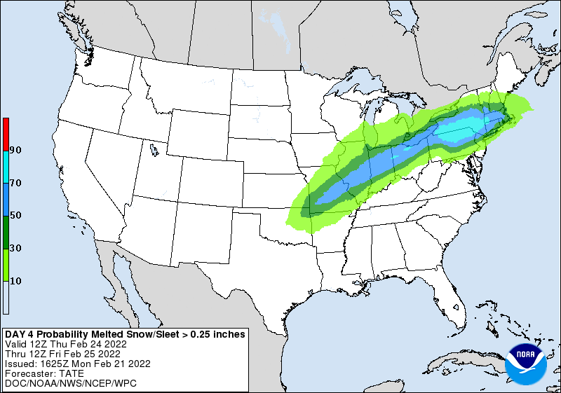
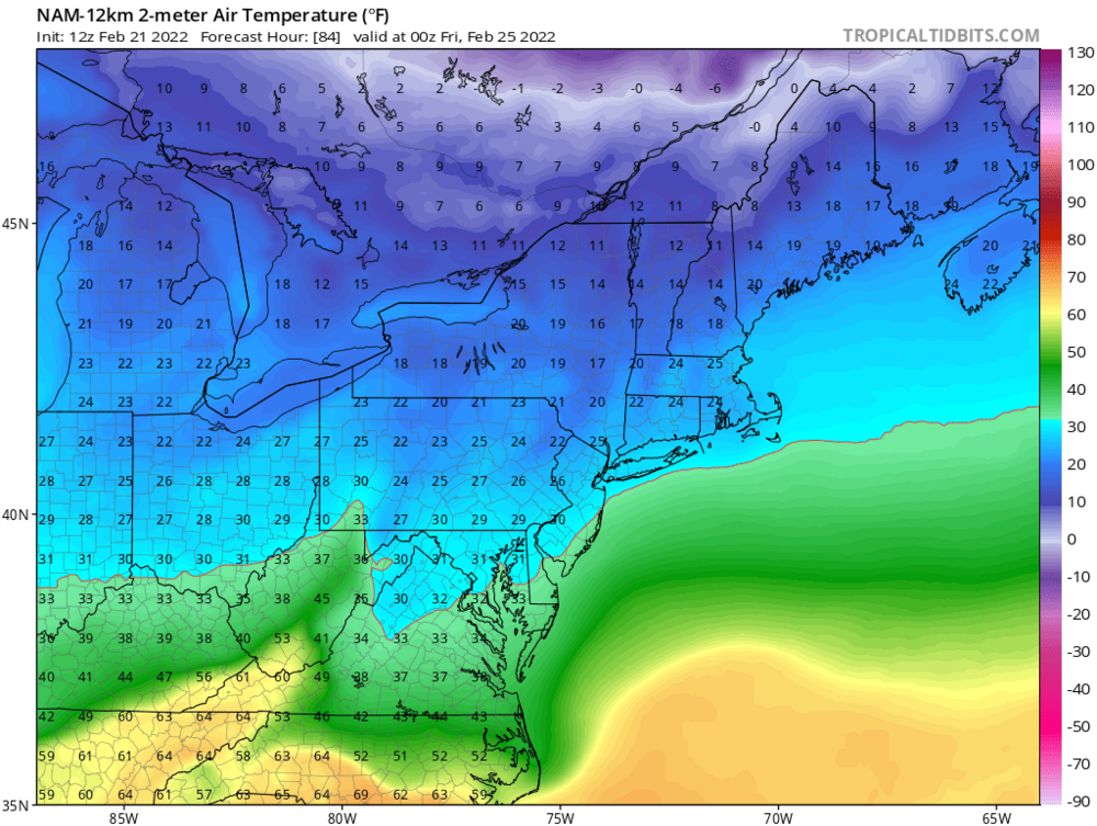
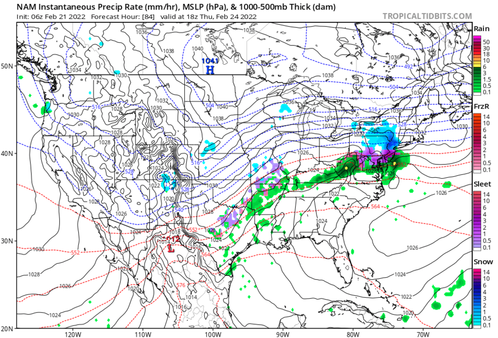
mt holly disco With the primary low tracking to our west, warm air advection aloft will occur over our area. And with a strong parent shortwave and potent southwesterly LLJ ahead of the low, warm advection will be quite strong. However, a strong center of high pressure to our north will help keep colder air entrenched near the surface. We`ll also see some evaporational cooling effects once steadier precipitation moves in. The eventual development of the secondary low will also act to back the winds and attempt to draw cooler air into the region north of the new low. Trends in today`s guidance were generally warmer with the overall evolution of the storm, especially aloft. The NAM has been leading the charge in this camp, and while it may be a little too aggressive bringing in the warmer air aloft, the other guidance seems to be playing catch-up to it. With the strong shortwave and good jet dynamics in play, it makes sense that the primary low would track a little further west (more amplified) and lead to stronger warm advection. However, there was less change in the surface temperature forecast, as low level cold is always very difficult to dislodge, and a prolonged period of wintry precipitation is still expected. The end result was less snow and more sleet in the forecast, and still several hours of freezing rain for many areas as well. https://forecast.weather.gov/product.php?site=PHI&issuedby=PHI&product=AFD&format=CI&version=1&glossary=1&highlight=off
-
warm nose in T-12hrs
-
not for snow-bunny 19 nowcast banding ftw

-
who says you can't be in two places at one time.....
-
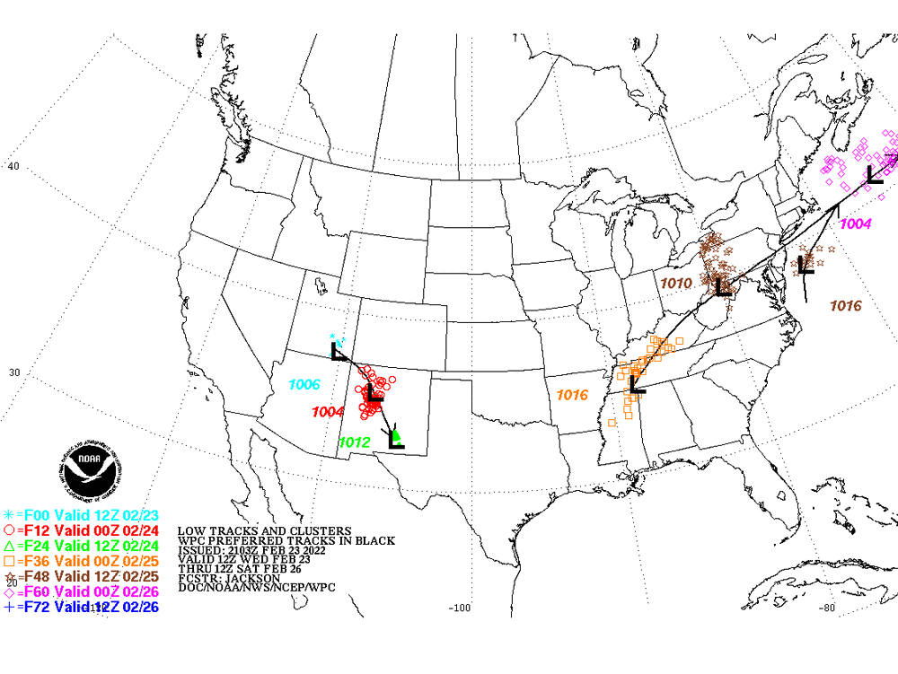
NAM is still synoptically very different from other guidance...it is tracking that vortmax NORTH of Lake Ontario....nevermind over it. If it is wrong with that, then it's going to bust too warm. It's not "Sniffing out a warm layer" like we sometimes see in these events when they all agree on the synoptics. The NAM is literally about 75-100 miles north of other guidance on the vort track and that makes a huge difference. ORH_wxman Moderator Meteorologist
-
The ely component llvl flow will aid in changing LI and NYC to rain during the day on Fri. A significant concern on the mesoscale is whether a strong cstl front develops, particularly with low pres deepening s of LI, allowing winds to stay backed more to the n, locking in the cold air at least at the sfc. Unless there is a big change in track however, the mid lvls should warm up enough for a changeover from snow for all of the area. A Winter Storm Watch has been issued for the nrn tier for roughly 4- 8 inches of snow. Elsewhere, the event looks advy lvl, but there is some wiggle room if the storm tracks a little further south. Will include the non-watch areas in the hwo for now. The amount of icing/sleet looks to remain blw warning lvls regardless of any change in track or the cstl front, so the main challenge for headlines is how much snow falls on the front end. In addition, parts of LI, especially the forks, could forgo most of the sleet and fzra and go directly over to rain with the ely flow off the ocean warming the bl. spot check guidance

-
EPS trend prog
-
https://psl.noaa.gov/map/images/ens/spag_f120_us.html Persistence Forecasting----
-
and at the benchmark the next run????
-
euro pops a coastal low ......more changes ahead
-
biggest euro run of the season up next....
-
how much of a shift do you need for your backyard????? stay with it........
-
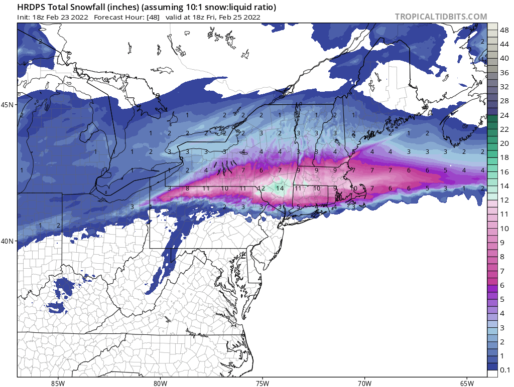
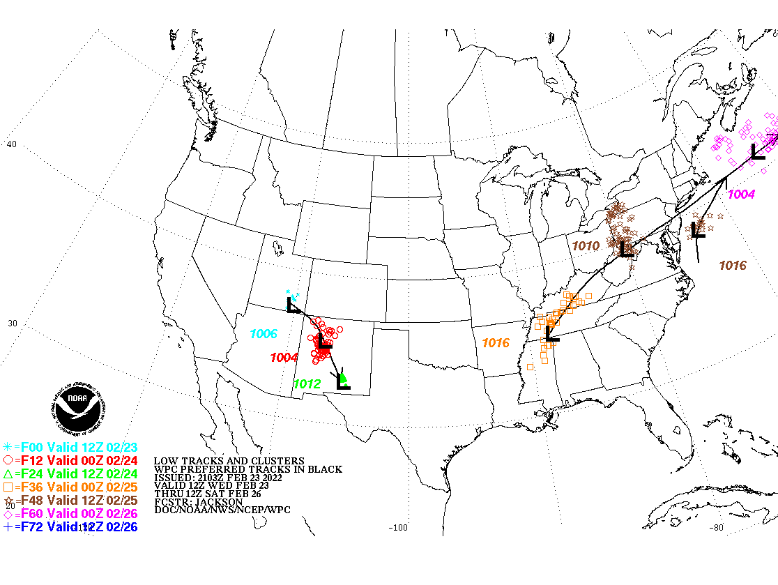
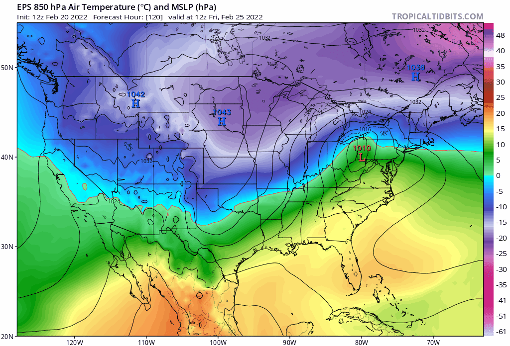
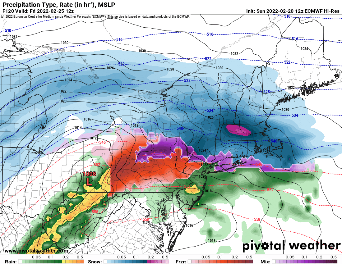
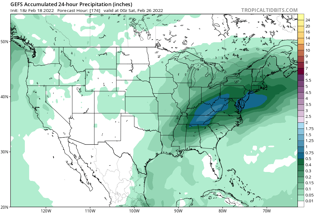
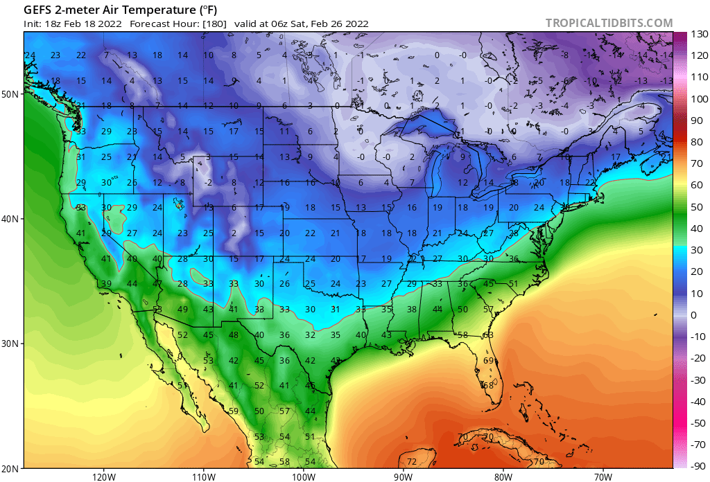
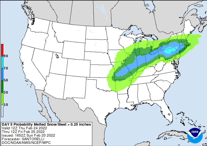
Upton Cold 1040mb high pressure remains anchored over Ontario on Thursday, a day that now looks to be mostly dry locally, with increasing clouds by later in the day. Models have again trended slightly north and have slowed the system for Thursday-Friday. Surface low pressure develops across the mid south, and heads through the OH Valley ahead of the aforementioned upper trough. With a weaker system overall and better dynamics to the north, models continue to bring a warm front north later Thursday and develop a secondary low along it by Friday morning. This low becomes the primary system as the mid trough approaches the coast by later on Friday, and deepens as it moves north of the region. This scenario would yield a general snow to rain ptype change across the area, with a transition to a wintry mix in between, starting late Thursday into Fri afternoon. QPF for the event is looking like a broad 0.5-1" across the area, with NBM IQR a bit higher, between about 0.6" and 1.25". Accumulating snow would be most likely across the interior where the changeover would be slowest. WPC maintains a 50% probability of advisory level snow here, with a 30% chance for NYC south and east. NBM v4.1 has maintained its snow exceedance trend this evening, with about a 30- 35% prob of >6" across the far interior, with 5-20% across the remainder of the CWA, which is similar to its previous few cycles. As a reminder, low track and intensity uncertainty plays into the ptype uncertainty and changes to this scenario are likely, and expected, as we are still 4-5 days out.
-
7:00 pm Thursday a small spot check of guidance available (atm) don't pay the ferryman
-
just a small reminder ..the end game is far from over with this system as some of the guidance trends colder this thread may heat up.... dm realizes crow is on the menu
-
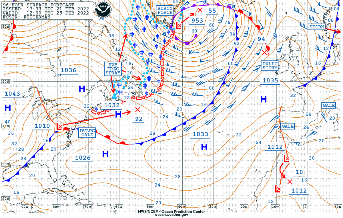
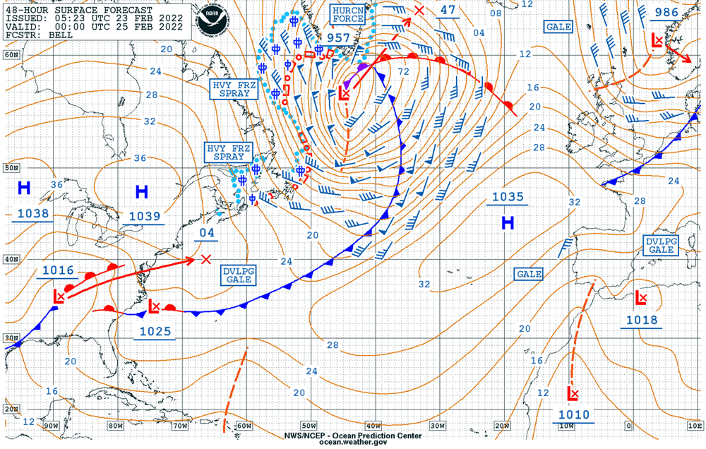
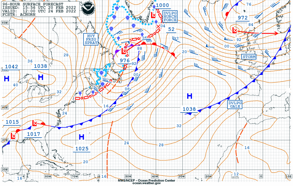
OPC 96 hr surface prog pregame----- o canada
-
love this prog....everything but the kitchen sink

-
well how about that... ... tracking ++++
-
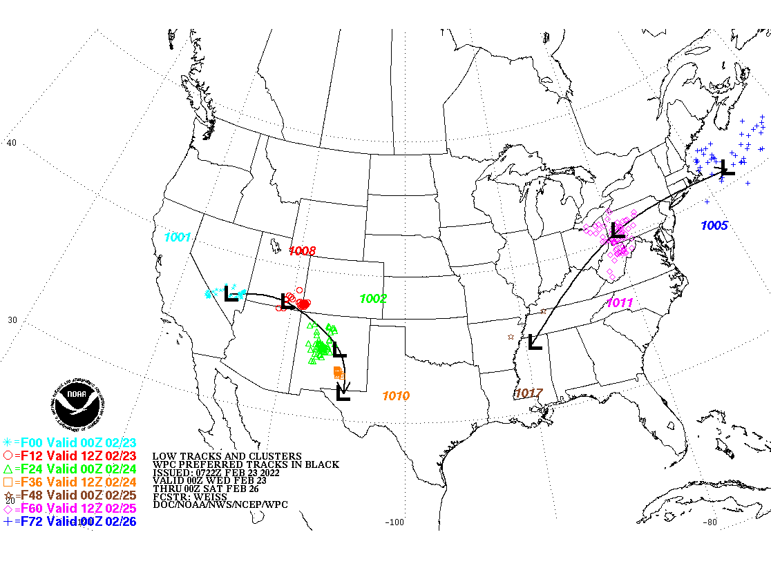
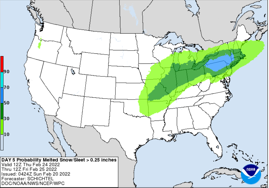
The Thursday-Friday timeframe is looking more and more interesting as confidence is increasing in winter weather returning to the region. Surface low pressure develops across the mid south, and heads through the OH Valley ahead of the aforementioned upper trough. Models are coming into a bit better agreement--for Day 6 at least--that a secondary coastal low will form by early Friday near DelMarVa and work up the east coast. At this point, track and intensity uncertainty plays into the ptype uncertainty and changes to this scenario are likely, and expected, over the next few days. Global models have trended colder, with the GFS and GEFS on the colder side, and the EU/ECENS on the (slightly) warmer side. Thus, the NBMv4.1 ends up somewhere in the middle, though is showing about a 20-30% of >6" across the far interior, with 5-20% across the remainder of the CWA, which is noteworthy. For now, have kept a rain to snow to rain trend across NYC and coastal locations, with a mainly snow event across the interior. It should be noted, however, that the setup with cold high pressure to the north nosing into the area--a cold air damming signature--does seem favorable for at least for some ice/mixed precip across at the onset early on Friday, especially north and west of NYC. This is supported by model soundings as well, depicting a small warm nose in the 700-850mb layer. Nonetheless, given that it`s so far out, have maintained a R/S mix in the forecast for this time. Stay tuned.
-
simple maps-- simple plan coastal storm is on all ens models my vibe is the metro will steadily improve on the snow accumulations as we move thru the week
-
enjoy the weekend ... don't put your shovels away just yet
-
Battle Zone .....ATM not a bad start for the hard core trackers

-
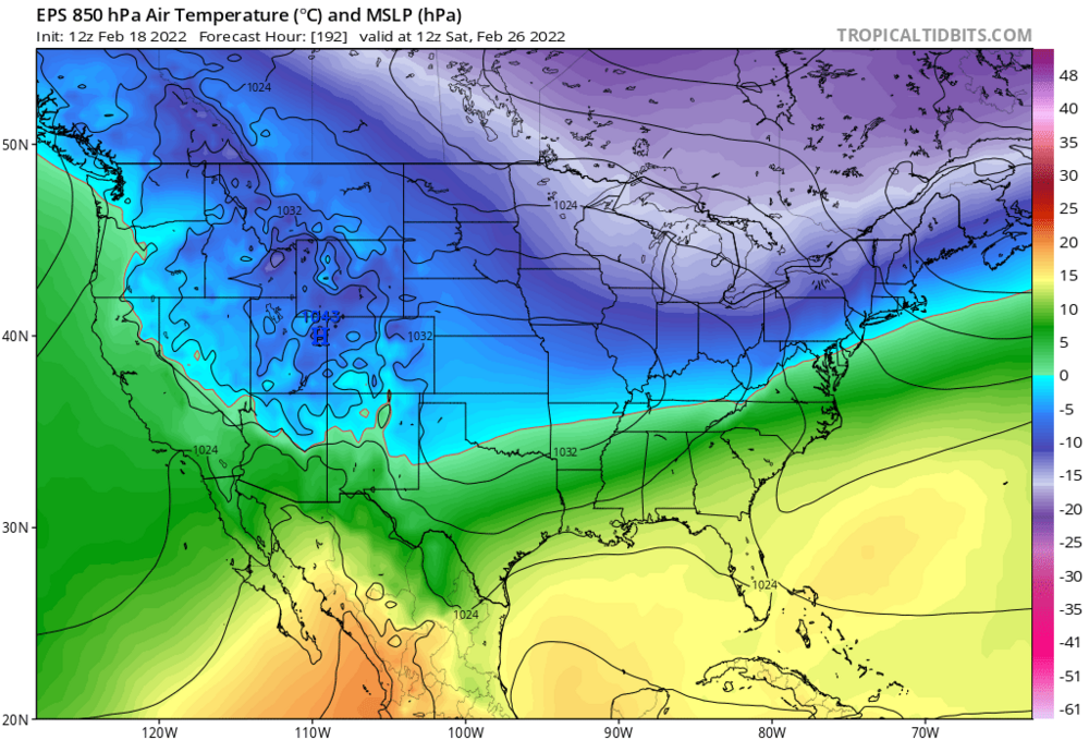
I love the tea leave and crystal ball forecasts (already) but let me hand pick one frame of the latest EPS ------just for the sake of argument careful what you hug 7 days out blend and balance...balance and blend